December 13, 2021
How Dangerous is Lukla Airport?
Holding a reputation as one of the most dangerous airports in the world, flight to Lukla Airport givHolding a reputation as one of the most dangerous airports in the world, flight to Lukla Airport gives you a combination of amazing yet thrilling experiences. Every day about Lukla 30 to 40 aircraft land in Lukla during the peak season. Furthermore, the number of trekkers is equally high with a maximum of 30,000 trekkers who visit the area annually flying into Lukla.
The airport is also popular as Tenzing Hillary Airport. Similarly, the Lukla airport is dangerous statistically but as a commercial airport, it is safe. The airport recorded the last accident in October 2008. Since then aviation officials have become more careful about the flight conditions and regulations for aircraft to improve passenger safety.
Despite this, the flight to Lukla can still be a nervous journey. The physical structure, the landscapes, the routes, and the landing are what make the airport thrilling. Also, the weather condition plays a vital role in the challenges that a flight and passenger have to face in this airport.
The airport can operate properly and can do a proper take-off and landing just when the weather condition is stable. Or else, the flight can be delayed due to the instability in the weather.
General Information of Lukla Airport
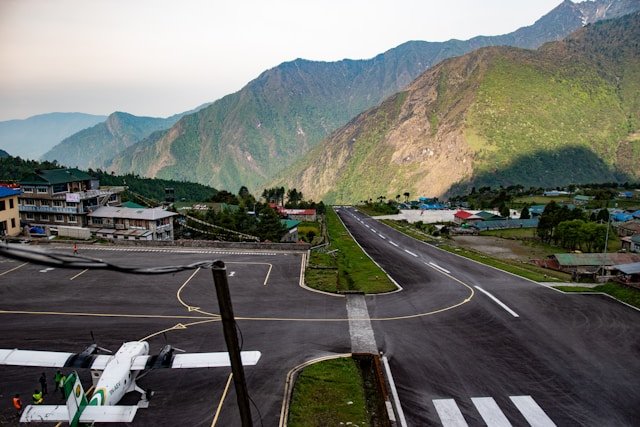
Name: Tenzing Hillary Airport Elevation: 2846 m /9337 feet Year of start: September 1971 Providence/ District: 1/ Solukhumbu Runway Dimension: 527 m x 20 m with a 12% gradient Named After: Tenzing Norgay Sherpa and Sir Edmund Hillary Modes of Communication: radio communication for landing and take off. Time is taken from Tribhuvan International Airport: 40 minutes Named in the year: 2008 Schedule Operating Airlines: Tara Air, Summit Air, Sita Air, Nepal Airlines Schedule Connectivity: Kathmandu, Ramechhap, PhapluThe Flight to Lukla Airport
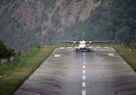
Lukla Airport is an extremely small and busy airport and is one of the world’s most dangerous airports. The flight to Lukla is one of the thrilling yet most exciting adventures in the world. You will be thrilled by the landscapes and amazed by the stunning view of the snow-capped peaks that seem very close to the window. Thousands of trekkers from all over the world have a dream of exploring the Nepalese Himalayas. So carrying the dream of exploring the majestic peaks, thousands of trekkers, climbers, and travelers from around the world wait anxiously at the Domestic terminal at Kathmandu’s sole airport (Tribhuvan International Airport). With the dream of exploring the wonderful Himalayan region, passengers are checked in and flights operate after the towering signal. Likewise, taxiing to the end of the runway for take-off, the flight soon takes off from Kathmandu airport orienting eastbound for 30 minutes to Tenzing Hillary Airport. Leaving the Kathmandu valley, the flight presents an astonishing scenario of scenic mountains. Leaving behind all the work, stress, and day-to-day busy life you walk towards the refreshing journey. Similarly, the flight presents the wonderful scenario of Langtang and the Rolwaling mountain range. The 30-minute flight will soon roost when the hill appears out of the blue when the pilot orients the flight towards it. Finally, the visible track appears where the flight will land in the next minute. The Runway has a sheer drop of 2000ft with a huge wall at the end. Soon, the flight lands at the sublime Lukla.Weather at Lukla Airport
It is a fact that the weather at a high altitude is unpredictable. On the same day, the weather can change constantly with rain, wind, sun, and storm. However, the weather at Lukla Airport degenerates very quickly because of its high mountainous location. Also, the serviceability of the airport is based on the weather conditions around there. The flights to Lukla begin early from 6 in the morning as the climate, weather, and temperature around this time are more stable than the remaining days. During the day the clouds start to build up. Within 40 minutes flights are navigated through high mountains and are conducted with Visual Flight Rules (VFR).About Lukla Airport
For any adventure to the Everest region in Nepal, one needs to go through the adventurous yet thrilling flight to Lukla. The airport in Lukla is popular as Tenzing Hillary Airport. It is a domestic airport in the Khumbu region of Nepal. The airport is worldwide famous as the most dangerous airport in the world. Mostly, people who are willing to go for the Base camp trek or expedition to any Khumbu Himalayas have to pass through this airport. It is a popular starting point for trekking and adventure in the Himalayan region of Nepal. Tenzing Hillary Airport in Lukla is restrained inside a chain-link fence and is guarded by the Nepali armed police or civil police around the clock.Daily Flight to Lukla
There is a daily flight from Kathmandu to Lukla. The flight’s intake is mostly during the daytime. Lukla Airport falls under one of the most dangerous airports, the flight can run only during good weather. In case of bad weather conditions, the flight might get postponed. Although the flight takes only 30 minutes in total time, the weather condition in Lukla matters the most to take off the flight. The weather conditions in Lukla and Kathmandu differ as when it’s sunny in Kathmandu, Lukla might be soaked in rain. So, before taking off the flight, the study of the weather is the most important. The factors that can delay the flight are high winds, cloud cover, and changing visibility. In 1964, the airport was built under the direction of Sir Edmund Hillary, (1st person to climb Mt. Everest). Hillary was intending to build the airport on flat farmlands but because the local farmers were completely against the idea the airport was then built in the current location. Sir Edmund Hillary bought the land for US$2,650 from Sherpas. Likewise, the airport got its name from Sir Edmund Hillary and Tensing Norgay Sherpa, the 1st person to summit the world’s highest peak, Mt. Everest. In the year 2008, the Airport was named “The Tenzing Hillary Airport”.Geography of Lukla Airport
Tenzing-Hillary (Lukla) Airport is situated at Khumbu Pasang Lampu-2 Rural Municipality of Solukhumbu District, Province No. 1. It is the gateway to Mount Everest, the world-famous tourist destination. The airport is situated in the Solukhumbu District of Sagarmatha Zone. Lukla airport is the busiest STOL airport and is considered the major airport for earning foreign currency. The airport is also located inside the buffer zone of Sagarmatha National Park.Pilots of Lukla Airport
This Tenzing Hillary Airport operates with experienced pilots only. Because of the most dangerous landing, pilots should have more than a year of experience operating at Lukla Airport. The airport only lands flights flown by experienced pilots, with at least 100 successful short-takeoff-and-landing (STOL) experiences. The pilots should have criteria of one year of STOL experience in Nepal along with the 10 flights into Lukla accompanied by a certified pilot. With extremely short runways at just 1,729 feet long, it slopes uphill with a gradient of almost 12% to assist planes in slowing down in time. Therefore, the experienced pilot is the one who can operate a safe flight to LuklaAircraft Types of Lukla Airport
The aircraft that operate in Lukla are helicopters and small fixed-wing propeller planes. Mountainous terrain surrounds Nepal’s Lukla airport and with very short Runways, most of the planes can’t have a proper landing here.The airlines that function here are:
- Nepal Airlines
- Sita Air
- Summit Air
- Tara Air
- Charter: Phaplu
Alternative for Lukla Airport
The best alternative option for the airports if your flight Alternative is to wait for your flight to be rescheduled. However, helicopters can be an alternative to regular flights to Lukla Airport. Helicopters can fly in conditions where planes cannot operate. Therefore, helicopters can be another option as they can most often. In case of a delayed flight, one can opt. for helicopter services. However, it can be a bit expensive, the pay ranges from $400 – $600 extra per person. Likewise, The price can vary and fluctuate with the rise of the demand. The price of a helicopter depends upon the number of seats taken. Generally, the cost depends anywhere between $2500USD – $3000USD. Holding a total capacity of 4-6 people, the cost can be split among the group that is flying (minimum of $400USD to a maximum of $3000USD per person)Update on Lukla Flights
The Civil Aviation Authority of Nepal issued the following updates regarding the flight to Lukla- Due to an increase in traffic congestion at Tribhuvan International Airport, there was an arrangement of operating all Lukla flights from Ramechhap airport in this summer season. Because of the high number of flights and passengers to Lukla, the Civil Aviation Authority came up with this idea.
- Lukla is the busiest airport during the tourist season among STOL airfields operated from Kathmandu.
Should one be afraid of flying to Lukla?
Despite the flight being one of the most dangerous journeys, one should not be afraid to fly to Lukla. There is a huge possibility of crashes, although it’s not common because of the continually changing weather and bad visibility. There is a huge difference in altitude between Kathmandu and Lukla as a result leading to changes in the weather. The weather during the take-off from Kathmandu is not the same as that of Landing in Lukla. Despite the airport containing various crash histories from the days of its opening in the year 1964 AD, the airport has faced 11 reported accidents. There are several cases of crashes and fires because of weather conditions. However, Lukla Airport Crash statistics show that most of the crashes are because of low visibility and constant changes in the weather. Therefore with experienced operators and proper analyses of the weather pattern, Lukla Airport is safe to fly. Therefore, the accidents are not because of the carelessness of the airport regarding safety but because of the weather pattern in Lukla. So, Lukla Airport is safe to fly and hundreds of people make their way to Lukla each day.Things to consider for Lukla’s flight
Before taking a take-off to Tenzing Hillary Airport in Lukla there are several things that one needs to consider and they are:- The flights to Lukla are often delayed because of unforeseeable weather conditions, Therefore taking the 1st early flight is recommended. As the 1st flight is more likely to have better visibility with more consistent weather.
- Getting a left-side seat can be a plus point for the stunning view of the mountain.
- Anyone willing to fly to Lukla should drive for 4 hours to Ramechhap as during the peak season the flights to Lukla run from Ramechhap to reduce the traffic congestion at Tribhuvan International Airport.
- The check-in time for the flight is 1 hour earlier than the flight time.
- The baggage limit on the flight is only 15 kg per passenger. so, if you have any excess weight it will cost USD 1 per kg.
You May Also Be Interested In
Read more... Read less
January 17, 2022
Teahouse Treks in Nepal
Teahouse means staying in a lodge or a cottage for a night on a track. There are a lot of teahouses Teahouse means staying in a lodge or a cottage for a night on a track. There are a lot of teahouses all around the world. Likewise, there are varieties of Teahouse Treks in Nepal. Teahouse treks in Nepal provide trekkers with the freedom to trek with minimum equipment. There are several teahouse treks in Nepal. For example Everest, Langtang, and Helambu, Annapurna. These regions are famous among tourists because of their facilities. Similarly, these places have a large network.
Furthermore, these places are famous for their trekking routes. In the case of Nepal, tea houses provide meals and resting places. A tea house is a large comfortable, well-built lodge or cottage. In Nepal, you can find small bamboo huts. Similarly, you can find big lodges too. Therefore, many tourists and trekkers love trekking in Nepal. Also, these tea houses provide facilities to the national visitors.
Why Teahouse treks in Nepal?
Small cottage lodges near the base camp of different summits are called tea houses in Nepal. It is known to the visitors as a tea house because it provides tasty meals and shelter. Mainly, Nepal provides a lot of tea houses in the Himalayan region. Additionally, different ethnic groups such as Tamang and Sherpa run tea houses. This will also help you gain knowledge about their culture. In addition, these tea houses are along with Everest and other trekking routes. Likewise, these tea houses provide a variety of lodging and meals facilities. You can leave your valuable items in the tea house. You can feel free and fully enjoy your trekking journey. In other words, the tea house trekking program is a trekking program based on tea houses dispersed all along the trekking routes. Therefore, Teahouse Treks in Nepal offers you comfortable and hassle-free trekking. Firstly, the teahouses of Nepal provide tourists with good hospitality. Secondly, some of the teahouses of Nepal provide visitors with guides as well. Above all, most of the teahouses are run by the local people and their families. So, this makes it cost-effective as well. Likewise, They provide foreigners with a very good environment to rest in. Daily many guides, porters, and travelers visit these teahouses. So, trekkers also enjoy it. Also, it is one of the fun activities in Nepal. Additionally, they can enjoy the facilities of this place. The main reason for Nepal to have such beautiful teahouses is its geography.Teahouse Treks in Nepal
A lot of visitors love to travel to these kinds of places. It helps the locals to run their families and live happily. Every visitor who comes to Nepal for trekking has a positive view of these tea houses. Two years back, I had a foreign friend who went on a trekking trip. Additionally, he discovered a lot of knowledgeable things. He shared all the amazing things about the trip with me. All the things were positive. He said Nepalese people are very kind. He said even though some of them had communication problems. But, also they communicated with us. Moreover, whenever they see foreigners they are very happy. They welcome us wholeheartedly. These tea houses also help the government. Most importantly, the people who run these teahouses are very friendly. Tourism is one of the main sources of income for the country. Furthermore, tourism plays a vital role in the nation’s economy. In addition to that, even among all the tourism sectors trekking and hiking are important. Not only to the international visitor but also the national visitors trekking is famous. Also, it is the main source of income for the people. To make trekking famous, teahouses play an important role. Tea house trek has a lot of benefits.Benefits of Teahouse Treks in Nepal
- The trek can be lightweight.
- It helps you carry less equipment in comparison to a camping trek.
- Tea houses are cost-effective.
Some Most Popular Teahouse Trek in Nepal
- Teahouse Trek in Everest Region:
- Everest Base Camp Trek.
- Ghorepani Poon Hill Trek.
- Annapurna Base Camp Trek.
- Annapurna Circuit Trek.
- Langtang Valley Trek.
Everest Base Camp Teahouse Trek
Most of the tea houses at the Everest base camp are huge. So, they normally have a common room designated for the group. Along with this, they provide different meals. World wide trekkers always bring their condiments. So, when people order off the menu in a tea house they can use those condiments. It helps enhance their food. Teahouse Treks in Nepal is the Everest base camp tea house that has a room that usually has two bunks. But, down lower in the valley, they have showers with a toilet. Also, they provide some hot water facilities. Moreover, they provide propane on-demand as well. But, if you trek up the valley you can find different styles of tea houses. In addition, most of the tea houses at Everest base have two beds in a room. Moreover, if you are tired and want to rest, they provide a suitable environment for you. Also, in some places they provide an outdoor courtyard. This will increase your trekking experience too. These tea houses will help you get in touch with nature. Most importantly, these tea houses are clean and comfortable. It is a really good way to go when you trek. In that way, people have a dry clean place to stay for the night. Furthermore, you can have a comfortable night’s sleep. This will help you the following day. Also, most of the tea houses built good relationships with the travelers.Highlights of Everest Base Camp Teahouse Trek
- The tea houses are reliable.
- The tea houses have wider rooms at lower altitudes.
- It provides you with charging stations, flush toilets, and hot water.
- They built good relationships with visitors.
- Experience different kinds of local foods.
- Increase your trekking experience.
Ghorepani Poon Hill Teahouse Trek
Poon Hill takes between two and three days from Pokhara. The view of Poon Hill is on the route to Annapurna Sanctuary, the destination is in the center of Annapurna Conservation Area. You must have an ACCAP Permit from Kathmandu. Poon Hill is a very busy tourist destination. Therefore Poon Hill is the best Teahouse trek in Nepal. Daily thousands of visitors visit this hill to trek. The tea houses are good too. Tea houses here provide you with a suitable place to rest. This teahouse trek is reliable. Not only foreign tourists but also national tourists love to visit. But the only drawback is that you have to have permission from Kathmandu. Many people have shared a lot of positive things about this place. But, it is accessible. It is a challenging trekking route of Nepal. So, the tea houses also play a vital role too. Because every trekker gets tired so they wanna rest in a safe and comfortable place. Teahouses here provide you with all the essentials. For example- Proper resting place
- It provides you with a proper shower and toilet facilities.
- Tea houses here have all the facilities such as water, food, and electricity.
- So, if you decide to trek in the Ghorepani Poonhill you will feel at home at these teahouses.
Annapurna Base Camp Teahouse Trek
Annapurna base camp trek is one of the most difficult treks in Nepal. The trekkers almost have to cover a total distance of 67 km over 10 days of the trek. You will feel a lot of adventure in it. A lot of visitors get injured daily due to the difficulty of this place. This trek is long so people stay at the tea houses. Due to its difficulty, the tea houses here play an important role. The ABC base camp tea houses provide you with a lot of facilities. For example- Suitable place to rest
- Spa facilities
- It’s reliable
Annapurna Circuit Teahouse Trek
Annapurna circuit teahouse Trek is another trek with good teahouse facilities, the Annapurna Circuit Trek has some of the better teahouses widespread along its entire route. No matter how long your hike is you can always find a suitable teahouse. So, this will help the trekkers to take short breaks in between. Annapurna circuit tea house is almost 12 to 21-day long. So, the widespread tea house makes visitors at ease. The trail also includes a lot of stairways which can be more difficult than walking on straight paths. Also, a lot of slippery and rocky trails.Highlights of Annapurna Circuit Teahouse Trek
- Security
- Chance to connect to the nature
- Experience the nature of the place
- Feel of adventure
- Hospitality
Teahouse Trek at Manaslu Circuit
Manaslu circuit trek is a moderately difficult trek. People with the low physical condition find it hard to trek here. Manaslu Trek is one of the challenging treks in Nepal that takes you through the remote villages of the Himalayan region. It is one of the off-beat treks in Nepal. It is a challenging trek so trekkers travel in a sense of adventure. Also, this route provides yaks on your way up. It is almost 180 km. So, it is quite challenging. So, the tea house here plays an important role. They should have the facility of electricity, water, and shelter and they have it all. Including beautiful scenery.Teahouse Trek at Langtang Valley
Langtang valley trek is one of the most famous treks in Nepal. It provides the trekkers with the feel of adventure. Langtang trip is a short trip if you are looking to excess it from Kathmandu valley. The sloppy road here is the main reason for people wanting to trek here. This trek is almost 10-15 days starting from SyabruBesi. Langtang valley trip is very safe. It is a moderate trek. You have to walk for many days with gradually increasing altitudes. People with bad health find it hard to trek here. So, the tea houses here come in handy.Highlights of Langtang Valley Teahouse Trek
- Friendly owners
- Good scenery
- Comfortable environment
Teahouse Etiquette
The etiquette of Nepali people is known worldwide. It is also the main reason for tourist attractions. The etiquette of Nepalese people varies from culture to culture. Most of the time Nepalese people join their hands to greet people. Likewise, teahouse etiquette is also the same. Mostly, people from the Himalayas run tea houses. So they welcome people according to their culture. The most common etiquette in these tea houses is. They do the formal and standard gesture, men hold fists(left over right), women put palms together, make a bow, and welcome visitors by giving them the garment made of flowers.Meals at Teahouse Treks
The typical meal of a Nepalese tea house is dhal bhat. But, it can differ from place to place. Teahouse Treks in Nepal the owner of the tea house most of the time provides meals according to the culture. But, the most common meals that can be found at the tea houses at high altitudes are Dhal Bhat: Dhal Bhat is like a national food of Nepal so it is found in every part of the country. So, it can also be found at the tea houses of high altitudes. Yak meat: Also yak meat famously known as (chauri ko masu) is easily accessible in these kinds of tea houses as yak is only found in the Himalayan region. Garlic soup etc.Rooms at Teahouse Trek in Nepal
Usually, there are two beds in a single room. The tea houses of Nepal usually have a window and a door with a cover of tin. These kinds of rooms are usually found in one storage building.Electricity at Teahouse
Most of the tea houses have electric facilities in them. Usually, people can charge their phones, watch television. But, in some places, it can be hard to find due to the geographical condition of the place. Usually, the places cost money to use the electric facility.Tips for the Teahouse Trek in Nepal
- Do advance booking for the tables.
- Bring all the personal essentials with you.
- Have a sufficient amount of toilet paper with you.
- Bring all your medications with you.
- If you have not booked a teahouse, do it before 7:00 am.
- Calculate your time properly before leaving the tea house.

January 18, 2022
Camping Treks in Nepal
What is a Camping Trek? Camping Treks in Nepal is a classic way of trekking. Mainly, done i Camping Treks in Nepal is a classic way of trekking. Mainly, done in remote areas with all camping equipment along with food, guides, and tents. Similarly, the camping trek is mostly done where there is no facility for tea houses.
What is a Camping Trek?
Camping Treks in Nepal is a classic way of trekking. Mainly, done in remote areas with all camping equipment along with food, guides, and tents. Similarly, the camping trek is mostly done where there is no facility for tea houses.
Why Camping Treks in Nepal
There are a lot of organized teahouses in Nepal. But, a lot of people love to do camping treks in Nepal as well. There are different types of treks in Nepal. But, you can choose the style of the trek which suits you the best. Likewise, a lot of people like the option of staying in a lodge for their Himalayan trek. Additionally, first, they trek and spend nights in the teahouse but they often come back to experience the Camping Treks In Nepal. Usually, Camping Treks In Nepal are a good experience for rookie trekkers. Also, Camping Treks In Nepal is more challenging than the tea house trek in Nepal. In addition, Camping Treks In Nepal are very famous all around the world. Annually, thousands of tourists come to experience the Camping Treks In Nepal. Similarly, Camping Treks In Nepal has a lot of benefits. You will get more time in Nature. In addition, you will have more fun while trekking. But, the advantage of Camping Trek In Nepal is you will be able to trek in more remote areas of Nepal. Likewise, Camping Treks In Nepal helps you know about the biodiversity of Nepal. Similarly, camping treks are famous among the youth of the country. In addition, students of Nepal finish their studies and make plans for going to Camping Treks In Nepal with their friends. Usually, people have a very good time doing Camping Trek In Nepal.Highlights of Camping Treks in Nepal
- Get to spend more time in nature compared to Tea House Trekking.
- Be able to explore remote and isolated areas of Nepal.
- Suitable for adventure seekers.
- Connect to the nature
- Camping Treks In Nepal pushes your body to the limits.
- Suitable for trekkers to rest where there is no facility of tea houses.
- Camping Treks In Nepal can help you travel to remote areas.
Some of famous Camping Treks in Nepal
Upper Dolpo Trek
Upper Dolpo Trek lies in the Dolpa district of Nepal. Dolpa trekking region is one of the loveliest districts with gigantic mountain ranges like Annapurna, Dhaulagiri, and Kanjiwara along with some other numerous mountains. Similarly, there used to be a small kingdom on the more level Dolpo in the recent past. This region provides trekkers with various mountains. The trekkers can have a good perspective of the grand locale. Annually, thousands of trekkers love camping trek Dolpo region. Furthermore, people love to do camping treks in Nepal because it provides them with the feeling of adventure. Likewise, camping here tests their limits. So, this is also the main reason for Upper Dolpo to be famous. Mainly, the walking begins at Darbang with an uphill climb to Dharpani from where you can see great views of the surrounding. Similarly, from there you continue walking to Muna village. After a long walk and camping, you arrive at Dhorpatan hunting reserve from there you can see the biodiversity of the place including some rare animals of the country. Furthermore, continuing our journey we arrive at Pelma Goo, a very remote area. However, Pelma Goo provides you with a lot of beautiful scenery of high mountains. Similarly, the local people there are very friendly and helpful. Similarly, whenever they see a tourist they get very excited. But, the place is very underdeveloped with a lot of illiterate kids. After seeing the various biodiversity we head to Syankhola. Furthermore, the way of Syankhola is very rough. So, you have to be very careful. However, from there you will be able to see a lot of huge mountains. Likewise, after walking all the way we come to Purbang Bass(4050m) which has a very difficult path for travelers. Similarly, in the evening you will be able to see a beautiful sunset. After camping in Purbang pass you will make your way to Dho Tarap where you will be able to see yaks and donkeys. In addition, you will be able to dry peaks and surroundings.Journey to Upper Dolpo
Finally, we come to Dho Tarap (3944m) where you will be able to experience Tibetan culture. However, the place is very remote. At Dho Tarap you will see all kinds of different monasteries where people worship. After visiting Dho Tarap you will come to Maran village. Similarly, Maran village is a north Tibetan village. So, it is obvious that you will see Tibetan culture. After visiting Marang village we came to Tokyu village. But, the people of this place are so far from modern society. Similarly, the infrastructure is not properly developed. Probably due to its geographical condition. After crossing Tokyu we come to the flat land of Numa La. The place is good for cultivation. Likewise, after crossing the valley you come to Numa La pass (5309m) where you will be able to see different prayer flags. In addition, people love to trek in Numa La pass. Furthermore, after this, your journey continues at Baga La pass (5179m) with an uphill climb. But, you have to be very careful you might be a victim of altitude sickness. You will continue your Journey to Phoksundo waterfall which is very beautiful. Continuing your journey you will come to Phoksundo lake locally known as Ringmo Lake. There you will be camping and enjoying the environment. Finally, after camping there you will come to Jupal where you will see some monasteries and beautiful mountains. After enjoying your time at Jupal you come to Juphal airport to Nepalgunj Airport where your camping trek ends.Highlights of Camping Treks in Nepal
- Get to know Tibetan culture.
- Visit Phoksundo Lake.
- Get a stunning view of the surroundings.
Dhaulagiri Circuit Trek
In Nepal, Dhaulagiri Circuit Trek is one of the best destinations for Camping Trek. Likewise, it is one of the most dangerous treks in Nepal. First, you drive to Beni from Kathmandu by bus. Dhaulagiri Circuit Trek is very adventurous. But, many people go to Dhaulagiri Circuit Trek from Myadi. Normally the trek starts from Kathmandu and follows through the roads of Pokhara Beni and Darbang crossing around 320 meters until you come to Dhara Pani. Similarly, people drive around 2-3 hours to reach here through some of the rough roads of Nepal. Dhaulagiri Circuit Trek is a rigged and sloppy altitude Camping Trek. In addition, Dhaulagiri Circuit Trek is one of the less-visited Camping Treks of the Annapurna region. Furthermore, for the first couple of days, you walk through Myadi Khola to the Chhonbardan glacier at the foot of Dhaulagiri. Likewise, the view from Dhaulagiri is very stunning. Similarly, when you walk through the trek you will see some of the Magar villages along the way. Not only this but also you will spend time trekking in this area without a permit. After you rest there you will continue your trek up the side of the glacier over the french pass (5360m) into the hidden valley.Journey to Dhaulagiri Circuit
Most importantly, if you have been trekking for a long time and have some experience. Then this is a perfect adventure for you. Similarly, this trek will be unforgettable for you. In addition, after spending several days above 5000meters altitude and passing through some snowy conditions. You will find that it is one of the most challenging Camping Trek In Nepal. But, it is worth every penny and time you spend there. Similarly, while you are camping and trekking through the Dhaulagiri circuit trek you will feel the remote nature of the trek. Likewise, you will be able to see some of the most beautiful landscapes and farming villages. Most importantly, you will see many snowy glaciers and rocky mountains. Similarly, if you are an experienced trekker you will have an option to climb Dhampus peak at 6060m. Likewise, you will be able to see a stunning view of Dhaulagiri (8167m) and other 7000m plus peaks. So, this trek value your time.Highlights of Dhaulagiri Circuit Trek
- Experience the remote nature
- Get a stunning view of Dhaulagiri (8167m).
- Visit different villages along the way.
Makalu Base Camp Trek
Makalu Base Camp trek is one of the spectacular Camping Trek In Nepal. But, this trekking route was not open until the 1950s. But, shortly after Eric Shipton trekked into this region and made it available for everyone. Similarly, this trek was very little known back then. But, it is now famous worldwide. Likewise, Makalu Base Camp provides good accommodation with some beautiful tea houses. Who welcomes you wholeheartedly and gives you a place to rest. Not only it is famous for its tea houses but also it is famous for the Camping Trek it provides.Journey to Makalu Base Camp
Makalu Base Camp trek is a very beautiful Camping Trek In Nepal. Similarly, this trails to the world’s fifth-highest peak. Furthermore, it takes you through the experience of the biodiversity of Nepal. Most importantly, it provides you with a rich selection of scenery as you climb over 5000m. The trekking is very challenging. In addition, you pass across four high passes which include Shipton La ( Eric Shipton’s original expedition route and three others which are over 4000m. The best time for trekking in Makalu Base Camp is in the spring season. Most importantly, at this time the trek shows us some lingering snow, crossing the passes which will make you very excited. Furthermore, the final approach towards the base camp is the best one because when you reach there you will see Mount Makalu, which dominates the surrounding with its majestic presence. Similarly, it will make you realize how exciting would it be to climb 8416m. In addition, to Mount Makalu, you can enjoy the panorama of Mt Everest 8848m, Lotshe 8516m, Chamlang 7319m, and Baruntse 7129m. It is the best place to enjoy your holidays. If you love trekking and love spending time in nature.Highlights of Makalu Base Camp Trek
- Get to see different mountains over 7000m including Mount Makalu and Mount Everest.
- Enjoy the views of the surroundings.
- Travel through the route of Eric Shipton.
Rolwaling Valley Trek
Between Everest and Langtang below Gauri Shanker lies a beautiful Rolwaling Valley. Many people love trekking and camping there. Similarly, the main highlight of the Rolwaling Trek is Rolwaling Valley, Khumbu, Tamang villages with some beautiful views of the mountains. Likewise, this region is rich in biodiversity, glacier lakes, mountains, and isolated villages. Furthermore, Rolwaling Valley is surrounded by alpine lakes, hanging glaciers, etc. The Rolwaling Valley Trek starts from Dolakha near Charikot, which is an eight-hour drive from Kathmandu. There you will experience the ultimate camping experience. Rolwaling Valley Trek is a very fine but very strenuous camping style expedition that can be done through Rolwaling Himal by crossing the Teshi Lapch La (5755m) into Solu Khumbu. Similarly, while on this trek you can see Mt Melungtse(7181m) Mount Dorje Lakpa, and Mount Tachi Lapcha. Most importantly, this will be an unforgettable experience for you.Highlights of Rolwaling Valley Trek
- Get a stunning view of different lake glaciers
- See the biodiversity of the place
- Experience the ultimate Camping Treks In Nepal
Ganja La Pass Trek
One of the most difficult Himalayan passes in the world is the Ganja La Pass with a height of 5132m. But, if you decide to trek in Ganja La Pass then you will never forget the experience. Similarly, you can experience Buddhist culture. Likewise, you can enjoy beautiful Himalayan sightseeing with some beautiful Buddhist Monastries in the region. Similarly, the route starts from Kyanjin Gompa in Langtang to Tarke Gyang in Helambu crossing 5106m begins Ganja La Pass trekking. Likewise, you will be crossing Lantang Khola below Kyangin Gompa and continuing the trail. But, the trail follows a steep climb along the ridge on the south side of the valley. In addition, you will be going through rhododendron and juniper forest to the south side following the trail. Most importantly, the views of the north from the pass which includes Langtang Lirung, and the snow peaks in Tibet are beautiful. In addition, you will also see Shisha Panama at 8013m which is outstanding.Highlights of Ganja La Pass
- Travel through the forest of Rhododendron and Juniper.
- Outstanding view of Shisha Pangma.
- Enjoying the beauty of the surrounding.
Balthali Village Trek
Balthali village trek is a very short trek around Kathmandu valley. Similarly, Balthali village offers traditional and rural Nepal with beautiful surroundings. Likewise, the trail of the Balthali village trek leads you to different villages of Tamang, Newar, and some other ethnic groups. In addition, this trek offers several excellent short hikes and mountain biking experiences. Most importantly, this trek can be done by anyone. Mostly, for camping treks, that’s why it is one of the best Camping Treks In Nepal. You should only walk 4-5 hours on this trek and you can fully enjoy yourself. The traditional Balthali village is very eco-friendly. Furthermore, this trek is not that crowded too. Similarly, while on this trek you can experience the stunning view of Langtang, Ganesh, Manaslu, Dorje Lakpa, Gaurisankher, and Everest on the north side. Not only the view but also the flora and fauna of the place will tell you the beauty of the place. Similarly, if you decide to trek here you will experience the beauty of the Nepali Hills and Himalayas.Highlights of Balthali Village Trek
- View 7000m plus high peaks including Everest.
- Experience different biodiversity.
- Get the feeling of the ultimate trekking experience.
Gurjebanjyang Suryachour Trek
Gurjebanjyang is a very beautiful trekking destination located 26 kilometers from the city. Similarly, it is possible to reach there in about 30 minutes from the bus driver to Kaule. Likewise, Kaule is the gateway point for Kakani hikes. Similarly, Kakani Hill Station is very popular because it gives you a glittering view of Annapurna (8091m) Manaslu (8165m) Ganesh Himal (7446m) Langtang Lirung (7245m) also a lot of snow-covered mountains. Suryachour is a very nice viewpoint that gives a stunning view of mountain ranges like Mt Manaslu, Mt Ganesh, Mt Langtang Mt Dorje Lakpa, and Gauri Shankar Himal. Similarly, trekking through this route is a lifetime experience. This trekking route is one of the most popular trekking routes in Nepal. Furthermore, this trekking route is also one of the best Camping Routes In Nepal. Annually, thousands of tourists come to this trekking route for camping and enjoying their time. In addition, this is also famous among national tourists.Highlights of Suryachour Trek
- View some of the famous 7000m plus peaks.
- Enjoy the surrounding.
- Know about the different cultures of Nepal.
Chitlang- Markhu- Kulekhani Village Trek
Chitlang village has an ancient Newar society. Similarly, people from Lichchavi and Gopal era lived here in the past. According to history, Amshubarma gave this place a name. Likewise, the major attraction of this place is Newari houses art and architecture. Similarly, the landscape of his place attracts trekkers from all around the world. Markhu is a small town on the northwestern shores of Indrasarover which is famous for trekking. Makhu is about 30 min drive from Kulekhani but a lot of people love to trek there. Similarly, Chitlang is also near around 9 km. so, these three villages are near each other. Therefore, this is perfect for a camping trek. Kulekhani, Markhu, and Chitlang are the best traveling destination for travelers. Kulekhani is very near to Kathmandu. So it is accessible to anyone. It is a perfect destination to hang out with your friends and families. Likewise, the tour of these villages is very good for trekkers to enjoy nature and do camping due to the landscape of this place.Highlights of Chitlang – Markhu Trek
- Enjoy the surroundings and the nature of the place.
- Experience the ultimate Camping Treks In Nepal.
- Learn about different cultures.
Lele Village Trek
Lele Village is a small village in Lalitpur district, Lele is 14 km away from Lagankhel, Patan, and other main cities. Similarly, the weather of this place is very good for trekkers. It gets about 12 degrees celsius in the summer. Likewise, Lele village is a very good trekking destination. Lele village trek takes you through some of the most beautiful forests of Nepal. Most importantly, the landscape is very favorable for new trekkers. Similarly, this trek is not that difficult, you can do this trek alone. But, rather than traveling alone, you should travel with your friends and family. It will be more fun. In addition, a lot of youth of Nepal love doing camping here. Because it provides favorable conditions for every trekker. So, it is one of the best Camping Treks In Nepal.Highlights of Lele Village Trek
- Trek in a favorable condition
- Suitable for new trekkers
- Experience the Ultimate Camping Trek In Nepal.
Some Info of Camping Treks in Nepal
Rooms and Beds in Camping Treks
Some of the rooms are luxurious and have a proper facility for everything. There are usually two beds in a single tent most of the time but you also can find double beds in some of the places. Similarly, in some places, it is built with a corrugated steel roof over a large, conventional ridge tent with something around 4 high foot walls and a 7-foot ridge.Dining and Food in Camping Treks
Most of the tented camps in Nepal provide their cultural food with proper dining facilities. Similarly, most of the time the cook of the trek western foods as well. Likewise, the foods are healthy and clean. Similarly, they also provide you with healthy drinks. Also, they serve you hot and healthy foods.Electricity Charging Points and Wi-Fi
All the camping treks in Nepal are very organized. However, camping treks in Nepal are done in the rural areas so, it is next to impossible to get the facility of electricity charging and Wi-Fi points. But, in some places it is possible but you have to pay more money.Toilets and Showers
Camping treks are the most interesting way of trekking in Nepal. The organizer tries their best to satisfy the consumer. They fully take care of your hygiene and health. You don’t have to worry about this. The camping staff there provide you with a suitable latrine and washbasin.Best Time for Camping Treks in Nepal
Usually, the best time for Camping Trek In Nepal is months from March to May, and September to November is an ideal time to go Camping Trek In Nepal. But, the time of March to May is perfect as the days are clear with plenty of sunshine and a suitable climate to trek. Read more... Read less
February 1, 2022
All About Kathmandu
Kathmandu city is the capital of Nepal. It is a city with wonders all around its territory. SimilarlKathmandu city is the capital of Nepal. It is a city with wonders all around its territory. Similarly, it has its unique way of presenting itself to the world. It is the most populous city of Nepal according to the studies done in 2011 AD. Today it is the seat of the Nepalese government. This city holds the residential area of the most powerful people in the country. Along with some ministers also Meetings and seminars are held here. Most importantly, Kathmandu city provides various facilities. These facilities are very hard to find in other cities of Nepal. So, it provides you with hospitals and schools with very good facilities.
Kathmandu
This city is one of the most important and beautiful cities in Nepal. As a result, its importance to Nepalese people is huge. In other words, it plays an important role in the overall development of the country. It has been the center of different art, culture, economy, and history of the country. Therefore, Kathmandu is its heart. Kathmandu is very rich in natural resources. As a result, it holds the power to run the country. It plays a vital role in Nepal’s economy and development. Then the people of this country will suffer a lot if Kathmandu stops running. Students come to this city for their studies and future. As a result, the city is populated. This city provides you with a lot of opportunities. Therefore people of this country also come to this city in search of jobs. Kathmandu city is also famous for its tourist destination. In this city, you will be able to explore a lot of things. It is famous for its hills, forest and a lot of things. Kathmandu is famous for its durbar square, temples, and heritage site. As a result, national and international visitors visit this place. According to the studies done in 2013. Kathmandu is among the top 10 destinations to visit and ranked number one in Asia. Therefore, Kathmandu is a perfect destination to visit.Location of Kathmandu
Kathmandu city is located at the center of Nepal. It lies in Bagmati province in Kathmandu valley. Similarly, the Kathmandu district lies at an altitude of 1400 meters. Lord Krishna and Manjusree according to Hindu mythology. It is the capital city of Nepal, surrounded by hills and Himalayan mountains from all sides. It lies in Kathmandu valley which consists of Lalitpur, Bhaktapur, Kathmandu. These cities are the brightest in Nepal.History of Kathmandu
Kathmandu city has a long long history. Lord Krishna and Manjushree found this city according to Hindu mythology. Kathmandu city may have been inhabited in the early 300 BCE. The oldest objects in the valley date to a few hundred years BCE. The oldest firmly dated building in the earthquake-prone valley is over 2,000 years old. But, the history books, Say that it was founded by king ‘GUNAKAMADEVA’ in 723. The first name given to the city was Manju Patan. However, the name of the city changed many times. But, the current name of the city is Kathmandu. Here Kath means wood and mandu means temple. It refers to the temple made of a single piece of wood. Late king Raja Lachmina Singh built it in 1596. Kathmandu city served as the seat for the shah family from 1768 to 2008. Still, it serves the president and prime minister to run the country.Climate of Kathmandu
The climate of Kathmandu is mild, warm, and temperate. It certainly gets rainy in the summer season. Kathmandu district lies in the hilly region of Nepal. Which in comparison is much better than the Terai and Himalayan regions. In summer the Terai region gets very hot and the temperature rises like crazy. Likewise, in the Himalayan region, it gets very cold in the winter season. According, to the studies the average temperature of the city is about 16.1 °C | 61.1 °F. People usually visit Kathmandu in September and October. Above all, it provides the best climate and environment for visitors to visit. Likewise, in the winters it snows. The snowfall generally happens at the high peaks such as Champadevi and Nagarkot hike. In short, the climate of Kathmandu helps you travel the city without any problem.Temples of Kathmandu
Kathmandu city is the city of temples. It provides a wide range of temples that you will like. Most importantly you can visit a lot of temples such as Pashupatinath, Shyambhunath, Boudhanath, etc. People visit the temples of Kathmandu for different reasons. Some of them are:- To spend quality time with their family and friends.
- Worshiping
- For finding peace of mind (especially for Nepalese people)
- Exploring
- For studies
- Swayambhunath Temple.
- Pasupatinath Temple.
- Budhanilkantha Temple.
- Dakshinkali Temple.
- Guhyeshwari Temple.
- Jagannath (Krishna) Temple.
- Kirateshwar Mahadev Temple.
- Kasthamandap.
- Boudhanath stupa.
Swayambhunath Temple
Swayambhunath temple is a holy temple for Buddhists. This temple has a huge value for the people of Nepal. As a result, Even Hindu visit this temple. It is one of the tourist destinations in Kathmandu. You should first take 320 steps from the entrance of the place. This will take you to the top of the Swayambhunath temple. You can enjoy a stunning view from the top. This temple is the ‘monkey temple. The dome of the statue symbolizes the world. Swambunath temple was built in the fifth century CE. It was born out of a lotus that bloomed in the middle. The name means ‘Self-created’. You can visit the place all day. The only drawback is you have to pay 200 rupees as an entry fee.Pasupatinath Temple
Pasupatinath temple is one of the oldest temples in history. It has very high value for the people of Nepal. Pashupatinath temple is at the bank of the Bagmati river. It is a reincarnation of shiva. The meaning of ‘Pashupatinath- The protector of animals’. It is a pagoda-style temple. It has four main doors. Legends say that the origins of Pashupatinath Temple lie in a mound where a cow offered her milk daily. Out of curiosity, a farmer dug at the spot and discovered a linga(a unique statue worshiped in the name of lord shiva) with Shiva’s faces carved on it, emitting a very bright light. Later, a shrine is said to be the incarnation of Shiva. As a result, many visitors visit here.Boudhanath Stupa
Boudhanath stupa is one of the oldest stupa/temples in the country. Firstly, Boudhanath watches Kathmandu like a guardian angel. Secondly, this stupa lies at the center of the city. This temple provides a great view of the city. The design of the stupa is a treat to the eye. Boudhanath temple is also a holy place for Buddhists. Therefore, daily thousands of Buddhists visit this place to worship. Very few places in the world can match the beauty of the Boudhanath Stupa. You can visit this temple to find peace for your heart and mind. Above all, It is an important tourist destination in Nepal. In conclusion, many national and international visitors come to this place to see the beauty including peace of mind and heart.Budhanilkantha Temple
This temple is famous for its stone-crafted statue of Lord Vishnu. The stone is carved from a single stone. The stone is 1000 years old. To sum up, this temple is also famous for its architecture. According to old legends, a farmer with his wife once stuck the statue while cultivating the land and suddenly the blood started to flow. This led to the finding of the water figure of the Budhanilkantha deity. Similarly, another legend says that Vishnu Gupta brought this statue to Kathmandu in the late seventeen century. Consequently, thousands of people come to see this place. As they celebrate the awakening of Lord Vishnu from a long sleep.Dakshinkali Temple
Goddess Kali’s dedicated temple is located in Kathmandu city. This temple is a holy place for Hindus. Consequently, daily thousands of people come to this place to worship. Daily thousands of uncastrated goats are sacrificed in this place. These rituals are done on Tuesdays and Saturdays. Most importantly, his temple is fully crowded in Dashain and Tihar. People come to this place for the fulfillment of their wishes. Above all, at the celebration, Dakshina kali is decorated beautifully. As a result, this temple has a huge significance in the Hindu community.Guhyeshwari Temple
Guhyeshwari temple is at the bank of the Bagmati river. It lies near Pashupatinath. It is called the Shakti Peeths of Nepal. Consequently, this temple holds a huge impact on Hindus. This temple was built by king Malla in the 17th century. According to the holy books of Hindus, after the death of Sati Devi, lord shiva wandered carrying her corpse on his shoulder. Similarly, Guhyeshwari got its name from Sati’s knowledge (Guhya) which fell here after her death. Above all, only Hindus are allowed to enter the shrine to worship the goddess. This shrine is in a water container called Kalash. in addition, the temple is a Bhutanese pagoda-style architecture. These are the most famous temples in the country. Which holds a huge value for the country is because it helps the country to generate revenue.Festival of Kathmandu
There are a lot of festivals in this city. Festivals are an important factor for the city as it helps to represent the city to the world. In addition, there are about 20 festivals each year. Some famous festivals of Kathmandu are:- Holi Festival.
- Vijaya Dashami Festival.
- Tihar Festival in Kathmandu.
- Chhath Parva Celebration.
- Gaijatra.
- Maha Shivaratri.
- Indra Jatra.
- Bisket Jatra in Bhaktapur.
Dashain
Vijaya Dashami is a religious festival celebrated in Nepal. This festival is also celebrated in India. It is Dussehra in India. It is celebrated for several reasons according to Hindu mythology. This festival is about the victory of good over evil. It is mainly celebrated in the month of Ashwin (September). According to Hindu mythology, Ravana was defeated by the hand of lord ram. People of our country mainly celebrate this festival by having different kinds of delicious food. Above all, this festival is celebrated for 10 days. So this is a long festival. The First Day – Ghatasthapana. Ghatasthapana is the first day, where Dashain begins. The Seventh Day – Fulpati. The Eighth Day – Maha Ashtami. The Ninth Day – Maha Navami. The Tenth Day – Vijaya Dashami.Tihar
Tihar festival is celebrated in Nepal. It is known as Diwali in India. This is right after the festival of Dashain. Most importantly, This festival is for five days in Nepal. Kaag Tihar Kukur tihar Gai tihar and laxmi puja Goverdhar puja and Mha puja Bhai tikaKaag Tihar
Kaag Tihar is the first day of Tihar. People celebrate this by feeding some food to the crow(kaag) before they feed themself.Kukur Tihar
Kukur tihar is the second day of tihar. People celebrate this by feeding food and worshiping them by making garments made of flowers. Most importantly They also provide some food to the Street dogs (kukur).Gai Tihar
Gai Tihar is the 3rd day of the festival where people worship the cow(gai) by feeding them food. Later in the day, mainly girls of the family make an art called rangoli. Children along with some adults play Vailo too.Govardhan puja
Govardhan puja is the 3rd day of the festival. On this day people worship Govardhan the same way they do in GAI Tihar.Bhai Tika
Bhai tika is the fifth and the last day of the festival. On this day brother and sister put tika on each other’s heads for better health.Indra Jatra
Indra Jatra is the biggest street festival in Kathmandu. This celebration consists of two events Indra Jatra and Kumari Jatra. Indra Jatra was first introduced by king Gunakamadeva, to celebrate the founding of Kathmandu. Likewise, the festival is celebrated by wearing a scary mask on the face and dancing. Indra- the king of heaven is celebrated in this festival. Most importantly, Those who have died in the past year are also remembered at this festival. So, the celebration is based on the lunar calendar. (calendar based on the cycle of moons). This festival runs in Kathmandu durbar square. So, it is very busy at the time.Kumari – The Living Goddess of Kathmandu
Kumari is the tradition of worshiping young prepubescent girls as manifestations of the divine female energy or Devi in Asian religious traditions. Trishna Shakya is the current Kumari of Kathmandu who took over from Matina Shakya on 27 September 2017. Consequently, this tradition runs through ages. This is an important festival in Kathmandu. It is a prevalent practice in Kathmandu valley. Believed to be the incarnation of Taleju, a manifestation of the goddess. It is believed that when she had her first menstruation it is believed that the deity vacates her body. It causes a major loss of blood from an injury and also causes loss of deityLosar
This is a festival of Buddhist people in Nepal. Losar runs in Kathmandu city too. Tamang sherpa and Gurung people celebrate this festival. It is celebrated as a new year. Nepal celebrates three types of Losar. Sonam, Gyalpo, and Tamu Losar. This festival follows the cycle of 12 years called Lohokor. So, people from mountain and hilly regions celebrate this festival. As a result, it is one of the biggest festivals in Nepal.Tamu Losar
It is the main festival of the Gurung community. As it means Gurung in their language. It is the main festival for their community. Also, this festival comes on Poush 15, according to the Nepali calendar. Every year people of the Gurung community gather together and they celebrate this festival. They sing, dance, and enjoy consequently they get time with their loved ones.Sonam Losar
Sonam losar is the festival of tamang. They celebrate this festival grandly. As we all know this festival is their main festival. Unlike Tamu Losar, this festival carries a traditional value. ‘ Lo means age and Sar mean new’. That is to say, this means a new start. Yearly people of the Tamang community celebrate this festival by dancing, singing, and eating.Gyalpo Losar
This festival is also one of the main festivals of our country. Gyalpo Losar is for the Sherpa community. Most Himalayan people celebrate this festival. However, few areas of the hilly region also celebrate this festival. It is the Tibetan new year. This Runs for almost 2 weeks. People dress well for the preparation for this festival.Things to do in Kathmandu
There are a lot of things you can do in Kathmandu. Here are some things which you will find interesting to do when you visit Kathmandu. Here are some.- You can pray at Swayambhunath.
- Visitors can visit Pashupatinath and seek blessings at the Temple.
- Tourists can visit Boudhanath Stupa and see the beauty of it.
- You can explore different things at Narayanhiti Palace.
- Go hiking at Langtang National Park.
- Visit the Casino Royale.
- Visit Durbar Square and explore new things
- Explore Bhaktapur and have juju dhau
Some of the most popular tourist activities in Kathmandu
Kathmandu is a tourist destination. consequently, yearly thousands of tourists visit Kathmandu city to see the beauty and the architecture of the city. According to the stats from 2019 Kathmandu is on the top 20 list of places to visit. So, a lot of tourists come to Kathmandu daily. So, here are some activities that you will like if you decide to visit Kathmandu.You can go hiking
Kathmandu city provides a lot of hiking destinations for you to hike. The best hiking spots in Kathmandu city are Nagarkot, Champadevi, Chandragiri, Shivpuri, etc.Visit religious places
Kathmandu city provides you with a lot of religious sites. Kathmandu city is rich in temples that you can explore. Some of them are:- Swayambhunath
- Pashupatinath
- Boudhanath
- Dakshinkali
Go cycling
Kathmandu is in the hilly region of Nepal. Consequently, it will help you get a feel of adventure. Moreover, The sloppy road adds to that. Here are some places you can go for cycling in Kathmandu.- Balaju – Kakani route
- Chobar – Champadevi
- Patan – Lakuri Bhanjyang
Go sightseeing
Kathmandu city provides you with a lot of places where you can go sightseeing. Whether you are a foreign or a national tourist you should go to these places for sightseeing. You can visit different high peaks such as Chandragiri and Nagarkot or you can go to Swayambhunath to see the beauty of the city. Daily many tourists visit Kathmandu for the same reason.Exploring the architecture of the city
The architecture of the city is the main reason for tourists to visit the city. We all know Nepal is very rich in its art and culture. Similarly, Kathmandu city is also very famous for its architecture. Kathmandu city provides a great example of architecture for example Swayambhunath, Pashupatinath, Boudhanath, Changunarayan, etc. As a result, most students visit this place as it provides a lot of information about the history of the city. Many researchers also visit these places too. It is a valuable source of information for everyone within or outside the country. Our late kings are the reason for this beautiful architecture. Read more... Read less
February 8, 2022
Monsoon Treks in Nepal
Trekking is a long hard journey, especially on foot. But, there is more to trekking than this. For sTrekking is a long hard journey, especially on foot. But, there is more to trekking than this. For some, it provides sheer adrenaline of adventure. Also for some people, it is the way to get away from busy city life. And, enjoy nature. Additionally, for some people, it could be the beauty of nature. Also, for some people they enjoy and make it an important part of their life. Above all, Nepal also provides us with these kinds of trekking routes. But, in Nepal, most of the trekking is done in the monsoon season. So, here are the top 5 Monsoon treks in Nepal.
Top 5 Monsoon Treks in Nepal
Annapurna Circuit Trek
Annapurna circuit is a trek in Nepal that is about 5400 meters. Additionally, this trek passes through Thorong la pass. One of the longest and highest trekking passes in the world. Furthermore, this is the pass which is just below 6000 and 8000-meter elevation from the Annapurna range. In addition, this trek lasts about 15 days. Most importantly, if you get to spend this much time in nature you will feel you are in heaven. This trek will make you realize the importance of connecting with nature. Furthermore, this trek is less crowded in mid-December. So, many trekkers like to visit this place during this time. But, this trek adds the risk of avalanche, frostbite, and a chance of losing the way in deep snow. Additionally, Annapurna is one of the longest treks in the world. Further, it is a classic trek for the trekkers. So, the trek normally begins at Besi Sahar. But, you can take the Chamje route. So, if you wanna reach the place fast. Furthermore, this trek follows an established and well-marked route. Additionally, this trek leads the way through numerous waterfalls and river crossings. Mostly, the river crossing is of steel and wood. Additionally, when you make your trek through the Annapurna circuit you will experience rainforest around every 200 meters. In addition to that, you will be able to experience the various wildlife of the place. Firstly, in the Annapurna circuit trek, you will find different kinds of historical places including different temples. Mostly, Buddhist stupas secondly, you will be able to see all different kinds of rocky peaks. Also, the buildings have great architecture. Lastly, the temperature of the Annapurna circuit range gets minus degrees celsius at night. Also, the Annapurna Circuit Trek is one of the famous Monsoon Treks in Nepal. Most importantly, when you get higher up in altitude you will feel the effect of high altitude sickness. So, most of the time trekkers stop their journey. This trek is not for weak people. This trek can even get challenging to the fittest person. So first, you have to be physically fit to go on this journey. Also, they are forced to stop their journey mid-way because of their condition. Similarly, you will also be able to find some really dangerous roads including the way. Therefore, when traveling through the Annapurna circuit you should be very careful. Likewise, when you stop at a tea house you will experience the welcoming nature of the people. Usually, the owners of the tea houses are very welcoming. Similarly, they get very excited to welcome their guests. Additionally, the view of Annapurna first and second are incredible. Also, you will forget all the pain of your life and if you spent a night in Ngawal’s tea house along your journey. You will acclimatize yourself very well. Finally, walking through all the way you will reach the end of your journey after almost 15 days. And, when you complete your journey you will experience the best time of your life. Additionally, you will always remember this trek. So, if you do this trek in the monsoon seasons you will have perfect weather with full sunshine most of the time.Upper Mustang Trek
This is one of the most fulfilling Monsoon Treks in Nepal. Kathmandu is an important city if you wanna reach the upper mustang. Because it has the only international airport in the country. So, many foreign tourists first come to Kathmandu. Therefore, one of the easiest routes you can take to reach the upper mustang is from Kathmandu to Tatopani. Firstly, take a road trip to Tatopani from Kathmandu and you will reach Pokhara at noon if you start your journey in the morning. Similarly, from there you should ride for 6 hours. Additionally, on your way, you will see a lot of sheep and domesticated animals. After that, you will arrive at Beni. Similarly, on your way to the upper mustang, you will see a lot of waterfalls. Not only foreigners but also national visitors love to visit here. Mainly, it is famous among the youths of the country. Finally, after a long hard journey, you come to Tatopani and make your way to Marfa. Similarly, Marfa is famous for its apple production. The upper mustang trek lasts almost 12 days. It’s a moderately difficult trek. Similarly, the upper mustang trek is 124kilometer and 77 miles. Additionally, it is a round trip from the mustang. Also, it is not that challenging. But, still, it requires a lot of hard work and determination. Most importantly, the highest elevation you reach during this trip is 4230 meters above sea level. Furthermore, Mustang is the best place in Nepal for tourism. The upper mustang trek usually starts with a scenic mountain flight from Pokhara to Jomsom. Trek follows the ancient salt caravan to Tibet. Furthermore, April to November is the best time to visit the upper mustang. Mainly, at this time of the year, the upper mustang is full of tourists. Similarly, the monsoon is the best time to visit Nepal. At this time of the year, Nepal has a perfect temperature and climate. Likewise, the upper mustang is the best trek in the Annapurna region to explore the setting of nature and live Nepali and Tibetan culture. Furthermore, if you visit the upper mustang you will be able to see yaks. Also, they provide you with raw yak milk. That gives you the power to trek at full speed. Following, the upper mustang is in the rain shadow area of the Himalayas. Above all, the upper mustang trek gives you the challenge and realistic deal with nature. Additionally, it provides the freshness of the surroundings. Most importantly, it lures people to learn new ways to enjoy nature. In its purest form. After traveling through villages like Shyang Bache, Ghami, Tsarang, Lo Manthang, Dharmar, Ghiling, Chuksang, etc in your trek. you come back to Jomsom Bazar at 2820 meters. Finally, take a morning flight back to Pokhara.Upper Dolpo Trek
The upper Dolpo trek lasts for 27 days at most. The trek is laborious. Very meditative and empowering as well. The upper Dolpo trek lies in the Dolpa district. Dolpa district itself is geographically very hard to reach. People find the upper Dolpo trek very challenging and adventurous. The upper Dolpo trek is one of the longest and hardest treks in the world. Besides, people do the upper Dolpo trek to simply challenge themself. Similarly, they choose this trek to know their potential and capabilities. Also, Dolpa itself is a rural district with minimal modern facilities. This itself is a hard task. Additionally, to spend about a month in such a district. It is near impossible for us to do. But, some people find this trek thrilling. They love challenges. So, they trek in the upper Dolpo. Furthermore, the best time to trek in the upper Dolpo is between April to September. Which lies in the monsoon season. Therefore, Upper Dolpo Trek is among the best monsoon treks in Nepal. Similarly, people sometimes get lost, robbed as well on this trek. And probably get assaulted in the wilderness. Not only do they make a hard decision to come to this trek but also they risk their lives just for the sheer feeling of adventure. Not a lot of people go trekking in Dolpo because a lot of trek routes are not commercialized. So, they should solely depend on themself and follow their instinct. Along with themself, they should carry all of their essentials and belongings with them. Dolpo lies in the mid-western part of Nepal. Additionally, it is considered to be the most remote and isolated region of Nepal. In the case of the upper Dolpo trek, you don’t have any trail markers to follow. Which makes the journey even more difficult. Particularly, this place is unknown to most people all around the world. Unlike your other trips, you will experience things beyond your expectation and imagination. It will be like a wild fantasy. On the first day of your trek, you go to Nepalgunj by flight. Similarly, traveling through the way on the fourth day you will reach Tallabazar, Tripurakot, likewise, when you travel you will see incredible beauty. But due to their geographical condition the tea houses there are unhygienic and unmanaged. You will find very few tea houses there. Only if you reach a high altitude will you be able to find some. Upper Dolpo trek duration is 8-27 days. Additionally, when you trek through upper Dolpo the max elevation is 5151m at (Kang la pass). Similarly, the starting and ending point of the upper Dolpo trek is at Jupal. Furthermore, the difficulty of this trek is challenging. Also, the upper Dolpo lies in the western part of Nepal. So, it is underdeveloped and quite poor. Most importantly, the tourism infrastructure of Dolpa is not that great. Most of the time it is necessary to carry our food supplies. As this place has very few sources of production. Also, Dolpa has very few shops. Besides, the permit for both lower Dolpo and Upper Dolpo are expensive. It starts from about $50 to $100 per day. Additionally, there is also a Rs 1000 at Shey Phoksundo national park. As it is a mandatory trek with a guide all the permits and fees are generally included in the total cost of your trip. Most importantly, the tour starts at Phoksundo lake on day 8. You trek for almost 4 days making your way through Phoksundo lake and Bhanjyang on the 11th day. Similarly, you go to Shey Gompa (4128m) and explore on the 12th day of your trek. Similarly, you will make your way through several places like Saldang, Tangtze, Gompa, Sibu, Jeng-la Phedi, Tokyu Gan, dho Tarap, Khani Gaon, Tarakot, Dunai, Jupal. Finally, on day 27th you depart to Kathmandu and your trek is completed.Rara Lake Trek
Rara lake is undoubtedly one of the most beautiful lakes of Nepal. This trek primarily centers around Rara lake. Similarly, yearly thousands of visitors visit the lake from all over the world. Most importantly, Nepal is the host of this beautiful lake. Which helps the tourism sector of the country. As it helps to generate revenue for the country. It is hands down heaven on earth. Rara lake lies with an area of 108 sq km at an elevation of 2990. Similarly, this beautiful lake is surrounded by green hills and Rara national park. Rara lake is undoubtedly one of the best monsoon treks in Nepal. So, Rara lake trekking is a good trekking destination. It is one of the places where you should visit before you die. Most importantly, the trek to Rara lake is located in the northwest part of Nepal. Usually, the trek starts from Kathmandu and takes you to the remote area of Jumla district. Adding to the beauty of Rara lake you will travel through some interesting villages like Gorushinga, Sija, Jaljala and finally complete the trek in a place from the heavens. Besides, Rara lake lies in Rara national park which is home to so many different wildlife. Also, the national park has some unique plants like blue pine, black juniper, oak, cypress, and rhododendron forest. Likewise, this national park is home to a lot of wildlife such as Himalayan black bear, musk deer, leopard, Ghoral, Thar, and red panda. Similarly, the forest is also home to more than 200 species of butterflies and birds. Above all Rara lake has one of the bluest waters in the world and surprisingly it shows three different colors in a day. Also, the background of the lake changes too. Although Rara lake is very famous it is less crowded and pretty much beaten off the trail. So, it is the best option for those who want to connect with nature. So, it can be said that it is one of the best monsoon treks in Nepal. Also, this trek provides you with different cultures and panoramas which are very different. Additionally, in winters it snows on the ridges surrounding the lake which is a treat to the eye. It also gives it a heavenly look. In this trek, you will experience the classic trekking tour of Nepal. Additionally, you will enjoy the beauty and versatility of Rara lake. You will also visit Sanja valley during your trek, which is an important historical place in Nepal. Similarly, in this trek, you will experience the rich biodiversity of Rara national park. Likewise, you will experience the beautiful landscape of the place and also view peaks like Dolpo and API Shirpal. While continuing your journey you will walk through a beautiful pine tree, birch, and rhododendron forests. Additionally, in this trek, we will know about the different cultures and lifestyles of the Jumla district. Most importantly, Rara lake trekking is very easy and appropriate for any level of trekker. So, anyone with any fitness level can complete it. You just have to hike for about 4 to 6 hours in hilly terrain. The best time to trek in Rara lake is during the monsoon season. So, it is called one of the best monsoon treks in Nepal. During this time the temperature and weather are pleasant. In addition, you will be able to see the splendid view of the Himalayas reflected in the lake. Not only the Himalayas but also the rhododendron here will add value to your trip.Nar Phu Valley Trek
The trekking region for Nar Phu valley is Annapurna and Manaslu region. Similarly, the trek lasts for about 12 days. Likewise, the trek altitude is 5240 meters. Also, the trek is of moderate level difficulty. Nar Phu Valley Trek Similarly, in this trek, you will find tea houses and lodges as your accommodation. Likewise, the average walking per day is 6-7 hours. But your transportation is mostly private. Above all the trek is the combination of two valleys Nar and Phu. In this trek, you will trek through high peaks and pass through glaciers, remote villages, narrow canyons, and beautiful forests. Including amazing rocks, formations, and the unique culture of Tibet. Above all this trek is the combination of both cultural and scenic delights throughout its trail. In addition, you can witness the lifestyle of medieval Tibetan-inspired tradition in these villages. Besides, these villages were isolated until a few years from the outer world. Nar Phu valley trek is one of the best monsoon treks in Nepal. Similarly, in this trek, you will experience the beauty of Nepal and its Himalayas. This trek usually starts at Besi Sahar. Which is also a traditional starting point of the Annapurna circuit. But, not long after it quickly dives into the remote area of Nar and Phu valley. Additionally, during this trek, you will most likely hang out with the locals. Which will also help you gain knowledge about their culture. You will also get a chance to spend a night in the Nar Phedi monastery. But, the only way to go to Nar Phu valley is through a certified trekking company in Nepal. Because you need to have a restricted area permit to do the Nar Phu valley trek. Nar Phu valley trek is a moderate-level difficulty trek. The best season to trek through Nar Phu valley is between April to September. So, the Nar Phu valley trek is also considered to be one of the best monsoon treks in Nepal. This is because it provides trekkers with a perfect atmosphere and temperature for trekking. Firstly, on day one you arrive at Kathmandu and on day two you will prepare for the trekking. Similarly, on day 3 you will go through Besi Sahar. Here are some places you will be on your trek to Nar and Phu valley. Upper Chyaku Phu village Nar phedi Nagawal Following this route, you will take a flight in the end and end your journey there. Nar Phu valley is a remote place in Nepal. So, you should bring all your clothes, footwear, backpack, gear equipment and all the personal gear with you.Why Monsoon Treks in Nepal
Especially, if you want to trek in Nepal you will find a suitable environment. The clear sky and the temperature are also great. Trekking plays an important role in the development of Nepal and its tourism sector. Many national and international visitors love to trek during this time of the year. Mostly, the above-listed treks are the best monsoon treks in Nepal. Similarly, people from abroad and Nepal love to visit these places. These places are very famous among the youth of the country. Also, these are their favorite destinations to visit with their friends after completing their studies. Read more... Read less
February 16, 2022
Top 5 Hiking Destinations in Nepal
Hiking: Hiking is an activity of moderate difficulty. It is a long, vigorous walk. Hiking is usuallyHiking: Hiking is an activity of moderate difficulty. It is a long, vigorous walk. Hiking is usually done on trails or footpaths along the countryside. Hiking in Nepal is mostly done by foreigners to feel nature. As we all know, Nepal is rich in natural beauty. People all around the world pay a lot of money to visit or see the beauty of Nepal. One of the important factors that foreigners come to Nepal is its hiking experience. Because Nepal provides a lot of hiking destinations all around the country.
The main reason for people to hike is they love nature and love to spend time here. Some people just do it for fun or to feel the adrenaline and the physical challenges of high ridges. Above all, Some people add hiking as their hobby because hiking is inexpensive and easy. Similarly, national visitors in Nepal hike with their friends just to spend time with them. Hiking has a lot of benefits to a human being both physically and mentally.
The Physical Benefit of Hiking
- Hiking helps you maintain the level of blood sugar in your body- It helps you maintain your blood sugar level because walking makes the sugar in your bloodstream.
- It makes your heart strong – Hiking can make your heart strong because hiking means walking and walking makes your heart beat fast.
- It helps you burn a ton of calories – As we all know hiking can burn you a lot of calories because it raises your heart rate.
Mental Benefit of Hiking
- It clears your mind- Hiking can improve your mind because while hiking you get to spend time in nature.
- It helps your outlook – Hiking can also enhance your outlook because you get to spend time in nature and nature is a nourishment for your skin.
- You will be mentally sharp- Hiking can also help you be mentally strong because you have to be sharp while hiking. You should see things all around the place or else there is a possibility that you can injure yourself or even worse.
- It helps you reduce rumination( according to the studies done at Sanford university)
Nagarkot Hike
Nagarkot hike is a place located 32 km far from Kathmandu valley. The hike has got a beautiful sunrise and a sunset. In addition, This hill station offers a beautiful view. Therefore people from all around the world come to see the beauty of this place. It is one of the most popular short treks in Nepal, this hike is ideal for beginners of all ages. It is one of the most visited hikes in Nepal. When you reach there you make your way through oak, pine, and rhododendron forests and learn about village life while taking in views of the Kathmandu Valley and snow-capped Himalayan peaks in Nagarkot. Wake up to a sunrise view of Everest from Kathmandu. This hike will teach you the culture of the hilly region along the journey to the top. Nagarkot is a very unique and worthwhile place to visit. October to April is the best time for visiting this place. It offers many adventurous activities also. Furthermore, It is a prominent tourist spot in Nepal and is visited by many tourists as well. Time moves at a different pace here, and no one seems to be in a hurry. Take a deep breath of fresh air and admire their laidback lifestyle. Further up the hill, we go, to ultimately reach the viewpoint. Try to bring some binoculars for an even more clear view of the rugged peaks. We take our time at the top, resting and enjoying the presence of the beautiful Himalayas. The beauty of the Nagarkot Day Hike is that it is the most accessible hike from Kathmandu, and it is possible for nature lovers of all ages and experience levels. Within a few hours of hiking on the soft trail, be encompassed by pristine peaks. It’s perfect for the whole family, a couple of friends, and the solo traveler. It offers a full wide view of different summits that includes Annapurna, Langtang, Manaslu, Jugal, Maha Langur, and Ganesh Himal ranges. Nagarkot hike is an extension of the Kathmandu valley tour. I would like to visit the place as it is one of my future destinations. Likewise, It offers a wide range of facilities. You can visit this place in a single day which is very suitable for busy people.Chisapani Nagarkot Route
If you stay here in Kathmandu this route is for you. You can start the trek from SundariJal and climb your way up from the Bagmati river to Chisa Pani. There you can see the sunrise from Chisapani lake while trekking. Moreover, the trial goes to Nagarkot. One night’s rest at Nagarkot will take you to Dhulikhel. There you can end your trek. It may be an easy trek but for those of you who have not hiked before it is the best.Phulchowki Hike
Pulchowki hill hiking is one of the highest ridges of Kathmandu valley at 2760 high. It falls under the Top Hiking Destinations in Nepal. Its average hike is about 4 hours. It lies south of Kathmandu valley. Further, It provides an extended view of the jugal, Manaslu including Everest and as a result, it is one of the best-hiking destinations for both national and international visitors in Nepal. It provides you with a stunning view after you reach the top. Phulchowki is located southeast of Kathmandu valley within the Lalitpur district. Lalitpur district also comes under Kathmandu valley. So, it is easy for the people of the valley. It takes less than an hour’s drive to reach a beautiful spot of Godavari village with a nice botanical garden. At the top of the hill, there is a shrine of Phulchowki Mai which is surrounded by prayer flags and tridents. If you happen to hike on this route in March / April you might have a chance to watch the month-long annual religious festival held at the shrine to Phulchoki, and some other major festivals on the full moon days in July and August every year. People are also fond of that so people come to see it too. During the heavy fall of autumn till the end of winter, snowfall can be encountered at Phulchowki. Travelers are fond of visiting Phulchowki mainly from December to February. Moreover, you will get an eye-catching view from the eastern part of the Annapurna range to Gaurishanker in the east on a clear day. Further breathtaking view of Kathmandu valley is another glorious part of this visit. It is also the only place in the vicinity of Kathmandu to experience snowfall in winter. Phulchowki hill is surrounded by a dense forest of different plants including Rhododendron of different colors, including pure white and dark red. Because of this beautiful and dense forest, different species of birds and butterflies can be found. During your hike, you can see different kinds of birds such as Rufous-gorgeted, Flycatcher, Rufous-bellied Niltava, Yellow-browed Tit, Chestnut-headed Tesia, Red-billed Leiothrix, Whiskered Yuhina, Besra, Bronzed and Racket-tailed Drongos, Greater Yellow nape, Grey-headed Woodpecker, Nepal Cutia, Ultramarine Flycatcher, and Black-winged Cuckoo-shrike. The outline guide for the Phulchowki hike is Hotel Pick up; Drive to Godawari (45 mins); Hike up to Phulchowki Mai (3-4 hours); Lunch at HillTop (1 hour); Descend to Godawari (2 hours); Drive back to Kathmandu (45 mins)Champadevi Hike
Nepal is widely known all around the world for its mountains and hills. There are a lot of Top Hiking destinations in Nepal. Champadevi hike will make you realize the beauty of our country. It is one of the oldest Top Hiking destinations in Nepal. Even foreign tourists come to this place to enjoy its beauty. Once you start the hike you will feel the adventure like never before. You can take beautiful pictures from here. You can spend quality time with your friend here. Once you start your trekking you will forget all your problems. The easiest ascent route to Champadevi begins from the north of Pharping up to the Hattiban Resort. From the resort, a well-trodden track leads northwest up and down through pine forest, along the grassy ridge top to the Buddhist stupa and Hindu shrine. It is the best place for the superb view of Langtang, Gauri Shankar, Jugal, Dorje Lakpa, and others, Champadevi hike is located in Kathmandu. The first kilometer has you trekking along asphalt roads through one of the least interesting sections of the trail, though you’ll be able to take in the scenery of Kathmandu’s outskirts. At the end of the black-topped road, you’ll come across a small Buddha shrine next to a huge tree that opens up to a sweeping view of the valley below. Take the opportunity to enjoy the shade and unencumbered lookout before readying yourself for another 200m to arrive at an intersection just before Bosan, a sprawling hill settlement. The right-hand turn will lead you to Bosan Danda, a popular viewpoint overlooking Kathmandu Valley. Meanwhile, the left route will take you along the off-the-beaten path to Champadevi. You’ll follow the path for another 1.2km west, passing through traditional Nepali villages at the top. The next section is the most challenging of the hike, a 2.2km stretch that climbs 600m to the top. Here you’ll follow the trail through dense forest for 700m until you reach a fork. From here, head northwest and take a right for the main trail. Taking a left will take you down to Hattiban Resort. The strenuous climb of 600m is a mixture of single tracks, steep trails, and graveled paths. Walk at a steady pace and take breaks if necessary. Also, don’t forget to look down to see how far you’ve climbed. Enjoy the breathtaking views of the lush green hills blanketed with colorful flowers, and see if you can spot the local wildlife, including a variety of birds. After walking for 1.6km in a northwest direction, you’ll finally make it to the Champadevi summit. Check out the small Hindu temple and prayer flags found on the hillside. Prayer flags are an important signifier for marking the topmost part of a hill. Moreover, it is famous for its peacefulness and walks. People from all over Nepal visit this place with their family and friends as it provides peace of mind and a memorable time with friends. It is a hike that can be done within a day. During Champa Devi Hiking you also can see the Bagmati river, Bagmati, Khokana, Pharping which are historical places of Nepal. You can see Fulchoki hill on your right, Chandra Giri which is the highest hill around Kathmandu Valley on your left. You can take some rest after you reach Champa Devi and have packed foods, cookies, junk foods which you take with you from Kathmandu. It provides the people with short holidays, sweetest time with their family and friends. However, In all of our hiking holidays, you can enjoy a leisure walk at your pace as it can be a private trip for you.Chandragiri Hike
Chandragiri hill is widely known in Hindu mythology. In addition, there is a saying that the forehead of goddess Sati Devi was there while Lord Shiva was carrying her. The government has built a suitable road for hiking. Moreover, Chandragiri hike is also very famous for its cable car. Chandragiri day hiking is one of the best days hiking around Kathmandu valley. Chandragiri hill also has a huge impact on the history of our country. It is said that the Late king Prithvi Narayan shah once visited the top of the hill and decided to make Kathmandu city the capital of the country. To remember this incident there is a big statue of king Prithvi Narayan shah near the Baleshwar temple. You can take beautiful pictures from this place. The hiking starts at Hindus Temple at Matatirtha or Hotel Outlook INN. The clean environment makes you different and you feel relaxed in your mind. Also, you can view the panoramic view of the Langtang and Ganesh Himal ranges. From Outlook Inn hotel the trail leads to Chhap Bhanjyang at 2275m through the small village and forest. Getting to the top of the hike you will be able to see a complete view of Kathmandu valley. You will walk 3 hours up a stone staircase to the Chhap Bhanjyang. Here you will get tea and coffee in a local tea shop. This tea shop only opens in season time. After one hour of walking through the forest, you will be in Chandragiri Hill at 2729 m. From Chandragiri Hill, you can observe spectacular mountain views west to east including Mt.Saipal to Everest, Makalu, Kanchenjunga Manaslu, Ganesh Himal, Langtang Himal, Dorje Lakpa, and Gaurishankar mountain range. Chandragiri day hiking is rich not only in its natural beauty but also in medicinal herbs. It is a better place to see various species of birds, a paradise for bird watching. Chandragiri hike in my view is one of the best hiking destinations. Likewise, it is also famous for its snowfall. In short, People from all around Nepal come to hike there mostly in the winter seasons. you can go to the Chandragiri hike through a muddy recently built road from Matatirtha. Matatirtha is one of the holy places where people believe they can see their mother. Mata means mother and third means holy place. It has a great value to the local people of the place. If you decide to trek on Chandragiri hill I tell you to visit it in March. If you decide to do it in the month of march you will be able to see the Matatirtha Aunsi festival. You have to walk about 2 hours from there. From that road, you can also enjoy the forest as it is one of the deepest forests in Kathmandu. Which holds the wildest of animals like cheetahs.Shivapuri Hike
Shivapuri hike is located north of the Kathmandu valley at 2535 m high. Similarly, the Shivapuri hike is a hiking destination that is very famous for its curvy road and walks. Shivapuri hike is around 3 hours. Shivpuri national park got its name from the peak. Shivapuri Nagarjun National Park is the ninth national park. It was established in 2002. It is located in the country’s mid-hills on the northern fringe of the Kathmandu Valley and named after Shivapuri Peak of 2,732 m altitude. Shivapuri National Park Day Hiking is a specially designed one-day tour package. This tour package is tailored to hike for a day around Kathmandu valley. Which starts from your staying location inside Kathmandu valley and ends in the same place. During the hike, you will also have a great opportunity for bird watching and numbers of the waterfall. similarly, The route is famous for the Panoramic view of Kathmandu valley. Therefore it is also one of the Top Hiking Destinations in Nepal. You will pass Tare Bhir then after hiking for 3 hours you will reach Mulkharka Sundarijal. The Shivapuri area has numerous options – whether to hike for just 2, 3 hours or an entire day. If you look for a short hike around this area then we can walk up to Nagi Gompa, and end the hike at Kapan Gompa. From Budhanilkantha we walk through the Shivapuri conservation area. The government protects forests where over 500 species are found. We start our hike from the southern boundary of the area where the army check post is located. Nagi Gumpa situated at an altitude of 2330 m north of Kathmandu and above Budhanilkantha Temple is the only Monastery for the Nuns to practice Buddhism and foreigners often come there for meditation. It is a steep uphill hike through a narrow and dusty trail for about half an hour and two hours of the gradual uphill trial to Shivapuri. Shivapuri hike provides a magnificent view of the Himalayas including the Annapurna range, Manaslu, Ganesh Himal Langtang, Gauri Sankar, and a few peaks of the rowing range. Shivapuri hike is slightly in the high price range with $120 per person. But, if you want to enjoy a thrilling time trekking in Nepal, this is your place. Read more... Read less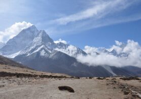
February 14, 2022
Guidelines for First Trek In Nepal
Nepal is one of the best trekking destinations in the world. The main reason for people to love trekNepal is one of the best trekking destinations in the world. The main reason for people to love trekking in Nepal is that Nepal is rich in natural beauty. Similarly, Nepal provides a lot of Mountains and Hills all around its territory. Trekking in Nepal is very entertaining even the most experienced trekkers find it fun trekking in Nepal. Likewise, trekking in Nepal is good for rookie trekkers as well. Even if you haven’t trekked anywhere and want to do your first high-altitude trek. Then trekking at the mountains and hills of Nepal can be very beneficial for you. The trekking routes of Nepal are not that hard and complicated. You can easily trek in Nepal. There are several trekking destinations here that can be perfect for you for your First Trek In Nepal.
Similarly, trekking in Nepal is easy but you will need some guidelines and knowledge before heading on the trek. There are several types of treks in Nepal. So, it’s no wonder that it attracts a lot of tourists every year. In addition, there are hundreds of trekking and climbing routes in Nepal with different lengths and difficulties. Furthermore, in Nepal treks are mainly classified into two types: teahouse trek and camping trek.
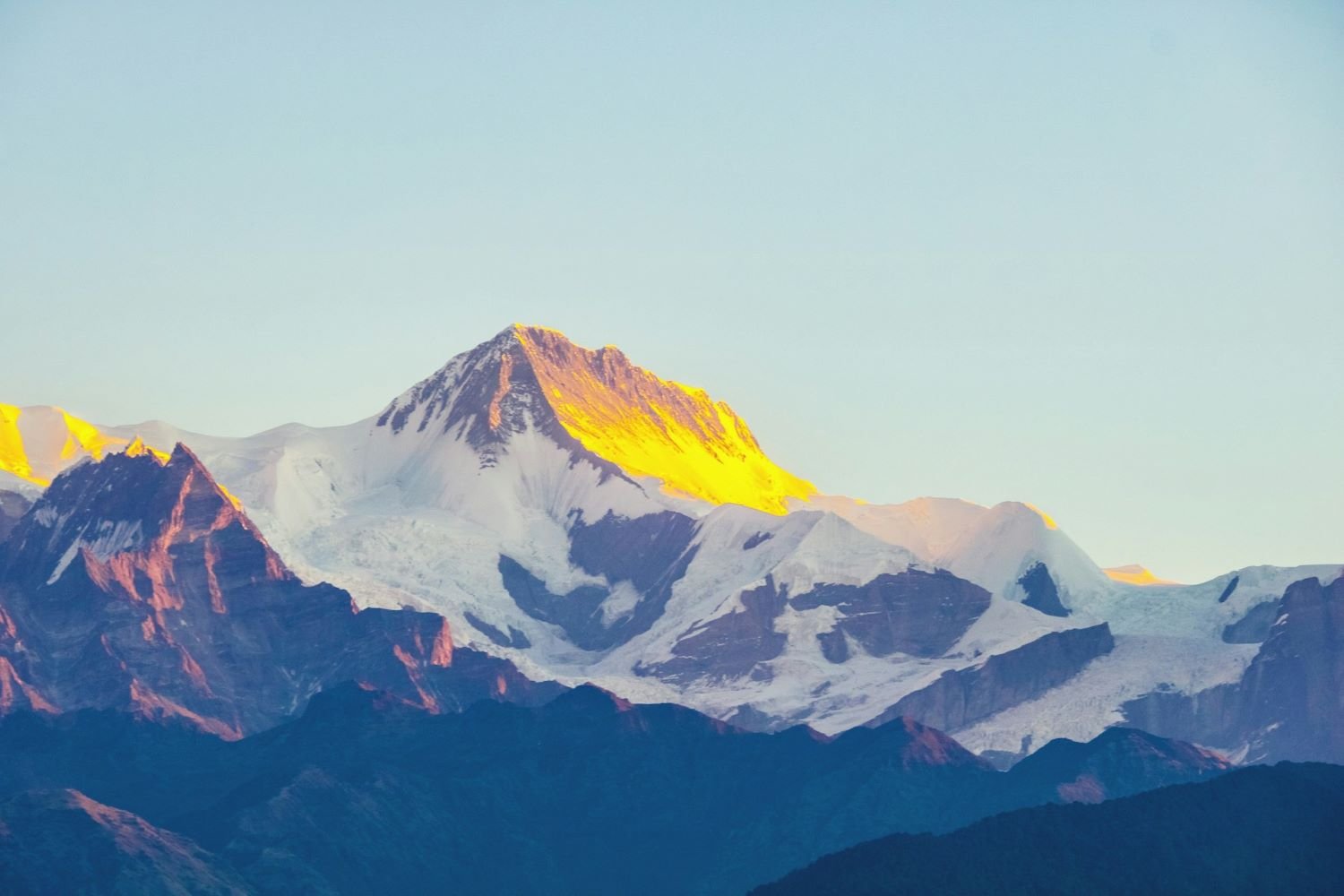
Teahouse Trek
Teahouse trek is known as the type of trek where you will stay at a lodge or teahouse for each night of your trek. Mainly all the treks in Nepal are teahouse treks. Teahouse trek is the most effective way of trekking in Nepal. Teahouse trek is very effective because it gives trekkers enough time to rest between the trek and acclimatize properly. Some of the most popular tea house treks in Nepal are:- Everest Base Camp Trek.
- Annapurna Circuit Trek
- Langtang Valley Trek
- Annapurna Base Camp Trek
- Annapurna Poonhill Trek
Camping Trek
Camping Trek is referred to as the trek where you go to the camping spot on foot and set your camp there. Similarly, when you are doing the camping trek you will get to travel to very remote areas of Nepal. In addition, the Camping trek is cheaper than the teahouse trek. Therefore, it can be very cost-effective. Some of the most famous camping treks in Nepal are:- Lumba Sumba Pass
- Limi Valley Trek
- Dhaulagiri Circuit Trek
- Dudh Kunda Trek
- Upper Dolpo Treks
Best time to visit for the First Trek In Nepal
You need to choose a perfect time for your First Trek In Nepal. Similarly, the best time to visit for the First Trek In Nepal is during the autumn and spring seasons. Most importantly, if you are a new trekker then choosing the perfect time is necessary. If you travel here during this time of the year then you will travel with clear visibility of the surroundings. Likewise, the climate is also moderate and stable. However, treks are performed at higher altitudes. So, it is obvious that the temperature is cold and chilly. But, if you travel here during this time then you will get a perfect birds-eye view of the surroundings. Furthermore, during this time the sun is out so you will be able to travel with a clear sky. Additionally, the time falls under the festive season. This means you will get to experience the different cultures of Nepal. During this time of the year, the beauty of the Himalayas is at its peak. So, the spring and autumn seasons are the best time to visit for the First Trek In Nepal. Similarly, here are some of the benefits that you will get when traveling for your First Trek In Nepal.- Travel with a clear visibility
- Get the best trekking experience
- Observe a birds-eye view of the surrounding
- Chance to travel with an experienced guide.
- Experience different cultures and festivals of Nepal
- The trails are easy and suitable for trekking in Nepal for the first time.
Why choose Nepal for your first trek?
There are many reasons for you to choose Nepal for your first trek. Nepal reaches mountains and hills. So, it provides thousands of trekking routes throughout its area. In addition, Nepal is mainly divided into 3 regions. Mountain region, hilly region, and Terai region. Similarly, the climate and weather are different in all three regions of Nepal. During your visit to Nepal, you can do different kinds of the trek. But, we prefer short treks if you are a rookie trekker. Likewise, you will get knowledge on a different aspect of this country when you trek here. Mostly, all the high-altitude treks are performed in the hilly and mountain region of Nepal. Because the hilly and mountain regions have a lot of peaks compared to the Terai region. Similarly, the mountain region is mostly for doing mountain expeditions. But, the hilly region is mainly for hiking and trekking. Most importantly, Nepal is the home to the world’s tallest mountain in the world, Mount Everest. Along with other 8000m plus peaks. This is also the main reason a lot of foreign tourists prefer trekking here. Likewise, when you trek in the territory of Nepal you will find the difference in the ecosystem. Furthermore, you can explore the different flora and fauna of the place. In addition, if you visit here during the autumn season then you will get a chance to observe Nepal’s biggest festivals, “Dashain and Tihar”. Most importantly, if you travel to Nepal you will never forget any experience you got here during the trek. Lastly, trekking in Nepal is different then trekking in other countries because of its unique climate and weather. In addition, the unique beauty of its landscape also attracts tourists.Guidelines for First Trek in Nepal
Pick up the Trek that You Think is Comfortable
There are many trekking and climbing routes in Nepal. But, if you are a new trekker and want to observe the best trekking experience. You must choose the right time for your visit here. Similarly, you should choose a perfect trek that you think is comfortable for your First Trek In Nepal. Likewise, here are some of the treks that you might find comfortable climbing as your First Trek In Nepal. For choosing the first trek you should choose some of the shorter treks. Some of the short treks in Nepal are:Ghorepani Poon Hill Trek
Ghorepani trek is one of the easiest treks in Nepal which explains the growing popularity of the place. Similarly, Ghorepani Poon Hill Trek is one of the best treks for doing the First Trek In Nepal. Likewise, the trails of Ghorepani Poon Hill Trek are easier compared to some of the other treks in Nepal. Furthermore, the trek can be completed within 2-3 days, the routes are well marked and you can find many tea houses, guest houses, and lodges on the trip. In addition, you will find very few people at the trails of Ghorepani Poon Hill Trek which will help you in the effective completion of your trek. Along with the rookie trekkers this trek is perfect for experienced trekkers as well. Ghorepani Poon Hill can be the best acclimatization for people trying to attempt the Annapurna Circuit Trek or Annapurna Base Camp trek. Altogether, the Ghorepani Poon hill trek is best for new trekkers trying to do the First Trek In Nepal.Highlights of Ghorepani Poon Hill Trek
- Get spectacular sunrise and sunset views on the manacles of the Himalayas from Poon Hill
- Experience the best panoramic views of Annapurna, Dhaulagiri, Machhapuchhre, Hiunchuli, Nilgiri, and Mardi
- Get a chance to ascend and descend the popular stone stairs of Ulleri village
- Let Slip all your hardships and pain of walking because of the amazing hospitality local people offer
- Experience the best local cuisine of the place
- Observe the culture and tradition of the place
- Explore different flora and fauna walking through the lush forests, scattered through the Gurung settlements
Helambu Trekking
Helambu trekking is the best trek if you want to experience the short trek in Nepal for the first visit. Similarly, Helambu is very near Kathmandu. So, it is easily accessible. Due to the stable climate of the place and a beautiful landscape, it is growing in popularity. Likewise, it is the best holiday destination in Nepal. In addition, the Helambu trek is short and can be completed within four days. This can be perfect for your First Climb In Nepal. Similarly, when you do the Helambu trek you will get to experience the local culture of the place. Likewise, you will get a chance to interact with the locals. In addition, if you travel here during the spring and autumn season you will travel with clear visibility of the surroundings. Along with the new trekkers it is best for those who have limited time on themselves. Furthermore, if you travel here during the winter season you will get a chance to travel in beautiful snowy surroundings.Highlights of Helambu Trekking
- Travel in one of the easiest and shortest treks of the country.
- People with a small-time limit can try this trial.
- The region is known for Buddhist monasteries and sweet apples.
- Explore the culture, tradition, and lifestyle of the Hyolmo people.
- Find ancient Sherpa towns and their traditional social practices, especially of Hyolmo people of the region
- Best for rookie and inexperienced passionate trekkers.
Emphasis on the Safety Rules for First Trek in Nepal
Traveling at a high altitude is always challenging and troublesome. So, you must value the safety rules of trekking. However, if you neglect the safety rules while trekking then it can affect your trekking experience. If you are a rookie trekker then considering the safety rules of trekking is very important. Similarly, if you have no experience of trekking the safety rules plays a vital role in your journey. Following the safety rules at the high altitude is very important because without following them you might not complete the trek properly. Most importantly, make sure that you follow all the instructions provided to you by the guide. Your guide is an important aspect for you to complete your trek effectively and safely. These things are very necessary for you if you are trekking in Nepal for the first time. Additionally, if you are trekking through Nepal make sure you pack these things for your trek.Trekking Equipment for First Trek in Nepal
- Trekking poles
- Good quality trekking shoes for trekking through steep paths
- A good quality trekking bag for carrying essentials
- UV protection, including sunglasses and sunscreen to protect you from sunburn
- Water purification tablets for drinking clear water
- Earmuffs or ear-covering caps to make you warm
- Oral rehydration solution for hydrating yourself
- Pain balm to get relief from the pain(in case you feel any pain during the trek)
- Insect vanisher for killing bugs
- Instant heating pad for warming your body
Safety Measure for the First Trek in Nepal
- You should always take safety measures when you are traveling to high altitudes. Similarly, it is very important when you are doing your First Trek In Nepal.
- You should never trek alone have an experienced guide with you all the time
- Use trekking poles and hiking boots for your trek
- Avoid altitude sickness
- Prepare yourself both mentally and physically
- Travel at your own pace
Make a Wise Choice While Choosing a Trekking Agency
Choosing the right company is very important because during your trek to the high altitudes all your necessities are performed by the agency. Similarly, your agency plays a vital role in the effective running of your trek. Furthermore, if you are planning to do the trek for the first time in Nepal choosing the right company is very important. Likewise, you should do a detailed study about the trekking agency. Most importantly, choose the trekking company which is licensed by the Nepal Government. Furthermore, make sure that the reviews about the agency are positive. In addition, make sure that you are eligible to do the trek from a certain company. Lastly, make sure that you are satisfied with the criteria of the trek.For the First Time, it is Necessary to Hire a Guide
Your guide plays a vital role in the effective running of your trekking. Especially, if you are planning to trek in Nepal for the first time, hiring an experienced guide is very important. Furthermore, if you are a foreign tourist then hiring a guide is of utmost importance for you. In addition, traveling alone to high altitudes is always dangerous. Additionally, if you travel with a guide the guide will provide you with all the necessary instructions during the trek. Most importantly, if you are doing it without any trekking experience then the importance of the guide is very important to you.Why is hiring a guide important for your first trek?
- Your guide will provide you with the necessary instructions during the trek.
- The guide will provide you necessary information during the trek.
- They will help you experience the visit like local people
- Your guide will help you make clear decisions during the trek.
- They can adapt to any situation and act accordingly
- They can educate you about the trek
- A great guide will help you transform your trekking experience completely.
- They will provide you with every small piece of information about the trek.
Keep an Open Mind on Your Trip
Having an open mind during the trek is very important. Similarly, if you have an open mind you can make clear decisions during the trek. Likewise, if you are unfocused and distracted during the trek. It might adversely affect your journey. Furthermore, traveling at a higher altitude stresses your body both mentally and physically. Therefore, if you have a clear mind during the trek it will help you decrease your stress. Having a clear and open mind will help you concentrate during the trek. Your mind is a powerful tool for you while climbing at a higher altitude. Likewise, having an open mind will help you make decisions more effectively. Due to the mental stress during the trek, having an open mind is very important.Your Body Should be Physically Fit before the Trek
Having a physically fit body is very important for you during the trek. Especially, if you are a rookie trekker and have no experience climbing at a higher altitude. Your physical fitness plays a vital role in the proper execution of your trek. Furthermore, if you have a weak body then you cannot complete any trek in Nepal. So, make sure you do a full body checkup before heading towards the trek. Likewise, running and jogging before the trek are very effective as they help you increase your stamina. And, having good stamina is always helpful while climbing to higher altitudes. Furthermore, you should not have any lung and heart-related diseases.Acclimatize well during the Trek
Your acclimatization is very important during your trek. While you are in Nepal you will get to acclimatize yourself in a suitable place. Furthermore, acclimatization is the process of getting familiar with the environment and temperature of a certain place. This is especially important because when you are traveling at a higher altitude you might fall victim to altitude sickness. Therefore, acclimatizing yourself before the trek is very important. Furthermore, if you are planning to do the first trek in Nepal you should know the importance of acclimatization. Most importantly, acclimatization helps you in relaxing. If your body is not properly relaxed then it will be very troublesome for you to complete the trek. In addition, a major reason for trekkers to fall, the victim of altitude sickness is traveling very high at a very fast speed. Your body needs proper rest between the trek. During your visit to Nepal for trekking, you will find suitable lodges and tea houses. Additionally, acclimatization is a biological process that helps you create more blood cells throughout your body. And, helps you with a good flow of oxygen. Having a good flow of oxygen is very essential for you when you travel to higher altitudes. Because sometimes the level of oxygen is not stable at the higher altitudes.Get Your Travel Insurance with Proper Coverage
Your travel insurance is an important commodity that you should have with you during your trek. Similarly, your travel insurance helps you cover all the trekking-related expenses at your trek. During your First Trek In Nepal, you should have your travel insurance with proper coverage of all the necessities of the trek. In addition, it helps you cover all kinds of unexpected expenses. Furthermore, your travel insurance will help you cover all the medical expenses, repatriation expenses, rescue missions, loss of property, and all the other losses. The risks are always high when you travel to high altitudes. Similarly, here is a list of commodities covered in your travel insurance for trekking.- Trip cancellation
- Flight accident
- Medical insurance.
- Lost luggage and other losses incurred while traveling at higher altitudes.
Travel Insurance benefits
- There are lots of benefits that you will have if you have your travel insurance with you.
- It gives you Complete Protection from all the expenses
- Your travel insurance will help you cover all the personal accidents
- Loss of Baggage(helps you in search of the lost baggage)
- Passport Loss
- Health Cover(helps you with primary first aid during the trek. In addition, in case of an emergency helps you cover all your hospital bills )
- Dental Treatment
- Hospital Daily Allowance
- Baggage Issues etc
What is covered in Nepal Travel Insurance?
Nepal Travel Insurance will cover such medical expenses and keep you secured. Furthermore, the Nepal travel insurance plan will protect you against the loss of checked-in baggage and vital documents like a passport and visa. In addition, it helps you cover hospital bills if something bad happens to you during your First Trek In Nepal or any treks in Nepal. Therefore, when you travel to Nepal you should have your travel insurance with you. Read more... Read less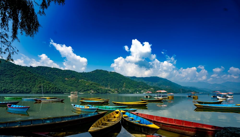
March 3, 2022
Best Honeymoon Tours in Nepal
Nepal is famous for its tourist destination. Similarly, Nepal is also famous for its honeymoon toursNepal is famous for its tourist destination. Similarly, Nepal is also famous for its honeymoon tours. Nepal offers various destinations such as the best Honeymoon Tours In Nepal. For a married couple who have tied their life threads with each other and have promised to stay by each other’s side till the very end. For that kind of couple having to spend quality time is very necessary for a healthy relationship.
So, if you decide to have your Honeymoon Plans set up in Nepal then there are a lot of options. You can either visit beautiful rivers, lakes, etc. Or, if you decide to be far away from the busy city life then trekking is your best option. But, everyone is capable of trekking. Some might not have an interest in climbing. However, climbing is a great way to get close to your loved ones and nature. Taking that aside if you decide not to trek in the Himalayan Region there are a lot of other options.
Aside from the Himalayan Region, the Terai and Hilly regions also have some of the best Honeymoon Tours in Nepal. While you are in the hilly region you can either visit Kathmandu or you can visit Pokhara for your Honeymoon. Similarly, in Kathmandu, you can visit different parks or hike infamous hiking destinations. Likewise, when you are in Pokhara you can visit different lakes. Furthermore, if you go to Terai then you can visit different wildlife reserves or do a safari tour with your partner. The most famous safari tour in the Terai region is Chitwan National Park Safari Tour.
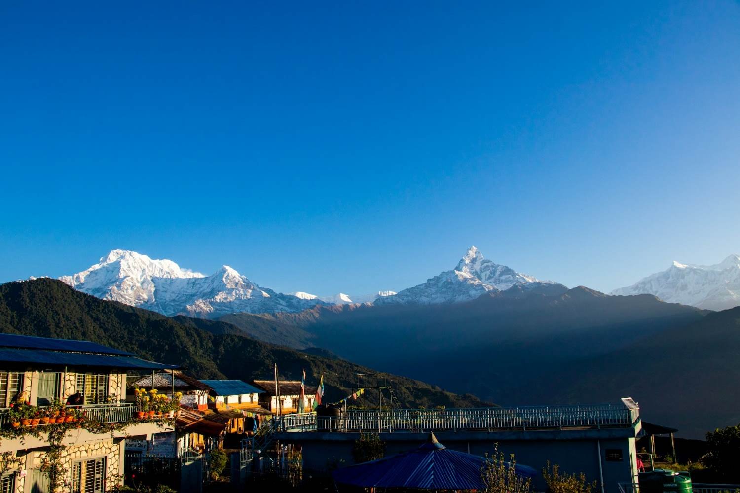
Everest Base Camp Luxury Heli Trek
Roving into the lap of the world’s tallest mountain is a dream of everyone. Similarly, the Everest Base Camp Luxury Heli Trek does exactly that. Almost every one of us has a dream of experiencing the beauty of the Himalayas. Likewise, when you do the Everest Base Camp Luxury Heli trek you will see the exquisite verdant landscapes and blooming vegetation of the place. Moreover, when you are doing the Heli trek you will get a mesmerizing view of the surroundings. Here, you will get a lifetime experience. This is one of the best Honeymoon Tours In Nepal. In addition, whenever you think about the Everest Base Camp Heli Trek these are the things that come to mind. Similarly, when you are on your Everest Base Camp Luxury Heli Trek you will get a fantastic view of the Mahalangur Himalayan Range. Furthermore, this is a perfect journey if you want to spend quality time with your loved one or a life partner. The beauty of this trek doesn’t end there. While you are doing this trek you will see the charm of the Khumbu landscapes. The Everest Base Camp Luxury Trek is considered to be the exact carbon copy of the Everest Base Camp trek. However, in EBC Luxury Heli Trek you are going to experience the trek with added luxury and comfort.Highlights of Everest Luxury Heli Trek
- Experience the abundant flora and fauna of the place.
- Explore different wildlife of the place.
- Visit Sagarmatha National Park
- Get breathtaking views of the mountains
- Fly on a scenic helicopter ride
- Explore Sherpa culture
Outlined itinerary.
- Day 1 Welcome to Kathmandu!
- Day 2 Helicopter from Kathmandu to Lukla, Trek to Phakding (8,563 ft / 2,610 m)
- Day 3 Trek from Phakding to Namche Bazaar (11,290 ft / 3,440 m)
- Day 4 Helicopter Tour from Namche to Kathmandu via Everest Base Camp
Everest Gokyo Lake Heli Trek
Everest Gokyo Lake Heli Trek is a week-long trek. During this trek, you will travel to the Everest region. So, during this trek, you will get a breathtaking view of the mountains. Similarly, this trek is very famous among all the national and international tourists. The spectacular Everest region helicopter tour is a thrilling ride over the Everest Base Camp. A lot of people do this trek for the same reason. The first few days of this trek are the same as the Everest Base Camp trek but, in this Heli Trek on day 6 or so you will ride a helicopter and you will enjoy a spectacular view of the Base Camp and Gokyo Lake. The beautiful Gokyo Lake is very famous in Nepal. A lot of people do this trek to enjoy the beauty of the Lake and the base camp. This is also the main reason for this trek to be famous. This is a perfect ride for someone who wants to experience everything in the Everest region but doesn’t want to walk the strenuous trek to the base camp. Most importantly, during this trek, you will get a mesmerizing view of the Kala Patthar. We will stop our chopper at Kala Patthar and Gokyo Lake and spend time there which will make your visit fruitful. In addition, if you are here with your loved ones on your Honeymoon Tours To Nepal then being on this trip can be memorable for you. Furthermore, when you are enjoying the beauty of the lake after landing this will make you even closer to nature. While you are in Gokyo, the pristine emerald-colored Gokyo lakes are ours to admire which will add to your visit. In addition, we will also get a chance at the beautiful Khumbu Valley, Khumbu Glacier, and the Icefall region. Similarly, on our helicopter ride, you can admire a beautiful view of some of the beautiful peaks such as Everest, Ama Dablam, Lhotse, Nuptse, and other Himalayan peaks.Highlights of Everest Gokyo Heli Trek
- Experience hiking around the famous Everest region
- Embark on thrilling flights with exceptional views to and from Lukla during this trek.
- Experience trekking to the gateway of the Khumbu region and Namche Bazar
- Explore a scenic helicopter ride to EBC and the serene Gokyo lake
- Observe different flora and fauna of the place
- Experience different local cultures of the place
Outlined itinerary.
- Day 01. Arrival in Kathmandu.
- Day 02. Sightseeing in Kathmandu and Patan.
- Day 03. Fly to Lukla, trek to Phakding.
- Day 04. Phakding to Namche Bazaar.
- Day 05. Namche Bazaar: acclimatization.
- Day 06. Heli tour of Everest Base Camp, Gokyo Lakes, and Kala Patthar.
- Day 07. Fly from Lukla to Kathmandu.
Annapurna Base Camp Heli Trek
The Annapurna Base Camp Heli Trek is a nine-long day trek. Similarly, this trek is a perfect combination of trekking and Helicopter ride across the beautiful landscape of the Annapurna Region. This is the perfect opportunity for someone who doesn’t have the time or doesn’t want to do a strenuous walk to the Annapurna Base Camp. In addition, the Annapurna Base Camp Heli Trek embarks with an enthralling flight to the lake-side city of Pokhara, where you would be trekking across some of the most beautiful terrains found on earth. This is the main reason for this trek to be famous. The Annapurna region is considered one of Nepal’s most naturally attractive and florally rich regions. So, if you do this trek you can experience the abundant flora and fauna of the place. The Annapurna region is confounded with the gleaming of the Annapurna Himalayas enhanced magnificently by the region’s fantastic mountain landscape and views. The Annapurna Base Camp Heli Trek helps you effortlessly capture all of the best elements of the region to present an experience that will be in your mind for years to come. Furthermore, this trek is perfect for those who have less time to spend climbing and trekking to the higher altitudes of Nepal. Along with all that this is the best Honeymoon Tours in Nepal. So, it is best to do this trek with your partner.Highlights of Annapurna Base Camp Heli Trek
- Luxury transportation from Kathmandu to Pokhara
- Get stunning views of the surrounding from Ghorepani and Poon hill
- Experience an astounding view of the different mountain and their landscape
- Explore different Magar and Gurung cultures and their tradition
- Walk on lakeside Pokhara
Outlined Itinerary
- Day 1 Drive From Your Hotel to Airport by Private Car.
- Day 2 Boarding
- Day 3 Pokhara to Annapurna Base Camp Flight.
- Day 4 Enjoy Your Time At The Annapurna Base Camp.
- Day 5 Annapurna Base Camp to Pokhara Flight.
Annapurna Panorama Trek
The Annapurna Panorama Trek is one of the best Panoramic treks in Nepal. Similarly, this trek is about 9 days long. So, you will have enough time to enjoy this trek and its beauty. Likewise, during this trek, you will get a lifetime experience. This trek is suitable for anyone passionate about the trek. The Annapurna Panorama Trek is one of the shortest treks in Nepal. So, you don’t have to worry about a lengthy trek. This is a short trek so, this trek is suitable for someone who doesn’t have much time to spear trekking and travel across Nepal. This trek can be said to be a carbon copy of the Annapurna Base Camp Trek but the trails are somewhat different. Similarly, this trek is suitable for couples as it is one of the best Honeymoon Tours In Nepal. Annually a lot of couples do this trek to spend quality time with their loved ones. One of the major attractions of Annapurna Panorama Trek is the hike to the beautiful Poon Hill. Poon Hill is the best hill there is in the Annapurna region of Nepal. It is the major attraction of the place because of the views it provides to the visitors. While you are here if you wake up early in the morning you will get to witness the magical sunrise in a calm environment that will energize your soul and leave you truly breathless. Similarly, as you reach the famous Ghandruk Village there you will get a warm welcome from the local people. Similarly, while you are in the Annapurna region of Nepal you can experience the beautiful cultures of the local people.Highlights of Annapurna Panorama Trek
- Explore abundant flora and fauna of the place
- Experience the different cultures of the place
- Get a panoramic view of the surrounding from Poon Hill
- Travel through some of the most beautiful Rhododendron Forest
- Visit famous places like Ghorepani, Chhomrong, and Tadapani
Outlined Itinerary
- Day 1 Arrival in Kathmandu and Trek Preparation (1,400m/4,592ft)
- Day 2 Drive from Kathmandu to Pokhara (800m/2,625ft) – 200 km, 6 to 7 hours drive
- Day 3 Drive from Pokhara to Hile (52 km, 2 hours 30 minutes), Trek to Ulleri (1,970m/6,463ft) – 4 km, 3 to 4 hours trek
- Day 4 Trek from Ulleri to Ghorepani (2,874m/9,429ft) – 9 km, 4 to 5 hours trek
- Day 5 Early morning Visit Poon Hill (3,210m/10,529ft) and trek from Ghorepani to Tadapani (2,600m/8,530ft) – 9.5 km, 5 to 6 hours trek
- Day 6 Trek from Tadapani to Jhinu Danda (1,700m/5,839ft) – 13 km, 6 to 7 hours trek
- Day 7 Trek from Jhinu Danda to Tolka (1,780m/5,576ft) – 9 km, 5 to 6 hours trek
- Day 8 Trek from Tolka to Australian Camp (2,100m/6,560ft) – 7 km, 4 to 5 hours trek
- Day 9 Trek from Australian Camp to Kande (3km, 1 hour), Drive to Pokhara (19 km, 1 hour), and fly to Kathmandu (30 minutes flight)
- Day 10 Final Departure from Kathmandu, Nepal
Mardi Himal Base Camp Trek
Mardi Himal Base Camp Trek is one of the best treks in Nepal. Similarly, this trek provides you with a breathtaking view of the Machapuchare Region. Likewise, this is not that difficult a trek; almost anyone can do this trek under the supervision of a guide. This is a simple trek that lies in Nepal. Mardi Himal Base Camp lies at 4440m altitude. Similarly, Mardi Himal Base Camp lies east of the Annapurna Base Camp. During this trek, you have to do your trek at your own pace. Or else you might fall victim to altitude sickness. Which can affect your tour. But, this is a very rare case if you are doing the Mardi Himal Base Camp Trek. The trekking routes of Mardi Himal are not that difficult. But, you have to do a steep climb at some of the places in the Annapurna Region. For the Mardi Himal Base Camp Trek, we will start our drive from Kathmandu to Pokhara on our first day of the Mardi Himal Base Camp Trek. Similarly, this trek is a hidden gem in Nepal. A lot of trekkers are passionate about this trek due to the charming nature of the trek. As a lot of trekkers make their way towards Mardi Himal Base Camp they might be able to experience a spectacular view of the Mardi Himal and other nearby peaks.Highlights of Mardi Himal Base Camp Trek
- Experience the ultimate base camp trek of Nepal
- Explore the different cultures of the place
- Enjoy a breathtaking view of Mardi Himal from the Base Camp
- Get to enjoy the local foods of the place
- Travel with an experienced guide(if you decide to take one)
Outlined Itinerary
- Day 01 Drive to Phedi and trek to Deurali (2200m, about 3 to 4 hours trek)
- Day 02 Trek to Low Camp (2,900m);7 hours walking.
- Day 03 Trek to High Camp (3585m) 5-6 hours trekking.
- Day 04 Hike Mardi Himal BC (4500m); back to Middle Camp (3200m)
- Day 05 Trek to Siding village (1,750m) -6 hours walking.
- Day 06 Trek to Lumre and drive to Pokhara- 3 hours walking and 2 hours driving.
Best of Nepal Tours
There are a lot of tourist destinations in Nepal. Among them, the most admired tourist destination lies in these three districts of Nepal. Kathmandu, Chitwan, and Pokhara. Similarly, these places provide the best honeymoon tours in Nepal as well. A lot of people come to Nepal. So, the first land to Kathmandu and after sightseeing, they go to Pokhara and after having a quality time in Pokhara they will most probably go to Chitwan for the famous Chitwan National Park and the Jungle Safari Tour. but, when it comes to trekking and Expedition they only visit Kathmandu or Pokhara. But, in some rare itineraries, Chitwan is added to the journey.Kathmandu
Nepal is a country with abundant beauty. And, the center of its beauty lies in its capital city Kathmandu. Similarly, Kathmandu city is one of the ancient cities of Nepal with a lot of beautiful architecture. Likewise, Kathmandu city is also known as the city of temples. In ancient times a lot of kings ruled Nepal for this place. The unique landscape of this place makes it favorable to rule. Similarly, the same unique landscape of the place is the main reason people find it amusing to travel here. In addition to the temples and National heritage sites. Kathmandu provides some suitable places for your Honeymoon Tours In Nepal.Chitwan
Chitwan is another famous city in Nepal. It lies in the terai region of Nepal. The major attraction of Chitwan are- Chitwan National Park
- Chitwan Jungle Safari
- Bis Hazari Lake
- Tharu Culture Museum and Research Center
- Local food, tradition, culture, etc
Pokhara
Pokhara is yet another beautiful city in Nepal. Annually a lot of People come to Pokhara to Experience its beauty. Similarly, the major attraction of Pokhara is- Phewa Lake
- David’s fall
- Mahendra Cave
- International Mountain Museum
- Gupteshwor Mahadev Cave etc
Highlights of Best Nepal Tours
- Visit world heritage sites in Kathmandu
- Come upon the Chitwan National Park
- Visit Phewa Lake in Pokhara
- One of the best Honeymoon Tours In Nepal
- Experience different cultures during the visit
Outlined Itinerary for Kathmandu, Pokhara, and Chitwan
- Day 1 Arrival in Kathmandu, Nepal (1,400m/4,593ft)
- Day 2 Sightseeing tour in Kathmandu, then drive to Nagarkot Hill Station (2195m/7201ft)
- Day 3 Sunrise view from Nagarkot Viewpoint, drive to Kathmandu, then fly to Chitwan(415m/1361ft, 25 minutes)
- Day 4 Chitwan National Park Jungle Safari, then enjoy Tharu Folk Dance
- Day 5 Drive from Chitwan to Lumbini (5 to 6 hours)
- Day 6 Sightseeing tour in Lumbini
- Day 7 Drive from Lumbini to Pokhara (800m/2624ft, 5 to 6 hours)
- Day 8 Sightseeing tour in Pokhara, then drive to Rupakot Resort
- Day 9 Flight from Pokhara to Kathmandu (35 minutes)
- Day 10 Final Departure from Kathmandu
Annapurna Luxury Trek
Annapurna Luxury Trek is the same as the Annapurna Base Camp Trek but with an added luxury to it. Similarly, this trek takes you through some of the dense forests of the region. During the trek, you cross some suspension bridges along with some steep roads. Likewise, this trek takes you through the Base Camp of the world’s 10th tallest mountain. Mt. Annapurna stands tall with a height of 8091m. If you do this trek you will get a lifetime experience. The ethnic experience that you will get during this trek is mostly Mongolian Community. The trek embarks after you reach Naya Pul from Pokhara, off to Tikhedunga. From Tikhedunga, you shall trek to Ghorepani. Early in the next morning, you will hike up to Poon Hill and trek to Tadapani. From there, you will trek to Chommrong, which takes about 5 hours. After Chommrong, you shall trek to the Himalayan Hotel before reaching Annapurna Base Camp. Following the Annapurna Base Camp, you shall trek to Bamboo. Most importantly, the average trek performed during the trek is about 4-5 hours. So, it is not that difficult. However, while doing this trek you should do it at your own pace.Highlights of Annapurna Luxury Trek
- Explore the abundant flora and fauna of the place
- Experience the local culture and tradition of the place
- Stay at a luxurious hotel in the region
- Enjoy a scenic flight to and from Pokhara
- Experience different wildlife in the region
- Experience the ultimate luxuries trek of Nepal.
Outlined Itinerary
- Day 1 Welcome to Kathmandu!
- Day 2 Fly from Kathmandu to Pokhara, Trek from Astam to Dhampus (1,700 m)
- Day 3 Trek from Dhampus to Majgaon (1,400 m)
- Day 4 Trek from Majgaon to Kande (1,770 m), Drive to Pokhara
- Day 5 Fly from Pokhara to Kathmandu, Depart!
FAQs For the Honeymoon Tours In Nepal
Is Nepal worth your Honeymoon Tour?
Many tourists, especially couples, may wonder if Nepal is a good honeymoon country. The answer is yes. From Nepal, you can enjoy stunning views of the mountains, lush, dense forests, ancient romantic paths, and courtyards. They depend on your taste. Whether economical, luxurious, adventurous, or carefree, Nepal has numerous tours and trekking. You can make a romantic trip to Kathmandu, Chitawan, Pokhara, or Nagarkot, stay in a luxury hotel or watch the sunrise over breakfast. You can also trek to Annapurna and the Everest area to bend your muscles and build stronger bonds. On your honeymoon in Nepal, there are many ways to experience your better half in different ways.Best season for Nepal Tour?
The best time to tour Nepal is the spring season from March to May and the autumn season from September to November. During these months, the sky is clear, offering vibrant views of mountains and green hills, blooming flowers, and a romantic atmosphere, so you will not be disappointed with the views. These seasons are ideal for the hills of Annapurna, Pohara, Chitawan, Kathmandu, and Everest. However, it should be remembered that this is a high season when many tourists gather in Nepal. Therefore, if you love loneliness and want to stay away from the crowd, you can do some selected tours even in the winter and summer off-season.Is Nepal Safe for couples to travel?
Nepal is certainly a safe travel country for all tourists, and Nepal promotes tourism for women traveling alone who are not facing safety issues. Couples on their honeymoon love young couples and are treated with equal love and respect by the locals in Nepal. Tourists are protected from all possible dangers by the authorities concerned. Arrival and tour details are requested in advance and recorded by security guards.Is traveling to Nepal Costly?
Traveling to Nepal is not costly. The average price for a 7-day trip to Nepal is around $ 1,135 for a solo trip, $ 2,024 for a couple, and $ 688 for a family of four. Hotels in Nepal range from $ 25 to $ 146 per night, averaging $ 41, but most vacation rentals range from $ 30 to $ 280 per night. Read more... Read less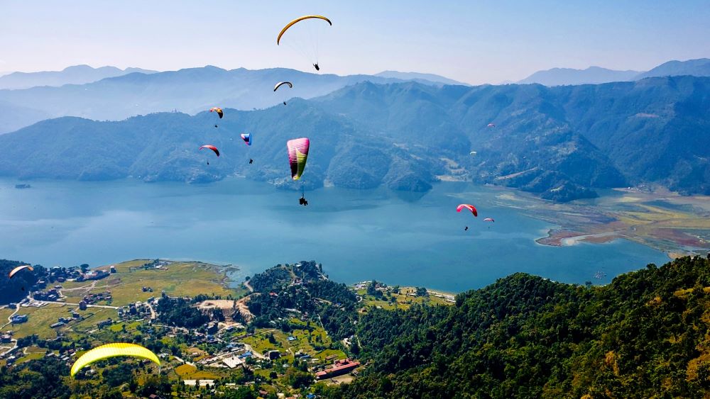
March 9, 2022
7 Days in Nepal
Nepal is the perfect holiday for someone wanting to get even close to nature. Similarly, Nepal is a Nepal is the perfect holiday for someone wanting to get even close to nature. Similarly, Nepal is a country where you can find various biodiversity in different regions. In Nepal, you can find different holiday destinations. If you want to spend a quality one-week visit in Nepal then you can find several hiking and trekking destinations. Similarly, you can also find different safari tours in this country for your 7 Days In Nepal. Here is the list of things you can do or visit Nepal for your 1-week tour.
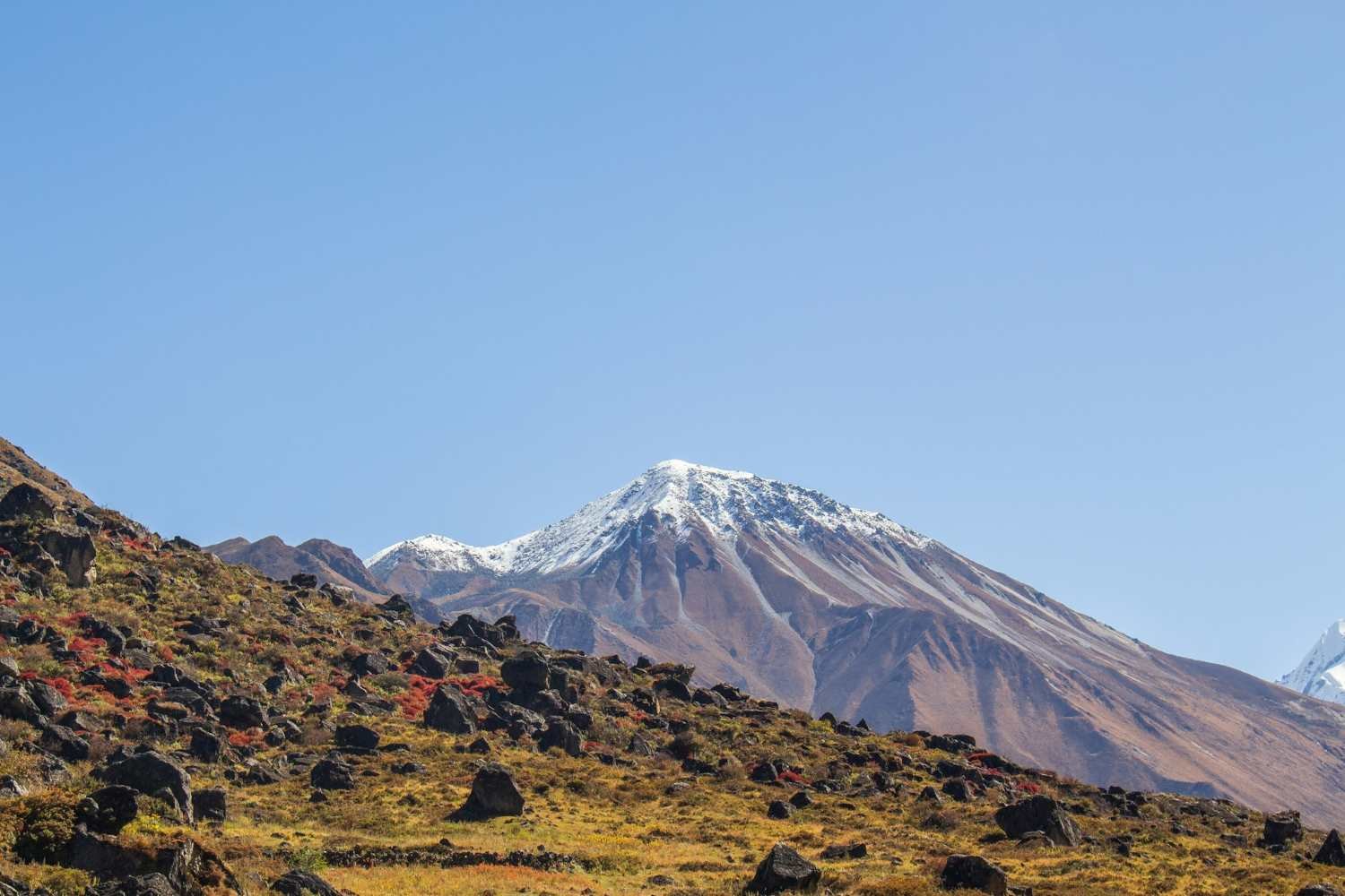
Annapurna Base Camp Short Trek
Annapurna Base Camp Short Trek is a moderate-level trek. Similarly, when you are doing this trek the trails of this trek takes you through some lush rhododendron, past the pristine white water rivers, terraced farms, hot springs, and stunning ethnic Gurung villages to Annapurna Base Camp (4130m). During this visit, you will experience and explore Gurung culture and tradition. Similarly, you will get a chance to have their traditional foods. There is a bonus about this trek that takes you through the famous Ghandruk village. Similarly, you can also enjoy the hot spring of Jinu Danda. In addition, when you are doing this trek you are going to catch a beautiful glimpse of several mountains. Like Hiunchuli, Annapurna, South Annapurna I, Khangsar, Kang, Gangapurna, Annapurna III and Machhapuchhare etc. Similarly, you are also going to travel through some famous routes in the Annapurna region. Likewise, it is one of the best places to visit for your 7 Days in Nepal.Why is Annapurna Base Camp Short Trek best for your 7 Days in Nepal?
Annually a lot of people do the Annapurna Base Camp Short Trek. This is all because this short trek is easier than the actual Base Camp Trek. Furthermore, this trek is best for traveling with friends. Similarly, if you have limited time for your trek then the Annapurna Base Camp Short trek is one of the best options. During your visit here you are going to experience different flora and fauna including some of the best wildlife in Nepal. This is best for you 7 Days In Nepal because this trek is short and won’t consume more time. Similarly, this trek is a little less expensive than the actual base camp trek. In addition, if you do this trek during the spring and autumn season your visit will be more valuable. Therefore, for the following reasons you can add this trek to your weekly visit to Nepal. Similarly, this short trek can be completed within the first couple of days of your visit.Highlights of Annapurna Base Camp Trek for 7 days in Nepal.
- Scenic flight transportation from Kathmandu to Pokhara
- Get mesmerizing views of the surrounding from Ghorepani and Poon hill
- Experience an astounding view of the different mountain and their landscape
- Explore different Magar and Gurung cultures and their traditions including their foods.
- Walk on lakeside Pokhara
Ghorepani Poonhill Trek
Ghorepani Poonhill trek is widely known for its majestic view of different mountains. Including Mount Dhaulagiri which is a famous mountain in Nepal. Similarly, this trek is one of the famous short treks in Nepal. Furthermore, when you are doing this trek then you will get to know about the local culture and tradition of the place. Likewise, if you travel here you will be resting at a comfortable teahouse facility on the trail of this trek. In addition, if you walk about 3000+ steps on the trail then you will get to see the panoramic view of the surroundings. At this trek, you will also travel or hike the famous Poonhill which stands tall a height of 10,500 feet. Most importantly, Poonhill is a go-to destination if you are doing this trek. Additionally, when you come to Tadapani you can experience the wonderful sunset in the evening while resting at a comfortable teahouse of the place. This will make you realize the beauty of this place. Similarly, this trek is also best for you for 7 Days In Nepal.Why Ghorepani Poonhill Trek on your 7 Days in Nepal
There can be several reasons for one to do the Ghorepani PoonHill Trek. Similarly, this trek is not that hard. Almost anyone with a good physical condition can do this trek. The main reason that people do this trek is to get close to nature and see the beauty of its landscapes. Similarly, when you are doing this trek then you will enjoy different alpine lakes, fields, and mountains—including Annapurna South. Likewise, this trek is less troublesome than the other treks such as Everest Base Camp, and the Kanchenjunga Base Camp trek. Furthermore, this can be a perfect destination for someone wanting to visit Nepal for a week because this trek is completed within a couple of days. In addition, you can enjoy this trek and have quality time with your family.Highlights of Ghorepani Poonhill Trek
- Experience one of Nepal’s most famous short treks.
- You can climb 3,381 steps to be rewarded by panoramic views of Dhaulagiri
- Explore and spend the night in comfortable teahouses along the trekking route
- Observe views of alpine lakes, fields, and mountains.
Mardi Himal Trek
Mardi Himal trek is one of the easiest and shortest treks in Nepal. It is also famous for its trails and route. The trek is about 40 kilometers long. Which is not that long if you compare it with something like Everest and Kanchenjunga. During this trek, you should only walk about 3-4 hours a day. Mardi Himal is famous for its beautiful landscapes and snowy peaks. Similarly, this peak is situated East of the Annapurna Peak. Annually, a lot of passionate trekkers do this trekking for entertainment. Mardi Himal is one of the hidden gems of Nepal. The beauty of this place is so mesmerizing that once you visit here you will never want to leave this place. Similarly, if you visit her you will never forget the experience you got here. Furthermore, this can be a perfect destination for you on your 7 days in Nepal. In addition, this trek is famous for its stunning views of the mountains in the Annapurna Range.Why Mardi Himal trek on your 7 Days In Nepal?
There can be many reasons for someone to love trekking at the Mardi Himal. But the most common reason for someone to love the Mardi Himal is because of the overall scenery of the place and amazing views of different mountains in the region. Similarly, if you are a rookie trekker ten this trek is perfect for you. If you want to get used to traveling at a higher altitude. In addition, this can be a perfect experience for you for your first trek in Nepal.Highlights of Mardi Himal Trek
- Get the ultimate base camp trek in Nepal
- Experience the different cultures of the place
- Observe a breathtaking view of Mardi Himal from the Base Camp
- Enjoy the local foods of the place
Everest View Trek
If you are short on time then the Everest View Trek is best for you. Everest View Trek is one of the best short treks in Nepal. Everest View Trek is a perfect destination for you for 7 Days In Nepal. The trek starts with a 35 minutes scenic flight from Kathmandu to Lukla. Similarly, in the first couple of days, you will hike through a beautiful canyon of Dudh Koshi from where you will get a beautiful view of the landscape and the surrounding. The following morning of the Everest View Trek you will go to a beautiful Everest View Hotel where you will get a perfect panoramic view of the Everest. It is a fantastic way to get close to nature. Similarly, during this trek for the Everest View Trek, you will pass through the beautiful and famous Namche Bazaar. Furthermore, when you are on this trek you will get to explore the beautiful village of the Khumbu Region. When you are on this trek you will experience different kinds of local foods which will add to your journey. Furthermore, this trek is perfect for your 7 Days In Nepal.Why this trek for your 7 Days In Nepal?
It is a relatively shorter trek than the Everest Base Camp Trek. Although during this trek you are going to experience the same feeling as the original Everest Base Camp Trek. Similarly, when you are doing this trek you are going to experience the abundant flora and fauna of the place. Likewise, when you are on this trek you are going to experience the various biodiversity of the place. This is the best trek that you can experience when you are in Nepal. Similarly, when you are doing this trek. This trek will make you want more. Likewise, after the trek, you will get full-scale knowledge about the Himalayas of Nepal. This is a wonderful trek any way you look at it. All the people you are going to meet here during your tour will add to your experience. Lastly, when you are on this trek you will get a bird’s eye view of different mountains in the Khumbu region.Highlights of Everest View Trek
- Get to travel in the famous Khumbu Region
- Get a fantastic view of the different mountains in the Khumbu Region
- Experience the tails as same as the Everest Base Camp
- Explore the abundant flora and fauna of the place
- Experience the local food, culture, and tradition of the Khumbu Region
Ghandruk Trek
Ghandruk Trek is one of the shortest treks in Nepal. Similarly, the Ghandruk trek is sometimes referred to as Ghandrung Trek. This trekking experience is for someone who is here for a short period. Similarly, this trek is best for someone wanting to spend 7 Days In Nepal. Ghandruk is a very famous place in Nepal. Annually, a lot of visitors visit here to see the beauty of the place. In addition, when doing the Ghandruk Trek you will go through the famous city of Nepal, Pokhara. During your visit to Pokhara, you are going to feel the difference in the environment. In addition, when you are doing this trek you are going to get a picturesque view of different villages in the region. Additionally, this trek gives you a birds-ey view of the surroundings. You will get to explore the beautiful view of Annapurna and the Fishtail. Which will add to your journey. The main attraction of this 3-day-long trek is the wonderful bustling villages of Ghandruk. This trek will make you want to visit Nepal again.Why Ghandruk Trek for your 7 Days In Nepal?
There can be several reasons for one to do this trek. While you are on this trek you are going to experience a lot of different things. Similarly, you are going to experience the different biodiversity of the place. During your visit to Ghandruk, you will face the same similarities as the other treks of Nepal. While you are on this trek you are going to explore different Gurung and Tamang cultures of the place which will add to your journey. Similarly, you are going to chat with the local people and know about their lifestyle.Highlights of Ghandruk Trek
- Experience the abundant flora and fauna of the place.
- Explore different wildlife of the place.
- Visit Ghandruk Village
- Get breathtaking views of the mountains and their landscape
- Fly on a scenic flight from Kathmandu to Pokhara
- Explore different cultures of the place
Luxury Annapurna Panorama Trek
This trek is a wonderful experience if you want to experience the life of the Nepali countryside. In addition, this trek can be the best way to spend your 7 days in Nepal. Similarly, this trek takes you through the wonderful route of different shepherds and donkey trains. While doing this trek you will experience a traditional Nepali farming life. This trek is a moderate-level trek. The trails of the Annapurna Panorama Trek are the same as the Annapurna Base Camp trek for the first couple of days. During your journey at Annapurna Panorama Trek, you will be walking through different famous places such as Astam, Dhampus, Landruk, and Ghandruk. Most importantly, during this trek, you will get a classic birds-eye view of Annapurna Range and Dhaulagiri. In addition, during this trek, you will get to rest at a luxurious hotel and lodge. Where you can experience different luxurious food during your stay in this region. Many people around the world call this trek one of the best panoramic and luxurious treks in Nepal.Why Luxury Annapurna Panorama Trek as your 7 Days In Nepal?
There are so many reasons for you to do this trek. This trek gives you the classic adventure experience in Nepal. The Annapurna Panorama is a classic trek of Nepal. Whereas in the Luxury Annapurna panorama trek you can experience the trek with an added luxury to it. Similarly, you can experience the different traditional life in the villages of Dhampus, Landruk, and Ghandruk which will add to your trekking experience. During this trek, you are going to learn about different Gurung and Tamang cultures and traditions. Similarly, this trek will make you knowledgeable about the different cultures of Nepal.Who can do this Luxury Annapurna Panorama Trek?
There is no special requirement to do this trek. However, you should be physically fit and mentally tough to complete this trek. Although this trek adds luxury to your trekking experience it can get a little troublesome at times. But, the added luxury will certainly help. For this trek, you should be physically fit which is the most important part of trekking at the higher altitudes. Similarly, you should not have any heart and blood-related diseases. So, if you follow these rules then your 7 Days In Nepal trekking at the higher altitude will be fruitful.Highlights of Luxury Annapurna Panorama Trek
- Explore and know the traditional life in the villages of Dhampus, Landruk, and Ghandruk
- Observe classic views of the Annapurna range and Dhaulagiri during the trek
- Get to know about Gurung culture, the largest ethnic group in the Nepal Himalaya
- Experience staying in the famous Ker & Downey lodges for a taste of luxury each night
Pikey Peak Trek
A lot of people around the world do Pikey Peak Trek to get a magnificent view of Everest. Many people say that the view of Everest from Pikey Peak is one of the best in Nepal. That is a pretty big statement but, Sir Edmund Hillary claimed it to be his preferred place from where he can get a stunning view of Everest and the mountains in the Everest region. This trek is a relatively short trek and this trek is suitable for everyone. Similarly, if you are a beginner then this trek can be the best experience that you can get traveling at a high altitude. Likewise, this is a less crowded route. So, you can peacefully enjoy your walk. Furthermore, after you reach the viewpoint then you can get a birds-ey view of the landscape and its surroundings. Similarly, the viewpoint of Pikey Peak is at a high altitude of 8251 feet. Altogether, the Pikey Peak Climbing is the best way to spend your 7 Days In Nepal.Why Pikey Peak Trek as your 7 Days In Nepal?
Pikey Peak is a short trek. So, any kind of special training is not required. Similarly, you can do this trek with your friends and family. While you are on this trekking journey you will experience different local cultures and traditions of the place. Similarly, the soil of Pikey Peak is different from the other places in Nepal. The soil is red in most parts of the place. Adding to this journey you are going to see different hills of Nepal at the peak of their beauty. In addition, this trek can be best for someone who has not done any trekking. This can be the best destination for your first trek in Nepal. Furthermore, this trek is suited for someone not wanting the extra physical challenge. Most importantly, this trek can be said as the best high altitude and short trek in Nepal. A lot of people dream about trekking at Pikey PeakHighlights of Pikey Peak Trek
- Experience climbing at the high altitudes without any extra physical challenge
- Get a mesmerizing view of Mount Everest
- Get a chance to visit different Buddhist sites (monasteries, gompas, and stupas).
- Observe differently unmatched scenery of the surrounding and landscapes.
Kathmandu and Pokhara Tour
Kathmandu and Pokhara are some of the most anticipated city tours of Nepal. Similarly, when you are doing this tour you are going to see the different cultures of Nepal. Similarly, while you are in Kathmandu you are going to visit different heritage sites. Likewise, when you are in Kathmandu you will visit UNESCO World Heritage Sites. Furthermore, Kathmandu is called the city of temples. So, it is obvious that you are going to find different old and beautiful temples around its territory. In addition, when you are in Kathmandu you are going to visit some ancient Hindu and Buddhist mythological temples such as the Pashupatinath temple, Swayambhunath stupa, and Boudhanath stupa. Most importantly, the best time to visit Kathmandu for your Kathmandu and Pokhara tour is during the time of spring. During this time it is the festive season in the country. This means you can enjoy the different festivals of Nepal. Furthermore, the Kathmandu and Pokhara tour is best for your 7 Days In Nepal. Similarly, when you are in Pokhara you can visit different famous places of Pokhara such as David Fall, Phewa Lake, Gupteshwor Cave, etc. Furthermore, when you are in Pokhara you are going to experience the different cultures of the place. Similarly, if the weather is good then you are going to view a beautiful reflection of a Fishtail and Annapurna in Phewa Lake. The most relaxing time when you are visiting Pokhara is when you are boating through Phewa Lake. Altogether the tour is going to be an unforgettable moment for you. Similarly, if you want to see the beauty of the place to the fullest extent then you should do this tour in the spring season. In addition, the best time to visit Pokhara for your Kathmandu and Pokhara tour is during the time of spring. During this time it is the festive season in the country. This means you can enjoy the different festivals of Nepal which will add to your tour.Highlights of Kathmandu and Pokhara Tour
- Visit Nepal’s most popular cultural heritage in Kathmandu valley which are a world heritage site
- Learn the culture of Kathmandu valley and Pokhara city
- Get a scenic overland journey from Kathmandu to Pokhara
- Explore the best sunrise view and breathtaking Himalayan Panorama (Annapurnas, Fishtail & more) from Sarangkot, Pokhara
- Relaxing boat trip to Phewa Lake
Kathmandu, Pokhara, and Chitwan Tour
Kathmandu, Pokhara, and Chitwan Tours are some of the best tours that you can do in Nepal for your 7 Days. This tour is very entertaining for someone wanting to do a tour here. During your Kathmandu Pokhara and Chitwan tour, you can visit different Natural, Cultural and Historical places in Nepal. Similarly, you can discover different traditions and lifestyles of Nepali people. Likewise, you can explore the beauty of Pokhara and the different Mountain Ranges. Furthermore, while you are in Chitwan you can experience different wildlife and vegetation of the place. In addition, while doing this tour you can experience the beautiful sunrise and sunset of the place. Similarly, when you are in Pokhara you can visit famous places like David Fall, Phewa Lake, Gupteshwor Cave, etc. Likewise, when you travel at a high altitude during the tour you can get stunning views of different mountains such as Mount Annapurna, Dhaulagiri, Machhapuchhre, and Manaslu. Altogether, this tour is best if you are planning to stay in Nepal for 7 Days.Highlights of Kathmandu, Pokhara, and Chitwan Tour
- Know about the different cultures of Nepal
- Experience various wildlife and vegetation when you are in Chitwan
- Get a stunning view of different mountains such as Machhapuchhre, and Manaslu.
- Get a mesmerizing sunset and sunrise during the tour.
Conclusions
These are some of the best holiday destinations in Nepal. Furthermore, this can be your best experience in Nepal. Similarly, when you visit these places you are going to experience the different cultures and traditions of Nepal. Likewise, if you are planning to visit Nepal these destinations are best. In addition, if you are planning your 7 Days In Nepal then these destinations are best. These visits will be an unforgettable memory for you in the future. Doing these visits will tell you a lot about Nepal and its people. Altogether, these destinations are best if you are planning to visit Nepal for a week. Most importantly, these tours are very easy to follow. Read more... Read less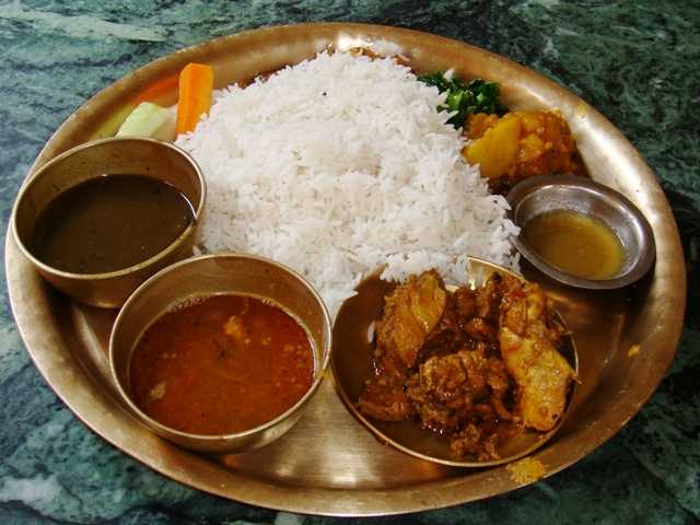
March 14, 2022
Top 10 Popular Foods in Nepal
Nepal is a Multilingual and Multi-racial country with its world inside it. Similarly, Nepal is famouNepal is a Multilingual and Multi-racial country with its world inside it. Similarly, Nepal is famous for its innumerable extraordinary natural beauty. That is the reason why Nepal is very popular among tourist destinations in the World. Nepal has its natural features and phenomenon to present itself to the world. Many people come to Nepal to enjoy its absolute beauty. This country is a living example of natural beauty. Along with its beautiful nature come to visit Nepal for its unique varieties of foods. The Most Popular Foods In Nepal are Dhal Bhat Tarkari, Newari Khaja Set, Momos, Dhido, Gundruk, Sel Roti, Chhoila, Yomari, Chatamari, Bara.
During your visit to Nepal, you can find a unique cross-section of human cultures and natural habitats. Many people experience Nepal as a museum of human cultures and civilizations. Similarly, the best time to visit Nepal to enjoy its full beauty is during the spring and autumn seasons. During these seasons you are going to find immense beauty in its surroundings. Similar to the traditional, cultural, and natural richness. The country is rich in its unique varieties of food. There are many reasons to visit Nepal. Mountaineering, Hiking, Bungee Jumping, Paragliding, Trekking, Mountain Biking, Rafting, etc. But some people come to Nepal to experience its distinctive foods.
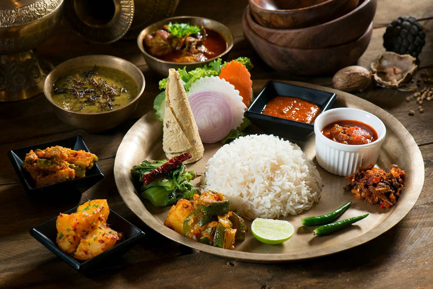
The Top 10 Popular Foods in Nepal
Daal Bhat Tarkari
Daal Bhat Tarkari is nowadays the national food of Nepal. The word Dhal Bhat Tarkari means “lentil, rice, vegetable curry. It is the foundation of Nepali cuisine. Similarly, it is one of the most Popular Foods In Nepal. Most of the people in Nepal have Daal Bhat Tarkari two times a day. It is a basic combination of foods. But, it may differ on the place, culture, and region. In Nepal without this meal, a day a person never starts. In Nepal, it is one of the most important meals. This is a simple combination of foods yet it is necessary for health purposes. Similarly, this meal is great for making healthy, well-balanced vegetarian meals. In addition, in Dhal Bhat Tarkari the main ingredients are (Rice, lentils, and vegetables). But, you can perform different experiments with this cuisine. Furthermore, this meal is good for growing children. This meal, in particular, is a very important part of any person’s lifestyle living in Nepal.Newari Khaja Set
One of the widely divided ethnic groups of Nepal, the Newars are the most versatile community when it comes to food. According to people’s opinion, the cuisine that the Newari people serve is unique and out of the world. Similarly, they prepare different kinds of cuisine among them the Newari Khaja Set is the Most Popular Foods In Nepal. Likewise, people from other communities also enjoy their food. The Newari Khaja Set is served in different restaurants and hotels in Nepal. The variety in this cuisine is something that people carve to experience. Most importantly, this cuisine is popular among foreign tourists in Nepal. Additionally, this is a huge achievement for a country like Nepal. Where a lot of cuisines are outshined by Western food. The Newari Khaja set is an exception. In addition, in Newari Khaja Set we will feast on a variety of foods. Similarly, in Newari, the most famous Newari Khaja Set is called the “Samaya Baji”. The colorful and flavorful plate of Khaja Set is something that you cannot miss. Furthermore, if you are a foreign visitor experiencing this cuisine the most when you visit Nepal.The main ingredients for this cuisine are:
Chiura means Beaten Rice Katamari means Rice Flour Crepe Aalu Tama means Potato and Boiled Shoots curry Chwela means Barbecued and marinated buffalo meat Bhatmaas / Haku Musya means Black soybeans Aalu-Wala means Spicy Potato Salad Juju Dhau means the Bhaktapur Royal curd Bodi ko Achar means Boiled Beans mixed with spices Sanya means Fried Fish Khen means Boiled Fried Egg Palu means Fresh Ginger Rhizomes Wo/ Bara meaning Lentil Patties Saag/Waucha means Green leafy vegetables Ayla means Homemade alcohol But, the ingredients and recipe can differ from place to place. Furthermore, the dishes can be prepared from spices like asafoetida, schezuan pepper, black salt, Himalayan pink salt, mustard, mustard oil, and satay of fenugreek seeds with turmeric powder.Origin of Newari Khaja Set
In ancient times the Newari community had a caste system. Similarly, in this system, there were merchants, priests, goldsmiths, and blacksmiths, while a huge section of the people were farmers. People had a particular and different lifestyle back then, and electricity and fuel were a luxury. So, they depended upon firewood to cook. Burning wood was a tedious and time-consuming job, so they decided to prepare meals twice a day and ate right before heading out to their farms, which used to be very far away. Therefore, they use to take some small snacks with them on their journey. Similarly, the snacks have food like chiura, chwela, bhatmas, palu, saag, etc., which were made so that they did not have to be re-cooked or reheated. People continued this process and it is now one of the most Popular Foods In Nepal.Momos
Momos are a special type of dumpling prepared and found in Nepal. A lot of people in Nepal love Momos. As it is one of the most Popular Foods In Nepal. Similarly, a lot of youngsters love Momos. If you visit Nepal you will find different kinds of Momo stalls in the streets and cities. Selling Momos is one of the most popular businesses in Nepal. Every Nepali family has a different recipe for this dish. Different people have different theories on how to make this dish juicy and delicious. There are different varieties of Momos in Nepal. Similarly, the most popular variety of momos found in Nepal is chicken Momo, Buff Momo, and veg-Momo. For preparing a flawless Momo you will need certain ingredients and a recipe for it. The Dough, The Filling, shaping the Momo, and steaming the Momo in medium heat. The Momos that you will find here in Nepal are utterly unique and delicious. Likewise, the cost of Momo starts from 100 to 500 Nrs.Ingredients for making Momo.
Ingredient List: Two pounds of ground chicken breast and thigh (for chicken only) Full white onion One bunch of scallions One tablespoon of grated ginger Half a tablespoon of grated garlic Half a tablespoon of white pepper One tablespoon of cumin powder Salt for taste(accordingly) Three tablespoons of oil (preferably Olive oil) Two bunches of finely chopped cilantro. Premade dough patties for wrapping the Momo. Green Chili for making sauce. One tablespoon of sesame seed for sauce Two pounds of ripe tomatoes for sauce But this changes according to the region, culture, and place to place. Furthermore, for preparing a veg Momo you will need to change the chicken with a suitable vegetable. This is suitable for vegetarian people.Origin of Momo
The history of momo was a long time ago. It was the food that originated from the Newari community. Later, when a Nepali princess was married to a Tibetan king in the late fifteenth century. It was introduced to Japan, China, and Tibet in the late fifteenth century. Initially, the first momo was made by the Newari Communities of Kathmandu Valley. Another legend says that the traders of Nepal(Newari People) liked the dumplings served to them and after they returned to Nepal they stuffed the filling and presented it to their community. Shortly after it was introduced to India.Dhido
Dhido is one of the ancient foods in Nepal. It is the most favored meal of Nepali people. A lot of people love to have this meal on some occasions. It is usually prepared by gradually adding flour to boiling water while stirring. Similarly, the traditional way to prepare Dhido is from ground buckwheat or millet. However, cornmeal is also common in Nepali households. Additionally, any kind of flour can be used to make white but these ingredients are common. Furthermore, Dido is a popular meal in Nepal also in Darjeeling and Shikim of India. There can be many secondary dishes complementing the Dhido in a traditional plate of Nepal. Most people enjoy it with mutton and chicken. However, adding pickles to the plate makes it more delicious. Many people in the Nepali community believe Dhido and Ghundruk to be the national food of Nepal. Similarly, Dhido is prepared in different restaurants and hotels. And, now it is one of the top businesses in Nepal. Likewise, this dish also plays an important role in the tourism sector of Nepal. A lot of foreign tourists come to Nepal for tasting the cultural food of Nepal. Most importantly, Dhido has made our country popular among foreigners through its unique taste and flavor. So, it is one of the most Popular Foods In Nepal.Gundruk
One of the most Popular Food In Nepal (Gundruk) is usually prepared in the rural areas of Nepal. Gundruk is one more popular food in Nepali cuisine. It acts as a side dish in many Nepali cuisines. Some people either make Gundruk as curry or add some potatoes into it and other spices or make it as a pickle. Similarly, by mixing Gundruk with onions, tomato, chilly, and other pickled items it can taste very good. Some of the popular dishes prepared from Ghundrek are ‘Gundruk ko Jhol’ and ‘Sinki ko Jhol’ To make Gundruk. Traditionally, some leafy vegetables are required to make Gundruk. The main difference between Sinki and Gundruk is, that Gundruk is prepared from leaves of vegetables, however, Sinki is prepared by tapping Roots of Radish. Gundruk has lactic acid bacteria that are necessary for acid development and contribute to making it more flavorful. Gundruk is preserved for a long time after drying in the sun. In the making process and then packaged under some polythene bag or some pouches. This food is very popular among all the ethnic groups of Nepal. It is also popular in some parts of India which are Sikkim, and Meghalaya where there are many people from the Nepali community. Usually, Ghundruk is prepared for the winter seasons. Therefore, it is the Popular Food In Nepal.Sel Roti
Sel Roti is one of the Popular Foods In Nepal. Without it any kind of occasion in Nepal is incomplete. So, it is a Popular Food In Nepal. Many small children in the Nepali community love this food. Similarly, some of the elderly people of Nepal are fond of eating this food. It is one of the unique foods in Nepal. Selroti is just like a large thin puffed-up doughnut with a crispy texture and a reddish-brown color in it. Similarly, it is prepared by grinding shocked rice to create a thick bladder. Add Ghee and Sugar for taste. This food has a high value in Nepali culture and tradition. Likewise, it is also famous in some parts of India like Sikkim and Darjeeling. The main ingredients to prepare Sel Roti are Rice flour, water, sugar, cooking oil, and ghee. But, it can change according to the community. Some prefer adding bananas, cashews, and almond and coconut mixture to it. Mostly, Sel Roti is prepared during the Dashain and Tihar. However, it is also prepared at marriage ceremonies. A lot of people eat Sel Roti as breakfast after the completion of a festival.Chwela
Chwela is the main cuisine of the Newar Community. Similarly, it also plays a vital role in the culture of the Newari people. Similarly, it has a huge significance in their community. Usually, Chwelas are very spicy. Many people love the spiciness of the food. It is the main reason for this food is very popular among national and international tourists. That’s why it is a Popular Foods In Nepal In addition, there are different types of Chwelas. Furthermore, a lot of people prefer it with Cheura as a complement to the food. Without Chwela any kind of Newari Cuisine is incomplete. This dish is very popular in the Kathmandu Valley as it is the main residence for the Newari people. Additionally, there are different types of Chwelas found in Nepal. Among them, Haku Chwela is the most popular. Mainly, preparing Chwela Buffalo’s meat is essential. However, nowadays people prepare it using chicken meat. The unique nature of the food made it one of the most Popular Foods In Nepal.Yomari
Yomari is a special and Popular Foods In Nepal. It is mainly prepared by the Newari Community. However, people from other communities love and prepare them. This food is mostly prepared during the Yamari Puja. Similarly, this dish is popular in the Kathmandu Valley. Likewise, it is also mainly prepared in the Kathmandu Valley. Most importantly, Yamari Puja is a Newari Festival. Furthermore, they celebrate this festival to mark the end of the rice harvest. By the end of this harvest celebrate this movement. The people of the Newari community prepare this food. In addition, this system has been practiced for a long time. But, recently it has become a Popular Food In Nepal.Chatamari
Chatamari is another popular food in the Newari Community. Similarly, Chatamari is a Newari Pizza. Likewise, it is very tasty food in their community. In addition, Chatamari is made out of rice flour instead of wheat flour. This food is a rice flour crepe cooked with toppings including coriander, minced meat, eggs, chopped onions, chilies, and a variety of spices. But, the ingredients can be changed according to the household. However, this is a traditional way to prepare it. Most importantly, this food has grown in popularity with its unique nature and food among the youngsters of Nepal. In addition, if you are a foreigner and planning to visit Nepal, you must try Chatamari. As it is one of the Popular Foods In Nepal.Bara
Bara popularly named (Wo) in the Newari Community are thick savory pancakes made from lentil paste; the paste is mixed with spices such as asafetida, cumin, turmeric, and ginger. Similarly, with the mixture of these ingredients, it is not just a batter. With this, it gives a wonderful taste to the batter. Nowadays you can find Bara in different restaurants and hotels as it has become a growing business in Nepal. Many people in Nepal eat it as a snack. This dish is very delicious which is why it is very popular among small children in Nepal. In addition, bara is cripped outside and fluffy in the middle. Also, it is best if you eat it when it is hot. Furthermore, if you are a foreigner then it is a must-try food on your visit to Nepal. Read more... Read less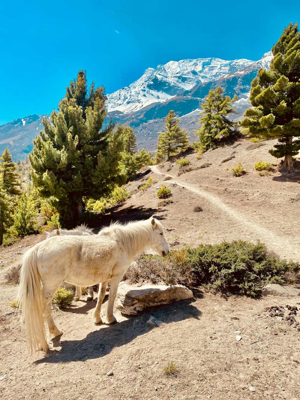
March 21, 2022
Main Attractions of Annapurna Region
Annapurna Region is one of the popular and famous regions of Nepal for trekking and climbing. SimilaAnnapurna Region is one of the popular and famous regions of Nepal for trekking and climbing. Similarly, the Annapurna region is one of the most beautiful Himalayan regions of Nepal. This is the home of all kinds of different famous mountains. Likewise, this region is the dream destination for many climbing and trekking lovers. Similarly, it is the best destination for many passionate trekkers. Due to its unique landscape, a lot of people love traveling here. Our country Nepal is blessed to have it in its territory. Similarly, the Main Attraction of the Annapurna Region is listed below.
It includes some of the most unique mountains of Nepal including the Annapurna Massif itself with some other popular mountains. Like Fishtail(Machapuchare). This region is very much suitable for trekking and climbing. With superb trekking infrastructure and easy access, most trailheads are just an hour or two from Pokhara. Similarly, when you are traveling via this region you will explore different ethnic groups such as Gurung, Manangi, and Thakli villages which will add a cultural highlight to your trip.
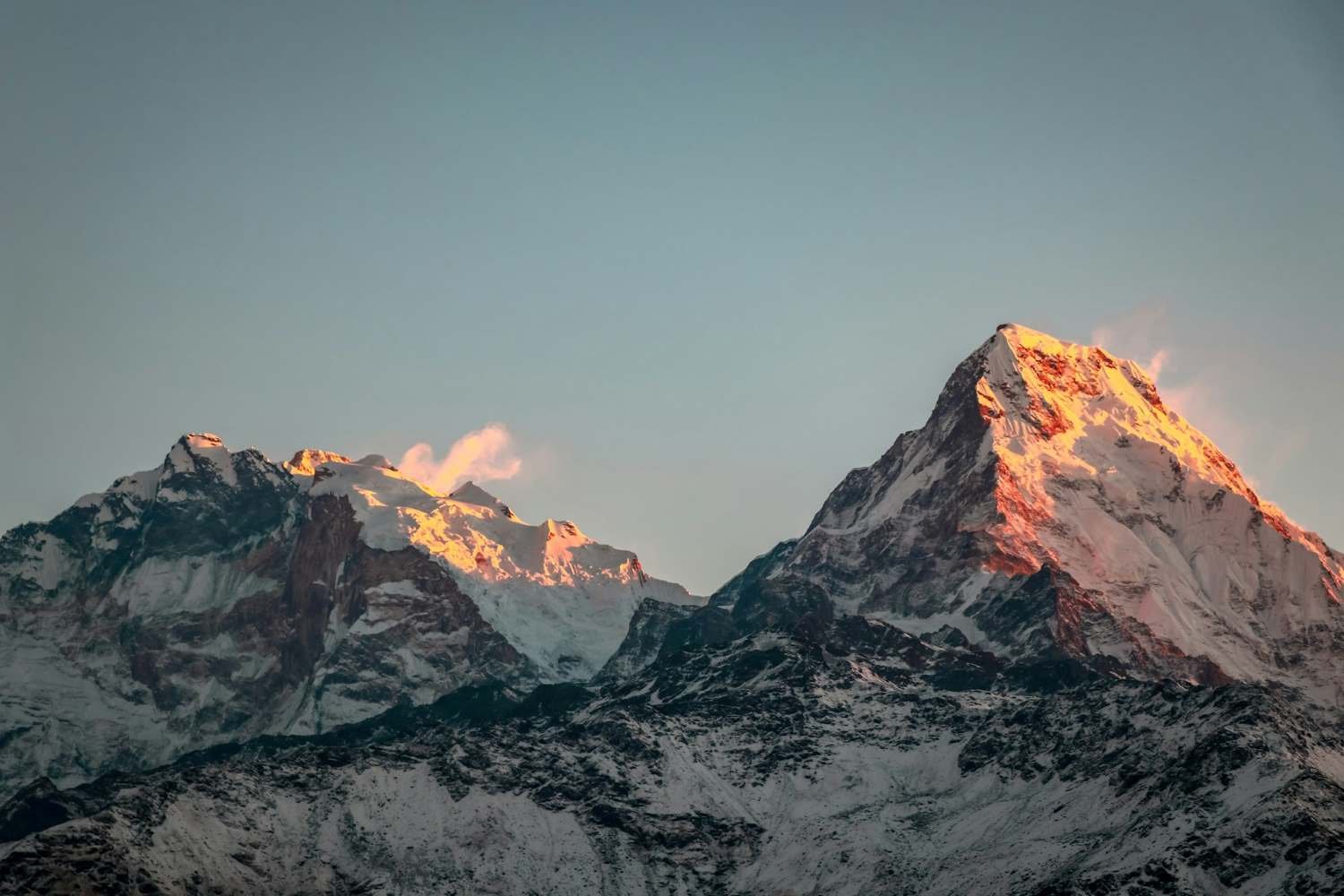
Main Attraction of Annapurna Region
There are many attractions in the Annapurna Region of Nepal. But, the most popular among them are.Pokhara – the city of Lakes
Pokhara is one of the most beautiful cities in Nepal. It is as popular as the capital city of Nepal Kathmandu. During your visit to this region first, you will arrive at the beautiful city of Pokhara. The outskirts of Pokhara are famous for their hiking and trekking in Nepal. Pokhara is filled with different kinds of enjoyment and adventure activities. Similarly, when you are in Pokhara you can participate in different kinds of adventurous activities like paragliding, bungee jumping, rafting, zip-lining, and so on. Furthermore, if you chrome here with your family and friends then you can enjoy boating in Phewa Lake. Therefore, it is the Main Attraction of the Annapurna Region.Muktinath is – the most important pilgrimage site
Muktinath is a place of great importance in the hearts of both Buddhist and Hindu pilgrims. In Hindu culture and mythology, Muktinath is known as a place of liberation.’ It is said and believed that bathing in the water from Muktinath’s 108 springs will liberate you from all your sins. According to Hindu and Buddhist scriptures, it is also one of the only places on earth to hold all five elements, fire, water, sky, earth, and air from which all material things in the universe can be made. It is the temple situated at the highest altitude. (3800m). Similarly, when you are here then you can get a magnificent view of Mount Dhaulagiri. So, it is the Main Attraction of the Annapurna Region.Manang- the most dramatic village with Annapurnas
There is no place better than Manang if you want to experience the lifestyle of people leaving in the remote areas of Nepal. The variety of food, clothing, and culture will make your mind blow. You will feel like you never want to leave here. Similarly, your visit to Manag will be very refreshing you will never forget this experience for the rest of your life. Similarly, Manang is the rest stop with a stunning view of mountain ranges, semi-deserted lands, and beautiful forests. Many people consider it as the gateway to the Annapurna region, where the trekking adventures start. Therefore, it is the Main Attraction of the Annapurna Region.Nar-Phu Valley – the twin hidden villages
The trek to Nar-Phu village is very different. Similarly, this will give you a different experience than the other trekking routes. The isolated part of the valley tells you a lot about the remote nature of the trek. As the trekking route is not as popular as other trekking routes, the rich ancient Tibetan culture is still living there. So, travelers can enjoy and travel back in time as they experience the villagers’ roving yak-herding lifestyle. With this, there is a magnificent view of vast pasture lands, white rocks, shining glaciers, the beautiful Nar-Phu River, and the beautiful Annapurna peaks. Which will add fun to your journey. Therefore, it is the Main Attraction of the Annapurna Region.Flora & Fauna in Annapurna Region
When you travel to this region you are going to find different flora and fauna of the place. Similarly, the flora and fauna of the place are both unique and rare. The flora and fauna you are going to find here are rare you cannot find this in the other places of the world. Some of the rare flora and fauna of the place are junipers, saxifrages, primulas, rhododendrons, cotoneasters, and ephedras. Similarly, if you want wildlife then you will find different species like snow leopard, musk deer, Tibetan argali, Tibetan wolf, etc. if you visit here then the abundant flora and fauna of the place will add value to your trip. Therefore, it is the Main Attraction of the Annapurna Region.Ethnic Communities in Annapurna Region
There are so many different kinds of ethnic communities that you are going to find during your visit to this region. Similarly, there are over 150000 inhabitants in this region. Including 10 ethnic groups like – Gurung, Thakali, Bhotia, Ethnic Tibetan, Magar Manangi, and Indo Aryan; Brahmin, Kshetri, Kami, Damai, and Sarki. These ethnic groups have been living here for a very long time enjoying their livelihood in the hillsides of the region. Permits and Fees in Annapurna Region There are only two types of permits for someone wanting to travel in this region.Trekkers Information Management System (TIMS)
Trekkers Information Management System or TIMS is very important for every trekker wanting to trek in Nepal. This is a basic permit implemented by the coordination of the Nepal Tourism Board (NTB) and Trekking Agencies Association of Nepal (TAAN) to make sure the safety and security of every trekker planning to trek in Nepal. Cost: TIMS permit: 1,000 NPR (Approx. US $10)Annapurna Conservation Area Entry Permit (ACAP)
This region was made a conservation area by Nepali Government in 1992. Similarly, the Annapurna Conservation Area is the largest in Nepal. Everyone wanting to trek in this region should compulsorily have Annapurna Conservation Area Entry Permit (ACAP). This conservation area is located across the Manang, Myagdi, Lamjung, and Mustang districts of Nepal. It was established to create sustainable economic and social development to benefit the local people of the region. Cost- ACAP try permit fee for foreigners: 3,000 NPR
- ACAP entry permit fee for SAARC nationals: NRP 200
When is the best time to go?
The best weather and climate that you are going to find suitable for climbing in his region is during the spring and autumn season. During this month the weather is pleasant and you can travel here in the clear sky. Similarly, you can fully enjoy the beauty of the surrounding. Likewise, if you travel here during this time then you can fully enjoy the view of Annapurnas and Dhaulagiri. Although the best time to visit here is during the spring and autumn season. Keep in mind that the monsoon season is also very favorable for visiting here. Therefore, if you are planning to visit this region then the best time is these seasons. Furthermore, if you travel here during the spring and autumn season then you are going to experience different festivals. As it is the festive season in Nepal. This time is best to enjoy the Main Attraction of the Annapurna Region.Weather and Temperature in Annapurna Region
The lower part of this region is slightly warmer than the upper part. Similarly, the temperature is around 15 degrees Celsius during the day when there is sunlight. Likewise, at the night it drops to about 7-8 degrees celsius. However, as you go higher up the altitude you will feel the weather getting a little colder. Most importantly, we recommend you check the weather forecast before leaving for the trek.Annapurna region after Earthquake
The earthquake in Nepal was very devastating. But luckily for us, not many trekking routes in Nepal were devastated. Similarly, the trekking region like Kanchenjunga, Makalu, Annapurna, Dhaulagiri, Lower and Upper Mustang, Dolpo, Humla, and Jumla escaped the widespread damage. So, they were ready to welcome all the passionate trekkers in the autumn of 2015. This region has also escaped the earthquake. Even after the earthquake a lot of trekkers planned their trek from Pokhara. And, completed the trek under the shadow of Mount Annapurna and Mount Dhaulagiri.Annapurna Region Trek Options
There are a lot of trekking options when you are trekking in this region. Due to the beautiful landscape of the region, you can find different trekking options in this region.Tiji Festival Trek
The Tiji Festival mainly falls under the spring season. Similarly, this festival trek takes place in Lo Manthang. This is a spring-renewal party that ushers in the monsoons while celebrating the triumph of good over evil in a ritual locals call “the chasing of the demons.” Tiji comes from the words ten Che, meaning the “hope of the dharma prevailing in all worlds. Likewise, this is a very popular festival in the Upper Mustang region. In addition, if you visit the Annapurna Region during the spring season then might also experience this festival. Additionally, the Mustang Tiji Festival Trek is one of the most popular Festival Treks In Nepal. Altogether, if you get a chance to experience this festival then the memory of the festival is going to be lifelong.Highlights of Tiji Festival Trek
- Get a chance to visit Historical places including Kagbeni and Lo-Manthang.
- Observe 3 days of Tiji Festivals in Upper Mustang and know their culture
- Explore the very beautiful backdrop of Dhaulagiri, Nilgiri.
- Experience the best views of the Himalayas range.
Annapurna Sanctuary Trek
Annapurna Sanctuary Trek is one of the most anticipated treks in Nepal. During the Annapurna Sanctuary Trek, you will be traveling into the frozen hearts of the Annapurna Region. The trail of this trek takes you through the beautiful rice paddies and leads through a gorge of bamboo and forests. Similarly, during this trek, you are going to see the beauty of the landscape. During this trek, you are going to experience different cultures and traditions of the place which is going to add value to your trek. Furthermore, you can get a 360-degree view of the Annapurna ranges, Hiunchuli, Gangapurna, and Machhapuchhre Himal from the Annapurna Base Camp. Which are also the main attraction of the trek. Similarly, if you do this trek during the spring and autumn season then you can explore the full beauty of the place. Likewise, the trails and routes also get easy during this time of the year. Therefore, it is the Main Attraction of the Annapurna Region.Highlights of Annapurna Sanctuary Trek
- Get an amazing view of the surrounding
- Experience the local culture and food
- Observe a 360-degree view of the Annapurna ranges, Hiunchuli, Gangapurna, and Machhapuchhre Himal from the Annapurna Base Camp.
- Experience traveling with 7000 and 8000 plus peaks around the trekking routes.
Begnas Thulokote Hiking
Begnas Thulokote Hiking is a 1-day hike. So, it is suitable for someone not wanting a physically tough trek. This hike is for someone who just wants to enjoy traveling in Nature. Similarly, you don’t need any kind of special training for this hike. You can simply enjoy the hike by being in the open air and enjoying the beautiful landscape. Most importantly, the Begnas Thulokote Hiking is a part of the Annapurna Royal Trek. The Begnas Thulokote Hiking starts with the beautiful city of Pokhara. This hiking destination is one of the most beautiful Hiking destinations in Pokhara. During this trek, you can enjoy a stunning view of the Annapurna and Himalayas. So, will not forget the tour for the rest of your life. Therefore, it is the Main Attraction of the Annapurna Region.Highlights of Begnas Thulokote Hiking
- Enjoy great views of Annapurna and the Himalayas
- Travel in the footsteps of royalty on a hike that is part of the ‘Royal Trek’ completed in 1980 by Charles, Prince of Wales
- Learn and explore the region from commentary by the guide
- Experience traveling by private guide and transportation, boat ride, and hotel pickup and drop-off.
Pokhara Day Tour
On this day tour, you will get a chance to know about Pokhara within a single day. During this Pokhara Day Tour, we will get to know about the local culture. During this day tour, you will be boating to the most beautiful lake in Nepal the Phewa Lake. if the weather is right then at Phewa Lake you are going to see the image of a Fishtail in the lake. Similarly, you can visit the Gupteswor Temple. The other place that you can visit on your Pokhara Day Tour is Davids Fall and Shree Gaden Dhargay Ling Monastery, etc. these places will add value to your trip. A lot of people including both national and international tourists visit these places on their Pokhara Day Tour. Altogether, this is the best tour in the Annapurna Region.Highlights of Pokhara Day Tour
- Experience World Peace Pagoda Sunset Tour
- Explore the ancient Gupteshwor Cave and Seti Gandaki gorge.
- Observe water fun trips on Phewa Lake and visit the local market.
- Visit the mountain museum as it is a source of mountaineering information.
- Get splendid views of the Annapurna Himalayan range during the tour.
Annapurna Circuit Trek
Annapurna Circuit Trek is one of the famous trekking journeys in the Annapurna Region. Annually a lot of passionate trekkers love trekking here when they visit the Annapurna Region. The whole Annapurna Circuit lies within the 7,629 sq. km which makes it a very big circuit trek. This trek is mostly around two weeks long. So, you should come prepared for this circuit trek. Similarly, during this trek, you will dramatic desert-like, Tibetan-style scenery of the upper Kali Gandaki Valley. Most importantly, the best time to do the Annapurna Circuit Trek is during the spring and autumn seasons. During this time of the year, you can travel in the clear sky. Furthermore, the trails get easy for you to travel. But, for the circuit trek, you can also do this in the monsoon season in June. Similarly, during the trip, you will travel through some of the most beautiful valleys along the way. Which will add value to your circuit trek.Highlights of Annapurna Circuit Trek
- Travel through some of the remote trekking routes
- Get a magnificent view of the surrounding
- Get a birds-ey view of Annapurna from the Annapurna Base Camp
- Experience to know about the local culture of the place
Upper Mustang Trekking
The upper mustang is a moderate-level trek. Anyone with any physical condition can do this trek without any difficulty. Usually, the Upper Mustang Trek is about 15 days long. Similarly, you can start your Upper Mustang Trek from Jomsom and end from the same place. Likewise, this is one of the must-do trekking destinations in the Annapurna Region of Nepal. A lot of young and passionate trekkers do this trekking all around the world. Similarly, this trek is also very famous among national visitors. Likewise, during this trek, you are going to explore Newari and Thakali culture and food. This will make you fall in love with Nepal. The deep desert of the place will make you feel like you are in a whole new world. This is also the main reason for this trek to be famous. Therefore, it is the Main Attraction of the Annapurna Region.Highlights of Upper Mustang trek
- Explore the ancient Kingdom of Lo Manthang
- Experience trekking through a stark desert landscape with spires and cliffs
- Observe lying in the rain shadow, a great trek to escape the summer monsoon
- Learn about the different cultures of the Upper Mustang.
Mardi Himal Trekking
Mardi Himal Trek is a short Trek with all the elements of the trekking journey. Everyone can enjoy the adventure during the trek. As it is one of the easiest treks in the country. Similarly, this trek is recently opened by the Nepal Government. This trek is best for someone who hasn’t got any experience in climbing or trekking. Similarly, if you are looking for a short trek in the Annapurna Region then this trek is best for you. During this trek, you will get the ultimate Himalayan feeling which will add to your journey. Most importantly, when you are at the Mardi Base Camp you will get an outstanding view of Fishtail and other mountains in the region. The Mardi Himal Trekking is a short trek which means you can complete this trek in a very little timeframe. Although this trek is a short trek that can be completed within 10 days, this will give you the extreme Himalayan experience. Similarly, during this trek, you will pass through different villages where you can learn a lot about the culture and tradition of the place. A lot of people have done this trek and all of them have a positive review of the trek. Every one of them loved it. So, if you are in this region, you should do this trek. You will have a lifetime experience. Therefore, it is the Main Attraction of the Annapurna Region.Highlights of Mardi Himal Trekking
- Get to know about different cultures of the place
- Get an ultimate trekking experience
- Explore different villages along the way
- Experience an ultimate trekking experience.
- Observe a stunning view of Machapuchere and Mardi Himal from the base camp.
Pokhara to Annapurna Helicopter Tour
This is a very famous tour in this region. A lot of people love to do this Helicopter Tour. Similarly, this tour allows you to bask in the splendors of nature and experience Nepal’s dotted travel destinations from the comfort of a helicopter. You will have your meals at the awesome vistas of snow-capped peaks, glaciated passes, quaint village settlements, and panoramic landscapes. This will add value to your tour. Likewise, the tour runs for about 1.5 hours by helicopter. During this time you will get a bird’s eye view of the Annapurna Base Camp. similarly, you will get an outstanding view of the lush forest and unique landscapes. Furthermore, the Annapurna Base Camp Helicopter tour takes you to some of the bases of Annapurna Range of Mount Fishtail, Gangapurna, Hiunchuli, and Nilgiri Peaks. Most importantly, the helicopter tour costs depend upon the itinerary that you choose. It usually is around $500 to $600. Therefore, it is the Main Attraction of the Annapurna Region.Highlights of Pokhara to Annapurna Helicopter Tour
- Get a scenic view of the surrounding from the helicopter
- Enjoy the views from Annapurna Base Camp
- Get to know about the local culture of the place.
- Experience having meals at the snow-capped peaks, glaciated passes, and quaint village settlements.
Ghorepani Poon Hill Trek
The Ghorepani Poon Hill Trek is a magnificent trek near Pokhara at the heart of the Annapurna region which will give you stunning views of the snowy rugged Annapurna and Dhaulagiri Himalayan range. The trek to Ghorepani Poon Hill will be a lifelong memory for you. The trek is normally for about 10 days but it depends on the itinerary you choose. During your visit to Ghorepani Poon Hill, you will be knowledgeable about a lot of local cultures. Similarly, you can enjoy different local foods that will add value to your trek. Furthermore, you should not be that experienced to complete this trek. Altogether this trek is very exciting. We recommend when you visit the Annapurna Region, you must do Ghorepani Poon Hill Trek.Highlights of Ghorepani Poon Hill Trek
- Learn about different cultures of the place
- Experience different foods while visiting the place
- Travel enjoying the beauty of the landscape
- Get an ultimate trekking experience while doing the Ghorepani Poon Hill Trek
Heli Sightseeing Pokhara
This is a 30 minutes Heli Tour. During this Heli Tour, you will get a wonderful view of the surroundings of Pokhara. On this trek, you will fly over many lakes like Begnas Lake, Rupa Lake, and last but not least Phewa Lake. Altogether, this trek will be a fun experience for you.Highlights of Heli Sightseeing Pokhara
- Fly over the beautiful city of Pokhara
- Get a wonderful view of crystal clear lakes
- Experience 30 minutes of exciting Heli Tour
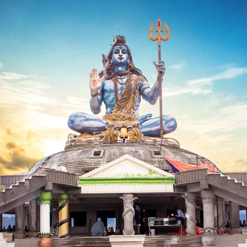
March 28, 2022
Pumdikot View Tower
Nepal is home to different kinds of beautiful places. Similarly, among them, Pokhara is one of the mNepal is home to different kinds of beautiful places. Similarly, among them, Pokhara is one of the most extraordinary and unique places. It is home to all kinds of different lakes, caves, and religious places in Nepal. Furthermore, Pokhara is at the height of 884 meters and approximately 203 Km to the west of Kathmandu. Likewise, Pokhara is one of the most popular tourist destinations in Nepal. Most importantly, Pokhara is a powerful spiritual land. In addition, it is a spiritual land, resting on the kind lap of the Annapurna Range. So, it is the main reason for the increasing popularity of Pumdikot View Tower. A lot of trekking and hiking destinations start from Pokhara.
If you visit Pokhara you will find a unique cross-section of human cultures and natural habitats. Pokhara is heavenly blessed with swiftly flowing rivers and lush vegetation. This is a city of paradise where a lot of tourists visit to enjoy the sheer beauty of nature.
Most importantly, you can get a 360-degree view of Pokhara from the Pumdikot View Tower. Only a single visit to the heavenly blessed city makes sure that the visit can be a memorable moment for you. The visitors cannot forget the experiment forever and ever. Similarly, Pumdikot View Tower is a recently opened tourist destination in Pokhara. Likewise, it is a three-storied view tower.
Which is at the Pumdi-Bhumdi village, a neighboring tourist city of Pokhara. Additionally, the village is at an altitude of 1500 meters from sea level. If you visit here you will get wonderful views of the Annapurna Range. Furthermore, the cost of making this view tower was about 6.4 million. This view tower offers the view of Pokhara city, Phewa Lake, Lekhnath, Sarangkot, Pame, and World Peace Stupa. And some parts of Syangja, Parbat, and Tanahun districts. Likewise, you can see mountains like Machhapuchre, Annapurna, and Dhaulagiri from the tower.
Construction of Pumdikot View Tower
Without the help of the District Technical Office, Pokhara, and the Ministry of Peace and Re-Construction this project would be impossible. Similarly, with the construction of Pumdikot View Tower, the Pumdi-Bhumdi village is now a famous tourist destination in the Annapurna Region. Pumdi-Bhumdi has recently been developing as an attractive destination for tourists. The view tower has become a popular landmark of Pokhara. Pumdikot View Tower is one of the best places in Pokhara for getting marvelous Mountain Views and views of Pokhara valley. The main attraction of the place is a 50 feet high statue of Lord Shiva. And, amidst the theme park. The Shiva statue has made the identity of the tallest and the largest statue in the country. Most importantly, the overall construction of the park and view tower is still going on. However, it has attracted a lot of tourists with its potential and views. Most importantly, it is a master plan that includes the construction of this view tower, trekking trails, conference halls, cottages, and roads.Major Attraction of Pumdikot View Tower
- Explore the tallest and biggest statue of Lord Shiva
- Beautiful theme Park
- Famous View Tower
- Get the most captivating view of the entire Pokhara Valley
- Experience the best viewpoint for the Annapurna and Dhaulagiri Massif
- Observe the most interesting remote settlements with unique cultures and traditions.
A New Attractions in Pokhara
There are a lot of attractive places and things to do in Pokhara. But, the View Tower and Shiva Statue are the newest and most famous attractions in Pokhara.Why is the Pumdikot View Tower an attraction in Pokhara
This view tower is one of the new attractions in Pokhara. There are a lot of attractions in Pokhara like David’s Fall, Gupteshwor Cave, and different kinds of temples and religious towers. Because of the View tower, the Pumdi-Bhumdi village is now a famous tourist destination in Pokhara. A lot of National and International people love to visit this tower. Similarly, the main reason for this tower to be an attraction in Pokhara is it provides a wonderful view of the Pokhara valley and many mountains. Similarly, with the help of the view tower, a lot of villagers are running their lifestyles smoothly. Although it lies in the neighboring village of Pokhara. Similarly, this is the perfect destination to visit from Kathmandu and other districts of Nepal. A person who comes to Pokhara loves to visit the view tower as it gives a mesmerizing view of the surrounding and beautiful landscapes. Furthermore, Pumdikot View Tower is situated at Pumdi Bhumdi which is right upward from World Peace Pagoda. Which is another famous attraction of Pokhara. Likewise, the World Peace Pagoda also attracts a lot of foreign tourists. This also helps in the overall development of the tourism sector of Pokhara. Additionally, when you are at the place you will get a wonderful sunset. Nowadays a lot of youngsters love to visit the place for sheer entertainment.View Tower
Pumdikot View Tower is a supplementary tourist attraction in Pokhara. Similarly, it is popular for its view tower and a huge Shiva statue. The new 3-story view tower is just above the World Peace Pagoda in Pumdi Bhumdi Village in Pokhara. Which adds value to the View Tower. Due to the help of the View Tower, the remote Pumdi-Bhumdi is slowly but steadily developing. Likewise, the view tower also helps the village by attracting different tourists from all around the world. The view tower helps the tourist to know the local culture and tradition of the place. When they come to visit the view tower. Most importantly, the view tower is a distinguished landmark of Pokhara. But, the construction of the tower is still going on. However, it is rapidly becoming an attraction to many tourists. Similarly, the overall construction of the park is still going on. Although it is still under construction it has attracted many tourists as one of the most loved hill stations in Nepal. Furthermore, when you are at the hill station it offers you a magnificent view of the surroundings. Similarly, this hill station gives you a wonderful view of famous peaks and mountains such as Dhaulagiri, Annapurna, and Machhapuchhre mountains. Therefore, it is a must if you visit Pokhara.Shiva Statue
There is another wonderful thing to get excited about while visiting the Pumdikot View Tower. A gigantic statue of Lord Shiva at Pumdikot with a height of 51 feet. The statue sits on top of an enormous dome in the theme park. Similarly, the total height of the temple is 108 feet. Likewise, the nearby theme park has an attractive garden with a 108-step stairway to visit the Shiva Statue. Furthermore, the view from the theme park is majestic. You will forget all the hardships of your life. Additionally, you can visit this place to be far from the busy city life. Similar to the Shiva statue, another major attraction of the place is the Shiva Damaru. Which adds value to your visit and the place. Most importantly, the Shiva Damaru in Pumdikot is considered the biggest in Asia. The same thing also attracts a lot of tourists annually. Additionally, there is another plan to construct Martyrs’ Memorial Park with a model of Mount Sumeru featuring shrines to Parvati and Shiva.How can Pumdikot View Tower help in the development of the tourism sector of Pokhara?
Pokhara is and always has been one of the most popular tourist destinations in Nepal. Due to the unique nature of the place and different landscapes, it has always been the best tourist destination in Nepal. However, the addition of Pumdikot View Tower has increased the total number of tourists arriving in Pokhara. Not only international tourists but also national tourists love visiting Pokhara just to see the view tower, park, and shiva statue. Because it is unique and you cannot find the same elements anywhere in Nepal. Similarly, Pokhara has a lot of tourist destinations like Phewa Lake, David’s Fall, Mahendra Cave, etc. Similar to these famous places now the Pumdikot View Tower is also a tourist attraction in Pokhara. Due to this nowadays the tourism sector of Pokhara is developing. Furthermore, the overall infrastructure of the place is also developing. Several major plans are going on for the development of Pokhara and Pumdi-Bhumdi villages. Therefore, Pumdikot View Tower is playing a vital role in the development of the Tourism Sector In Pokhara.Hiking routes of Pumdikot View Tower
If you are looking for a simple hiking route to reach Pumdikot View Tower. Then don’t look anywhere. We will give you a perfect guide on how to reach Pumdikot View Tower with an easy trail and route. Most importantly, for a comfortable hike, you should start your hike from Chhorepatan or at least from Stupa. Which takes around 45 minutes from the stupa. However, the last part of the hike is slightly steep, which can be a little uncomfortable for new hikers. But, the same hill just below the tower provides the best views on a beautiful day. To enjoy and travel in good weather. You can choose the month in the spring season. Similarly, you can see the most beautiful view of Mount Machhapuchhre. Likewise, on your right is Phewa Lake on the bottom, beautiful hills on your left, and also the view of Pokhara. Furthermore, the stoned steps trail to the view tower is so pure and untouched. You will feel it when you get there. It is so underrated and great because tourists ride on the motorway now and this last part is untouched and emits pure natural vibes. Additionally, if you are a nature lover then this place will be equal to heaven for you. Just make sure you choose the right time to do the Pumdikot View Tour tour.What to expect on this tour?
It is a three-storied view tower constructed at Pumdi-Bhumdi VDC. It is a neighboring tourist city of Pokhara. Pudi-Bhumdi village is at an altitude of 1500 meters from sea level. The whole project costs around 6.4 million. The tower gives a wonderful view of Pokhara city, Phewa Lake, Lekhnath, Sarangkot, Pame, World Peace Stupa, and some parts of Syangja, Parbat, and Tanahun districts. Similarly, you can also enjoy a majestic view of Machhapuchhre, Annapurna, and Dhaulagiri mountains. Along with it, the scattered villages on the lush hillside provide a glimpse of the pure Nepali cultures and traditions. There below is a short and simple description of some of the major attractions of the Pumdikot View Tower.Hiking to Pumdikot View Tower
There are a lot of wonderful hiking destinations in Nepal. Similarly, hiking in Nepal is a wonderful experience. The unique landscape adds to the hiking experience in Nepal. Hiking is one of the most popular tourism activities in Nepal. Pumdikot view tower and the big Shiva Statue are about 13 km southwest of the primary market of Pokhara. Likewise, if you are planning to hike in this region you better start it early in the morning. You can hike up to the World Peace Pagoda. In addition, you can choose various options to reach the Pumdikot View Tower. You can do hiking trails, blacktopped roads, and cycling trails, to get to the place. And after you reach the place. You can either visit the Buddhist shrine or head uphill to Pumdikot Danda. The choice is yours. And, you can reach the place within 45 minutes of the uphill climb from the World Peace Pagoda. The journey is going to be very fun for you. In addition, it can be an entertaining journey for you. Moreover, while hiking to Pumdikot View Tower you will get an ultimate hiking experience in Nepal. The trail is pure and natural and also very easy to take. There is no special requirement for hiking to the Pumdikot View Tower. Apart from this, you can also take a vehicle. But, the roads are slippery and can be quite uneasy. Therefore, hiking is a good choice.Hike to World Peace Pagoda and Shiva Statue
While you hike uphill from Pokhara. You will get a wonderful view of Phewa Lake and nearby temples. That will follow you along the way. As the hiking goes on, the views become wider and clearer. Similarly, the morning rays of the sun peeking through the majestic mountains like Annapurna, Machhapuchhre, and Dhaulagiri will encourage you on your tour. As you reach the World Peace Pagoda, you will have a great angle view of nearby lakes and Pokhara city. After hiking for about 40–45 minutes, you will reach the hill just below the enormous statue of Mahadev and the Pumdikot Viewpoint. Walking past the green hill is one of the greatest moments of hiking near Pokhara. After you climb up the hill, you will explore the great Pumdikot Shiva Statue right before you. Lord Shiva rests on an enormous dome. Right beside the statue, you view a three-story view tower. Climbing up the tower offers a wonderful view of Pokhara city, Sarangkot, the World Peace Pagoda, and different lakes. As you see the mountains looking right at you, you can’t stop smiling and being happy. With the touch of the cool breeze on your face. With the beautiful scenery and the mountains, you will create a lifetime memory at the viewpoint. Without a doubt, the Pumdikot hike is one of the top experiences in Pokhara.Last but not the least
Pumdikot View Tower is the most wonderful destination in Pokhara. Also with the addition of the view tower, it has become the most popular choice of visitors. It is a majestic place not only in terms of its strategic location of the place but also of the pristine and undeterred environment. We recommend you to visit the Pumdikot View Tower while in Pokhara. It is the most glorious hike in Pokhara. You would love this tour. Read more... Read less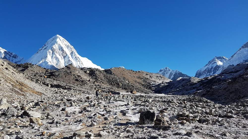
April 4, 2022
Everest Base Camp Heli Tour
The EBC Heli Tour is best for someone who is interested and wants to tour the Everest Region but doeThe EBC Heli Tour is best for someone who is interested and wants to tour the Everest Region but doesn’t have much time on his hand or is just not ready yet. Trekking is one of the most popular hobbies in the world. And, traveling to the Himalayas is the dream of every adventure addict.
And of course, the Everest area is a trekking paradise. Likewise, trekking to Everest Base Camp requires little free time, strength, and preparation. Similarly, Everest Base Camp Heli Tour is the best way to experience the highest peaks in the world. Everest (8848m).
The Everest Base Camp Heli Tour is specially designed for those who want to avoid difficult trekking and don’t have enough free time. Moreover, the EBC Heli Tour gives you immediate access to the Everest Base Camp with panoramic views of the most beautiful mountains.
Nepal is a land of the wonderful Himalayas and stunning natural wonders. Most importantly, there are 14 mountains in the world with a height of over 8000 meters. And eight of them are in Nepal.
So if you want to experience the huge mountaintop wilderness, Nepal is your best choice. Similarly, it will give you many wonderful experiences that you will cherish forever.
Nepal has ample space for hiking, trekking, and mountaineering. Of all the places, everyone likes to visit the Everest area. Indeed, this mysterious area offers all its uniqueness. Everest Base Camp Trekking is painful, physically demanding, and troublesome at times.
So if you don’t have enough time and physical condition to experience the beauty of Himalayan heaven, the EBC Heli Tour is what you need to make your dreams come true.
The Everest Base Camp Heli Tour is a great trip to the Everest region, which offers uncompromising views of the high Himalayas. This is one of the best luxury trips in the world and you don’t have to worry too much.
Just choose this tour and enjoy a smooth ride. Furthermore, you should not go against a fierce trip. We are always there for your support.
Everest Base Camp Trek is one of the most attractive experiences of her life. Book a special chartered helicopter service on this tour. You enjoy the wonderful Mountains of Nepal and enjoy a view that has not been disturbed.
Immerse yourself in the natural beauty of the Khumbu region, including the snow-capped Himalayas, glaciers, and entire settlements.
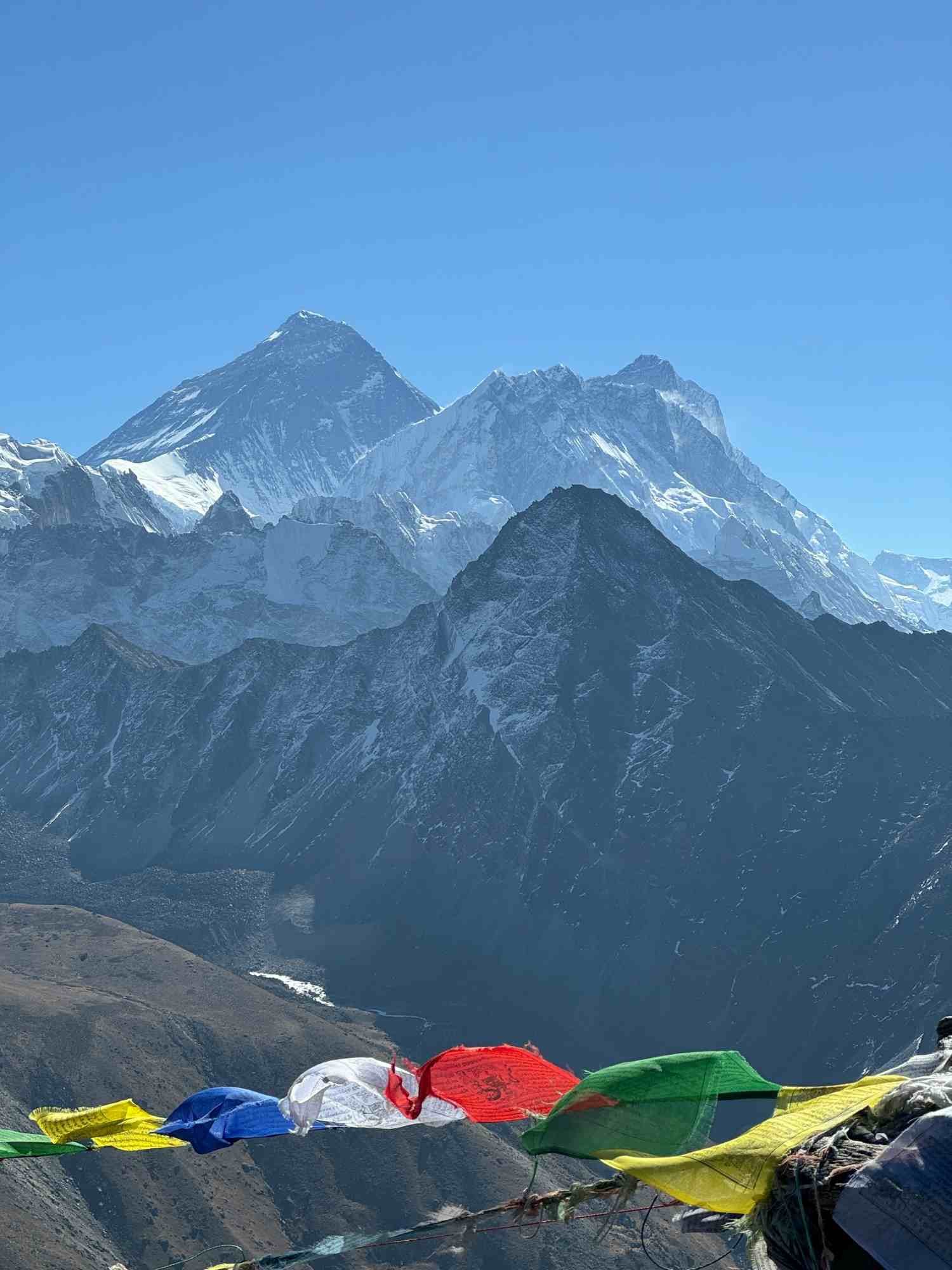
Main highlights of the Everest Base Camp Heli Tour
- Get Helicopter Tour to the mystic Himalayas
- Is Best for the one who doesn’t have good physical structure and enough time
- Observe a luxurious and efficient way of getting to Everest, the highest peak of the world.
- Explore Kala Patthar (5,565 m) & Everest Base Camp (5,364 m)
- Get ariel’s view of the entire Himalayas
- Enjoy an iconic view of Khumbu Icefalls & Khumbu glacier from Everest Base Camp
- Experience fully customized options for Private as well as Group Heli Tour
Weather and climate for the Everest Base Camp Heli Tour
The climate on the mountain stays quite unstable. It changes each season. Surprisingly, it changes each hour too. However, Everest Base Camp Heli Tour may be finished anytime during the 12 months. The climate at Everest stays clean during the morning for the duration of the 12 months however at some point of the monsoon season, the climate is commonly disturbed. The daylight temperature in Everest Region above 2000 m to 4000 m is from 15°C to 20°C. The nighttime may be a bit less warm than the daylight. The temperature at some point of the night time drops from 10°C to -0°C withinside the most important seasons. In the center of September to December, the climate may be easy and gives a pleasant view of the mountain. The temperature is degrees from -5°C to 20°C at some point in daylight. At night time, the temperature will drop from 10°C to -5°C. During the iciness season, the view may be clean however the temperature may be less warm than in October. The daylight temperature may be 10°C to 15°C and at night time it drops from -15°C to -10°C. Many tourists additionally pick Everest Base Camp Helicopter Tour from April to June. At that time, the temperature begins moving upward pushing withinside the mountain and it’ll be appropriate for our body. During the daylight, the temperature may be around 15°C to 20°C and nights may be less warm than daytime.Best seasons for Everest Base Camp Heli Tour
The EBC Heli tour can always be done. You just make sure that the weather conditions are good and executable to remove the helicopter. Therefore, it is recommended that you don’t miss this lifetime adventure whenever you are here in Nepal. However, if you want the best experience on the tour, please read the details below. You will get some knowledge about the best time to visit the Everest Region.March to June
These months are the perfect time for the Everest Base Camp Heli Tour as a whole. During these months, the average daily temperature is about 15 ° C to 20 ° C. The weather is fine and the sky is almost sunny. Undoubtedly, here you can get the best views of the area and the Himalayas. The temperature is moderate, so you don’t have to prepare for extreme situations. Similarly, flights are most unlikely to be canceled during these times of the year.September to October
During this time of the year, it is the period of the most beautiful autumn months and the beginning of winter. Therefore, you can take it as the second-best option for an Everest Base Camp helicopter tour or your EBC Heli tour. During these months, the average daily temperature is about 20 ° C. The temperatures at night and early in the morning are quite low, but the weather is good. Therefore, it is convenient for helicopter flights.December to March
During this time of the year, the days are the coldest. And, the temperature is so cold that they can even fall below zero during the day. Therefore, such bad weather makes the tour very difficult. Nevertheless, you have a perspective. In addition, everything is covered in snow, so the whole area looks great.Detailed itinerary of the Everest Base Camp Heli Tour
The Everest Base Camp Heli Tour is a wonderful and luxury trek in Nepal. It usually lasts for 4 to 5 hours. Here is the standard Everest Base Camp Heli Tour itinerary:05:50 AM: Wake Up and Get Ready
Our representative will pick you up from your hotel in a private vehicle early in the morning and drop you at the Tribhuvan International Airport, from where your journey starts EBC Heli Tour.6:30 AM – 7:00 AM: Arrival At Airport And Check-In
The check-in process begins as soon as you arrive at the airport. Guides are available everywhere, but be sure to bring your passport, tickets, and other necessary documents. After official verification, you are ready to participate in the battle.7:00 AM – 08:00 AM: Fly From Kathmandu To Lukla Airport (2860M)
At first glance, there are fascinating aerial photographs. It starts with a view of the Kathmandu Valley. You can easily find famous landmarks such as Swayambhunath, Boudhanath Stupa, and Pashupatinath. Then the panorama of the village of Jiri in Draka may make the view more comfortable. Glittering mountains such as Mt. Ganesh and Gaurishankar are also nearby. After crossing the lush hills, when you reach the Khumbu region, it turns into alpine plants. The beautiful view of the Sherpa settlement welcomes you first. You have mountains around you. After flying for about 45 minutes, we will land at Lukla Airport.8:00 AM – 8:15 AM: FLIGHT REFUELING AT LUKLA
You will spend a while at Lukla. Here you can enjoy the refreshing scenery of the morning and have a cup of tea. You can witness the culture and lifestyle of the local Sherpa. There you will also meet a Sherpa guide. So you have a chance to learn a lot in this short time.8:15 AM – 8:30 AM: FLY TO KALA PATTHAR (5643M)
Then fly directly to Kala Patthar. Along the way, you’ll see breathtaking views of the entire Khumbu Valley. Your flight will eventually follow the route to Namche, Tengboche, Dingboche, Gorakshep, and finally Kala Patthar. The views of these settlements, the Tengboche Monastery, and Everest Base Camp are spectacular. Don’t forget to discover Khumbu Falls and glaciers. at the EBC Heli Tour I feel that the plane is close to the mountains. After a 15-minute flight, you will reach the point of view. Kala Pather.8:30 AM – 8:45 AM: EXPLORATION AROUND KALA PATTHAR
Now that you are at the best point of your trip, you`re unfastened to discover it in your very own way. You can take photographs, movie the moment, or have a relaxed time amidst the mountains. This enjoyment goes to be a brilliant one. You could have the nearest view of Mount Everest, Nuptse, Cho Oyu, Langtang, Pumari Amadablam, Cholatse, Tamraseku, and more. Undoubtedly, you may fall in love with the serene environment.8:45 AM – 9:00 AM: FLY TO EVEREST VIEW HOTEL, SYANGBOCHE
After having the wonderful and lovely panoramas from Kala Patthar, we can head to one of the maximum locations withinside the world; Everest View Hotel on your EBC Heli Tour It is the area from which you’ll have an all-around view of majestic mountains. You get there within 15 mins and get the warmest welcome ever.9:00 AM – 9:45 AM: BREAKFAST AT EVEREST VIEW HOTEL (3880M)
Hotel Everest View is well-known for its scrumptious delicacies and gives a nice provider withinside the Khumbu region. Hence, having breakfast there after an hour of flight may be relaxing. You can experience several foods like Continental, Japanese and more. The indoors of the inn are famous for the masterpiece of Nepali sculpture and it additionally draws visitors.9:45 AM – 10:15 AM: FLY TO LUKLA & REFUELING
We will return to Lukla after having a few exceptional moments in the hotel. From the hotel, you may fly return to Lukla. You can another time experience the magnificent ariel view of the Himalayas. You will retrace the aerial path, so attempt to spot the locations you overlooked before. We will once more take a quick wreck at Lukla.10:15 AM – 11:00 AM: BACK TO KATHMANDU
Finally, it`s time to bid goodbye to the Everest Region and cross to Kathmandu. You may have a very last appearance down on Namche, Lukla, Phakding, and surrounding landscapes. Don`t neglect to identify new scenes for your manner again as you probably did before. After forty-five mins of the flight, you’ll attain Kathmandu. Your Everest Base Camp helicopter excursion ends here. Upon your return, our representatives will drop you again at your hotel.Clothes Required For Everest Base Camp Heli Tour
Everest Base Camp Heli Tour is one of the most costly tours withinside the world. The tour ist continually as long as others and one dont want to worry about packing heavy bags and masses of clothes.
However, to make sure a comfortable experience along the journey, proper clothing is a must.
The clothes that one wants to have for Everest Base Camp Heli Tour rely on the season you are traveling the place.
You want to do on layers of clothes even though the weather is normal. It is normally very cold at high altitudes, and the wind pace is also strong at such heights.
Everest Base Camp Heli Tour can be a comfortable and brilliant journey if you are placed on the right clothes.
Essentials for the Everest Base Camp Heli Tour
- Insulated Down Jacket
- Windproof Warm Trousers
- Hiking Boots
- Lip Balms
- Comfortable Innerwear like underwear, sports bra
- Warm hat/beanie and a wide-brimmed sun hat
- Sunglasses
- Water Bottles
- Toilet papers
- Camera, Cell Phones, and Recorders
Recommendations for Everest Base Camp Heli Tour
- Wear warm clothes and comfortable shoes
- Don’t forget to bring your Passport and ID card.
- Don’t carry heavy bags and luggage.
- Wear masks, face shields, and sanitary gloves.
- Maintain social distancing
- Fasten your seat belt on board your helicopter tour to Everest Base Camp.
- Don’t Change your seat and stand from your seat during your flight.
- Don’t throw out anything from the helicopter during your flights.
- Smoking is prohibited during your flight, be prepared.
- Wait in the helipad until our operators call you to come. Sometimes Pilot needs to re-position the helicopter in the Helipad.
FAQ for Everest Base Camp Heli Tour
When is the best time for Heli Tour?
The best time for the EBC Heli Tour is during the spring and autumn season. During this time of the year, the temperature is moderate and you can travel in the clear sky. However, if the conditions are right this tour can be done during the winter seasons as well.How difficult is Heli Tour?
There is no difficulty during the Everest Base Camp Heli Tour. However, you should not have Acrophobia otherwise, this is going to be difficult for you.Is the Heli Tour Safe?
Yes, the Everest Base Camp Heli Tour is safe for everyone.How long is the Everest Base Camp Heli Tour?
The Everest Base Camp Heli Tour is about 4 hours long.What is the cost of the Everest Base Camp Heli Tour?
The average cost for the Everest Base Camp Heli Tour is around US$3500 to $4000 per trip. Read more... Read less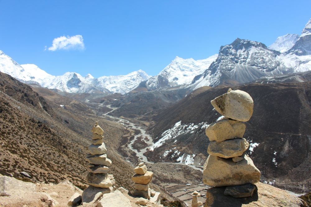
April 11, 2022
The Difficulty of Lobuche Peak Climbing
There are about 2000 high peaks in Nepal among them only 414 peaks are open for mountain climbing. SThere are about 2000 high peaks in Nepal among them only 414 peaks are open for mountain climbing. Similarly, these high peaks and mountains of Nepal have a beautiful position in the Himalayas of Nepal. Some of these mountains have great religious importance for the Hindus. Likewise, Nepal is home to 8 of the 14 8000m+ peaks in the world. Going to trek or on high peaks expedition is an exciting and adventurous activity in Nepal. Annually, a lot of passionate people come here for trekking and climbing and they have a lot of fun doing so. Furthermore, going to trek in the mountains is an exciting experience. Along with its beauty, you should consider all Lobuche Peak Climbing Difficulty
Similarly, Lobuche Peak is a peak in the Himalayas of Nepal. It lies in the Khumbu District of Nepal at Sagarmatha National Park standing tall with a height of (6,119 m / 20,075 ft.) The Peak lies at the southeast of Mount Everest whereas Lobuche village lies to the southwest part. The first official ascent of the Lobuche peak was made in 1984. It is one of the most challenging and thrilling summits in Sagarmatha National Park. Due to its unique landscape, a lot of people are fond of doing this trek.
Lobuche Peak is technically straightforward and anyone can attempt the climb very easily. But we suggest you have basic and little knowledge about using all of the climbing equipment. Furthermore, it is more Challenging than Island Peak. Your physical and mental toughness helps you do this adventure successfully. Similarly, the initial days of the Peak Climbing take you through the route to reach the Everest Base Camp.
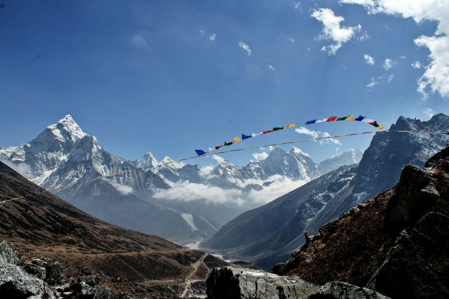
Lobuche West and Lobuche East
The summit of the peak gives you the most beautiful panoramas of Everest and other neighboring mountains in the region. Due to the location of the peak being on the way to Everest Base Camp, many climbers go for this peak as a warm-up for Everest Expedition. Importantly, it has two main peaks, Lobuche East and Lobuche West. However, the western peak is a little more challenging and troublesome than the eastern peak. Similarly, the western peak is more like an expedition than a trekking peak. Likewise, in the case of the eastern peak, you can easily reach the summit of the peak. The east peak is moderately difficult. Even if the west Lobuche is challenging a lot of people to reach the summit successfully. Furthermore, climbing Lobuche West can be a good exercise for someone planning the Everest Expedition. Moreover, for Lobuche East, there is not much technical climb. So, anyone passionate about trekking and climbing can easily complete the climb and have fun at the same time. However, even for the east climbing, if you are not prepared then it can add to your Lobuche Peak Climbing Difficulty. Lobuche Peak Climbing rewards you with the most marvelous scene of the highland terrain with a spectacular view of snowy mountains. Similarly, on your visit here you can explore remote Sherpa villages and elegant Buddhist monasteries. In addition, the summit offers a stunning view of the surrounding peaks.Highlights of Lobuche Peak Climbing
- Experience Lobuche East Peak Climbing with Everest Base Camp
- Get spectacular mountain peaks
- Explore Sherpa culture and hospitality
- Experience the warm-up peak for Everest
- Get suitable trails for novice trekkers
- Explore the technically straightforward trekking peak of Nepal
Lobuche Peak Climbing Difficulty
Although Lobuche Peak is technically straightforward and is relatively easy. But, you should consider and make the necessary preparation for the climb. To overcome most of Lobuche Peak Climbing Difficulty. Although, Lobuche Peak is one of those trekking peaks of Nepal which is slightly more challenging than other similar peaks in the same region the scene you will have after completing the climb is certainly a rare opportunity. Similarly, this climb involves different factors that make the journey rather troublesome. Below are some short descriptions of each of them.High altitude
The Lobuche Peak is at the high altitudes of the Khumbu region. Similarly, the peak stands tall with a height of 6,119 m / 20,075 feet. So, climbing at a high altitude is always difficult. You might fall, victim to altitude sickness. Therefore, you need to be very careful while doing this peak climbing. Furthermore, any peak higher than 2500 m is vulnerable to altitude sickness. At such a huge height, you are likely to have altitude sickness. Furthermore, the climate is unpredictable and unstable at high altitude mountains. Moreover, the fierce blow of the wind makes it harder to climb the peak. However, having a good physical and mental condition will certainly help you during the climb.Temperature, climate, and weather
Early mornings and late nights are always too cold in the Himalayas. Hence, you need warm gear for climbing Lobuche Peak at any season of the year. During, autumn the average temperature at Lobuche is around 5º Celsius. Similarly, in spring it is around – 2º Celsius. Likewise, in winter the temperature is around -9º Celsius whereas in the summertime it is around 5º Celsius. Furthermore, temperatures at the lower altitudes are a bit warmer than at the higher altitude. Therefore, the more you climb towards higher altitudes, the less temperature will be there. So, the harsh cold of the mountain is one of the elements that make the climb difficult. And, add to your Lobuche Peak Climbing Difficulty.Steep Trail
The trails of Lobuche Peak Climbing are steep and uneven which makes it a little challenging to climb Lobuche Peak. Therefore, before you begin Lobuche Peak climbing, you have to trek from Lukla to Lobuche Base Camp. So, for that section of trekking, you will require an average of 5 to 6 hours of trekking per day. The hiking trails are not simple but steep and tiring. Beginners who have not trekked before can face a little challenge while doing this climb. And, can add to your Lobuche Peak Climbing Difficulty Once you pass Lobuche village, the trail begins to get rough, rocky, and steady. The harsh trails get steeper and steeper as you head towards Lobuche Base Camp. Therefore, it is also a factor that makes the Lobuche Peak Climb a little difficult.Accommodation facilities
The high-altitude region of Nepal is not that developed. Therefore, finding proper accommodation facilities is a little challenging. Mostly, the climbing itinerary of Lobuche Peak Climbing includes a camping itinerary for some days of the climb. . Some nights, until you return to the village, are supposed to be spent in the camp tent and have to eat food cooked by the helper there. So, this situation can be a little challenging situation for those who have not climbed a mountain before. And, can add to your Lobuche Peak Climbing Difficulty.Summit of Lobuche Peak
Lobuche Peak Climbing is a moderate level climb. Almost anyone can do this climb. However, you should be physically fit to do this climb successfully. Similarly, the summit of Lobuche Peak is especially challenging for rookie climbers that can add to your Lobuche Peak Climbing Difficulty. The summit of Lobuche Peak can be difficult even for experienced climbers. There is a snowy and steep section just a few climbs below the summit which is sloped at around 45°. Similarly, this particular section is as lengthy as 50 m and it can be more difficult than other sections. A total of around 7 to 10 hours is essential to do on the summit day. In addition, you can not do this adventure without the use of climbing gears. Moreover, beginners face more challenges at this part of Lobuche Peak climbing and they have to give a real test of their skills. Even with these facts written above, the Lobuche Peak is a doable trekking peak in Nepal.How long does it take to climb Lobuche Peak?
Lobuche Peak is a small peak that lies in the Kumbu region of Nepal. Comparing Lobuche Peak to some of the other peaks like Island Peak and Everest Peak. It is a shorter climb. However, you should spend some time climbing Lobuche Peak. Similarly, the average itinerary of Lobuche Peak Climbing has a 20-day itinerary. The overall journey includes sightseeing in Kathmandu, preparation for the climb, flight to Lukla, Trek to Lobuche Base Camp, Acclimatization, the actual summit climbing, and the return journey from the place. Roughly, it takes approximately 18 to 21 days for Lobuche peak climbing. Furthermore, to have the successful summit of Lobuche Peak within the limited time frame, you should walk around for 6 to 7 hours on the daily basis. But, the final summit takes around 8 hours. In addition, if you follow this outlined itinerary then you will have a clear idea of the time that might take to climb Lobuche Peak. And, will help you figure out most of the Difficulties of Lobuche Peak Climbing. This will make your climb easier.Outlined itinerary of Lobuche Peak Climbing
(note: below numbers indicate the day you will be spending climbing Lobuche Peak.) 01 Arrival at Kathmandu and transfer to hotel. 02 In Kathmandu preparation for the trek and climb 03 Fly to Lukla 2,800 m & trek to Phakding 2,640 m- 03 hrs. 04 Trek to Namche Bazaar 3,440 m – 06 hrs. 05 Rest day at Namche Bazaar for acclimatization and local hike. 06 Trek to Thyangboche 3,867 m – 05hrs. 07 Trek to Dingboche 4,260 m – 05hrs. 08 Rest day at Dingboche for acclimatization and excursion. 09 Trek to Lobuche 4,930 m – 05 hrs. 10 Trek to Gorakshep 5,170 m and Everest Base Camp 5,364 m and return to Gorakshep -08 hrs. 11 Hike to Kalapatthar and trek to Lobuche Base Camp 4,865 m – 05 hrs. 12 Trek and climb to Lobuche High Camp 5,600 m – 04 hrs. 13 Climb Lobuche Peak 6,119 m / 20,070 ft and to base camp – 08 hrs. 14 Reserve or contingency day in case of unfavorable bad weather. 15 Trek to Thyangboche – 05 hrs. 16 Trek to Monjo 3,830 m – 06 hrs. 17 Trek to Lukla – 04 hrs with afternoon free. 18 Fly to Kathmandu & transfer to hotel. 19 In Kathmandu with sightseeing tour. 20 International departure for homeward bound.How much is the cost to climb Lobuche Peak?
Lobuche Peak Climbing is a cheaper mountain for trekking expeditions in Nepal. Lobuche is a beautiful peak that gives you a complete vibe of the Everest region. The Lobuche Peak climbing costs around USD 2500 to 3500. The overall Lobuche Peak Climbing includes transportation, accommodation, permits, and miscellaneous expenses. Lobuche Peak Climbing cost can change depending upon the season. Likewise, if you travel in a group, the cost will be less because you will get a discount. However, it will be a little expensive to travel independently or alone. Lobuche Peak Climbing Permit cost can change from season to season. Similarly, it costs USD 250 in the spring season, USD 70 in summer and winter, and USD 125 in September. And, other elements vary the price of the peak. Similarly, you should have a Local Area entry permit for this climb which costs USD 20. The entry permit cost of Sagarmatha National Park is different for the SAARC national and other country residents. But, it costs around USD 30 for foreigners. The peak Climbing cost includes guide and porter costs in the package. It costs USD 20 for the porter to carry a 25kg backpack for you and the average cost for having a tourist guide on Lobuche Peak Climbing is $22 to USD 25 per day.Climbing route of Lobuche Peak
Lobuche Peak has two main peaks. The Lobuche East Peak is easy and technically straightforward and is famous among trekkers for that reason. If you choose this trekking route then you can easily reach the summit without facing many Lobuche Peak Climbing Difficulty Furthermore, the peak is near the Khumbu Glacier. Therefore, the standard route for this peak is up southeast Ridge. Similarly, the route gained popularity after Mr. Laurice Nielson and Ang Gyalzen Sherpa successfully did the summit from this route on 25 April 1984. The South and Southeast Ridges is an unusual rock triangle that extends from the panel to the Khumbu Glacier. Lateral moraines with stone memorials make the ridges easy to see from the trek. Likewise, the journey begins with a flight to Lukla from Kathmandu and then trek via villages like Phakding, Namche, Dingboche, Tengboche, and finally Lobuche. And, from Lobuche, the routes get changed where the EBC route heads on to Gorakshep, and Lobuche Peak’s trail moves to Lobuche Base Camp. Lobuche Base Camp is at an altitude of 4,950 m. After the Base Camp, the way heads upward just over the Khumbu Glacier to reach Lobuche High Camp at 5,400m high. After, you will do camping accommodation there. The summit of Lobuche Peak is only one hard stretch far from the high camp. Likewise, at the high camp, the path turns steeper and steeper where the summit track finds its way via a sharp snow ridge. Then, the route goes towards the northwest of the peak where some small snow peaks and notches lie. After that is the final summit climb over a steep way onto the summit point.Experience Required to Climb Lobuche Peak
Lobuche Peak Climbing is a relatively easy trek. Almost anyone passionate about trekking and climbing can easily do this climb. However, having prior knowledge about trekking and climbing will certainly help. Although the climb at a lower altitude of Lobuche Peak is easy the climb at the summit can be a little difficult to climb even for experienced climbers. The climb to the summit will test your skill and stamina. It will push your body to limits. Furthermore, running and jogging before attempting the climb will certainly help you face most of the Lobuche Peak Climbing Difficulty. However, people with little experience can easily do this trek.Best time to do the Lobuche Peak Climbing
Nepal is a paradise for trekking and the mountains of Nepal are the most wonderful ones. Nepal lies in the subtropical zones. So, Nepal receives the summer monsoon. The weather and climate of Nepal are also amazing you can do any kind of adventure here. Overall, Nepal has a pleasant and mild climate. However, climbers often seem to be worried about the climate factor before doing any adventure in Nepal. Trekking, Hiking, and Mountaineering can be done throughout the year in this country. However, spring and autumn are the most ideal time for such adventures in Nepal. Lobuche Peak Climbing is time bounded climb. You cannot get ready for this peak any time you like. There are two perfect times in the year for climbing the Lobuche East; March to May (spring) and September to November (autumn) these times of the year give you an ideal time for Lobuche Peak Climbing.Spring and autumn season
Spring and autumn seasons give the best conditions to do a trek and climb. Both of the seasons are completely rain-free and possess stable weather and warm temperatures and the sun is out every day. During autumn and spring, you will travel with a clear sky and visibility. And, there are lower chances of trip cancellation at this time of the year. One can enjoy the real wonder and beauty of this trek if it is either in Spring or Autumn. These months are clear and on bright days. Similarly, you can have unbelievable views from the summit during these seasons. Furthermore, you can eat and breathe mountains everywhere in this region. And, these vistas will help you forget all the Lobuche Peak Climbing Difficulties during this adventure. You can see different high peaks in one glance as there will be no clouds blocking the beautiful view. Most importantly, Lobuche Peak climbing is mostly a trouble-free experience if it is during the autumn and spring season. However, the summer and winter seasons are not suitable for this climb and adventure. In summer, the unpredictable and reoccurring rainfall will hinder you a lot and during the winter season, there will be a very cold climate at such a high altitude.Gears Required to Climb Lobuche Peak
Lobuche Peak Climbing is a strenuous climb. Similarly, it is technically very straightforward. Furthermore, this peak demands enough mental stamina and physical to face every challenge. Lobuche Peak Climbing expedition demands some technical climbing gear for the climb. The last 50 m journey is so deadly therefore you should be very skillful in using all the gears. Even the experienced climbers feel a little uncomfortable climbing this section. So, when you are doing the last stretch of Lobuche Peak you need to be very careful. In addition, here is a list of the essential items that you should not forget to bring with you on your Lobuche Peak climbing.Clothing
- A pair of trekking boots with good ankle support
- Rucksack or daypack at least 30 liters with a waterproof cover
- Trekking pants and waterproof trousers
- Hard Shell Trousers
- Down jacket
- T-shirt and shirt
- Wind/ waterproof light jacket
- Fleece jumper or jacket
- Inner Thermal top and trousers on the high altitudes
- Socks and underwear
- Sunglasses, sun hat, woolen cap, or balaclava
- Inner and outer gloves
- Summit Mittens bring warm insulated gloves with safety straps
- Headlamp, power bank, and extra batteries
- Sun protection cream, wet wipes, and hand sanitizers
- Towel, flip-flop or rubber sandal, toiletries
- Water bottle and water purification tablets
- Gaiters
- Sleeping bag
- Sleeping bag liner
- A sleeping bag that is suitable for all 5 seasons
Climbing equipment
- Climbing Boots (insulated stiff-soled, ideal for high altitude)
- Crampons that fit your climbing boots
- Climbing Helmet
- Harness
- Carabiners (lockable and non-lockable)
- Prussiks
- Ice Axe
- Jumar or ascending device
- Descending or belay device
- Tape Sling
- Tips for Lobuche Peak Climbing
- Acclimatize properly; do not rush for the summit
- Take proper training and technical skills before the climb
- Drink plenty of freshwaters
- Don’t drink alcohol and avoid smoking
- Inform your guide if you have minor symptoms of altitude sickness
- Don’t travel alone
- Carry sufficient gears and types of equipment
- Do Insurance
- Don’t travel in the offseason
- Be ready for unexpected happenings
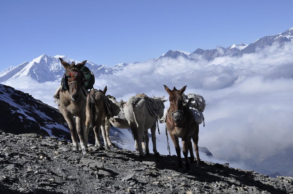
April 18, 2022
Recent Trek Routes in Nepal
Panch Pokhari Trekking Panch Pokhari trekking is new and one of the Recent Trek Routes in Nep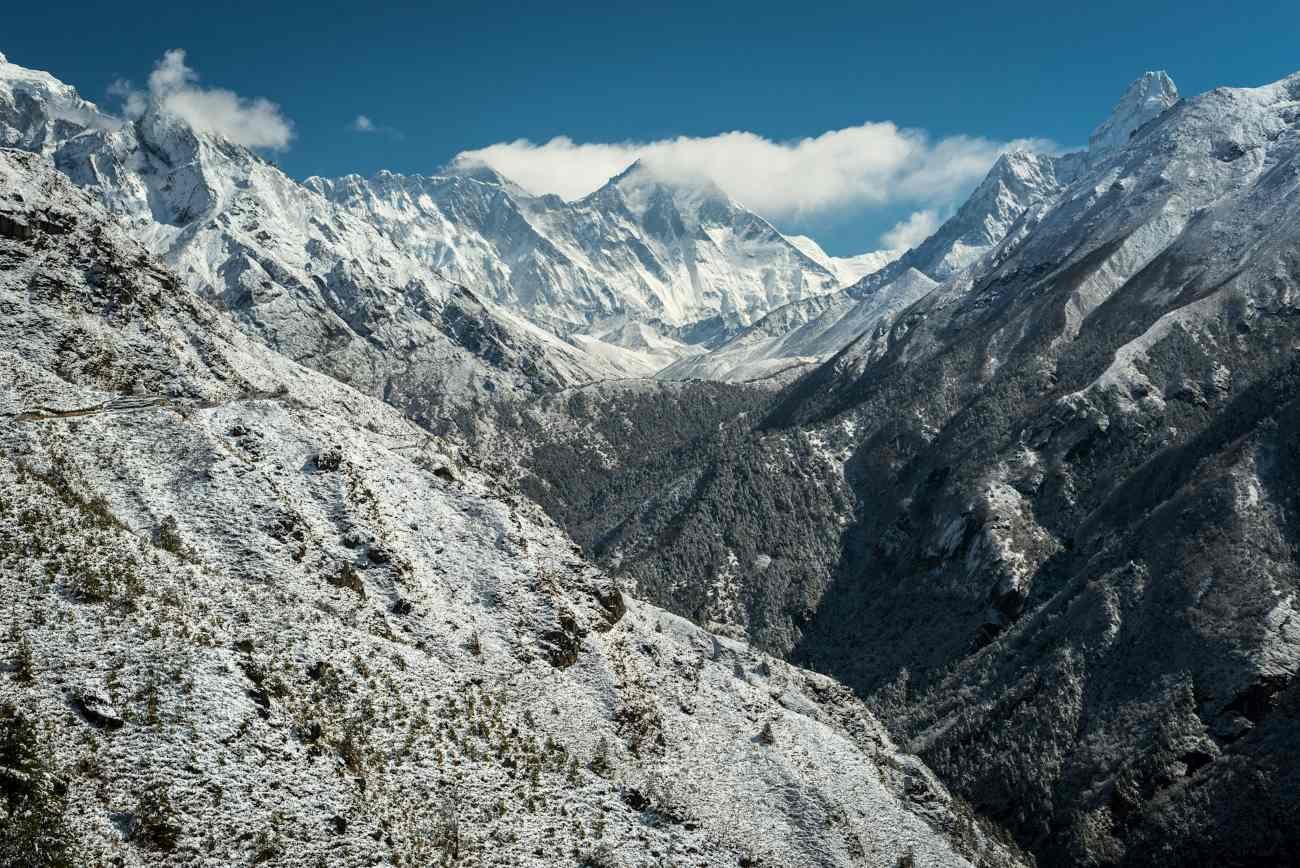
Panch Pokhari Trekking
Panch Pokhari trekking is new and one of the Recent Trek Routes in Nepal. Although it is a newly opened trekking route in Nepal. But, it did not take long for people to see the potential and beauty of the trek. Similarly, the treks include a sacred and pristine group of five glacial lakes, Panch Pokhari, seated on the base of Jugal Himal. Furthermore, this trek is a moderate-level trek. Almost anyone with any physical condition can complete this trek. Most importantly, this place has great importance in the Hindu and Buddhist cultures and traditions. It is located in the wild nature in the northeast region of Sindhupalchowk district. Furthermore, this place is located at an altitude of 4010m in a beautiful natural setting surrounded by the various Himalayas. Annually, a lot of Hindu and Buddhist enthusiasts come to this lake for holy purposes. Similarly, this is a small trekking journey. So, it is suitable for someone with a limited timeframe. And, hs a desire to be near the Himalayas. A short trek to Panch Pokhari starts from Kathmandu. After you arrive in Kathmandu, you will drive to Simpal from there you will continue your trekking. Panch Pokhari Trek starts from Chautara of the Sindhupalchok. Similarly, many settlements of Sherpa and Tamang people lie on the trail. And you have a chance to know the cultural factors of their lifestyles and incredible hospitality. Furthermore, the landscape is untouched and luring. Also, it is one of the Recent Trekking Routes In Nepal.
What to expect from this trek
This trek is one of the most popular short treks which has become popular in recent days. Similarly, this trek is designed uniquely to offer glorious holidays in Nepal. It has been recently opened and includes the sacred and pristine glacial lakes. Furthermore, it is the Recent Trek Routes in Nepal. The main highlight of the trek is the five lakes that are famous for the Hindu pilgrims. Likewise, the superb Himalayan views in the northeast and the charming biological diversities make the trip wonderful. In addition, this trek covers the base of the Jugal Himal and some parts of the Langtang Region. The trek covers an altitude of 4,500 meters. And you need to have a good physical and should be in mentally tough condition for an easy and pleasant trekking experience. Likewise, the major highlights of the trek include different significant valleys, waterfalls, gorges, and ancient caves. Although, it is a recently opened trek in Nepal. But it has quickly gained popularity.Why do Panch Pokhari Trek
Panch Pokhari trek is an exciting trek. Furthermore, this trek is recently opened trek in Nepal. So, a lot of passionate trekkers are excited to do this trek. During the Panch Pokhari trek, you will get the ultimate trekking experience of Nepal. Annually, a lot of native and foreign tourists love to do this trek. Similarly, this trek is less crowded so you can travel fully enjoying the beauty of the place. Likewise, you will experience different Sub-Tropical forests with a large variety of Rhododendrons. Furthermore, on your visit, you will explore various ancient settlements of Tibetan origin Lama and Tamangs, and their rich heritage. This will add to your Panch Pokhari Trek. Another reason is it is one of the Recent Trek Routes In Nepal.Trip Facts For The Panch Pokhari Trek
- Location: Bhotang, Sindupalchowk
- Duration: 5 to 7 days
- Maximum Altitude: 4,100 m
- Trip Grade: Moderate
- Accommodation: Camping
- Best Time: April, May, September, October, and November
Highlights Of Panch Pokhari Trek
- Travel on less crowded trails
- Explore Paanch Pokhari (Five Holy Lakes) of Nepal
- View Jugal and Langtang Himal
- Get a sub-Tropical forest with a large variety of Rhododendrons
- Experience the ancient settlement of Tibetan origin Lama and Tamangs and their rich heritage
Outline itinerary of Panch Pokhari Trek
Note: Below numbers indicate the day you will be spending at the Panch Pokhari Trek 01: Arrival in Kathmandu 02: Drive to Bhotang Village (1800 meters) 03: Trek to Nasimpati 04: Trek to Panch Pokhari Lakes (4100 meters) 05: Trek down to Bhotang village 06: Drive to Kathmandu 07: Final departureTamang Heritage Trail
Tamang Heritage Trek is a Recently Opened Trek and short trek in Nepal. Similarly, it is a community-based trekking journey between the Ganesh Himal and Langtang ranges. Likewise, it is a culturally rich trail. And populated by the Tamang people who are closer to the Tibetan Traditions as it touches the Tibetan border in the north. Furthermore, trekking on the Tamang Heritage way offers you an off-the-beaten-track experience on a newly developed route with charming mountain views. Therefore, it is the best trek to explore both naturally and culturally. Furthermore, this is a Recent Trek Routes in Nepal The Trail combines wonderful landscape, enchanting white peaks, and scattered settlement which is rich in ancient traditions and culture. The beautiful trip is also popular for an exploration of the nomadic lifestyle to its heavenly Shangri-La. In addition, the natural hot spring at Tatopani releases the tiredness of the second hiking day. And, you will be able to capture the incredible mountain views of Langtang Lirung and Ganesh Himal during this tour. Furthermore, the trek region protects various wild animals like red pandas and bears. Which are rare animals in Nepal. Tamang Heritage Trail is the best choice to experience the most amazing hospitality in the country. Likewise, the sceneries of the ancient monasteries and houses added with prosperous wood engravings around the Tamang heritage trail are wonderful. Therefore, the experience of this trek is fantastic. You will get an ultimate and lifetime trekking experience when you are trekking at the Tamang Heritage Trail.Who can do Tamang Heritage Trail
There is no special requirement for doing this trek. However, you should be physically and mentally tough. Because whenever you are climbing at a higher altitude it is always challenging. Similarly, the Tamang heritage is at the high altitudes of Nepal. But, it is a moderate level trek. So, you can easily do this trek. Furthermore, if you are a passionate trekker then you can do this trek. In addition, if you are a nature lover then this trek is suitable for you.Why does Tamang Heritage Trail
It is one of the Recent Trek Routes in Nepal, so, a lot of people would want to do this trek. Similarly, when you are on this trek then you will get a stunning view of Langtang and Ganesh Himal. You will get to explore the luxurious hot spring of the place. Likewise, during the trek, you will experience the typical Tibetan Culture developed within Nepal. In addition, during this trek, you will trek in a verdant environment. Lastly, this trek is less crowded. And, this is a Recently Opened Trekking Routes so everyone would want to do it. Therefore, you can travel freely. You can enjoy the amazing view of the landscape and the surroundings. Additionally, you will have a lifetime experience during this trek. You can also get the amazing hospitality of the local people which will add value to your trek. And this is a short trek so this is perfect for someone who has limited time on them. Also, another main reason to do this trek is it is one of the Recent Trek Routes In Nepal.Facts of Tamang Heritage Trail
- Location: Rasuwa
- Duration: 8 to10 days
- Maximum Altitude: 3,870 m
- Trip Grade: Moderate
- Accommodation: Homestay
- Best Time: September to January and March to August
Highlights of Tamang Heritage Trail
- Get spectacular views of Langtang and Ganesh Himal
- Experience the hot spring waters at Tatopani
- Explore the typical Tibetan Culture developed within Nepal.
- Get amazing hospitality in a homestay
- Travel on one of the nearest treks from the capital
- Observe off the beaten trek with the verdant environment
- Travel through less crowded trails
- It is a Recent Trek Routes in Nepal so, there is a lot to explore
Outline itinerary of Tamang Heritage Trail
Note: (below number indicates the number of days on your Trek) 01: Arrival in Kathmandu 02: Drive Kathmandu to Syabrubesi 03: Syabrubesi trek to Gatlang (approx. 5.5 hours) 04: Gatlang to Tatopani (approx. 7 hours) 05: Tatopani to Thuman (approx. 4 hours) 06: Thuman to Briddim (approx. 5 hours) 07: Briddim trek to Syabrubesi (approx. 3 hours) 08: Return to Kathmandu 09: DepartureLumba Sumba Trek
Lumba Sumba Trek is one of the new and Recent Trek Routes in Nepal. Similarly, this trek was founded in April 2012. Lumba Sumba Peak (5,200 m) is the main attraction of this trek. Similarly, his trek offers some of the most spectacular Himalayan landscapes in the region. Lumba Sumba Trekking Route is home to various ethnic groups like the Limbus, Sherpas, Tamang, Gurung, Magars, Newars, and Rai. So, during this trek, you will learn about the different traditions and cultures of the place. Lumba Sumba Pass Trek coast via Kanchenjunga Conservation Area (KCA) in the eastern Himalaya. Visitors can explore the traditional farming practices and see various birds and wildlife species. Including the endangered red panda and snow leopard, from the route. There are some big mountain lakes in Olangchung Gola. Which is one of the important transits to Tibet from Nepal. Via this route, we experience two of Nepal’s best-preserved protected areas the Makalu Barun National Park and Kanchanjunga Conservation Area. Likewise, via the route, trekkers can trek to the base camps of Mount Kanchanjunga and Mount Makalu. In addition, if you visit here you will be in love with the nature of the place.Tourist attraction of Lumba Sumba Trek
Furthermore, the Arun River and Tamor systems is the other attraction for tourists visiting here. These two rivers are the main influent on the mighty Sapta Koshi River. Similarly, the route circumscribes alpine grasslands, rocky outcrops, dense temperate and sub-tropical forests, and low river valleys of the region. Not only natural beauty but also trekkers can explore the cultural heritage of the region. Like monasteries, Chortens, temples, and prayer walls which is the main attraction of the trek. In addition, the festivals of all of these people living in harmony only serve to make the native culture livelier. Additionally, it is one of the Recent Trek Routes in Nepal. Therefore, there is a lot in this trek to explore.Why do Lumba Sumba Trek
Lumba Sumba Trek is a must-do trek in Nepal if you want to experience the undeterred natural landscapes. Additionally, it is a beautiful place in the world. Similarly, annually a lot of native and international tourists do this trek to witness the natural beauty of the place. Furthermore, on this trek, you will explore a spectacular Himalayan Landscape. Also, another main reason to do this trek is it is one of the Recent Trek Routes In Nepal. Moreover, you will get a lot of Knowledge about the culture and traditions of different ethnic groups Sherpa, Limbu, Rai, Gurung, and Tamang which will add value to your trek. In addition, this trek is a Recently Opened Trekking route in Nepal. So, you can travel on a less crowded trekking route and explore a lot about the place. Likewise, if you are a nature lover then this place is heaven for you. And, during this trek, you will get a magnificent view of Mount Makalu and Mount Kanchenjunga. Also, this trek is 22 days long. So, you will have plenty of time to enjoy nature. Altogether, this trek is perfect if you want to be free from the busy city life and experience the beauty of Mother Nature.Who can do Lumba Sumba Trek
There is no special requirement to do this trek. Everyone passionate about trekking can do this trek. However, you should be physically and mentally tough for this trek. Because whenever you are trekking at a higher altitude it is always challenging. Likewise, the Lumba Sumba Trek is at the high altitudes of Nepal. But, it is a strenuous trek. Therefore, you can easily do this trek just to have confidence in yourself. Additionally, if you are a passionate trekker then you can do this trek. And, if you are a nature lover then this trek is suitable and perfect for you.Facts of Lumba Sumbha Trek
- Location: Taplejung
- Duration: 20 to 25 days
- Maximum Altitude: 5,159 m
- Trip Grade: Strenuous
- Accommodation: Teahouse + Camping
- Best Time: March, April, May, October, and November
Highlights of Lumba Sumbha Trek
- Lumba Sumba Peak is 5,300 m high
- Explore spectacular Himalayan Landscapes
- Visit Makalu Barun National Park and Kanchenjunga Conservation Area with rich preservation of endangered species.
- Explore different ethnic groups (Sherpa, Limbu, Rai, Gurung, Tamang)
- View Mount Makalu and Mount Kanchenjunga
- Experience beautiful and picturesque river valleys
Itinerary of Lumba Sumba Trek
Note: (below number indicates the number of days on your Lumba Sumba Trek) 01: Arrival in Kathmandu 02: Sightseeing Trip in Kathmandu Valley 03: Fly from Kathmandu to Bhadrapur and drive to Phoomling (Taplejung) by Jeep 04: Trek from Phoomling to Mithlung 909m/5 hours 05: Trek from Mithlung to Chhirwa 1246m/6 hours 06: Trek from Chhirwa to Lelep 1687m/7 hours 07: Trek from Lelep to Ela Danda 2051m/5 hours 08: Trek from Ela Danda to Selep Kharka 2525m/5 hours 09: Trek from Selep Kharka to Olangchung Gola 3208m/5 hours 10: Trek from Olangchung Gola to Upper Langmale 3893m/6 hours 11: Trek from Upper Langmale to Pass Camp 4,747m/6 hours 12: Trek from Pass Camp to Chaurikharka 4,595m/5 hours via Lumba Sumba Pass 5,177m 13: Trek from Chaurikharka to Thudam 3500m/7 hours 14: Trek from Thudam to Yak Kharka 2877m/6 hours 15: Trek from Yak Kharka to Chyamtang 2229m/6 hours 16: Trek from Chyamtang to Hatiya 1595m/7 hours 17: Trek from Hatiya to Gola 1128m/6 hours 18: Trek from Gola to Hedangna Gadi 1179m/5 hours 19: Short trek from Hadangna Gadi to Num and drive to Tumlingtar 405m by jeep 20: Flight from Tumlingtar to Kathmandu from the domestic airport in Tumlingtar 21: Free day in Kathmandu 22: DepartureKhopra Danda Trek
Khopra Danda Trek is one of the best Recent Trek Routes in Nepal. It is located in the Annapurna region of Nepal. The trek is featuring the most wonderful natural views of the mountain landscapes and amazing ethnic cultures. Similarly, the trek is less crowded and families and children should be free from busy life. One can walk easily on the routes as the trails are well maintained for any kind of trekker. Likewise, this trek is suitable for inexperienced trekkers. Similarly, Khopra Ridge offers stunning views of Mt Dhaulagiri, Annapurna, Tukuche Peak, Nilgiri, and Dhampus Peak. As well as one of the most spectacular valleys on the Kali Gandaki River can be seen from this trek. Khayer Barahi Temple or Khayer Lake, Tatopani, Narchyang village, and Ghandruk village are the main attractions of Khopra Danda Trek. Here you will learn a lot about the local culture and traditions of the place. The trail of Khopra Danda Trek passes via wonderful villages of Gurung, Chhetri, Magar , and Brahmin communities, which allows trekkers to observe and experience the pure Nepali lifestyle and culture. Similarly, the trek is a perfect way to make your children familiar with the joys of trekking and exchanging culture and experience with the local people, which will make them knowledgeable about the landscapes and beauty of Nepal.Facts Of Khopra Danda Trek
- Location: Annapurna Region
- Duration: 5 to 7 days
- Maximum Altitude: 3,640 m
- Trip Grade: Moderate
- Accommodation: Teahouse
- Best Time: Spring and Autumn
Highlights of Khopra Danda Trek
- Get a stunning view of the Annapurna Manaslu Range
- Explore wild and peaceful trekking experience challenging going hike to the Khayar Lake
- Experience traditional settlement of Gurung and Magars
- Get superb Panoramas of the lush hillsides
- Enjoy hot spring
- Enjoy a wonderful sunrise view
Itinerary of Khorpa Danda Trek
Note: (below number indicates the number of days on your Trek) 01: Arrival at Kathmandu Airport. 02: Drive from Kathmandu to Pokhara. 03: Drive from Pokhara to Nayapul /Syauli Bazaar / Kimche (1,784m). Trek to Ghandruk (1940m / 6,364ft) 04: Trek from Ghandruk (1940m / 6,364 ft) to Bayeli Kharka (3,450m / 11,318ft) 05: Trek from Bayli Kharka (3,450m/ 11,318ft) to Khopra Danda (Ridge) (3,660m / 11,811ft) 06: Trek from Khopra Danda (Ridge) (3,660m / 11,811ft) to Swanta (2,214m / 7,874ft) 07: Trek from Swanta (2,214m / 7,874ft) to Ghorepani (2,880m / 9,350ft) 08: Early morning hike to Poon Hill (3,210m / 10,525ft) then trek to Birethanti (1,039m / 3,250ft) -Drive to Pokhara. 09: Flight to Pokhara 10: DepartureLimi Valley Trek
Limi Valley Trek is one of the best long Recent Trek Routes in Nepal that is fully under isolation. Similarly, it is a newly opened Trek. The trek lies in the Humla, Limi Valley which is very near to the Tibetan Border. So, trekking to this region was prohibited to protect the sensitive place until 2002. Furthermore, the trek has its own distinct identity as it follows a historical trade and pilgrim route over rugged trails and high passes of the region. Humla Limi Valley Trek is still unknown to many people. Similarly, the region attracts fewer tourists, to make sure that the flora and fauna continue to exist for future generations. It is considered one of the most infertile places in Humla, however, the century-old Buddhist culture remains. The Humla Limi Valley Trek gives not only beautiful mountain scenery but also a visit to the holiest Mount Kailash, which will add value to your trek. Also, another main reason to do this trek is it is one of the Recent Trek Routes In Nepal. Humla Limi valley trek is a perfect “new track” in the western Himalayas of Nepal. Along with exploring the Karnali River. This trek takes you to an unexplored Upper Limi valley. But, the village of Halji, Dzong, and Til includes strenuous routes and a beautiful Tibetan culture and tradition. Therefore, Humla Limi Valley Trek is popular for its divine beauty. You should try this trek with your friends.Facts Of Limi Valley Trek
- Location: Humla
- Duration: 20 days
- Maximum Altitude: 4,949 m
- Trip Grade: Moderate/Strenuous
- Accommodation: Camping
- Best Time: Spring and Autumn
Highlights of Limi Valley Trek
- Explore the best outdoor activity!
- Tibetan Buddhism is preserved better than in Tibet in this region.
- Experience most amazing landscapes, people, culture, and traditions
- Get off the beaten trail
- Get a peaceful trekking experience
- Explore traces of the ancient trek route on the way
Itinerary of Limi Valley Trek
01: Arrival in Kathmandu (1350 m) 02: Free day in Kathmandu 03: Fly from Kathmandu to Nepalgunj 04: Fly from Nepalgunj to Simikot (2950 m) 05: Trek to Dharapuri (2300 m) 5 hrs walk. 06: Trek to Kermi (26500 m), 4 hrs walk 07: Trek to Yalbang (3010 m) 6 hrs. Walk 08: Trek to Tumkot (3380 m) 6 hrs. Walk 09: Trek to Yari (3690 m) 5 hrs. Walk 10: Trek to Hilsa (3720 m) via Nara La Pass (4620 m) 11: Trek to Manepema (3990 m) 6 hrs walk 12: Trek to Til (4000 m) 6 hrs walk 13: Trek to Halji (3670 m) 4h00 walk 14: Trek to Jang (3930 m), 4 hrs walk 15: Trek to Talung (4370 m), 8 hrs walk 16: Trek to Shingjuma (3620 m) via Nyalu La pass (4950 m), 8 hrs walk 17: Trek to Kermi (2670 m), 7 hrs walk 18: Trek to Simikot (2950 m), 7 hrs walk 19: Fly from Simikot to Kathmandu with h brief stop at Nepalgunj 20: Leisure at Kathmandu 21: Final departure Read more... Read less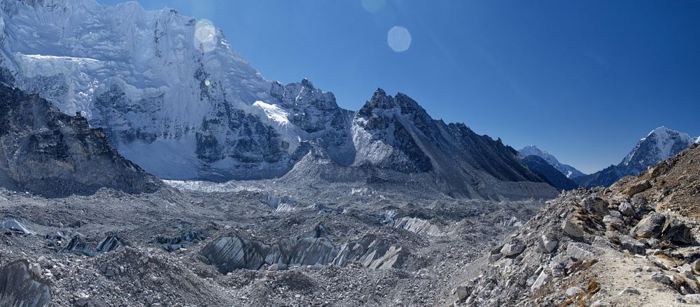
April 25, 2022
Three Peak Climbing in Nepal
What is Three Peak Climbing in Nepal Three-peak climbing is the combination of three popular 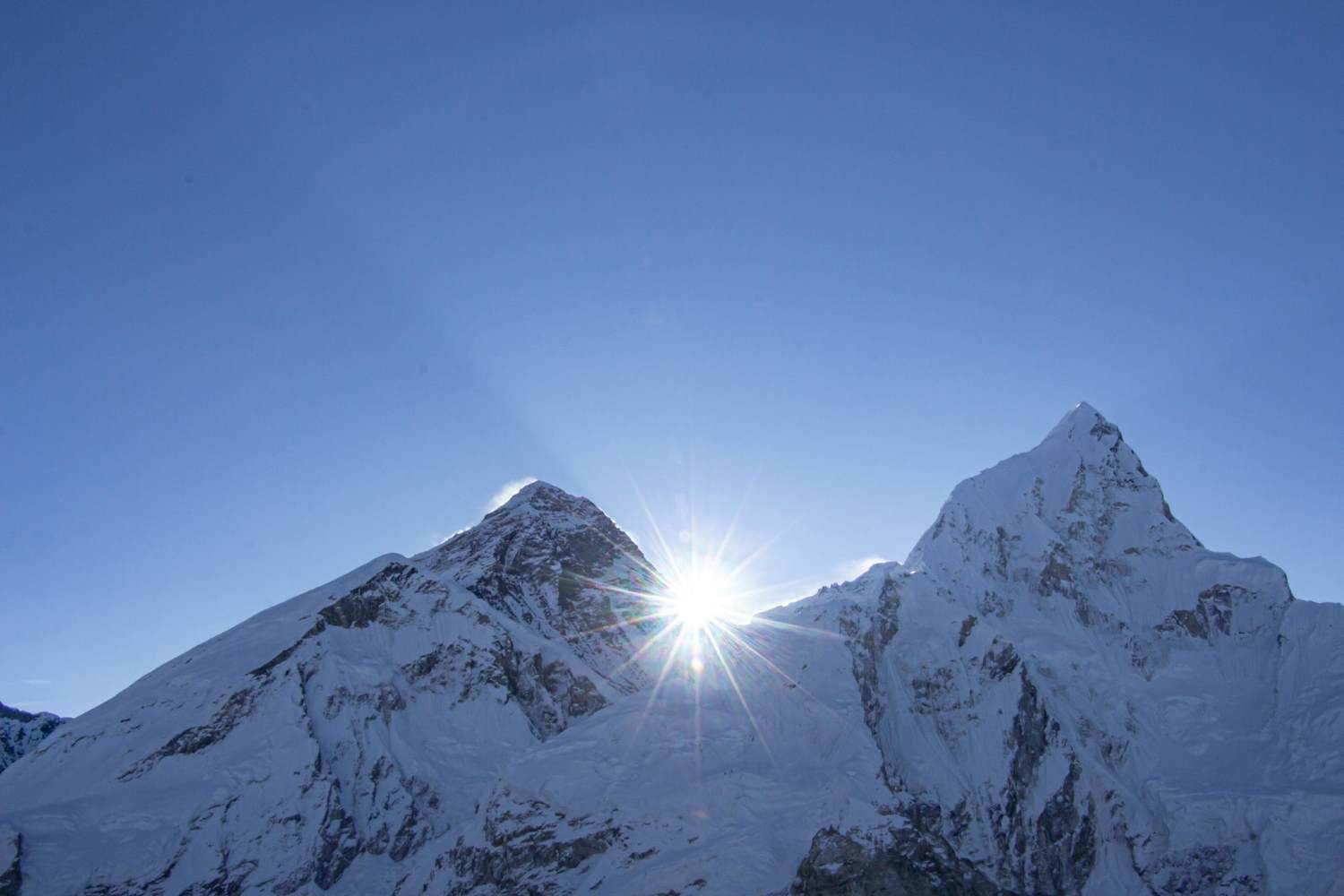
What is Three Peak Climbing in Nepal
Three-peak climbing is the combination of three popular peaks in Nepal. Nerekha Peak, Island Peak, and Lobuche Peak. Similarly, if you want to enjoy the best adventure peak climbing in Nepal this is the best. This trekking and climbing route in the Everest Region is the most popular one. Annually, a lot of people love to do this peak climbing. Furthermore, Nepal is a country with a lot of beautiful peaks and to stand out among them is an accomplishment on its own. Likewise, the unique structure of the peaks is the main reason for their attraction. Similarly, Three Peak Climbing in Nepal is the combination of adventure, excitement, and the thrilling experience of climbing three peaks above 6,000 m in Nepal. This combination of peak climbing is best for foreigners who want to travel to the high altitudes of Nepal. Likewise, the three peaks of Nepal offer the most wonderful views of mountains like Mt. Everest, Makalu, Pumori, Makalu, Lhotse, Lhotse Shar Nuptse, Ama Dablam, and many more surrounding mountain peaks. In addition to the climbing adventure, the Everest trekking period and the Khumbu region offer a surprising opportunity to explore the local people’s valley, landscape, and glacier full-scale cultural lifestyles.
Mera, Island, and Lobuche Peak
Mera Peak is the best trekking top in Nepal. Similarly, the best Three Peak Climbing in Nepal. Mera Peak is 6,476 m excessive. Though it’s by far the best trekking top, it calls for a very little technical trekking experience. Mera Peak Climbing is well-known as a mild hiking and trekking experience. If you’re making plans to head on this journey in Nepal, consider that it isn’t too technical however it surely calls for primary alpine skills. Island Peak, additionally called Imja Tse, is a surprising top amid the giants of the Himalayas. It is 6,189 m excessive and it does now no longer require superior hiking skills. Therefore, it’s far similarly famous amongst skilled and newbie trekkers. Similarly, the splendor of this mountain can not be aptly defined in words. This mountain does certainly appear to be an island withinside the snowy field. The perspectives from the pinnacle of this mountain are simply wonderful. Lobuche Peak is a lovely top positioned at an altitude of 6,119 m above sea level. From the summit of Lobuche, you may have breathtaking and panoramic perspectives of the Everest Region. Furthermore, the top is positioned close to the Khumbu Glacier. Likewise, this trek additionally gives a possibility to have a look at the historical Buddhist monasteries and look at excellent scenery. This trek additionally entails several peaks over seven or 8 thousand meters altitude.Main Highlights of the Three Peak Climbing in Nepal
- Climb three stunning peaks over 6,000 meters in the Everest region
- Climb the Amphu Lapcha Pass
- Unique Sherpa culture
- Alpine plants and wildlife
- Old monasteries
The difficulty of Three Peak Climbing in Nepal
Three Peak Climbing is the ultimate rock-climbing holiday, climbing three peaks over 6,000m and climbing the Anhurapcha Pass at an altitude of 5,850m. Climbing to Mera, Island, and Lobuche Peak is physically and technically difficult. Furthermore, these three peaks are the most famous and most popular mountaineering peaks in the Everest region. The combination of the three will make this summit a perfect adventure full of thrills and excitement. Mera, Island, and Lobuche are perfect for trekkers seeking full thrill and adventure during trekking and mountaineering. Of the three peaks, the island peak is relatively difficult in some technical sections. Also, there are several glaciers, crevasses, rocks, and ridge walkways. In addition, the Three Peak Slime is considered intense due to the long trekking/climbing times in remote, isolated areas over 5,500 m and the need to sleep for several days at altitudes above 5,000 m. To be successful in climbing Three Peaks, the climber must have a good physical level. Similarly, on Summit Day, climbers should leave the base camp at 2 am and return to the base camp only late in the afternoon. Likewise, this climbing involves the use of climbing equipment (harnesses, ice axes, crampons, climbing shoes, climbing shoes). Previous experience is essential. Overall, the rise in Three Peaks is exhausted.Which seasons are best for Three Peak Climbing in Nepal
Peak climbing in Nepal is a seasonal activity. Autumn and spring are the best seasons to climb most of Nepal’s mountains. Likewise, the autumn season (September, October, and November) and the spring season (March, April, and May) are the best time to climb Mera, Island, and Lobuche Peak. During these months, Himalayan days are sunny and warm. Additionally, the sky is sunny and the Himalayan atmosphere is fascinating. So we have a wonderful view of the mountains. However, adventurous guests who do not like the hustle and bustle of the trip can also choose the winter season (December, January, February) for this trip. The monsoon season (June, July, August) is a very difficult time to climb the Himalayas due to the monsoon. During the monsoon, the trails become slippery and muddy, and landslides also occur.Autumn and Spring
Autumn and spring are ideal seasons for climbing three peaks. The temperatures will drop considerably as you ascend higher and higher. Moreover, the nights are cold (between 5˚C to 5˚C) and the days are sunny and hot (between 10˚C to 20˚C). Mornings are usually clear, beautiful with clouds building up in the afternoon and disappearing at night. Furthermore, trekking and climbing during the monsoon seasons and winters are not recommended as the visibility is poor and limited whilst upper parts and high passes will be covered with snow. Most climbers prefer March, April, October, and November for Three Peak Climbing in Nepal. We also recommend booking trekking for any of the above months. In addition, there is no obstacle to ruining trekking during this time.How long does it take to climb the Three Peak Climbing in Nepal?
Mera, Island, and Lobuche Peak Climbing are one of the longest peak climbing routes in Nepal. This package, commonly known as three-peak climbing, takes about 28-30 days to complete. Similarly, this climbing route requires climbers with experience in altitude trekking and rock climbing as they climb high passes and climb high mountains. Our 3 peak climbing begins with an arrival at Tribhuvan International Airport Similarly, on a subsequent day, you’ll have time to put together the trek, meet the guides, and set up the system for the hit trek. We may have a scenic flight to Lukla from wherein our real trek begins at the 1/3 day. We will begin our trek slowly via the untouched and far-flung Hinku Valley of Khumbu place. Furthermore, the path to Mera Peak hiking gives stunning herbal eventualities of plants and fauna, alpine vegetation, river and streams, snow-capped mountains, and the world-well-known Sherpa lifestyle, culture, and traditions. On the manner to Mera Peak Base Camp, you’ll skip with the aid of using exclusive stunning valleys like Ningsow, Chetrekhola, Kothe, Thangnag, Khare, etc. After right acclimatization, instruction, and schooling with the aid of using our hiking manual withinside the camp we climb Mera Peak, the very best hiking top withinside the world.Mera, Lobuche, and Island Peak Climbing
After Mera Peak Climbing, we can maintain our trek to Island Peak. Frozen waterfalls, glaciers, and jaw-losing snow-capped mountains deliver corporation at some point of the trek, a thrilling experience. In the center of snow-included heaven crossing Amphu Lapcha by skip is a sensational second supplying a 360-diploma snow-included view with big partitions of mountains like Mt. Everest, Cho Oyu, Makalu, and lots more. After filing Island Peak, we whole Kongma-La Pass (5,535 m) and trekked in the direction of Everest Base Camp earlier than Lobuche top as trekking 3 excessive peaks again to again may be difficult. So, we tour Everest Base Camp and live in Gorakshep. And we can go back to Lobuche after trekking to Kala Pathar early withinside the morning and live in Lobuche Peak Base Camp. After acclimatizing to Lobuche High Camp we can climb one of the well-known Lobuche East Peak (6,119 m). After efficaciously hiking the 3 famous peaks withinside the Everest region and trekking to Everest Base Camp we can descend to Lukla and fly again to Kathmandu. For this itinerary, you want to stroll for approximately four to five hours daily.Cost for Three peak climbing in Nepal
Mera, island, and Lobuche peak climbing are slightly expensive for their length. The entire climbing expedition takes more than about four more weeks. Therefore, the expedition costs in the season are $ 4,500 to the USD 5,000 range. General expenses for three-peak climbing in the Everest region are a 4-night stay in Kathmandu at the tourist tour including BB plan, city guide, all entrance fees, and private traffic. After that, the cost also covers the Kathmandu Lukla up and down the flight, climbing permit, trekking permissions, and national park entrance fees. In addition, all meals, room rates, guides, and porter costs are also guided at the same cost. We also offer camping facilities, climbing machines, general emergency assistance, and all government taxes from the same amount. We think that we do not have to provide the best service at competitive prices in a 100% successful warranty.Experienced required for the Three Peak Climbing in Nepal
Mera, Lobuche, and Island peak is a technical adventure activity in Nepal, which requires Peak Climbing equipment and also requires previous trekking experience, and technical skills to have a successful summit. Furthermore, the journey is very suitable for adventurous motivated trekkers with the opportunity to run snow crushes and adventurous roads. If you walk at a height of high height to attract high altitude illness, a steady walk will be a perfect solution. We recommend that you are all Trekkers. If you made other small peaks in the same area, you recommend that you realize Mala, Island, and Lobuche. List of activities where you must have to be obliged before you try to peak clients in Nepal:- Go on the hills and hills, and you need to climb and run.
- A long walk once a week. Swimming and cycling.
- You can also increase the stairs of the skyscrapers up and down. Eat healthy food. keep it up.
- If you can do more yoga related to breathing.
Fitness required for the Three Peak Climbing in Nepal
One of the most common questions with Three Peak Climbing is the level of the physical strength required to climb these peaks. Mera, Island, Lobuche is a considerable amount of trekking peaks. Thus, the summit itself is technical and generally, increases fatigue. These summits are not for beginners. They are primarily suitable for climbers that are mainly experienced and physically matched. Because they are healthy, this does not mean that they are ready to expand the summit. Our weir has enough space for adaptability, but it is recommended that you go through many fitness routines a few months before your actual trip. Likewise, physical training should be started 3-4 months before the trip. If you’ve done some kind of high-altitude trekking, it’s usually an advantage. However, if you have never done advanced trekking before, you may need a little more difficult training. The Three Peak Slime carries a backpack and gear to climb and descend thousands of feet on consecutive days. Therefore, it is important to start preparations early and gradually improve your physical and mental condition. This is an essential part of your trip. Here are some things you can do to prepare for an adventure:- Go hiking often
- Build up stamina
- Practice jogging, running, walking, aerobic exercise, and other prescribed cardiovascular fitness workouts.
- Follow security guidelines.
Gears required for the Three Peak Climbing in Nepal
The tools and devices indexed below are important for the Three Peak Climbing. We request you to get all of the devices indexed underneath for a successful trip. We additionally request you to put together a tick list and be acquainted with the usage of those instruments. Similarly, you can purchase or rent the equal in Kathmandu as they’re to be had in lots of hiking stores from branded to nearby producers in Kathmandu.Clothing and Footwear:
- Long sleeve shirt
- Pants
- T-shirt
- Warm jacket / sweater / sweater
- Waterproof jacket and trousers
- Underwear
- Underwear
- Warm socks
- Warm hat, gloves (bottom), bandana/scarf
- Extra clothes to wear in Kathmandu when returning from trekking.
- Trekking shoes (full)
- Snow skirt
- Camping slippers / flip-flops
- Daypack 3035 liters (to carry sunscreen, water, cameras, waterproof jackets, and anything else you need during a trek)
Documents
- Passport with visa and validity of 6 months after your trip completion
- 4 copies of passport size photos for permits and official formalities
- Travel Insurance (Please refer to the general information page for more detail about it)
- Credit cards in case of emergencies
- Flight Tickets
- Driving ID or any other ID in case of loss of your passport.
Others
- Thermarest or similar sleeping mat
- Headlamps with extra batteries
- Sunglasses with UV protection
- Camera with charger or spare batteries
- A pair of trekking poles
- Water bottle one (1) liter
- Laundry bag to keep the dirty clothes
- Large plastic bags to keep the clothes dry
- Binoculars
- Padlock
- Reading materials, notebooks, and pens
Toilets And Hygiene:
- Quick-drying towel
- Small face towel
- Toothbrush &Toothpaste
- Deodorants, Soap, and Shampoo (Smaller bottle)
- Face and body moisturizer, Sunscreen, and lip balm
- Hand sanitizer/Antiseptic wipes
- Hygiene product
- Basic first aid kits
Personal Climbing Equipment
- Plastic mountaineering boots
- Mountaineering/Climbing Harness
- Ice Axe
- Helmet
- Crampons
- Ascender/Jumar
- Descender/ 8 figure (Rappelling device)
- Screw gate Karabiners (Lock 2/Unlock 2)
- Prusik loop
Outline itinerary of Three Peak Climbing in Nepal
Note: Below number denotes the days you will be spending on the Three Peak Climbing in Nepal 1 – Arrival in Kathmandu [1,350m/4,430ft] 2 – In Kathmandu for trek/climb preparation [1,350m/4,430ft] 3 – Fly to Lukla [2,800m/9,187ft] and trek to Poiyan [2,800m/9,184ft] 4 – Trek to Pangoma [2,850m/9,348ft] 5 – Trek to Ningsow Bhuk [2,850m/8,348ft] 6 – Trek to Chetra Khola [2,800m/9,184ft] 7 – Trek to Khote [3,600m/11,812ft] 8 – Trek to Thaknag [4,356m/14,292ft] 9 – Acclimatization and rest day [4,356m/14,292ft] 10 – Trek to Khare [5,045m/16,552ft] 11 – Pre-Climb training and acclimatization day [5,045m/16,552ft] 12 – Trek to Mera High Camp [5,800m/19,029ft] 13 – Summit Mera [6,476m/21,247ft] and trek to khongma Ding [4,840m/15,180ft] 14 – Trek to Seto Pokhari [5,000m/16,405ft] 15 – Trek to Amphu Lapcha High camp [5,400m/17,717ft] 16 – Trek to Chukung [4,730m/15,518ft] via Amphu Lapcha Pass [5,850m/19,190ft] 17 – Rest and contingency day 18 – Trek to Island Peak Base Camp [5,200m/17,060ft] 19 – Summit Island Peak [6,189m/20,305ft] and trek to Chukhung (4,730m/15,518ft) 20 – Trek to Dingboche [4,412m/14,475ft] 21 – Trek to Lobuche [4,910m/ 16,105ft] 22 – Move up to Lobuche High Camp (5,400m/17,712ft) 23 – Summit Lobuche East [6,119m/20,075ft] and trek to Thugla [4,600m/15,088ft] 24 – Reserve day for contingency 25 – Trek to Pangboche [3,985m/13,071ft] 26 – Trek to Namche Bazaar [3,450m/11,316ft] 27 – Trek to Lukla [2,800m/9187ft] 28 – Fly back to Kathmandu [1,350m/4,430ft] 29 – Free day in Kathmandu [1,350m/4,430ft] 30 – International departureFAQs about Three Peak Climbing in Nepal
When is the best time for Three Peak Climbing?
Peak climbing in Nepal is a seasonal activity. Autumn and spring are the best seasons to climb most of Nepal’s mountains. Similarly, the autumn season (September, October, and November) and the spring season (March, April, and May) are the best time to climb Mera, Island, and Lobuche Peak. During these months, Himalayan days are sunny and warm. The sky is sunny and the Himalayan atmosphere is fascinating. So, we have a wonderful view of the mountains.Is the Three Peak Climbing Safe?
Nepal is certainly a safe tourist destination for all tourists, and Nepal promotes sightseeing on a woman’s trip that is not a security issue. Likewise, those who love trekking and climbing can do the Three Peak Climbing. Similarly, tourists are protected by the victims before all possible hazards. The details of education and tour are required in advance and recorded by the security unit.How fit should I be for the Three Peak Climbing?
One of the most common questions with Three Peak Climbing is the level of physical strength required to climb these peaks. Mera, island, Lobuche is a considerable amount of trekking peaks. Thus, the summit itself is technical and generally has increased fatigue. Moreover, these summits are not for beginners. They are primarily suitable for climbers that are mainly experienced and physically matched. Because they are healthy, this does not mean that they are ready to expand the summit. Our weir has enough space for adaptability, but it is recommended that you go through many fitness routines a few months before your actual trip.How experienced should I be in the Three Peak Climbing?
Mera, Lobuche, and Island Peak are technical adventure activities in Nepal and require peak climbing equipment. Also, a successful summit requires previous trekking experience and technical skills. Furthermore, this trip is very suitable for adventurous trekkers who have the opportunity to crash snow or walk adventurous roads. If you are walking in the highlands to attract altitude sickness, stable walking is the best solution. We recommend the trekker.What is the average cost for the Three Peak Climbing?
Mera, Island, and Lobuche peak climbing are a little expensive for their length. The entire climbing expedition takes more than about four more weeks. Therefore, the expedition costs in the season are $ 4,500 to the USD 5,000 range Read more... Read less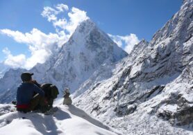
May 2, 2022
Major Airports in Nepal
Nepal is a small landlocked country. So, air transportation plays a vital role in every aspect, be iNepal is a small landlocked country. So, air transportation plays a vital role in every aspect, be it transportation. Therefore, having good airports are very important in the case of Nepal. Furthermore, having a good airport facility helps foreign flights to land and helps in welcoming foreigners. And, this country has a unique landscape that helps attract many foreigners.
About 86 % of Nepal’s total land is covered by hills and mountains. Many high altitudes parts of Nepal are remote. Also, road transportation is the most dependable transportation here because of the same reason. Also, because there is no sea in this country. So, water transportation is impossible
Similarly, Ropeways and Railways are not advanced in Nepal. After, road transportation, air transportation has great importance in Nepal. As of right now, there are 34 actively operating Airports in Nepal. Likewise, it has no relation to the sea and oceans. Also, the country is surrounded by huge snowcapped peaks and giant hills. In that case, road transportation is more common in this country.
But, many remote and secluded parts cannot be by road. Therefore, air transportation is gaining more popularity and importance. There are many airports in Nepal. But, some of them are Major Airports in Nepal which plays a vital role in the transportation of the country.
The air transportation facility in this country, also, provides you access to the remote and secluded areas of Nepal. Without much effort and time and at the same time, you would have the most thrilling experience and stunning mountain views. In addition, flying over the wonderful mountain peaks themselves is so beautiful. Watching through the window, you will have the most beautiful scenes and sights from the flight. Additionally, you will get beautiful views of the different lush forests and greenery of Nepal.
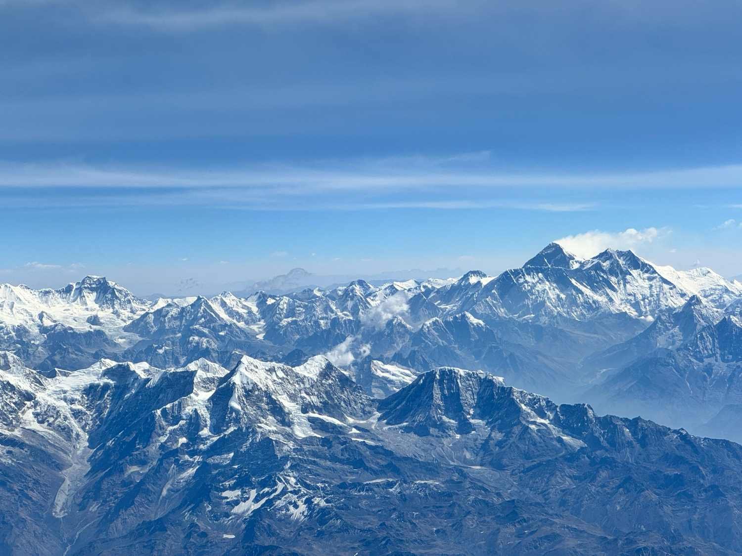
Description of Major Airports In Nepal
Altogether, a journey by plane is a lifetime experience you will never forget. For a lot of people, it is a dream come true. Here in this article, we provide some important airports in Nepal that are making travel easy for many years. Also, these airports are the Major Airports in NepalTribhuvan International Airport
Tribhuvan International Airport is the only international airport in Nepal until now. This airport is in Kathmandu. Similarly, this is the first airport in Nepal. Likewise, this airport was built in 1942. Firstly, the name of Kathmandu was Kathmandu Airport. Likewise, after 13 years the airport was renamed Tribhuvan International Airport in 1955. The airport code of Tribhuwan International Airport is KTM for IATA and VNKT for ICAO set by the officials. Being only the International Airport in Nepal. It is a Major Airport In Nepal which plays a vital role in the International transport of this country. Tribhuvan International Airport connects Nepal with 17 countries in 40 different destinations. Therefore, it is the busiest airport in Nepal. Kathmandu airport lies at an elevation of 1338 m Similarly, the runway length of Kathmandu airport is 3350 meters and is 45 meters wide. Furthermore, it is the biggest airport and is one of the Major Airports In Nepal. Furthermore, international airlines such as Air Arabia, Qatar Airways, Air India, Thai Airways, Air China, Jazeera Airways, Etihad Airways, and many more airways operate regular flights to Tribhuwan International airport. The airport runs all year round in all weather conditions despite being the only International Airport. Moreover, some domestic airlines that run flights to and from Tribhuwan International airport to every corner of the country are Nepal Airlines, Buddha Air, Saurya Airlines, Simrik Airlines, Yeti Airlines, Shree Airlines, and Tara Air, Sita Air, and Summit Air.Tenzing-Hillary Airport – Lukla Airport
The name of Tenzing-Hillary is the name of a famous person who first successfully did the summit of Mount Everest. And, created a lot of history throughout their lifespan. Similarly, the second name of this airport is Lukla Airport. Lukla Airport is situated in the bustling town of Solukhumbu district of province No. 1. Importantly, the airport was built in 1964 but the proper runway was not built until 2001. Due, to the geography of the place. Furthermore, the runway length of this Airport is 527 meters. Which is a small runway. But, even this small runway is suitable for domestic flights. Similarly, the airport codes of Lukla airport are LUA (IATA) and VNLK (IACO). Lukla Airport (Tenzing Hillary Airport) is poured as the most dangerous airport in the world. Apart from a short runway, it has an elevation of about 9500 feet which results in two main problems thin air and lesser landing time. In addition, the landings must be in one go as the airport is surrounded by mountains and peaks. Lukla Airport only runs domestic flights. Importantly, the airport actively operates scheduled flights to Kathmandu airport. Some airlines that operate flights to and from Lukla are Tara Air, Summit Air, Nepal Airlines, and Sita Air.Pokhara Airport
Pokhara Airport is the third busiest domestic airport after Lukla Airport and Tribhuvan International Airport. The airport is in the middle of Pokhara valley. The airport was built in 1958 AD. Pokhara airport serves as the main gateway for the visitors heading to pilgrimage sites like Muktinath temple and many trekking trails of the Annapurna region for visitors. The IACO and IATA codes for Pokhara airport are VNPK and PKR. The airport lies at an elevation of 827 m above sea level. With growing popularity as a tourist spot, the Nepal government has started its massive makeover as an international airport. Similarly, the new runways will be 8200 feet long along with a breadth of 147 feet. Likewise, there will be multiple parallel taxiways. The Civil Aviation Authority of Nepal is taking all the responsibility for the airport. Flights to Jomsom, Bharatpur, Kathmandu, Manang, and Bhairahawa are available from Pokhara airport. Additionally, Buddha Air, Yeti Airlines, Tara Air, Sita Air, Summit Airways, and Simrik Airlines. Nepal Airlines and Shree Airlines regularly operate flights from Pokhara airport to the above-mentioned places in Nepal.Biratnagar Airport
Biratnagar Airport is one of the most popular airports in Nepal. Similarly, the airport lies in the big city of Kathmandu. Likewise, the main focus of Biratnagar Airport is its 5000 feet by 98 feet asphalt runway and facility for aircraft refueling. Biratnagar Airport is one of the biggest international hubs in Nepal. Similarly, it is correlated with different Major Airports in Nepal. Therefore, this airport plays a vital role in the overall air transportation of Nepal. In addition, this airport opens your way to different destinations in Nepal. After its popularity and value to the tourist, the Nepal government had made a to make it a Multi-National airport. Additionally, The IATA and ICAO codes for the Biratnagar Airport are BIR and VNVT. Most importantly it is one of the important airports in Nepal which plays a vital role in the overall development of the tourism sector in Nepal. Furthermore, Buddha Air, Nepal Airlines, Sita Airlines, Yeti Airlines, etc. are the major flights of the Biratnagar Airport. The Biratnagar Airport is the busiest domestic airport in Nepal. Similarly, the flights of this Airport take you to some of the popular places in Nepal. Likewise, this airport operates in every kind of weather.Nepalgunj Airport
Nepalgunj airport in Nepalgunj district. And, is one of the Major Airports in Nepal. It is the second-largest airport in Nepal. After Kathmandu in case of air connectivity. Nepalgunj airport runs flights with 16 airports in different areas of Nepal. Similarly, it plays a valuable role to connect the rural hilly, and mountainous areas of the west and far west of Nepal. It contributes significantly to the tourism development of Nepal. And, as many potential tourist destinations lie in these regions it is important that this airport is in good condition. Furthermore, it serves as the main air gate for Indian devotees to visit the Kailash Manasarovar of Tibet. Nepalgunj airport lies in the Terai region, at an elevation of 150 meters. The IATA and IACO codes for this airport are KEP and VNNG, respectively. Since, 1961, the airport has been offering its facilities to the people of Nepal. Nepalgunj Airport has a runway with a length of 1505 meters and a width of 30 meters. Likewise, the airport has a large apron that can operate a variety of large and small domestic planes. Altogether, the airport aims to add additional flights in the future because of its capacity to operate larger aircraft and link to several air routes in Nepal.Bharatpur Airport
Bharatpur Airport is in the beautiful Chitwan district of Nepal. Similarly, Bharatpur Airport is a Major Airports In Nepal. Which plays a vital role in the tourism development of the country. After Pokhara and Lukla airports, it is a major foreign currency earning domestic airports in Nepal. The airport, located in the Chitwan area, gives different services to nature enthusiasts since its establishment in 1961 AD. Chitwan is one of the most favorite destinations for the best vacation and enjoying Nature. In addition, the Bharatpur airport gives a high volume of passengers. Because of people’s demand, the airport is developing the number of aircraft and flight services in the country. The code of Bharatpur Airport for IATA is BHR and for ICAO is VNBP respectively. The airport runs in all weather conditions and is in direct correlation with Pokhara airport and Kathmandu airport. Similarly, this airport puts a huge value on the tourism development of the country. Annually, a lot of visitors who want to visit the charmful city of Chitwan takes this scenic flight. Furthermore, some of the popular airlines like Buddha Air, Yeti Airlines, and Simrik-run active flights to and from Kathmandu and Pokhara. Despite being one of the busy domestic airports of Nepal, just two airlines only operate regular flights to and from Bharatpur airport. And the airlines are Buddha air and Yeti airlines of Nepal.Jomsom Airport
Jomsom Airport is one of the Major Airports in Nepal. Annually, a lot of native and international visitors go and come via this airport. Furthermore, it is the most dangerous airport in Nepal. Because this airport is at a high altitude. Likewise, this airport is at an altitude of 8900 feet above the Kali Gandaki River canyon. This airport is very important to the local citizen. Clearly, just because this airport connects Jomsom to the rest of Nepal. Furthermore, this airport is the main gateway to the popular tourist destination of Nepal. Including, Muktinath Temple which is a favorite choice and holy place for both Nepali and Indians. Jomsom Airport has an asphalt airstrip of 2400 feet long and 66 feet wide. Similarly, The air route to this airport is covered with snow-capped mountain ranges of Nepal. Furthermore, if you travel via this route at the right time of the day, the sun shining and views of the snow-capped mountains will simply amaze you and will be unforgettable to you. The IATA code for this airport is JMO and the ICAO code of this airstrip is VNJS. In addition, this Airport is famous among those who love to trek and be at the beautiful nature of Nepal. Furthermore, Nepal Airlines, Sita Air, and Tara Air are the most operating flights to this airport.Bhairahawa Airport
The other name for Bhairahawa Airport is Gautam Buddha Airport. Similarly, this is a Major Airport In Nepal that plays a vital role in the development of Nepal. Most importantly, this is valuable for the tourism sector of Nepal. But, there is a huge construction going on at this airport for the better function of the airport. Likewise, this is the gateway for many foreign tourists who want to visit Lumbini. Furthermore, after the completion of this airport, this airport will be the second international airport in Nepal. The IATA and ICAO codes of Bhairawa Airport are BWA and VNBW respectively. Similarly, the main reason for this airport development is it has got an asphalt concrete runway and apron. Likewise, from Bhairahawa airport, flights to Kathmandu and Pokhara airport are in operation regularly. Buddha Air, Yeti Airlines, Shree Airlines, Nepal Airlines, and Saurya Airlines are some of the airlines that intervene in regular flights to and from Bhairahawa airport. In a year or so, the airport will start running international flights after the construction.Manthali Airport (Ramechhap Airport)
The Manthali Airport or Ramechhap Airport is situated in the Ramechhap district of Nepal. Similarly, this airport is a Manthali which is the headquarters of the Ramechhap district. Therefore, this airport plays a vital role in the air transportation of Nepal. Manthali Airport is famous as Ramechhap Airport. The IATA code of Manthali airport is RHP and the ICAO code of the same is VNRC. This airport is gaining popularity as the flights to Lukla are from this airport as these places are important destinations for someone wanting to trek in Nepal. Similarly, this Airport is a Major Airport in Nepal because it helps to attract a lot of foreign tourists to Nepal. The airport was built in 1979 and was renovated in 2015 by the officials. But, now the airport is one of the busiest domestic airports. Because the number of tourists heading toward Everest is very high starting from Lukla. And the flights must be early in the morning because it is not possible for landing and take off during the afternoon. The harsh gust of wind and poor visibility may increase the chances of accidents while landing.Dhangadhi Airport
Dangadi Airport is a domestic airport in the Kailali District of Nepal. Similarly, this is one of the oldest Major Airports In Nepal. This airport was built on 6 July 1958. Likewise, after some years this airport will be an international airport of Nepal. The surface of the runway is asphalt with concrete and has a length of 5000 feet. With an elevation of 600 ft. It is 650 km away from Kathmandu it is a major airport for local people. The IATA and ICAO codes of this Airport are DHI and VNDH respectively. Similarly, major domestic airlines of Nepal operate daily flights to and from Dhangadhi. In addition, Buddha Air has daily and direct flights from Kathmandu to Dhangadhi. Likewise, from Dhangadhi you can explore and observe further popular places such as Karnali Bridge, Tikapur National Park, and Ghodaghodi Tal.Phaplu Airport
Phaplu Airport is a domestic airport in the Phaplu village in Solu Dudhkunda at Solukhumbu district in Nepal. This airport is only 280 km away from Kathmandu valley and lies closer to Lukla Airport. And it lies at an elevation of 2413 meters. In addition, you can enjoy an alpine climate all-round the year at this place. The runway is 671 meters in length with a blacktopped surface that was asphalted in 2013. Likewise, several airlines are flying to and from Kathmandu and Biratnagar. The airport is the second most busy airport after Lukla where different charter flights are available. Furthermore, you can explore destinations near Phaplu which are Renjo Pass, which will add value to your flight. Additionally, you can explore the Halesi Mahadev temple Tengboche Monastery, Sagarmatha National Park, and many more. Furthermore, you can get other beautiful views of the landscape of the place.Janakpur Airport
Janakpur Airport is a major domestic airport in the Dhanusa district of Nepal. Similarly, it is operated by the Civil Aviation Authority of Nepal (CAAN). Likewise, it is 4 km away from Janakpur. In addition, the biggest temple of Nepal ‘Janaki Temple’ lies in Janakpur. The surface of the runway is tarmac with asphalt and has a length of 4000 feet. And, with an elevation of 256 ft. Similarly, it is 200 km away from Kathmandu. Furthermore, the IATA and ICAO codes for Janakpur Airport are JKR and VNJP. Major domestic airlines of Nepal operate daily flights to and from Janakpur. Likewise, Buddha Air has direct and daily flights from Kathmandu to Janakpur. Similarly, the nearest location you can travel to from Janakpur is Jaleshwor and Dhanusha Dham which is popular. Also, these places are famous for their cultural importance.Chandragiri Airport (Bhadrapur Airport)
The other name for Chandragadi Airport is Bhadrapur Airport. Similarly, this is one of the oldest and Major Airports in Nepal. And this airport is in the Jhapa district of Nepal. So, if you want to visit Jhapa and if you decide to take a flight then you will get to see the beautiful landscape of the place. Similarly, it is only 4-5 km away from the city center of Bhadrapur. Additionally, Bhadrapur is the oldest municipality in Nepal. Furthermore, it is the closest city to Bhadrapur is Ilam which is the tea city of Nepal. The airport was built in 1963 with a surface of asphalt and a length of 5000 ft. Similarly, it is at an elevation of 300 feet and is 450 km away from, Kathmandu. Likewise, domestic airlines operate daily flights to Bhadrapur. Most importantly, Bhadrapur is the major entry point for trekkers visiting Mt Kanchenjunga, the third tallest mountain in the world. Similarly, you can visit Makalu Barun National Park and Siliguri on your visit here.Talcha Airport (Rara Lake, Mugu)
The Talcha airport is the most remote airport in Nepal. Talcha airport in Mugu district is one of the most visually pleasing airports globally and, the world’s scariest airport at the same time due, to its structure of the airport. The airport lies at a height of 2720 meters above sea level on a hilltop in Nepal. Because of its complex setting, taking off and landing are challenging and troublesome. Furthermore, this domestic airport has been serving people since 2003, and it is widely famous for getting to Rara Lake at the earliest. Therefore, many people refer to Talcha Airport as Rara Airport. Moreover, the airport has one runway of length 570 meters and 20 meters wide. The airport codes for this airport are THL for IATA and VNRR for IACO. Summit Air, Tara Air, Sita Air, and Nepal Airlines regularly operate flights to Talca airport from Nepalgunj, the only connected airport to the place.Juphal Airport (Dolpa Airport)
Juphal Airport or Dolpa Airport is in the beautiful Dolpa district of Nepal. Similarly, it is a gateway to several traveling destinations. For Example, Dolpa Airport is the one and only gateway to Shey Phoksundo Lake and Shey Phoksundo National Park. Likewise, it is the gateway to many trekking destinations in the Dolpo Region. Jupal Airport, similar to any other airport in Nepal, has a single airstrip. Dolpa Airport runway is about 560 m long and 20 m wide. The airport codes for Jupal Airport are DOP (IATA) and VNDP (IACO). In addition, the parking capacity of Jupal Airport is two DHC6 types of planes, and its apron size is 2400 square meters. Sita Air, Nepal Airlines, Tara Air, and Summit Air are the only airlines that operate their flights to Dolpo Airport.Tumlingtar Airport
Tumlingtar Airport is a major domestic airport in the Sankhuwasabha district of Nepal. Similarly, Tumlingtar is the deepest valley in Nepal between Arun and Sabha Rivers. Importantly, Tumlingtar Airport was established on 1 October 1972 and from then it is providing its services to the people. Similarly, the surface of the runway is surface with asphalt and has a length of 4001 feet. With an elevation of 1315 ft, it is 500 km away from Kathmandu it is a Major Airport in Nepal. The IATA and ICAO codes for Tumlingtar Airport are TMI and VNVT respectively which are important for any flight. Different domestic airlines of Nepal run daily flights to Tumlingtar. And, Buddha Air has daily and direct flights from Kathmandu and Biratnagar to Tumlingtar. Similarly, it is the main gateway to Makalu Trek. You can visit Makalu Barun National Park during this unforgettable trek the place. Read more... Read less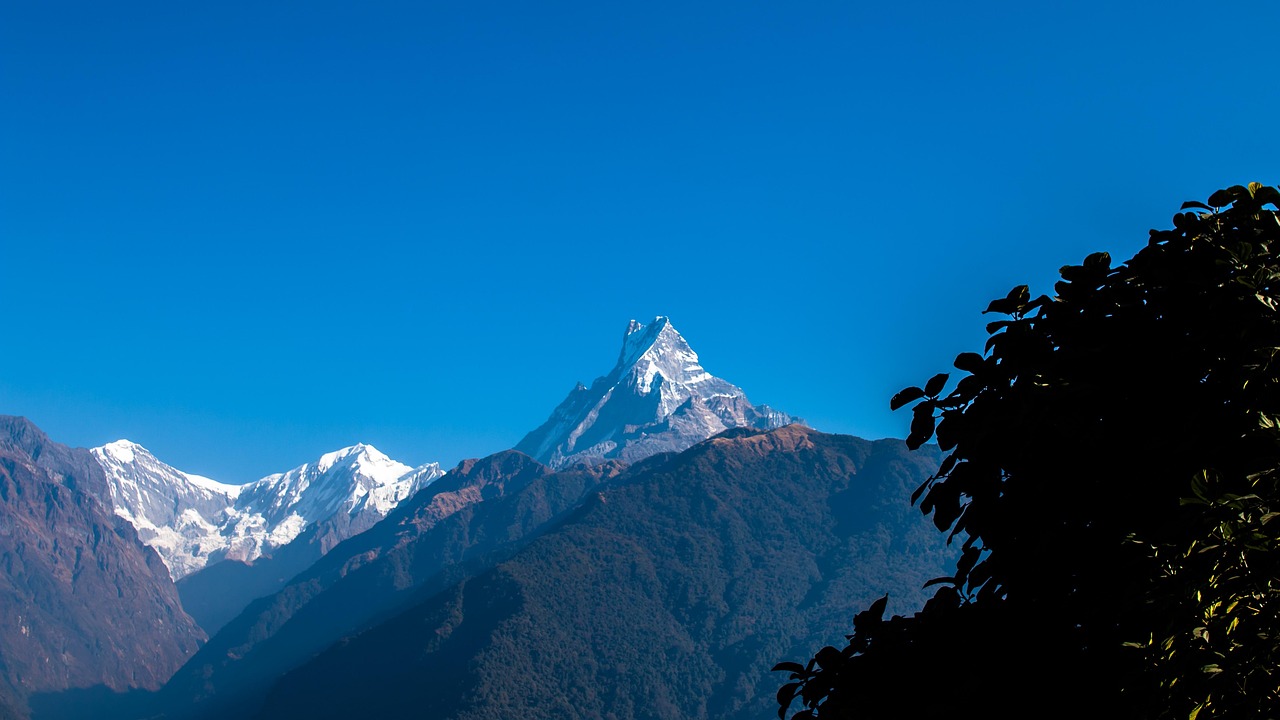
July 14, 2022
Adventure in Nepal
Nepal is the home to beautiful Hindu temples and Buddhist monasteries. Similarly, the mighty snow-caNepal is the home to beautiful Hindu temples and Buddhist monasteries. Similarly, the mighty snow-capped Himalayas, green forests, and white rivers come to mind when thinking about Nepal. Nepal, located between two large countries, India and China, may be small but should not be underestimated. There are many Adventure in Nepal to do.
Similarly, the state has to offer more than just stunning views. If you’re looking for adventure, there’s nothing better than Nepal. The chivalry and beauty of this place are doubled by the unlimited fun and excitement package of Adventure in Nepal available here.
If you explore attractive external sports here in Nepal, your heart is beating with thrill. A sudden adrenaline rush is when you can be sunbathed in one of these sports. So, let’s make something worthwhile to go with Lodge from a relaxed bed and remember the lifetime. Similarly, you may have completed a series of sports in various countries, but the great truth is Nepal is rustic labeling of wonderful Himalaya. This is a list of thriller Adventure in Nepal.
Trekking
When you think of adventure in Nepal, this is the first thing that springs to mind. It’s understandable, given that you have the unique opportunity to explore the Himalayas. Similarly, Nepal is home to eight of the world’s ten tallest peaks, making it a trekking paradise for visitors from all over the world. Every year, some 200,000 trekkers travel to Nepal in quest of thrill and adventure. It is the best Adventure in Nepal. Some of the most beautiful trekking trails may be found in the Himalayas. It’s no surprise that Nepal is at the top of trekkers’ bucket lists all around the world. You will be completely awestruck by the breathtaking splendor of the Himalayan ranges as you begin your amazing trek. In addition, the mountain residents’ ancient way of life will astound you.Best Time For Visit in Nepal
Although you may hike in Nepal all year, most trekkers opt to do so during the prime hiking seasons of fall and spring. If you’re going trekking in Nepal for the first time, we recommend going during one of these high seasons. Although the trails may be more congested, we believe the benefits will outweigh the inconvenience.Fall (October – November)
This is Nepal’s most popular trekking season. You’ll have the highest chance of seeing clear mountain views, sunny sky, temperate temperatures, and no precipitation during this period. Similarly, on the downside, you’ll be sharing the trail with hordes of other tourists, and teahouses will be crowded, especially along the most popular routes.Spring (March-April)
In Nepal, spring is the second most popular season for trekking. Giant rhododendron plants bloom across Nepal’s hillsides as the winter melts on high mountain passes. The weather is normally pleasant at this time of year, and it’s also an excellent time to see wildlife. Similarly, spring hiking has two major drawbacks: crowded routes and the risk of the hazy sky, which can obscure mountain views. However, as you gain altitude, foggy skies become less of an impediment.Off Peak Season
Trekking in Nepal outside of the peak seasons can also be rewarding. Solitude is simpler to come by, prices are lower, and making friends with the locals is also easier. However, there are considerable disadvantages to trekking outside of Nepal’s peak seasons, so don’t be too hasty when planning your trip. Winter travelers will discover bright days and spectacular mountain vistas during this time of year (December – February). Similarly, Temperatures can be bitterly cold, daylight hours are reduced, and severe winter storms can disrupt travel plans without warning. Due to excessive snowfall at high elevations, several popular trails will be closed this time of year. Trekking during the rainy season (May to September) is usually not recommended. Landslides and leaches are common in Nepal during the monsoon season. The former makes mountain travel difficult (if not dangerous), while the latter is simply disgusting and inconvenient. This time of year, the weather can be hot and humid, and the mountains are frequently shrouded by clouds. Here are some of the best trekking experience that you can get in Nepal- Everest Base Camp
- Annapurna Circuit
- Poonhill trek
- Manaslu Trek
- Gokyo trek via the east of the Everest Base Camp
- Upper Mustang
- Upper Dolpo
- Makalu base camp
- Kanchenjunga
Cost to do some of these treks are:
NPR 65,000 and NPR 5,46,000 (for eight to ten days). This includes permits, a guide, some transportation to the trailhead (where the walk begins), lodging, and meals (including your guides).White Water Rafting
Nepal features some of the best whitewater rafting in the world. Splash about in the cold waters while experiencing one of the most thrilling river rafting and kayaking adventures. As you row along serpentine channels surrounded by rocks and boulders, the adrenaline rush peaks. It is the best Adventure in Nepal. Similarly, Most of the rivers in this area flow down from the snow-capped Himalayas into the river valley below. The emerald woodlands and clear skies add to the beauty of your river rafting adventure. This is a must-see for watersports enthusiasts; the adrenaline rush is out of this world.Why White Water Rafting in Nepal
Because Nepal is home to some of the world’s most famous Himalayan rivers, river rafting in Nepal is unique. The catch is the steep descent; as the rivers cut through Nepal’s rugged terrain, they create steep falls that are faster and more intense than other rivers on the earth. The rivers provide a thrilling proposal for thrill seekers, as they create a series of beautiful formations and rappelling torrents, making for ideal river rafting conditions. And rafting across raging streams may be the most exciting of all the activities available in the beautiful Himalayan region.Here are some of the best white water rafting in Nepal
- The river Seti
- Trishuli River
- River Sun Koshi
- River Karnali.
Cost
- 10-Day trip: NPR 80,000
- Day trip: Including transport and lunch mostly cost around NPR 7000.
Paragliding and Parahawking
Do you want your heart to race as you soar into the gorgeous skies of Nepal? In Nepal, paragliding is an adventure you must not miss. Exhilarating is the panoramic vistas of villages, monasteries, lakes, emerald jungles, and temples. Fly with Himalayan griffins, eagles, and kites, among other species. Parahawking, a new sport, is another highlight. Keep a piece of meat in your gloved hands to feed the birds while you fly. It is the best Adventure in Nepal.Paragliding in Nepal
Paragliding in Nepal allows you to see the Himalayas from above. As you glide over villages, monasteries, temples, lakes, and jungle with a great perspective of the mighty Himalayas, you will share airspace with Himalayan griffin vultures, eagles, and kites and share airspace with Himalayan griffin vultures, eagles, and kites. Paragliding is available in Pokhara, a lovely lakeside town at the foot of the Annapurna Mountains. The best time to visit is from October through April. There are several packages available for both experienced and inexperienced paragliders. Beginners can take a three-day introduction course, and tandem flights with an instructor are also available. Nepal, which is shaped like a rectangle on the southern slopes of the Himalayas, is without a doubt the most beautiful country on the planet. It is the best Adventure in Nepal. The Pokhara valley, with views of three of the world’s 8000m peaks and welcoming and consistent conditions for your paragliding holiday, is the major area for paragliding. The stable climate of this region, which is located in a vast valley at an altitude of 800 meters, allows for consistent and favorable circumstances for paragliding pilots. It’s no surprise that Pokhara has established a reputation as one of the top paragliding locations in the world in just a few years.Here are some of the spots for Paragliding in Nepal
- The Himalayas
- Annapurna range
- Pokhara is the finest destination to go paragliding because of its magnificent scenery. As you fly across the sky, the lakes appear as blue dots. Sarangkot and Lakeside, Khahare, and Khapaudi are the take-off and landing points, respectively.
Cost
- Flight Duration: 30 to 50 minutes
- 30-minute flight: NPR 10,000
- 50-minute flight: NPR 15,000
Jungle Safari
Nepal’s diverse biodiversity has provided opportunities for nature lovers and animal enthusiasts. It’s entirely up to you whether you want to ride an elephant or explore the deep jungles in a jeep. The Terai, or southern lowlands of the country, are home to some of the world’s most unusual species. Natural reserves, national parks, and wildlife sanctuaries cover about 16% of the country’s total area, giving you lots of opportunities to explore the country’s natural wilderness. It is the best Adventure in Nepal. Crocodiles, one-horned rhinoceros, and elephants are among the endangered animals to be found here. And if you happen to stumble upon the majestic Royal Bengal Tiger, consider yourself fortunate.Jungle Safari in Nepal
Chitwan National Park, Bardia National Park, and 11 other national parks in Nepal are home to a diverse range of flora and fauna, including the endangered great one-horned rhinoceros, and several types of deer, bear leopard dolphin, crocodile, birds, and tigers, among others. Elephant safaris, dugout canoeing, nature walks, bird viewing, jungle excursions, and visits to the Tharu village are all popular activities in the parks. Chitwan National Park in the center of Terai lowlands and Bardia National Park in the western Terai are two of Asia’s best destinations to see wildlife and nature. Elephant back, jeep, and boat tours are available. Jungle Lodges, Tented Camps, and Guest Houses are available from which to explore the Himalayan parks and wildlife. It is the best Adventure in Nepal. Similarly, all sightseeing and outings, including elephant back safaris, nature/bird walks, boat rides, and vehicle safaris (as per the specified schedule provided for different packages), park entrance fees, and all meals for the length of the package tour are included in the price. Likewise, this unique wildlife lodge is nestled in a woodland setting in an area rich in the park’s diverse biodiversity, providing the ideal jungle experience.Here are some of the best jungle safari in Nepal
- Chitwan National Park
- Bardia National Park
Cost
Jungle Safari Price: Starting from NPR 2000 to NPR 17,000Canyoning
Canyoning is a must-do water activity in Nepal. Because of the high altitude and unusual topography of the area, you will have a canyoning experience unlike any other. The rivers of Nepal are the birthplace of some of the world’s most exhilarating and spectacular adventures, including canyoning. Similarly, you’ll be glad to see the beautiful environment in the background as you climb over the granite rocks. More importantly, the spectacular waterfalls pouring into shallow pools here add to the allure of canyoning. It is the best Adventure in Nepal.What Happens in canyoning in Nepal?
The usual trip for canyoning in Nepal embarks from either Chitwan or Pokhara. We’ll change at a small home at the bottom of the hill once we arrive. There will be time for a brief cup of tea before embarking on a 20-minute climb to the summit, where you will be greeted by a 100-meter waterfall. It has to be one of Nepal’s most gorgeous locations. Likewise, you’ll have time to take photos under the enormous waterfall or have a quick dip in some of the natural pools while your guides get everything ready. After a thorough safety briefing, you will be fitted with a harness, life jacket, and helmet, and we will begin teaching you how to climb and abseil.Best Place to go on a canyoning in Nepal.
- The waterpark at the Jalbire Canyon
- Bhotekoshi Valley (about 100 km from Kathmandu)
- Kakani ( about 35 km from Kathmandu)
- Marsyangdi valley
- Sisneri (about 30 km from Kathmandu)
Cost
For Indian nationals, a day journey costs NPR 4700. (this includes both-way transportation by bus, lunch, and canyon activities). Moreover, additional agencies’ identical packages range in price from NPR 9000 to NPR 20,000, depending on the group size and other amenities provided.Bungee Jumping
Bungee jumping is one of the most adrenaline-pumping activities on the planet. Fall of the world’s sharpest ravines and enjoy a free fall like no other. One of New Zealand’s top bungee experts created the bungee jump in Nepal. It is the best Adventure in Nepal. Similarly, the pleasant and professional jumpers here will ensure that you enjoy a secure freefall while also providing an exciting adrenaline rush. This is unquestionably your call, adventure seekers.Bungee Jumping in Nepal
Bungee jumping is one of Nepal’s most popular adventure sports. You take a terrifying free fall from a suspension bridge over the fast-flowing Bhote Koshi River into a 160-meter-deep valley. Similarly, the 160-meter jump was created by one of New Zealand’s top bungee consultants and is run by some of the industry’s most experienced jump masters. Safety is taken “very seriously” by the agency. Similarly, if you’re visiting Nepal for vacation, don’t miss Bungee Jumping in Nepal, a once-in-a-lifetime experience in the Himalayan country. This jump package may be added to any of Nepal’s trekking or tour itineraries, as the destination is only 3 hours away from Kathmandu.Best place to go on Bungee Jumping in Nepal
- Last Resort (160 meters)
- Hemja (20 minutes from the Lakeside in Pokhara)
Cost
Last Resort: Starting from NPR 8500-NPR 9000 for one day (including equipment and one meal). Hema: NPR 6500-NPR 7000.Mountain Flights
Do you have a limited amount of time but yet want to see the beauty of snow-capped mountains? You won’t have to accomplish it on foot because the mountain flights here will take care of it. Moreover, the magnificent mountain peaks, rich foliage, and blue lakes will leave you speechless. It is the best Adventure in Nepal. Similarly, every day, numerous flights allow you to soar close to the breathtaking mountain ranges. It was truly fortunate to be able to see the peaks so closely and with such little effort.Best Place for Mountain Flights in Nepal
- Buddha Air (50 minutes)
- Everest Base Camp Heli Tour
Cost
Locals and SAARC Citizens: NPR 11,550 Foreign nationals: NPR 16,000.Rock Climbing
This is a popular adventure sport that has grown in popularity in recent years. Nepal’s rugged landscape provides a very unique and exhilarating rock climbing opportunity. As you climb the rugged slopes, beads of sweat develop, but every drop of sweat is worth the excitement and adventure. Similarly, climbers of all levels can enjoy the country’s outstanding rock climbing opportunities, which include beginner, intermediate, and professional climbers. Similarly, you’ll appreciate it if you challenge yourself with these Nepalese rocks. The heavily grown vegetation surrounding greets you with wide arms as you wind your way to the top.Rock climbing in Nepal
Climbing is a sport in which participants ascend or descend natural or man-made rock formations or rock walls. Furthermore, the goal is to avoid falling and reach the top of a formation or the finish of a pre-defined route. Moreover, climbing differs from other sports in that it requires the use of hands to support the climber’s weight and provide balance. Moreover, many people come to do this Adventure in Nepal. Climbing is a physically and intellectually difficult sport that puts a climber’s strength, endurance, agility, and balance, as well as mental control, to the test.Best Places to go on rock climbing in Nepal
- Astrek Climbing Wall in Thamel, Kathmandu
- Pharping (also called Hattiban)
- Nagarjun Forest (a 20-minute drive from Kathmandu)
- Bimal Nagar (a 15 minutes drive from Bandipur)
- Nagarkot
- Namche Bazaar
Cost
- Full-Day Pass at Astrek: NPR 400
- Rental facilities: For harness and shoes are also available for NPR 100 each.
Heli-Skiing
As you slide down the undisturbed, pure slopes in Nepal, you’ll get a mind-blowing panoramic picture of the Himalayan environment. Heli-Skiing has been increasingly popular in recent years, and anyone searching for a thrilling adventure in Nepal will not be disappointed. Similarly, exploring the distant mountain slopes in powdered snow only adds to the excitement. While skiing in Nepal, you can admire the magnificent Nepalese Himalayas in all of their majesty and glory. This is the perfect area for experienced skiers to put their skills to the test. Moreover, many people come to do this Adventure in Nepal.Heli-Skiing in Nepal
The Himalayas, the world’s highest mountain range, are well-known in Nepal. Nepal is home to eight of the world’s fifteen highest peaks. A ski or snowboard vacation in this region necessitates thorough planning and the best guides available. Annually, many people come to do this Adventure in Nepal. Himalayan Heliski Guides is a partner of Epique. Experienced guides and modern helicopters will securely transport you across this breathtaking scenery. Epique ensures that you arrive at the foot of the Himalayas fully prepared. Moreover, this journey leads you to the western Himalayas, where you will spend the night in Pokhara. The population of Nepal’s second largest city is roughly equal to that of Utrecht. Moreover, many people come to do this Adventure in Nepal. Furthermore, it is a popular tourist destination in Nepal due to its stunning views, and diverse selection of hotels, pubs, and activities. When the weather in the mountains is terrible, staying in Pokhara is usually the best option. Swap your ski or snowboard boots for flip-flops as soon as you step off the helicopter and explore the city or surrounding area.Best Places for Skiing in Nepal
- Annapurna range
- Mount Fishtail
- Dhaulagiri
- Makulu
- Cho Oyu
- Kanchenjunga
- Dolpo Region


