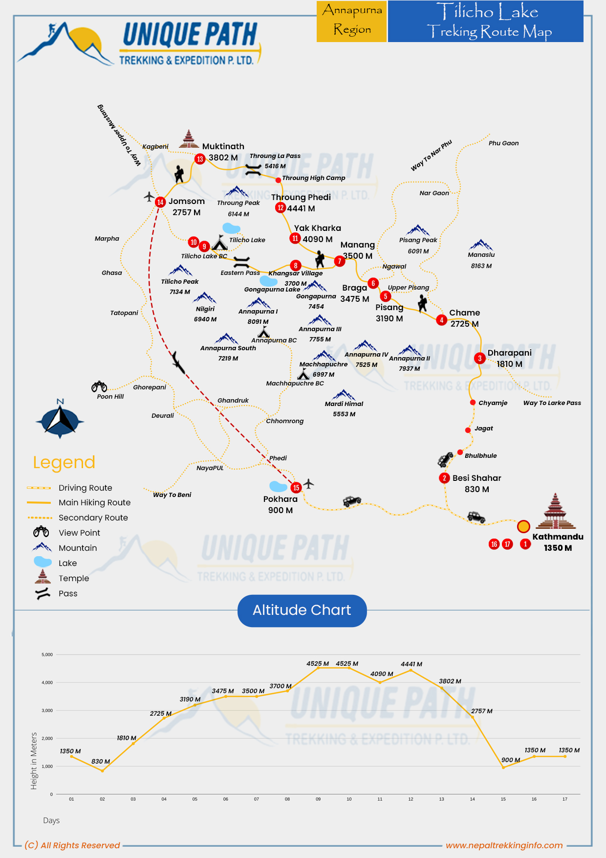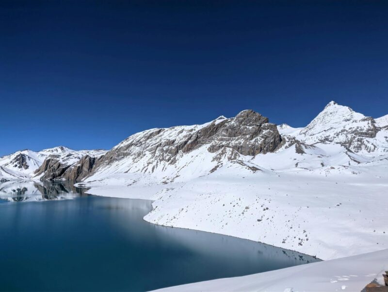
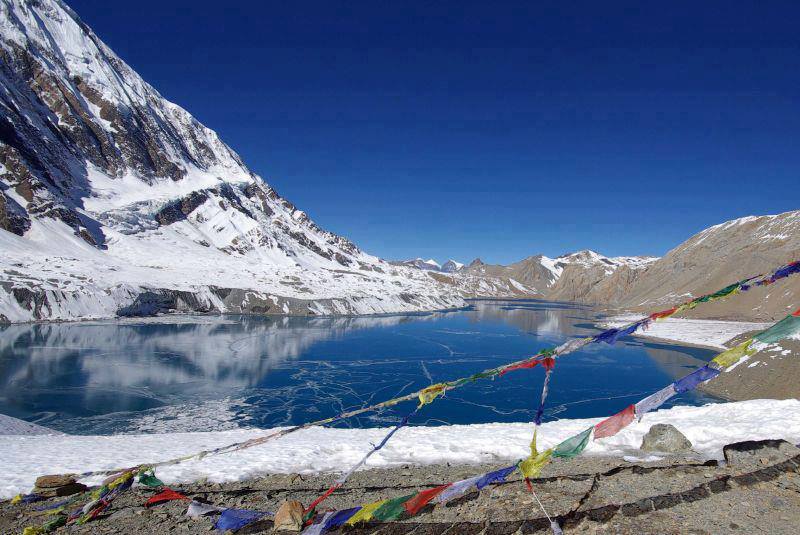
This magnificent Tilicho lake trekking leads you to the fine village inhabited by a wide diversity of people from different ethnic groups, offering spectacular and majestic views of the white Himalayas. You will discover the ever-changing landscapes of this lovely land, as you trek through the Annapurna region-an area of Nepal. Green subtropical forests filled with life are sights that you will come across, then beautiful terraced farms around which locals grow their crops, and finally, high mountain deserts with rocky terrain reminiscent of the moon around glaciers. It is at an astounding height of 4,919 meters (16,138 feet) above sea level and so is one of the highest lakes on Earth.
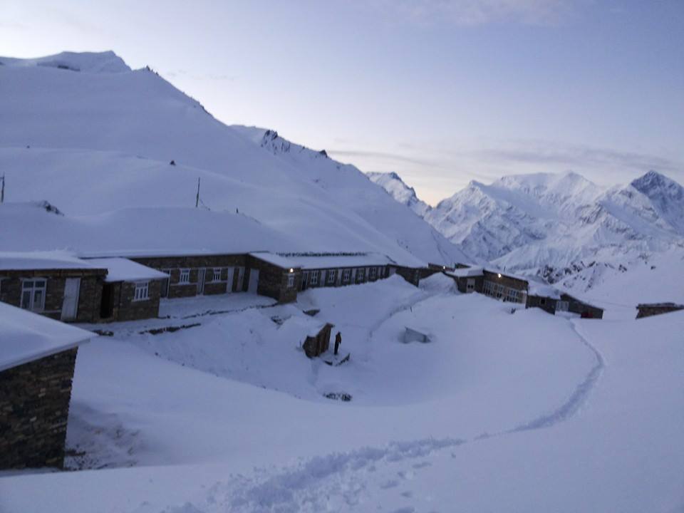
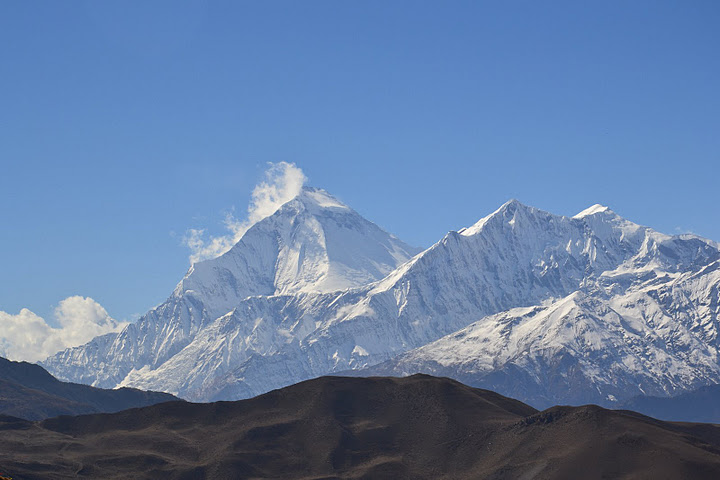
It is really among the alpine meadows and passes of the famous Annapurna Circuit trail with the eight highest towering mountains in the sky- Mount Annapurna II (7,937 m), Mount Gangapurna (7,455 m), Mount Manaslu (8,163 m), and Mount Dhaulagiri (8,167 m) and many other mountains. The last villages include Manang, which is filled with the rich culture of Tibet as you find the prayer flags wavering in the wind, great Buddhist stupas and sweet smiles from local folks. The last trek to Tilicho Lake is fairly hard; but when at length, you find yourself gazing at the blue-green waters of the lake, encircled by snowy peaks, it becomes apparent that all your toil was worth it.