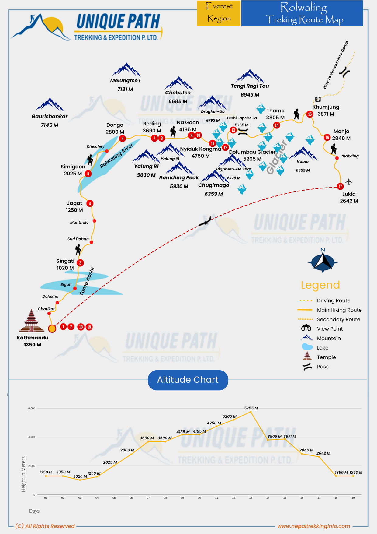
The trail leads to the Sherpa village of Beding, the largest settlement in the valley, and continues toward the stunning Tsho Rolpa Lake (4,580m) one of Nepal’s largest glacial lakes. For experienced trekkers, the route can be extended across the high-altitude Tashi Lapcha Pass (5,755m) into the Everest region, with an option to climb Pachermo Peak (6,273m) with proper permits and guidance.
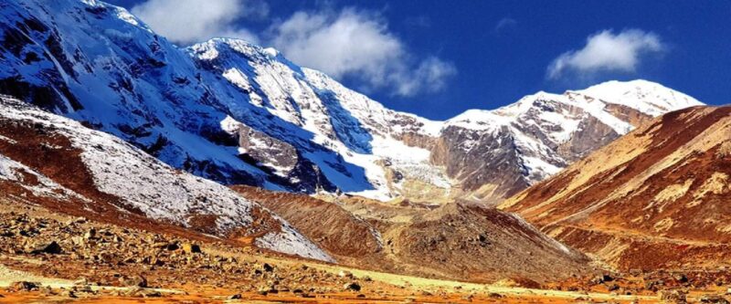
Rolwaling Valley is home to over 50 peaks, including Gauri Shankar (7,134m), Melungtse (7,181m), and Melungtse II (7,023m). The name “Rolwaling” means “valley carved by a plow,” reflected in its dramatic cliffs and rugged terrain. Due to limited infrastructure, trekkers may need to camp along the way, especially in remote sections.
This trek offers a raw Himalayan experience through dense forests, alpine pastures, and pristine valleys perfect for adventure seekers looking to explore Nepal’s hidden gems.
This trek is one of Nepal’s finest high mountain valleys West of the Khumbu, directly on the Tibetan frontier there is a wild, lonely high valley the “Rolwaling” which is called simply “the grave” by the indigenous Sherpa on account of its location buried down between steep ice giants.
Many mysterious stories have been passed on about this valley. Through which the forefathers of the present-day Sherpa once came.
Our 14-day Rolwaling trek begins with a scenic drive along the 106 km friendship highway towards the east of Kathmandu, through beautiful scenery towards the border town. And another 50km, at Khadichaur, we leave the main highway to travel eastwards as far as the bus goes at Charikot Dolakha.
It is here that the notorious and celebrated Yeti is supposed to make his home. Entire research expeditions have, so far unsuccessfully, attempted to find him.
West of the Khumbu, directly on the Tibetan frontier there is a wild, lonely high valley the “Rolwaling” which is called simply “the grave” by the indigenous Sherpa on account of its location – buried down between steep ice giants.
Many mysterious stories are about this valley through which the forefathers of the present-day Sherpa once came. It is here that the notorious and celebrated Yeti is supposed to make his home.
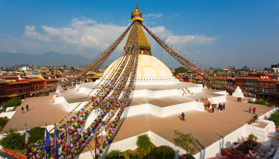
Plan your Rolwaling Trek for 2025–2026 and discover one of Nepal’s most secluded and rewarding trekking routes.
What happens on this trek
Entire research expeditions have, so far unsuccessfully, attempted to find him. Very few tourists succeed to do trekking in this area, because it covers the mountain terrain of the Nepal-China (Tibet) border, the trail of Rolwaling Trek to this pass goes between huge mountains along with glaciers, situated in the eastern parts.
The forests in this area are full of different types of pine, bamboo, fir, and wildflowers. Animals such as black bears, wolves, jarals, and Hemitragus roam the forest. Upstream of the Rolwaling Valley, the climate changes to the Arctic. From the Rollwarin Valley, 4,444 peaks such as Gaurishankar (7,181m), Dorge Lakpa (6,988m), and Rumdung (5,925m), Kangtari (6,000m), and Pacharmo (6,273m) rise toward the sky.
Similarly, Tibetan Boundary is very close to the Rolwaling Valley. Nepal and Tibetan northern parts include culture, climate, religion, and lifestyle.
What to expect from the Rolwaling Valley Trek?
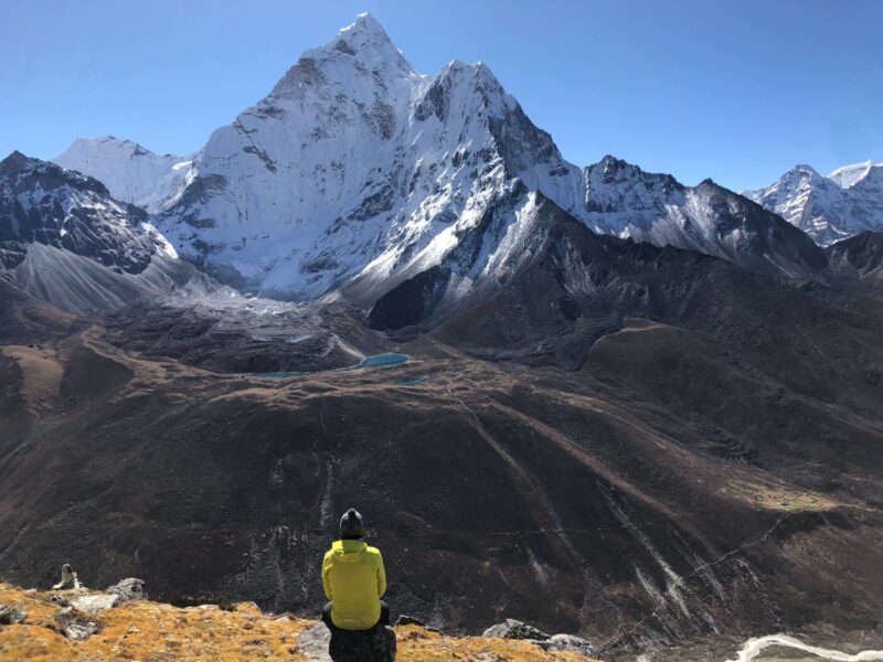
On the Rolwaling Valley Trek, you will get an outstanding view of Mount Gauri Sankar. Which will make your visit even more enjoyable. Similarly, you will get an outstanding view of the Khumbu Himalayan and you will know all about the local culture of the place.
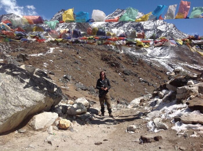
Likewise, you will be traveling through the unmarked route and then pass the Trakarding Glacier before climbing onto the Drolambau Glacier. Also, the highest point on the trek is the Teshi Lapcha La (5755m) on the slopes of Patchamo.
It is one of Nepal’s highest trekking passes and rises in a glaciated wilderness set amongst snowy peaks. I
ncluding Tengi Ragi Tau (6943m), Bisphero Go Shar (6729m), and Dragkar (6793m). Furthermore, the descent to the campsite is steep and some 300m below the pass.
From here, it descends easily to the Solu Khumbu to meet the ancient caravan route from Tibet that leads to the lowlands via Namche Bazaar and the trek ends at Lukla and a flight back to Kathmandu.