Everest Trek: A Complete Guide to Highlights, FAQs, and What to Expect
Beyond the Summit: The Real Highlights of Everest Trekking
The Moment Everything Changes
Somewhere above 4,000 meters, the landscape begins to shift. The dense pine forests thin out, the air turns crisp and sharp, and the trail transforms from a pleasant hike into something far more demanding. The chatter that carried you through the lower elevations fades away, replaced by the steady crunch of boots on rocky paths and the sound of your own breathing. This is the threshold. This is where the real journey begins.
Most travelers imagine the Everest Base Camp trek as a single-minded pursuit: reach that famous boulder at 5,364 meters, snap the photo, and declare victory. But the true treasures of this trail aren't waiting at the finish line. They're woven into every step along the way—in the villages you pass through, the faces you meet, the quiet moments of reflection that catch you when you least expect them.
Where It All Begins: Kathmandu's Unforgettable Chaos
Your adventure doesn't start in the mountains—it starts in the vibrant, chaotic streets of Kathmandu. The city hits you with everything at once: the persistent honk of scooters, the rich smell of spices drifting from street-side stalls, and the ancient temples of Durbar Square standing defiantly amid the hustle of modern life. It's overwhelming in the best possible way, the perfect place to shed your everyday self before stepping into the wild.
Then comes the flight that separates the dreamers from the doers. The 30-minute hop to Lukla's infamous runway—perched precariously on a hillside at 2,860 meters—is an adventure in itself. As the plane descends toward that short, sloping strip of asphalt, you'll understand why this approach makes even seasoned travelers grip their armrests. Consider it your first test of courage. The real one begins the moment you step off the plane.
Namche Bazaar: The Beating Heart of Sherpa Country
Two days of hiking through fragrant rhododendron forests and across suspension bridges draped in colorful prayer flags bring you to a moment you won't forget. You round a bend, and there it is: Namche Bazaar, a stunning horseshoe-shaped village clinging to the mountainside at 3,440 meters. This is the cultural and commercial hub of the Khumbu region, a place without roads where everything—from building supplies to bottled water—arrives on human backs.
But here's the delightful surprise: Namche is also home to some of the best bakeries you'll ever find. The Everest Bakery has become legendary among trekkers, serving up cinnamon rolls and apple pies that taste like five-star dining after days of simple dal bhat. You'll find yourself lingering over coffee, swapping stories with travelers from across the globe. The Sherpa Museum offers a sobering contrast to this cozy scene, revealing the extraordinary—and often heartbreaking—role local people have played in Everest's history.
Tengboche: Where the Sky Touches the Spirit
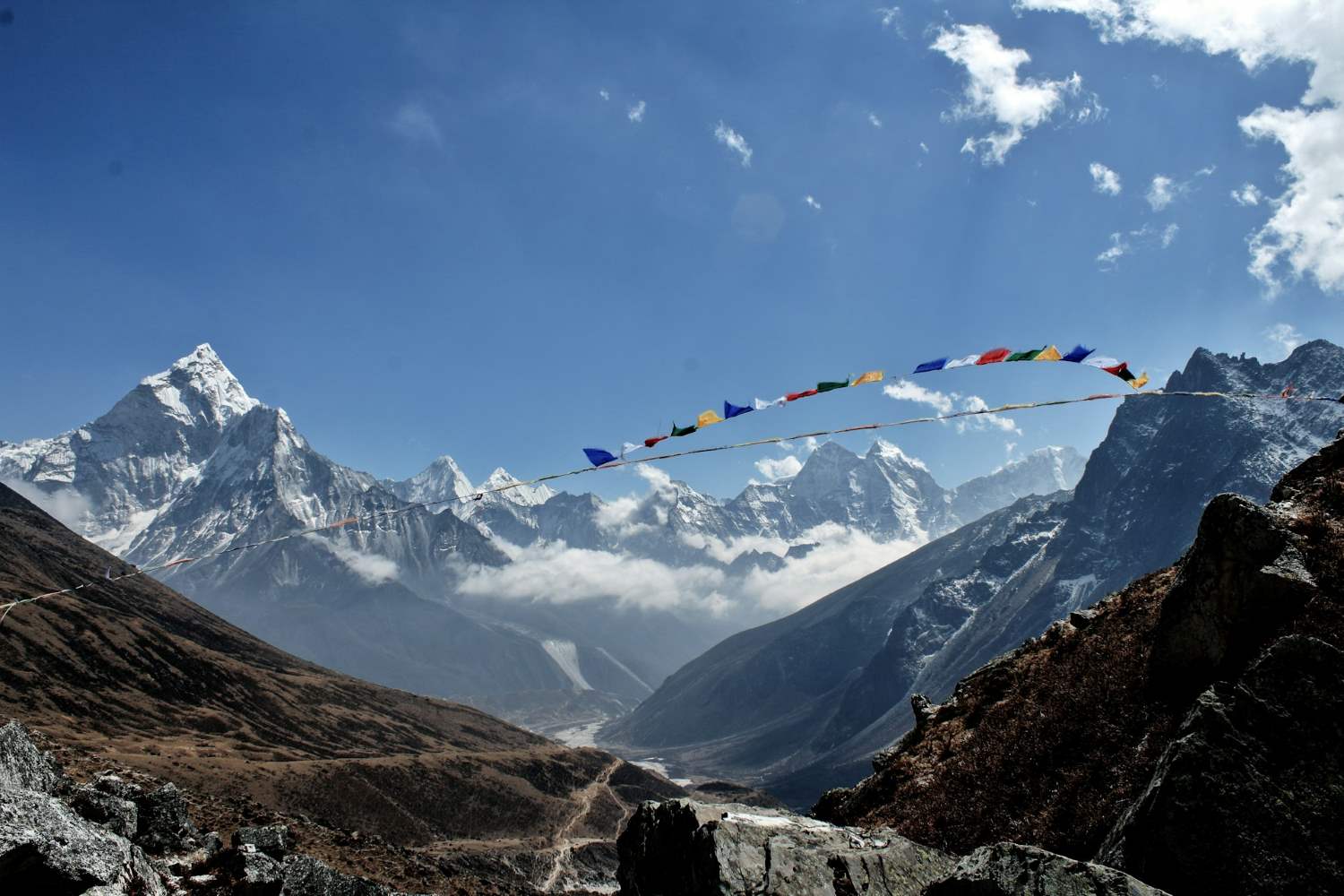
As you climb higher, the landscape grows more dramatic, the peaks more imposing. Then you reach Tengboche, home to the largest and most significant Buddhist monastery in the entire Khumbu region. It's perched against the staggering backdrop of Ama Dablam, one of the world's most beautiful mountains, its golden roof and fluttering prayer flags creating a scene of almost spiritual perfection.
Step through the monastery's doors and you'll find yourself in a different world. Intricate altars glow with butter lamps, the air is thick with incense, and the deep, rhythmic chanting of red-robed monks fills the space. This is the soul of the region, a place where trekkers often pause not just to rest, but to reflect. And the view? From here, you can see Everest, Lhotse, and Nuptse in all their glory—a 360-degree panorama that feels like a gift from the mountains themselves.
The Khumbu Glacier: A Frozen World
Above the treeline, everything changes. The last of the vegetation disappears, replaced by vast expanses of scree and rock. And then you see it: the Khumbu Glacier, a 17-kilometer river of ice that stretches across the valley like a frozen serpent. It moves so slowly you'd never notice with the naked eye, yet it's retreating so steadily that scientists watch it with growing concern.
The glacier's surface is a surreal landscape of blue ice pinnacles and deep crevasses that glow with an almost supernatural light in the afternoon sun. This is where the scale of the endeavor becomes real. The constant rumble of distant rockfalls serves as a stark reminder of the risks faced by those who push for the summit—and the unforgiving nature of this place.
The Hard Truth No One Tells You
Let's be honest with each other. This trek is not a luxury vacation. It's a trial. There will be nights when frost forms on the inside of your teahouse window and the pipes are frozen solid. Days when your head pounds from the altitude and every step feels like walking through wet concrete. Moments when you'll find yourself questioning every decision that led you here—and wondering if you have what it takes to continue.
Some trekkers describe reaching Base Camp as a deeply anticlimactic experience—a "momentary high" that fades quickly when you realize you still have to walk back down the entire route. Others admit to crying on satellite phone calls home. A few confess that if they'd known how brutal it would be, they might never have boarded that plane to Kathmandu.
But here's the thing: those moments of doubt are part of the experience. They're where growth happens. They're what makes the good moments so unforgettable.
Kala Patthar: The View That Makes It All Worthwhile
Here's a secret that no guidebook quite captures: you can't actually see Everest from Base Camp. The world's highest mountain remains hidden behind the bulky mass of Nuptse, teasing you with its absence. For the view you came for, you need to climb higher—specifically, to the summit of Kala Patthar at 5,545 meters.
The ascent begins in the pitch-black hours before dawn. Headlamps bob in the darkness as a line of trekkers picks their way up the rocky slope. The cold is relentless, biting through every layer you're wearing. It's punishing. But then, as the first rays of sunlight hit the highest peak on Earth, something magical happens. Everest turns brilliant gold against a sky of impossible blue, and you're standing above the clouds, surrounded by giants. In that moment, every step of the journey makes perfect sense.
What You'll Actually Carry Home
But for all the mountain's majesty, the memories you'll carry home aren't really about the mountain at all. You'll remember the Sherpa porter jogging past you in worn-out flip-flops with two doors strapped to his back, making your heavy backpack seem laughable. You'll remember the camaraderie of fellow trekkers who reassure you that your splitting headache doesn't mean you're dying—you're just dehydrated, and here, drink this water. You'll remember the warmth of a teahouse stove where strangers became friends over cups of salty butter tea, exchanging stories and sharing laughter. And most of all, you'll remember the kindness of people who live at the roof of the world, who welcomed you into their homes and their lives as if you were family.
That's the real highlight of Everest trekking. Not reaching the foot of the world's highest mountain. But discovering just how far you can push yourself—and how much kindness exists in the most unlikely of places.
Frequently Asked Questions About Everest Trekking
1. How long does the trek take?
The standard Everest Base Camp trek takes 12 to 14 days round-trip from Lukla, including acclimatization days. Most itineraries follow this breakdown:
-
Lukla to Namche Bazaar: 2 days
-
Acclimatization day in Namche: 1 day
-
Namche to Tengboche: 1 day
-
Tengboche to Dingboche: 1 day
-
Acclimatization day in Dingboche: 1 day
-
Dingboche to Lobuche: 1 day
-
Lobuche to Gorak Shep (Base Camp day): 1 day
-
Kala Patthar ascent and return to Pheriche: 1 day
-
Return trek to Lukla: 3-4 days
Some trekkers opt for a quicker 10-day itinerary, but this increases the risk of altitude sickness. Take your time—the mountains aren't going anywhere.
2. What's the best time of year to go?
The two main trekking seasons are:
-
Pre-monsoon (March to May): Clear skies, warmer temperatures, and spectacular rhododendron blooms. This is the most popular time, but trails can be crowded.
-
Post-monsoon (September to November): Crystal-clear views, stable weather, and comfortable daytime temperatures. Many trekkers consider this the absolute best time.
Avoid the monsoon season (June to August)—trails become muddy, leeches appear, and clouds often obscure the mountain views. Winter (December to February) is possible but brutally cold, with temperatures dropping to -20°C at higher elevations.
3. How fit do I need to be?
You don't need to be an elite athlete, but you do need to be in good physical condition. The trek involves:
-
5-7 hours of walking per day
-
Elevation gains of 300-600 meters on walking days
-
Steep ascents and descents with uneven terrain
-
Walking at high altitude, where oxygen is scarce
Recommended training: Start at least 2-3 months before your trek. Focus on:
-
Cardiovascular fitness: Running, cycling, swimming—anything that gets your heart rate up for extended periods.
-
Leg strength: Squats, lunges, and step-ups to prepare for endless uphill sections.
-
Hiking practice: Carry a weighted backpack on hilly trails to simulate trekking conditions.
-
Stair climbing: If you live in a flat area, find stadium steps or use a stair machine.
4. Do I need a guide and porter?
You are required by Nepali law to hire a licensed guide for the Everest Base Camp trek (as of 2023). This regulation was introduced for safety and to support local employment.
Options include:
-
Full-service guided trek: Includes guide, porter, all meals, accommodation, and logistics. Most expensive but most convenient.
-
Guide only: The guide handles navigation, permits, and cultural interpretation. You carry your own backpack.
-
Guide + porter: The porter carries your heavy gear (usually up to 15-20 kg), leaving you to walk with a daypack.
Going fully independent is no longer permitted on this route. Even before the regulation, most trekkers recommended hiring a guide—they know the terrain, the teahouses, and the early signs of altitude sickness better than any guidebook.
5. What's the deal with altitude sickness?
Acute Mountain Sickness (AMS) is the single biggest risk on this trek. Symptoms include headache, nausea, dizziness, fatigue, and loss of appetite. Severe cases can lead to High Altitude Pulmonary Edema (HAPE) or High Altitude Cerebral Edema (HACE)—both life-threatening.
The golden rules:
-
Climb high, sleep low: Ascend to a higher elevation during the day, but descend to sleep at a lower altitude.
-
Don't gain more than 300-500 meters of sleeping altitude per day above 3,000 meters.
-
Take acclimatization days: These are built into every responsible itinerary—don't skip them.
-
Stay hydrated: Drink 3-4 liters of water daily. Avoid alcohol and tobacco.
-
Know when to turn back: If symptoms worsen, descend immediately. There's no shame in retreating—the mountain will still be there.
Diamox (acetazolamide) is a prescription medication that can help prevent and treat AMS. Consult your doctor before the trip. However, it's not a substitute for proper acclimatization.
6. What should I pack?
Pack light but smart. Your porter (if you hire one) can carry up to 15-20 kg, but you'll carry a daypack with essentials.
Essential clothing:
-
Layering system: Base layers (merino wool), insulating mid-layers (fleece), and a waterproof/windproof outer shell.
-
Down jacket: Essential for evenings and the Kala Patthar ascent.
-
Trekking pants (quick-dry) and warm thermal leggings.
-
Waterproof hiking boots (broken in before the trip).
-
Warm hat, gloves, and buff/neck gaiter.
-
Sunglasses with UV protection (snow blindness is real).
Essential gear:
-
Sleeping bag rated to -10°C to -15°C (teahouses provide blankets but not enough for higher elevations).
-
Headlamp with extra batteries (for early morning starts and dark teahouse dining rooms).
-
Water purification (tablets, filter, or SteriPen—avoid buying plastic bottles).
-
First aid kit including blister treatment, painkillers, and any personal medications.
-
Power bank (charging opportunities are limited and costly at higher altitudes).
-
Trekking poles (reduce knee strain on descents).
7. How much does the trek cost?
Costs vary widely based on your choices:
| Expense | Budget Estimate |
|---|---|
| Permits | $50-60 USD (Sagarmatha National Park + TIMS) |
| Flights (Kathmandu-Lukla) | $300-400 USD round-trip |
| Guide + Porter (per day) | $30-60 USD total |
| Teahouse accommodation (per night) | $10-30 USD |
| Meals (per day) | $30-50 USD |
| Trekking gear rental/purchase | $100-500+ USD |
| Travel insurance | $100-300+ USD |
| Emergency evacuation insurance | Mandatory—ensure it covers helicopter rescue up to 6,000 meters |
Total budget: Expect to spend $1,500-$4,000 USD for a 12-14 day trek, depending on your choices. Budget trekkers can manage on the lower end, while luxury options (private guides, nicer teahouses, helicopter returns) push costs higher.
8. What about food and water?
Food: Teahouses serve a surprising variety of meals. Common options include:
-
Dal bhat (rice, lentil soup, and vegetables)—the trekker's staple, often with free refills.
-
Noodle soups, fried rice, momos (dumplings), and pasta.
-
Western options: Pizza, pancakes, and even apple pie (the bakeries in Namche are legendary).
-
Breakfast: Porridge, eggs, toast, and Tibetan bread.
Prices increase with altitude—a simple meal that costs $5 in Lukla might be $15 at Gorak Shep.
Water: Never drink untreated water. Options include:
-
Water purification tablets (cheap and effective).
-
SteriPen or filter (good investment).
-
Boiled water (available at teahouses for a small fee).
-
Avoid bottled water—it's expensive, creates plastic waste, and isn't always reliably sourced.
9. What's the accommodation like?
Teahouses are basic but comfortable lodges that line the entire trekking route. Expect:
-
Shared rooms with twin beds (thin mattresses, pillows).
-
Communal dining areas with wood-burning stoves—this is where everyone gathers to eat, drink, and share stories.
-
Toilets: Basic squat toilets (or sometimes western-style) located outside. Toilet paper is rarely provided—bring your own.
-
Hot showers: Available for a fee ($3-6) at lower elevations. At higher altitudes, showers are often cold or unavailable. Baby wipes become your best friend.
-
Electricity: Available for charging (fee applies, and power is limited).
-
Wi-Fi: Available at most teahouses (for a fee), but don't rely on it—consider this a digital detox.
10. Is it safe for solo travelers?
Yes, the Everest Base Camp trek is generally safe for solo travelers, especially now that guides are mandatory. You'll also find a strong community of trekkers on the trail—solitude is rare, and you'll quickly make friends along the way.
Solo traveler tips:
-
Book a guide (now required anyway)—they'll handle logistics and keep you safe.
-
Join a group—many trekking agencies offer fixed-departure group treks.
-
Stay in popular teahouses—you'll meet other travelers.
-
Inform someone of your itinerary—share your plans with family or friends back home.
-
Get comprehensive travel insurance that covers helicopter evacuation—non-negotiable.
11. Do I need any special permits?
Yes, you'll need two permits:
-
Sagarmatha National Park Permit: Around $30-40 USD, available in Kathmandu or at the park entrance in Monjo.
-
TIMS Card (Trekkers' Information Management System): Around $20 USD. Due to the new guide regulation, this is typically arranged by your trekking agency.
Important: You cannot obtain these permits in Lukla—you must get them in Kathmandu before flying. Your guide or agency will handle this for you.
12. Can I do the trek if I have a medical condition?
This depends entirely on the condition. You should:
-
Consult your doctor well in advance.
-
Discuss the effects of high altitude on your specific condition (heart conditions, respiratory issues, diabetes, etc.).
-
Ensure your insurance explicitly covers your pre-existing condition and high-altitude evacuation.
Be honest with yourself: The altitude puts immense stress on the body. If there's any doubt about your ability to handle it safely, consider an alternative trek at lower elevations (like the Annapurna Circuit or Poon Hill).
13. What about internet and phone coverage?
You'll be surprised how connected you can be:
-
Mobile network: Ncell and NTC offer coverage in most villages up to Namche Bazaar. Coverage becomes patchy beyond Tengboche.
-
Wi-Fi: Available at most teahouses for a fee (around $2-5 per hour or $10-20 for unlimited use). Speeds are slow—enough for messaging but not for video calls or streaming.
-
Satellite phones: Available for rent in Kathmandu, but expensive.
Recommendation: Consider this an opportunity to disconnect. Tell loved ones you'll be out of touch for 10-14 days, and enjoy being fully present in the moment.
14. What's the environmental impact of the trek?
The Everest region faces significant environmental challenges:
-
Waste: Trekkers generate tons of non-biodegradable waste each year.
-
Deforestation: Firewood for teahouse heating has led to forest loss.
-
Glacier retreat: Climate change is visibly impacting the Khumbu Glacier.
How to trek responsibly:
-
Carry reusable water bottles and treat your own water—avoid single-use plastic.
-
Bring a reusable shopping bag for snacks and supplies.
-
Don't litter—pack out everything you pack in.
-
Support eco-friendly teahouses that use solar power and alternative energy.
-
Consider offsetting your carbon for the flight to Lukla.
15. What happens if I get injured or sick?
Your guide will be trained in first aid and altitude sickness recognition. For serious emergencies:
-
Helicopter evacuation: Available from most points along the trail. Your travel insurance must cover this—it costs $3,000-$10,000+ without insurance.
-
Medical facilities: There are health posts in Namche Bazaar and Pheriche (run by the Himalayan Rescue Association) with staff trained in high-altitude medicine. They can stabilize patients before evacuation.
In case of emergency: Your guide will coordinate with the nearest health post, your trekking agency, and your insurance provider to arrange evacuation.
16. Do I need to book teahouses in advance?
During peak seasons (March-May and September-November), teahouses in popular stops like Namche, Tengboche, and Dingboche can fill up quickly.
-
With a guide: They'll usually call ahead to secure rooms.
-
Solo/independent: Book at least a day in advance when possible, especially for higher elevations.
-
Alternative: Start your day's walk early to arrive before the crowds.
Even if you haven't booked, you'll almost always find somewhere to sleep—but it might not be your first choice.
17. Is it worth it?
Let's end with the question everyone asks but rarely voices aloud.
The honest answer: Yes. But not for the reasons you think.
You won't find yourself transformed into a different person just because you stood near the world's highest peak. You won't suddenly have all your life's answers. The mountain is indifferent to your personal growth.
What you will find, though, is a profound appreciation for the journey itself—for the kindness of strangers, the resilience of your own body and mind, and the sheer majesty of a world that operates on its own terms, indifferent to human schedules and ambitions.
You'll find yourself changed in small, lasting ways: more patient, more humble, more aware of your own limits and your own strength. You'll carry the memory of that golden sunrise on Everest not as a trophy, but as a quiet reminder of what's possible when you keep putting one foot in front of the other—even when every part of you wants to stop.
Read more... Read less
Everything You Need to Know Before Trekking the Annapurna Circuit
Circling Annapurna: A Field Guide to Nepal's Trek
What This Trail Actually Is
The Direction Question: Why Everyone Goes the Same Way
The Walk, Broken Into Pieces
The Warm Beginnings: Marsyangdi Valley (800m–1,400m)
The Middle Ground: Pisang and the Climb to Manang (1,400m–3,540m)
-
Gangapurna Lake — a short walk above the village, good for gentle movement
-
Ice Lake (Kicho Tal) — a demanding day hike to 4,600m, then back down to sleep at 3,540m. This "climb high, sleep low" pattern is the single most effective acclimatization tool you have
-
Milarepa's Cave — a sacred site associated with the Tibetan Buddhist poet-saint
The Thin Air: Yak Kharka to Thorong Phedi (3,540m–4,450m)
The Pass: Thorong La (5,416m)
The Other Side: Muktinath to Jomsom (3,750m–2,700m)
The Tilicho Lake Question
Where You Sleep: The Teahouse Economy
| Item | Lower Elevations | Higher Elevations |
|---|---|---|
| Room | 100–300 (often free if eating there) | 300–500 |
| Dal bhat | 400–600 | 800–1,200 |
| Hot shower | 200–300 | 300–500 |
| Device charging | 100–200 | 200–500 |
| WiFi | Often free | 100–300 |
Getting There and Back
Kathmandu to Pokhara
-
Flight: 25 minutes, $100–$150. Sit on the left side for views of Annapurna, Manaslu, Ganesh, and Langtang.
-
Tourist bus: 7–8 hours, $10–$25. Bumpy but scenic, following the Trishuli River.
-
Private jeep: 6–7 hours, $150–$200. Faster, more comfortable, shareable.
Pokhara to the Trailhead
Exit: Jomsom to Pokhara
When to Walk
| Season | Months | Conditions | Crowds | Best For |
|---|---|---|---|---|
| Winter | Dec–Feb | Cold, clear, stable. Nights to -20°C at the pass. | Very low | Solitude, photography, experienced trekkers |
| Spring | Mar–May | Warm days, occasional clouds. Rhododendrons bloom. | High | Flowers, comfortable temperatures, longer days |
| Autumn | Sep–Nov | Sunny, mild, most stable weather. Cold and windy at altitude. | Very high | Reliability, visibility, festival season (Dashain) |
| Summer | Jun–Aug | Warm. Rain at lower elevations. Drier above Manang. | Very low | Empty trails, lush greenery |
Altitude: The Physics of Thin Air
The Three Conditions
The Rules
-
Sleep no more than 500 meters higher per day above 3,000m. If the trail forces a bigger jump, add a rest day or split the stage.
-
Take rest days. At least one in Manang. Two is better.
-
Climb high, sleep low. Hike to a higher elevation during the day, then return to sleep lower.
-
Drink 3–4 liters of water daily. The air is thin and dry. Dehydration accelerates altitude problems. Clear urine is a good sign.
-
No alcohol. No sleeping pills. Both suppress breathing. Save the beer for after the pass.
-
Eat small, frequent meals. Digestion slows at altitude. Large meals can trigger nausea.
Diamox
-
Consult your doctor before the trip
-
Typical dose: 125–250mg twice daily, starting 1–2 days before high altitude
-
Side effects: increased urination, tingling in extremities, taste changes
-
It supplements proper acclimatization. It does not replace it
Emergency Resources
-
Manang Medical Clinic (3,540m): Run by the Himalayan Rescue Association. Pulse oximetry, altitude care, medications.
-
Muktinath Health Post (3,800m): Available during descent.
-
Helicopter evacuation: Possible from multiple points, weather permitting. Comprehensive travel insurance covering trekking above 5,000m and helicopter rescue is mandatory.
The rule that cannot be broken: If you have symptoms, do not go higher. Descending even 500–1,000 meters can transform a dangerous situation into a manageable one. The pass will be there tomorrow. You need to be, too.
What You Need: Permits, Insurance, and a Guide
Permits
| Permit | Cost | Purpose |
|---|---|---|
| ACAP | 3,000 NPR (~$22) | Entry into the Annapurna Conservation Area |
| TIMS Card | 2,000 NPR (~$15) | Safety tracking, search-and-rescue support |
The Guide Requirement
Insurance
-
Trekking to 5,500m (Thorong La is 5,416m)
-
Emergency helicopter evacuation
-
Medical treatment in Nepal
-
Trip cancellation or interruption
Physical Preparation
A 12-Week Framework
-
Cardio 3–4x/week: running, cycling, swimming (30–45 min)
-
Strength: squats, lunges, step-ups, planks
-
One long hike (2–3 hours) on weekends
-
Cardio 45–60 min; add intervals
-
Weighted squats, calf raises
-
Long hikes (3–5 hours) with a weighted pack (start at 5kg, build to 8kg)
-
Stair climbs: repeated ascents in a tall building or stadium
-
Back-to-back long hikes: two consecutive days of 5–6 hours with full pack
-
Elevation hiking if possible (even 2,000–3,000m helps)
-
Descent practice: downhill walking is where knees fail
-
Mental pressure: push through discomfort when tired and cold
-
Reduce intensity by 50%
-
Mobility, stretching, rest
-
Final gear checks
What to Pack
Clothing
| Layer | What | Why |
|---|---|---|
| Base | 2–3 merino or synthetic tops; 2 bottoms | Wicks sweat, regulates temperature, resists odor |
| Mid | 1 fleece or light down jacket | Insulation, breathable |
| Shell | Waterproof jacket and pants | Rain, wind, snow protection |
| Down | 1 warm down jacket (800+ fill) | Essential for cold mornings and high camps |
| Pants | 2 lightweight, quick-dry pairs | Main hiking wear |
| Shorts | 1 pair | Lower elevations |
| Underwear | 4–5 pairs (merino or synthetic) | Quick-dry; avoid cotton |
| Socks | 4–5 pairs (merino wool) | Cushioning, moisture management |
| Gloves | 1 light pair; 1 insulated waterproof pair | Layering |
| Hat | 1 sun hat; 1 warm beanie | Sun protection and warmth |
| Neck | 1–2 buffs or gaiters | Versatile protection |
Footwear
-
Trekking boots: Mid-to-high ankle, waterproof, broken in. Never trek in new boots.
-
Camp shoes: Lightweight sandals or Crocs for teahouses
-
Gaiters: For snow, mud, leeches
Gear
-
Backpack: 40–50L daypack with rain cover
-
Duffel bag: For porter-carried gear (if using a porter)
-
Sleeping bag: Rated to at least -10°C
-
Sleeping bag liner: Silk or synthetic; adds warmth and hygiene
-
Trekking poles: Essential, especially for the Thorong La descent
-
Headlamp: For the pre-dawn pass start; extra batteries
-
Sunglasses: UV400, category 3–4; glacier glasses for snow
-
Water system: 2–3 liters capacity; bladders can freeze at altitude
-
Water purification: Tablets, drops, or filter
-
Sunscreen: SPF 50+; lip balm with SPF
-
First aid: Blister plasters, painkillers, antiseptic, anti-diarrheal, Diamox (if prescribed)
-
Electronics: Camera, power bank, cables, adapter (Nepal uses C/D/M plugs, 230V)
-
Toiletries: Biodegradable soap, toothpaste, wet wipes, sanitizer, toilet paper
-
Towel: Lightweight, quick-dry
Documents
-
Passport (valid 6+ months)
-
4–6 passport photos (for permits)
-
Travel insurance (printed and digital)
-
Permits (ACAP, TIMS)
-
Cash: Nepali Rupees. ATMs are rare on the trail. Carry enough for the entire trek.
The People and the Etiquette
Who Lives Here
How to Behave
-
Walk clockwise around stupas, mani walls, and prayer wheels
-
Remove shoes before entering monasteries and homes
-
Ask permission before photographing people
-
Dress modestly — no revealing clothing in villages
-
Learn a few words: Namaste (hello/goodbye), Dhanyabad (thank you), Tashi Delek (Tibetan greeting)
Environmental Responsibility
-
Pack out all trash. There is no waste management on the trail.
-
Purify water instead of buying bottled. Plastic is a critical pollution problem.
-
Stay on marked trails to prevent erosion.
-
Respect wildlife — blue sheep, Himalayan tahrs, and diverse birds live here.
-
Use established toilet facilities.
What It Costs
Independent Trek (with Mandatory Guide)
| Item | Approximate Cost (USD) |
|---|---|
| Guide | $25–$40/day |
| Porter | $20–$25/day (optional; carries 15–20kg) |
| Permits | $40 total |
| Teahouse room | $0–$5/night |
| Food | $15–$30/day |
| Kathmandu–Pokhara flights | $100–$150 |
| Jomsom–Pokhara flight | $120–$150 |
| Gear | $200–$500 (if buying) |
| Insurance | $100–$200 |
| Miscellaneous | $100–$200 |
Organized Trek
The Roads: What Has Changed and What Has Not
Final Word
Things To Know Before Doing Everest Three Passes Trek in 2026
Beyond Base Camp: The Ultimate Guide to the Everest Three Passes Trek
For many adventurers, standing at Everest Base Camp is a bucket-list dream. But as peak trekking seasons grow more crowded, seasoned hikers are looking for something deeper, wilder, and more physically demanding. If you want to escape the highway of tourists, push your physical limits, and experience the Khumbu region from raw, unedited vantage points, there is only one definitive answer.
Welcome to the Everest Three Passes Trek.
Consistently rated as one of the most challenging and rewarding high-altitude loops in the world, this trek is a grand Himalayan circuit. Rather than retracing your steps, it loops together the classic Everest trail with the remote, pristine valleys of Bhotekoshi, Gokyo, and Imja Tse.
What is the Three Passes Trek?
Unlike the traditional "out-and-back" route to Everest Base Camp, the Three Passes Trek is a comprehensive, counter-clockwise (or clockwise) circular journey. Over the course of 16 to 19 days, you will traverse four distinct high-altitude valleys and conquer three grueling mountain passes, each towering well above 5,000 meters.
What sets this route apart is that it doesn't just bypass the main highlights—it absorbs them. This trek seamlessly integrates Everest Base Camp (5,364 m), the iconic sunrise viewpoint of Kala Patthar (5,545 m), and the breathtaking Gokyo Ri (5,360 m) into a single, epic itinerary.
The Three Giants You Will Conquer
-
1. Kongma La Pass (5,535m / 18,159 ft)
-
The Vibe: The highest, most isolated, and physically taxing of the three.
-
The Terrain: Rocky scree, steep boulders, and an unforgiving incline. Because there are absolutely no teahouses or water sources between Chhukung and Lobuche, you must carry full rations and water for an intense 8-to-10-hour push. It rewards you with an intimate, face-to-face look at Nuptse and Lhotse.
-
-
2. Cho La Pass (5,420m / 17,782 ft
-
The Vibe: The most technical and weather-dependent pass.
-
The Terrain: Connecting the Khumbu valley to the Gokyo valley, Cho La requires traversing a literal, active glacier. Depending on the season, you will navigate slippery ice, hard-packed snow, and areas prone to rockfalls. Microspikes/crampons are highly recommended here to safely negotiate the steep, icy descent into Dzongla.
-
-
3. Renjo La Pass (5,360 m / 17,585 ft)
-
The Vibe: The grand finale and the most visually stunning viewpoint in Nepal.
-
The Terrain: While the stone staircases on the western descent can be tough on the knees, the climb up from Gokyo is a steady, rhythmic grind. The reward at the top is a legendary, postcard-perfect panorama that frames the third turquoise Gokyo Lake in the foreground with Everest, Lhotse, Makalu, and Cho Oyu dominating the skyline.
-
Essential Trekking Metrics
To help you gauge if this trek fits your experience level, here is a quick overview of what to expect logistically and physically:
| Metric | Details |
| Total Distance | Approximately 166 km (103miles) for the full loop |
| Average Daily Hiking | 6 to 8 hours (extends to 9–11 hours on pass days) |
| Accommodation | Local Sherpa teahouses (basic twin-sharing rooms, communal dining) |
| Required Permits |
1. Sagarmatha National Park Permit 2. Khumbu Pasang Lhamu Rural Municipality Permit |
| Navigation | High risk of getting lost in heavy fog/snow; hiring a licensed guide is strongly advised |
The Verdict: Is it Right for You?
The Three Passes Trek is fundamentally more demanding than the standard Everest Base Camp route. The sheer amount of time spent sleeping and exerting yourself above 4,500 m puts immense stress on the body, meaning excellent cardiovascular fitness and prior high-altitude trekking experience are mandatory.
However, if you have the stamina, the rewards are unmatched. You will step away from the commercialized, crowded trails and enter a world of quiet glacial lakes, remote Sherpa communities like Thame, and pristine mountain solitudes that few travelers ever get to see.
The Ultimate 17-Day Itinerary Outline
While shorter variations exist, mountain safety experts heavily advise a steady, conservative schedule. Pushing too fast above the tree line is a recipe for Acute Mountain Sickness (AMS). A well-acclimatized, structurally sound counter-clockwise itinerary looks like this:
Phase 1: The Approach & Acclimatization
-
Day 1: Flight to Lukla (2,830 m) & Trek to Phakding (2,610 m) * The Trail: A thrilling, scenic flight into Tenzing-Hillary Airport is followed by an easy, net-downhill trek past hand-carved Mani stones and spinning prayer wheels alongside the roaring Dudh Koshi River.
-
Day 2: Trek to Namche Bazaar (3,440 m) * The Trail: Enter the Sagarmatha National Park at Monjo, cross the iconic, suspension-bridge marvel that is the Hillary Bridge, and tackle the infamous, grueling pine-forest zigzag climb up to the Sherpa capital.
-
Day 3: Strategic Acclimatization Day in Namche * The Trail: Adhere to the "climb high, sleep low" rule. Take an active recovery hike to the Everest View Hotel (3,880 m) for your first glimpse of Everest and Ama Dablam, then explore the local trading hub.
-
Day 4: Trek to Tengboche (3,867 m) * The Trail: Drop down to the riverbed before climbing steeply through lush rhododendron forests to reach Tengboche Monastery, the spiritual epicenter of the Khumbu.
-
Day 5: Trek to Dingboche (4,260 m) * The Trail: The landscape shifts dramatically from sub-alpine forests to a raw, exposed alpine shrubland. Cross the Imja Khola and pass under the looming shadow of Ama Dablam.
-
Day 6: Second Acclimatization Day in Dingboche * The Trail: A vital rest day before hitting the extreme altitudes. Take a rigorous 4-hour side trip up the ridge of Nagarjuna Hills (5,100 m) to witness a jaw-dropping view of Mt. Makalu (8,463 m) and Lhotse.
Phase 2: The Heart of the High Circuit
-
Day 7: Trek to Chhukung (4,750 m) * The Trail: A short, gradual incline into the glacier-locked Imja valley. Use this afternoon to rest, check your gear, and prep your water reserves for the next day's massive pass.
-
Day 8: Cross Kongma La Pass (5,535 m) to Lobuche (4,940 m) * The Trail: An intense 8-to-10-hour day. You will scramble up steep, shifting scree slopes to the highest pass, then cross the moving ice and shifting boulders of the Khumbu Glacier to arrive in Lobuche.
-
Day 9: Trek to Gorak Shep (5,164 m) & Everest Base Camp (5,364 m) * The Trail: Walk along the rocky moraine of the Khumbu Glacier to Gorak Shep. Drop your heavy packs, then push onward to the prayer-flag-strewn boulder marking Everest Base Camp. Return to Gorak Shep to sleep.
-
Day 10: Hike Kala Patthar (5,545 m) & Trek to Dzongla (4,830 m) * The Trail: A pre-dawn climb up Kala Patthar for the absolute best, unobstructed sunrise view over Everest's massive black pyramid. Head down, pack up, and trek to the tiny outpost of Dzongla to position for the next pass.
-
Day 11: Cross Cho La Pass (5,420 m) to Thagnak (4,700 m) * The Trail: A highly technical day requiring microspikes. You’ll ascend a steep rock face, traverse the slippery, gently sloping Cho La glacier, and negotiate a steep, loose rockfall zone on the descent to Thagnak.
-
Day 12: Trek to Gokyo Lakes (4,790 m) * The Trail: A shorter, gentler trek crossing the massive Ngozumpa Glacier—the longest glacier in the Himalayas—to reach the stunning, deep-turquoise third lake of Gokyo.
-
Day 13: Gokyo Ri Hike (5,360 m) & Rest * The Trail: Climb the steep, grassy hill of Gokyo Ri for an elite, sweeping perspective of four of the world’s fourteen 8,000-meter peaks simultaneously: Everest, Lhotse, Makalu, and Cho Oyu.
Phase 3: The Final Pass & The Descent
-
Day 14: Cross Renjo La Pass (5,360 m) to Marlung (4,210 m) or Thame * The Trail: A steady climb reveals a legendary backward look at the Gokyo lakes framed by Everest. The descent takes you down stone staircases into the pristine, wild Bhotekoshi Valley, a historic Tibetan trade route.
-
Day 15: Trek from Marlung/Thame back to Namche Bazaar (3,440 m) * The Trail: Follow the river downstream through ancient, less-visited Sherpa villages, completing your magnificent high-altitude loop as you rejoin the main trail at Namche.
-
Day 16: Trek from Namche Bazaar back to Lukla (2,830 m) * The Trail: A long, knee-pounding final day down the steep Namche hill, crossing the suspension bridges one last time to celebrate your achievement in Lukla.
-
Day 17: Fly from Lukla back to Kathmandu * The Trail: A morning mountain flight back to the capital, leaving you with an afternoon to unwind and recover.
How Difficult is It? (3 Passes vs. Standard EBC)
To put it plainly: the Three Passes Trek is an entirely different beast than the standard Everest Base Camp trek. ```
Standard EBC Trek: [Lukla] ═══(Main Trail)═══> [Base Camp] ═══(Retrace Steps)═══> [Lukla]
Three Passes Trek: [Lukla] ───(Kongma La)───> [Base Camp] ───(Cho La)───> [Gokyo] ───(Renjo La)───> [Lukla]
1. Distance & Duration
The standard EBC trek covers roughly 130 km (80 miles) over a linear, well-trodden, out-and-back trail. The Three Passes Trek expands that into a massive 166 km (103 miles) loop. Expect to be actively hiking for 16 to 19 days instead of the typical 12 to 14 days required for the classic base camp route.
2. Terrain Complexity
While the standard EBC route stays on a wide, clearly defined mountain trail, the Three Passes Trek drops you right into raw backcountry. You will navigate loose, slippery scree slopes, rockfall-prone channels, and uneven moraines where the route shifts constantly over moving glacial ice and boulder fields.
3. Sustained Altitude & Atmosphere
On a standard EBC trek, you cross the 5,000-meter mark only twice (at Everest Base Camp and Kala Patthar). On the Three Passes Trek, you cross it six separate times (all three passes plus Base Camp, Kala Patthar, and Gokyo Ri).
At 5,500 meters, the atmospheric pressure drops significantly, meaning each breath gives you roughly 50% less oxygen than at sea level. This extreme environment drastically amplifies physical exertion, slows down muscle recovery, and exposes you to freezing temperatures, harsh alpine winds, and sudden whiteout blizzards. Prior multi-day high-altitude trekking experience is highly recommended.
Highlights of the Trail
Authentic Sherpa Culture
While parts of the main EBC trail can feel highly commercialized, this loop takes you directly into the quiet, everyday life of the Khumbu. You’ll stay in traditional, family-run eco-teahouses, visit historic monasteries like Tengboche and Thame, and cross paths with local yak caravans that serve as the lifeline for these remote high-altitude communities.
Unrivaled Himalayan Vantage Points
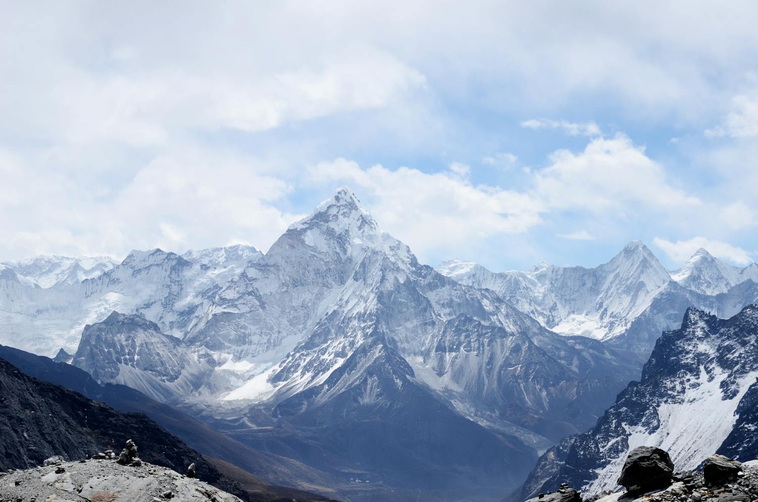
Standard trekkers typically only get a glimpse of Everest from Kala Patthar. This circuit, however, grants you 360-degree views from three entirely distinct angles. Standing atop the passes feels like sitting in an arena of giants, offering unparalleled close-ups of Everest, Lhotse, Nuptse, Ama Dablam, Cholatse, and Makalu.
Deep Wilderness Solitude
Because of its demanding reputation, the Three Passes loop sees only a small fraction of the tourist traffic that jams the main trail. You’ll experience long, quiet hours of pristine mountain wilderness all to yourself—just you, the crisp alpine air, and the massive scale of the Himalayas.
When to Go?
Timing your trek perfectly is essential for ensuring the high-altitude passes are safely clear of snow and passable without mountaineering gear.
-
Spring (March to May): A spectacular time to visit. The lower valleys are filled with blooming red and pink rhododendrons, and the weather is generally stable. The trails are alive with energy as global mountaineers set up camp at EBC for their summit bids.
-
Autumn (September to November): The absolute prime window for clear photography. Dry trails, minimal dust, and crisp, post-monsoon skies offer unparalleled visibility of the big peaks.
Seasonal Warning:
Winter (December to February) brings extreme sub-zero cold and heavy snow that frequently blocks the passes, making crossings dangerous or impossible without advanced mountaineering skills and equipment.
Summer Monsoon (June to August) brings heavy rain, slick mud, high landslide risks, and thick cloud cover that completely obscures mountain views and disrupts flights into Lukla.
Final Thoughts
The Everest Three Passes Trek is the ultimate mountain journey for adventurers who want to see the Everest region in its entirety. It tests your stamina, takes you far off the beaten path, and treats you to some of the most spectacular landscapes on Earth. If you have the physical fitness, the time, and the spirit for a true mountain challenge, this legendary loop is calling.
Read more... Read less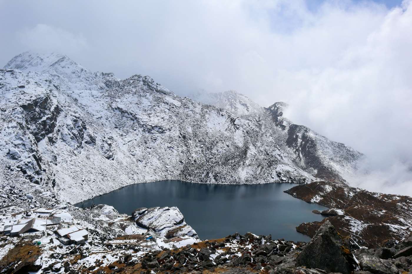
Langtang Gosaikunda Trek 2026
The Ultimate Guide to the Langtang Gosaikunda Trek: Mountains, Monasteries, and Sacred Lakes
If you are searching for a Himalayan adventure that seamlessly weaves together dramatic mountain landscapes, vibrant indigenous culture, and profound spiritual heritage—all while bypassing the dense crowds of the Everest or Annapurna circuits—the Langtang Gosaikunda Trek stands out as Nepal's premier choice.
Perfectly situated just north of Kathmandu in the rugged Rasuwa district, this trail charts a course through the country's historic first Himalayan national park. It takes trekkers from deep, glacial valley floor views up to high-altitude mountain passes, culminating at a striking cluster of alpine lakes revered for centuries.
Why Choose the Langtang Gosaikunda Trek?
1. A Masterful Conjoining of Two Diverse Landscapes
The brilliance of this route lies in how effortlessly it bridges two entirely different ecological and spiritual worlds. The first half of the journey immerses you in the classic glacial topography of the Langtang Valley, leading to the high-mountain pastures of Kyanjin Gompa. The second half shifts dramatically into the stark, subalpine lake-strewn plateaus and exposed ridges of the sacred Gosaikunda region.
2. Living History: The Tamang Heritage
The trails serve as a living museum for the ancestral traditions of the Tamang community. As an indigenous group with Tibetan-influenced roots, their distinct craftsmanship, language, and traditional attire define the region. Your daily trek is framed by cultural touchstones:
-
Mani Walls & Chortens: Hand-carved stone tablets inscribed with Buddhist mantras (Om Mani Padme Hum) line the trails.
-
Prayer Wheels: Copper cylinders spun by trekkers and locals alike to release blessings into the mountain wind.
-
Architecture: The classic, wood-accented alpine teahouses offer a firsthand look at native mountain masonry and hospitality.
3. A Fragile, Biodiverse Sanctuary
Spanning 1,710 square kilometers since its establishment in 1976, Langtang National Park protects a multi-tiered ecosystem that shifts rapidly with altitude:
-
The Flora: The trail begins in humid subtropical forests dominated by Sal and Chir Pine, quickly climbing into temperate bands of oak, maple, and laurel. Above 3,000 meters, these give way to subalpine stands of Silver Fir and massive rhododendron orchards that paint entire hillsides in crimson, pink, and white during the spring.
-
The Fauna: This park remains a globally critical habitat for over 46 mammal species, most notably the highly endangered, arboreal Red Panda. Trekkers sharing the valley with locals may also cross paths with Himalayan black bears, musk deer, gray langurs, and the elusive snow leopard roaming the high crags.
-
Avian & Winged Life: For bird enthusiasts, the park is a paradise hosting 250+ bird species. The canopy frequently reveals the iridescent plumage of the Danphe (Himalayan Monal—Nepal’s national bird), blood pheasants, and majestic Himalayan griffons catching thermal updrafts. Over 70 species of high-altitude butterflies add vibrant movement to the alpine meadows.
4. Front-Row Seats to Giant Peaks
Unlike treks where big mountains remain distant backdrops, the Langtang circuit puts you in immediate, humbling proximity to the ice-carved topography of the Central Himalayas:
-
Langtang Lirung (7,234m): The undiscovered monarch of the valley, dominating the northern skyline with massive icefalls.
-
Dorje Lakpa (6,966m): An elegant, razor-sharp pyramid peak that serves as a visual anchor for the region.
-
Ganesh Himal & Yala Peak: Accessible, jagged massifs that frame the high-altitude horizon.
-
Naya Kanga: A challenging trekking peak that guards the pass into Helambu, overlooking the northern borders of Tibet's vast Qomolangma National Nature Preserve.
Key Trekking Metrics at a Glance
Before setting foot on the trail, understanding the foundational logistics ensures a well-planned expedition. Here is the core operational data for the journey:
| Metric | Core Specifications & Data |
| Total Duration | 9 to 14 days (A 12–13 day itinerary is highly advised to ensure safe, gradual altitude adjustment) |
| Trail Difficulty | Moderately Strenuous (Demands robust physical stamina, though it requires no technical mountaineering skills or climbing gear) |
| Maximum Altitude | 4,610 meters at the crest of the Lauribina La Pass, reaching up to ~4,984 meters if scaling the Tsergo Ri viewpoint |
| Trailhead Location | Syabrubesi (1,503m) — Accessed via a rugged 7-to-8-hour overland journey (122 km) heading north from Kathmandu |
| Lodging Style | Traditional, locally operated alpine Teahouses (offering basic twin-sharing rooms, communal dining, and local meals) |
| Mandatory Entry Permits | Langtang National Park Entry Permit coupled with an authorized TIMS (Trekkers Information Management System) Card |
The Sacred Significance & Lore of Gosaikunda Lake
Perched high in the alpine zone at 4,380 meters, Gosaikunda is far more than a stunning geographical landmark. It anchors an intricate, fragile alpine wetland system composed of 108 interconnected glacial lakes—including neighboring Bhairavkunda and Saraswatikunda—collectively recognized as a protected global Ramsar Site. For centuries, this high-altitude basin has held immense spiritual and historical weight.
1. The Hindu Legend of Nilkantha Shiva
According to ancient Vedic mythology, the creation of Gosaikunda is tied directly to the Samudra Manthan (the churning of the cosmic ocean). During this cosmic event, a lethal, dark poison (Halahala) emerged, threatening to consume all of creation. To protect the universe, Lord Shiva drank the venom. The poison held such intense potency that it locked in his throat, turning it a deep blue and earning him the moniker Nilkantha.
In agonizing pain from the burning venom, Shiva sought the cold sanctuary of the Himalayas. He struck his divine trident (Trishul) deep into the mountain ridge. Holy water immediately burst forth from the rock, cooling his torment and collecting into the basin that is known today as Gosaikunda.
2. The Janai Purnima Pilgrimage & Shamanic Rituals
Every August, during the auspicious full moon festival of Janai Purnima, the quiet alpine trails transform. Thousands of devout Hindu pilgrims from across Nepal and India undertake a grueling journey to the lake.
They plunge into the near-freezing holy waters, a ritual believed to wash away lifetimes of sins. A central highlight of this event is the presence of traditional faith healers and shamans (Jhankris), who trek to the lake in elaborate costumes, beating traditional drums and chanting ancient incantations to renew their spiritual powers.
3. Tibetan Buddhism & The Holy Kora
For the indigenous Tamang people and Tibetan Buddhists, the lake holds equal spiritual gravity. They believe the sacred waters are spiritually tied to Guru Rinpoche (Padmasambhava), the legendary master who brought Buddhism to Tibet. Buddhist pilgrims journey here to pray for the souls of the deceased and perform a Kora—a meditative, clockwise circuit walk around the massive perimeter of the lake.
4. Historical Legacy: The Retreat of a Warrior
Gosaikunda also claims a unique place in the geopolitical history of Nepal. Bada Kaji Amar Singh Thapa, one of Nepal’s greatest military commanders who led forces on the western front during the Anglo-Nepalese War (1814–1816), sought absolute peace late in life. Refusing to live under British-influenced political shifts, the legendary general retired to these isolated, sacred mountains, spending his final days meditating in a cave near the shores of Gosaikunda.
Best Time to Plan Your Journey
Timing your trek dictates your visibility, temperature comfort, and overall safety on the high passes. The trekking year is defined by three distinct alpine seasons:
Autumn (September to November) • The Peak Window: This post-monsoon period offers the most reliable weather of the year. The heavy summer rains wash the atmosphere completely clean
, resulting in crisp air, comfortable daytime hiking temperatures, and unparalleled, blue-sky visibility of the high ridges and peaks.
Spring (March to May) • The Blooming Wilderness: As temperatures rise, the lower and middle elevations come alive. This is the ultimate season for nature lovers, as the vast subalpine forests burst into a sea of red, pink, and white rhododendron blooms. Days are longer and wildlife activity peaks, though afternoon clouds are more common than in autumn.
Winter (December to February) • The Icy Challenge: For trekkers seeking complete solitude, winter offers empty trails and a starkly beautiful, snow-covered landscape. The surface of Gosaikunda freezes completely into solid ice. However, daytime temperatures drop significantly and nights are bitterly cold (often plunging below -15°C at high altitudes), requiring heavyweight cold-weather gear and traction devices like microspikes for safe pass crossings.
Route Overview & A Comprehensive Day-by-Day Itinerary
While the trek can be condensed into a grueling 9 days or stretched out to 14 days, a 12-to-13-day itinerary strikes the perfect balance. It builds in necessary physiological safety margins for altitude acclimatization while ensuring you don't rush through the striking cultural milestones.
Phase 1: Deep into the Langtang Valley
-
Day 1: Kathmandu to Syabrubesi (1,503m) * Distance/Time: ~122 km, 7–8 hours overland drive via public bus or private 4WD.
-
Terrain & Highlights: The drive skirts along the edge of deep river gorges, passing through the bustling trading town of Trishuli Bazaar before climbing sharply via hairpin bends into the Rasuwa district.
-
-
Day 2: Syabrubesi to Lama Hotel (2,470m) * Distance/Time: ~11 km, 5–6 hours trek; Altitude Gain: +967m.
-
Terrain & Highlights: Crossing the suspension bridge over the Bhote Koshi River, you immediately enter a dense wilderness of oak, maple, and bamboo. The trail follows the roaring Langtang Khola upstream, utilizing steep stone steps. Keep an eye out for wild honeybee hives hanging from sheer cliff faces.
-
-
Day 3: Lama Hotel to Langtang Village (3,430m) * Distance/Time: ~14 km, 5–6 hours trek; Altitude Gain: +960m.
-
Terrain & Highlights: You pass through Ghora Tabela (2,970m), a former Tibetan resettlement project where the valley suddenly cracks open. The dense jungle transitions into alpine meadows dotted with prayer flags. You will cross the sobering memorial site of old Langtang Village, which was entirely buried by a massive co-seismic ice-and-rock avalanche during the 2015 earthquake, before arriving at the rebuilt settlement nearby.
-
Phase 2: Spiritual Hubs & Glacial Peaks
-
Day 4: Langtang Village to Kyanjin Gompa (3,830m) * Distance/Time: ~6 km, 3–4 hours trek; Altitude Gain: +400m.
-
Terrain & Highlights: A shorter, gentle climb past massive mani walls (always pass them on the left/clockwise) and wooden bridges over glacial streams. Kyanjin Gompa sits in a spectacular natural amphitheater flanked by icefalls. Take the afternoon to sample fresh yak cheese at the government-established factory or visit the ancient monastery itself.
-
-
Day 5: Acclimatization & Peak Exploration Day * Distance/Time: Variable, 5–7 hours round trip.
-
Options: * Kyanjin Ri (4,773m): A steep, non-technical ridge walk directly behind the village offering views of the Langtang icefall.
-
Tsergo Ri (4,984m): A highly demanding, high-altitude push over loose scree and rocky blocks. Reaching the prayer-flag-strewn summit grants a mesmerizing 360-degree look at Langtang Lirung, Yala Peak, and the vast glacial expanses stretching toward Tibet.
-
-
Phase 3: The Sacred Lakes of Gosaikunda
-
Day 6: Kyanjin Gompa to Lama Hotel (2,470m) * Distance/Time: ~20 km, 5–6 hours; Altitude Loss: -1,360m.
-
Terrain & Highlights: Retracing your steps down the valley. Gravity is on your side, making this a fast, long descent back into the oxygen-rich forested zone.
-
-
Day 7: Lama Hotel to Thulo Syabru (2,230m) * Distance/Time: ~11 km, 5 hours; Altitude Loss/Gain: A net descent followed by a sharp climb.
-
Terrain & Highlights: The trail drops down to Bamboo by the river, then splits off from the main Langtang route. You cross a bridge and begin a steep, hot climb up to Thulo Syabru, a magnificent Tamang village terraced across a massive hillside ridge.
-
-
Day 8: Thulo Syabru to Shin Gompa / Chandanbari (3,330m) * Distance/Time: ~7 km, 4–5 hours; Altitude Gain: +1,100m.
-
Terrain & Highlights: A steady, punishing incline through pristine hemlock and rhododendron forests. You will pass through Dursagang before reaching the serene ridge settlement of Shin Gompa. This village features a legendary local dairy that produces authentic, artisanal yak cheese and a beautiful, quiet Buddhist monastery.
-
-
Day 9: Shin Gompa to Gosaikunda Lake (4,380m) * Distance/Time: ~9 km, 5–6 hours; Altitude Gain: +1,050m.
-
Terrain & Highlights: The trail climbs dramatically out of the tree line past Lauribina (3,910m)—a spectacular ridge point showcasing views of the Annapurnas, Manaslu, and Ganesh Himal. Entering the high alpine zone, you skirt a cliffside path to witness the first of the sacred lakes, Saraswatikunda, followed by Bhairavkunda, before arriving at the shores of the great Gosaikunda.
-
-
Day 10: Gosaikunda Lake over Lauribina La Pass (4,610m) to Ghopte (3,440m) * Distance/Time: ~12 km, 6–7 hours; Altitude Gain/Loss: +230m to the pass, then a steep -1,170m descent.
-
Terrain & Highlights: You climb along the edge of the lake before ascending a rugged, exposed trail to the rocky crest of Lauribina La Pass. Marked by stone cairns and hundreds of fluttering prayer flags, this is the highest point of the trek. The descent on the other side is steep and rocky, leading down into the Helambu region.
-
-
Day 11 & 12: Ghopte to Kutumsang, Chisapani, and Kathmandu * Terrain & Highlights: The trail rolls through high ridges, lush oak forests, and typical hillside Brahmin and Chhetri villages, eventually ending near the rim of the Kathmandu Valley for your drive back to the capital.
Detailed Climate & Seasonal Matrix
| Season | Months | Daytime Temp (Valleys) | Nighttime Temp (High Altitudes) | Trail Conditions & Visibility |
|---|---|---|---|---|
| Autumn | Sept – Nov | 15°C to 22°C | -5°C to -10°C | Optimal. Crisp, post-monsoon air means exceptional mountain views. Trails are dry and completely open. |
| Spring | Mar – May | 18°C to 25°C | 0°C to -5°C | Vibrant. Mild temperatures. The lower and middle elevations are ablaze with blooming red and pink rhododendrons. Moderate cloud build-up in the afternoons. |
| Winter | Dec – Feb | 8°C to 12°C | -15°C to -20°C | Challenging. Completely clear mornings but bitterly cold. Gosaikunda Lake freezes solid. High passes like Lauribina La may require microspikes or crampons due to heavy snow/ice. |
| Monsoon | Jun – Aug | 20°C to 26°C | 5°C to 10°C | Not Recommended. Leeches, heavy downpours, muddy trails, and significant risks of landslides along the driving routes from Kathmandu. |
Trek Difficulty, Logistics, and Preparation
Understanding Acute Mountain Sickness (AMS)
Because this itinerary takes you from 1,503 meters to nearly 5,000 meters in a matter of days, understanding high-altitude physiology is crucial.
-
The Golden Rule: Never ascend more than 400–500 meters of sleeping altitude per 24-hour period once above 3,000 meters.
-
Prevention: Drink 4 to 5 liters of water daily. Hydration helps oxygenate your blood. Avoid alcohol and tobacco entirely on the way up. Consider carrying Acetazolamide (Diamox) after consulting a doctor.
Regulatory Compliance & Mandatory Permits
Independent, unguided trekking is heavily restricted in Nepal's national parks to ensure safety. You must secure two permits, which can be acquired at the Department of Tourism in Kathmandu or directly at the park checkpoints:
-
TIMS Card (Trekkers Information Management System): NPR 2,000 (~$15 USD). It is mandatory to hire a licensed guide to activate this.
-
Langtang National Park Entry Permit: NPR 3,000 (~$23 USD) plus 13% VAT for foreign nationals; SAARC citizens receive a discounted rate of NPR 1,500.
Master Packing Essentials
To seamlessly transition from the hot, humid sub-tropical river valleys to freezing high-mountain passes, pack according to a strict multi-layer system:
-
The Base Layer: High-quality moisture-wicking merino wool or synthetic thermal tops and bottoms (avoid cotton, which retains sweat and freezes).
-
The Insulation Layer: A breathable mid-weight fleece jacket and durable trekking trousers.
-
The Outer Shell: A windproof, waterproof jacket (Gore-Tex or equivalent) and a high-loft down jacket rated for at least -15°C.
-
Footwear: Broken-in, high-ankle trekking boots, multiple pairs of merino wool hiking socks, and a pair of lightweight camp shoes/sandals for the evenings.
-
Gear & Safety: A 50L–60L rucksack with a rain cover, a -10°C rated sleeping bag (teahouse blankets are often insufficient in late autumn/winter), collapsible trekking poles to save your knees on descents, a 100+ lumen headlamp with spare batteries, UV-blocking sunglasses, and water purification tablets or a filtration pump.
Nepal Trekking Seasons Guide For 2026
The Ultimate Guide to Trekking Seasons in Nepal: When to Go and Where to Peak
Nepal's Himalayan landscape offers an unparalleled tapestry of trekking experiences, from the iconic Everest massif (8,848m) to the rhododendron-clad trails of Annapurna, the tranquil Langtang Valley, and the ancient Tibetan-influenced realms of Mustang and Dolpo. While trekking is technically possible throughout the year, the quality of your experience hinges on a complex interplay of weather systems, altitude dynamics, trail accessibility, seasonal crowds, and your personal tolerance for temperature extremes and solitude.
The country's trekking calendar is shaped by the South Asian monsoon system, creating four distinct seasons that dramatically transform trail conditions. While spring and autumn are universally recognized as the prime windows, summer and winter offer unique rewards for those willing to venture off the beaten path. This comprehensive guide provides detailed weather analysis, strategic pros and cons, trail recommendations, and essential planning considerations to help you choose your ideal trekking window.
1. Spring (March–May): Nature's Grand Awakening
Spring represents one of Nepal's most spectacular trekking periods, offering a sensory feast that extends far beyond mountain vistas. As winter's grip loosens, the Himalayas undergo a remarkable transformation that draws photographers, botanists, and nature enthusiasts from across the globe.
Weather Dynamics and Trail Conditions
The transition from winter to summer brings gradually rising temperatures and lengthening daylight hours. Lower valleys experience pleasant daytime conditions of 15–22°C, while mid-altitude trails (2,500–4,000m) maintain comfortable trekking temperatures of 10–18°C. Above 4,000m, temperatures remain cold, particularly before sunrise, with nighttime lows frequently dropping to -5°C to -10°C early in the season.
Snowmelt accelerates through March and April, progressively opening high passes that remained blocked during winter. The famous Thorong La (5,416m), Cho La (5,420m), and Renjo La (5,340m) typically become passable from late March, though conditions vary annually. Trails at lower elevations begin drying out, though lingering snow patches above 4,500m demand caution and appropriate footwear.
The Rhododendron Phenomenon
Between March and early April, Nepal's hillsides erupt in a riot of color as rhododendrons (Nepal's national flower) burst into bloom alongside magnolias, orchids, and wild primulas. The Annapurna region hosts over 30 rhododendron species, with the Ghorepani-Poon Hill circuit offering particularly spectacular displays. The forest floor becomes carpeted with fallen petals, creating surreal pink, red, and white trails that make this period uniquely photogenic.
Detailed Pros and Cons
Advantages:
-
Spectacular floral displays at lower and mid-elevations create unparalleled visual experiences
-
High-altitude accessibility improves progressively, allowing safe crossings of major passes
-
Optimal acclimatization window with moderate temperatures that reduce cold stress at altitude
-
Fewer crowds than autumn on most routes, particularly before the Easter/spring break period
-
Cultural festivities overlap with Holi (March) and Nepali New Year (mid-April), offering cultural immersion opportunities
-
Wildlife viewing peaks as animals become more active after winter
Disadvantages:
-
Atmospheric haze from agricultural burning and dust can reduce visibility in lower valleys, especially in March and late May
-
Afternoon heat becomes noticeable below 2,000m, particularly in May when temperatures can reach 25–28°C
-
Increasing cloud cover late in the season can obscure sunrise views
-
Pre-monsoon storms become more frequent in May, potentially disrupting schedules
-
Late-season snow at high altitudes can still occur, particularly in early March or unusual weather years
-
Trail dust increases as snowmelt reveals dry, loose terrain on popular routes
Recommended Routes
Everest Region:
-
Everest Base Camp (5,364m): Optimal visibility and safer Khumbu Icefall conditions for climbers; moderate crowds compared to autumn
-
Gokyo Lakes (4,700–5,000m): Frozen lakes begin thawing, creating stunning turquoise reflections
-
Three Passes Trek: Snow conditions are generally favorable from mid-April, offering challenging yet achievable crossings
Annapurna Region:
-
Annapurna Base Camp (4,130m): Rhododendron forests at their peak; stunning macro and wide-angle photography opportunities
-
Mardi Himal (4,500m): Lower altitude makes this ideal for spring conditions; fewer crowds than ABC
-
Ghorepani-Poon Hill (3,210m): The classic rhododendron viewing route; sunrise views over Dhaulagiri and Annapurna
Langtang Region:
-
Langtang Valley (to 3,800m): Pleasant temperatures; wildflowers carpeting the valley floor
-
Gosainkunda Lake (4,380m): Snowmelt reveals the sacred lakes; cultural pilgrimage season begins
2. Summer/Monsoon (June–August): The Green Challenge
The monsoon season transforms Nepal's landscape into a verdant paradise but presents significant challenges that make it suitable only for specific trekking objectives and experienced, weather-tolerant adventurers.
Weather Dynamics and Trail Conditions
The South Asian monsoon typically arrives in early June, bringing sustained rainfall that peaks in July and gradually diminishes through August. Precipitation patterns vary dramatically by region: the southern slopes receive 80% of their annual rainfall during these months, while rain-shadow zones north of the main Himalayan range receive significantly less moisture.
Afternoon and evening rainfall is the norm, often preceded by morning cloud buildup. Temperatures remain warm at lower elevations (22–28°C daytime) but drop to reasonable trekking temperatures at altitude (10–15°C at 3,000m). However, cloud cover severely limits views for days or even weeks at a time.
Critical Safety Considerations:
-
Landslides become prevalent on unstable slopes, particularly in the Annapurna and Langtang regions
-
Leeches thrive in wet conditions at elevations below 2,500m, requiring salt or leech socks
-
Trail mud and erosion make footing treacherous; river crossings become dangerous
-
Lukla flights face cancellation rates of 40–60%, potentially stranding trekkers for days
-
Altitude sickness risk paradoxically increases due to reduced oxygen uptake in humid conditions
Detailed Pros and Cons
Advantages:
-
Dramatic landscape transformation with the Himalayas at their greenest; waterfalls cascade from every cliff face
-
Unprecedented solitude; you may have entire teahouses or trails to yourself
-
Significant cost savings on accommodation, guides, and permits
-
Rain-shadow trekking in Mustang, Dolpo, and northern Annapurna offers drier conditions
-
Botanical interest peaks; mushrooms, flowering plants, and lush vegetation abound
-
Cultural festivals including Janai Purnima and Gai Jatra provide unique experiences
-
Wildlife viewing improves in lower-elevation national parks like Chitwan (best visited separately)
Disadvantages:
-
Mountain views are obscured 70–90% of the time at high elevations
-
Trail hazards include landslides, washed-out bridges, and slippery surfaces
-
Health risks include waterborne illnesses; water purification becomes critical
-
Leaches and insects are abundant and persistent below 2,500m
-
Limited route options; most classic high-altitude treks are inadvisable
-
Lower oxygen availability due to high humidity (the "thick air" effect)
-
Equipment drying becomes nearly impossible; adequate waterproof gear is essential
-
Photo quality suffers from flat lighting and low contrast
Suitable Routes
Rain-Shadow Treks:
-
Upper Mustang (3,800–4,200m): The premier monsoon destination; Tibetan plateau climate with minimal rain; dramatic red rock canyons and ancient Buddhist culture
-
Dolpo (Shey Phoksundo): Remote rain-shadow region; turquoise lake at 3,600m; accessible only during monsoon when snow-free
-
Annapurna Circuit's northern section (Manang to Jomsom): Protected from monsoon by the Annapurna massif
Lower-Elevation Options:
-
Kathmandu Valley cultural treks: Short day walks combining temple visits with gentle hiking
-
Chitwan National Park: Combine with jungle safari activities
-
Pokhara's surrounding hills: Lower elevation walks with fewer landslide risks
Routes to Avoid:
-
Everest Base Camp (extreme flight disruption, no views, trail damage)
-
Langtang Valley (landslide risk; trail remains vulnerable)
-
Annapurna Base Camp (mudslide-prone; zero visibility)
-
Any route requiring high passes (Thorong La, Cho La, etc.)
3. Autumn (September–November): The Golden Window
Autumn is universally regarded as Nepal's premier trekking season, offering the perfect convergence of stable weather, exceptional visibility, comfortable temperatures, and cultural vibrancy. This is the season that defines the classic Himalayan trekking experience.
Weather Dynamics and Trail Conditions
The post-monsoon period brings some of the most stable weather patterns on Earth. September sees residual moisture, with occasional afternoon showers that gradually diminish as October approaches. By late September, skies transition to crystalline clarity, maintaining exceptional visibility through November.
Temperature profiles are ideal for trekking: daytime highs range from 15–22°C in lower valleys, 10–18°C at mid-altitudes, and 5–12°C above 4,000m. Nighttime temperatures drop significantly, with lows of -5°C to -10°C common above 4,000m, requiring appropriate sleeping gear.
The famous "Himalayan veil"—the persistent haze of spring—is entirely absent. Humidity levels drop, reducing the "felt" temperature and making physical exertion more comfortable. Trekkers consistently report seeing the mountains "as if through a freshly cleaned window," with distances appearing compressed and details razor-sharp.
The Cultural Dimension
Autumn coincides with Nepal's most important festivals, adding a cultural dimension rarely available in other seasons:
-
Dashain (September-October) : Nepal's biggest festival; families reunite, goats are sacrificed, and kites fill the skies; teahouses may close for 2–3 days
-
Tihar (October-November) : The festival of lights; homes are decorated, lamps illuminate villages, and the goddess Laxmi is honored
-
Festival Impact: While culturally enriching, be aware that logistics may be disrupted during Dashain (limited staff availability, transportation challenges)
Detailed Pros and Cons
Advantages:
-
Exceptional visibility with atmospheric stability creating postcard-perfect photographs
-
Predictable weather with negligible precipitation; planning reliability is maximized
-
Comfortable day temperatures that reduce cold stress while maintaining physical comfort
-
Fresh monsoon-washed trails with pristine ground conditions
-
Full teahouse availability with all high-altitude lodges open and staffed
-
Wildlife activity at peak; birds, Himalayan tahr, and blue sheep are frequently sighted
-
Color palette includes golden aspens, orange maples, and snow-dusted peaks
-
Perfect for photography with golden light, clear skies, and snow-capped peaks
Disadvantages:
-
Peak crowds on popular routes; Everest Base Camp and Annapurna Circuit can feel like highways
-
Elevated costs; accommodation and guide fees increase 20–40% during October
-
Limited availability; teahouses book weeks in advance; permits face delays
-
Competitive trails; popular viewpoints like Kala Patthar and Poon Hill can be crowded at sunrise
-
Cool nights at altitude require quality sleeping bags and thermal layers
-
Festival disruptions during Dashain (limited transport, closed businesses)
-
Increased elevation risk as more trekkers attempt high-altitude routes without adequate preparation
Recommended Routes
Everest Region (All Routes):
-
Everest Base Camp Trek: Iconic views; every viewpoint offers world-class panoramas; the classic first-time Everest experience
-
Gokyo Lakes Trek: The sixth lake (4,700m) offers rival views of Everest; fewer crowds than the main EBC route
-
Three Passes Trek: The ultimate Everest challenge; all passes are snow-free and stable; unparalleled mountain vistas
-
Everest View Trek: Shorter option (7-10 days) perfect for time-limited trekkers; excellent autumn clarity
Annapurna Region:
-
Annapurna Circuit: Classic circuit; Thorong La is generally snow-free; diverse ecosystems from subtropical to alpine
-
Annapurna Base Camp: The sanctuary bowl glows with autumn light; rhododendron leaves turning golden
-
Mardi Himal: Emerging favorite; outstanding Machapuchare views; manageable crowds
-
Ghorepani-Poon Hill: Short and accessible; majestic dawn views; good for beginners
Off the Beaten Path:
-
Manaslu Circuit: Less crowded alternative to Annapurna; pristine landscapes; requires special permits
-
Langtang Valley: Recovering from the 2015 earthquake; fewer crowds than Everest/Annapurna; spectacular valley views
-
Gosainkunda: Sacred lake pilgrimage route; combines Hindu pilgrimage with mountain scenery
-
Kanchenjunga Base Camp: Remote and challenging; true wilderness experience; for experienced trekkers only
4. Winter (December–February): Solitude and Clarity
Winter trekking in Nepal offers a dramatically different experience from other seasons—one defined by extreme cold, pristine beauty, and unprecedented solitude. For those willing to manage the challenges, winter rewards with some of the most intimate Himalayan experiences available.
Weather Dynamics and Trail Conditions
The winter months bring dry, stable weather patterns with consistently clear skies, minimal precipitation, and excellent visibility. However, these conditions come at the cost of significantly colder temperatures and shorter daylight hours.
Daytime temperatures range from 10–16°C in lower valleys, 5–12°C at mid-altitudes, and often below freezing above 4,000m. Nighttime temperatures are severe: lows of -10°C to -15°C are common at 3,500–4,000m, dropping to -20°C or lower above 4,500m. Snowfall is common at higher elevations, with many high passes becoming impassable from mid-December through February.
Daylight limitations are significant; sunrise occurs around 6:30-7:00 AM with sunset by 5:00-5:30 PM, reducing daily trekking windows to 6-7 hours at most. This requires early starts and careful route planning.
The Solitude Factor
Winter offers perhaps the purest Himalayan experience available: empty trails, genuine interactions with locals, and the feeling of having the mountains entirely to yourself. Teahouse hosts have more time to share stories, guide rates are negotiable, and the pace of life slows to match the seasonal rhythm.
Detailed Pros and Cons
Advantages:
-
Crystal-clear air with unparalleled visibility; distant peaks appear close enough to touch
-
Complete solitude; you may trek for days without seeing another foreigner
-
Lower costs; accommodation and services are significantly discounted
-
Authentic cultural experiences; teahouse owners have time for conversation; villages feel more authentic without tourism pressure
-
Birdwatching excellence; migratory birds descend to lower elevations
-
Snowscapes transform the landscape into a monochrome masterpiece; fresh snow blankets the terrain
-
Lower avalanche risk on established trails due to stable winter conditions (once snow has settled)
-
Less trail dust; frozen ground prevents the dust clouds of spring and autumn
Disadvantages:
-
Extreme cold at altitude; risk of hypothermia and frostbite demands careful preparation
-
Limited trail access above 4,000m; many high passes are completely blocked
-
Shorter days requiring early starts and strict schedule adherence
-
Teahouse closures; many high-altitude lodges shut down completely from December-February
-
Reduced oxygen availability; the "thin air" effect is amplified by cold temperatures
-
Equipment requirements; specialized winter gear significantly increases pack weight
-
Emergency response in remote areas is severely compromised by weather conditions
-
Higher altitude sickness risk as cold-induced vasoconstriction reduces oxygen delivery
-
Water management; hydration sources freeze; water purification requires melting snow or carrying water
-
Limited route options; most trekkers are restricted to lower or mid-altitude routes
Recommended Routes
Mid-Altitude Classic:
-
Annapurna Panorama (Poon Hill, 3,210m): The classic winter trek; accessible, safe, and spectacular; frozen rhododendron forests create unique photography; teahouses remain open in major villages
-
Everest View Trek (to Namche Bazaar, 3,440m): Lower altitude option; spectacular Everest views without the extreme cold; Lukla flights are more reliable than in summer
-
Lower Langtang Valley (to Langtang Village, 3,430m): Accessible in winter; snow-covered landscapes; fewer teahouse closures than higher elevation routes
-
Helambu Circuit (2,000–3,650m): Lower altitude; warmer than other routes; accessible from Kathmandu; good winter option
Cultural and Lowland Options:
-
Kathmandu Valley Cultural Trails: Temple-hopping with short hill walks; ideal for cultural immersion without altitude concerns
-
Chitwan National Park: Winter offers excellent wildlife viewing; comfortable temperatures; combine with jungle activities
-
Lumbini: Buddhist pilgrimage site; flat walking; cultural focus
Routes to Avoid:
-
Annapurna Circuit high passes (Thorong La impassable)
-
Everest Base Camp (extreme cold; teahouse closures above Namche)
-
Three Passes Trek (completely inaccessible)
-
Any route requiring crossings above 4,500m
-
Remote regions (Dolpo, Mustang) where teahouses are closed and routes are snow-covered
Quick Reference Comparison Table
| Aspect | Spring (Mar-May) | Monsoon (Jun-Aug) | Autumn (Sep-Nov) | Winter (Dec-Feb) |
|---|---|---|---|---|
| Visibility | Good (some haze) | Poor to Fair | Excellent | Excellent |
| Temperatures | Mild to Warm | Warm & Humid | Comfortable | Very Cold |
| Crowds | Moderate (rising) | Low | Very High | Very Low |
| Trail Conditions | Good (snowmelt) | Muddy, Slippery | Excellent | Snow & Ice |
| High Pass Access | Good | Poor | Excellent | Very Poor |
| Photography Quality | Good (flowers) | Poor (flat light) | Excellent | Excellent (contrast) |
| Costs | Moderate | Low | High | Moderate |
| Teahouse Availability | Good | Limited | Full | Very Limited |
| Flight Reliability | Good | Poor | Excellent | Fair |
| Recommended Level | All Levels | Experienced Only | All Levels | Intermediate+ |
| Best For | Flowers, Pass Crossings | Solitude, Rain-Shadow Treks | Everything | Solitude, Photography |
Essential Planning and Safety Considerations
Peak Months and Booking Strategies
October and April represent the absolute peak of the trekking calendar. During these months:
-
Book teahouses 2-4 weeks in advance for popular routes (Everest, Annapurna Circuit)
-
Secure flights to Lukla 3-6 months ahead
-
Arrange guides/porters at least 2 weeks before departure
-
Consider shoulder seasons (late September, early May) for better availability with similar conditions
-
Be flexible; build 2-3 buffer days into your itinerary for weather delays
Altitude Dynamics and Acclimatization
Altitude is the single most critical factor determining trekking success. All routes above 4,000m require rigorous acclimatization protocols:
Golden Rules:
-
Ascend no more than 300-500m sleeping elevation per day above 3,000m
-
Plan rest days: one for every 1,000m of elevation gain
-
"Climb high, sleep low" - hike to higher elevations during the day, descend for sleep
-
Stay hydrated: 4-5 liters daily, drinking regularly (even when not thirsty)
-
Consider Diamox (acetazolamide) after medical consultation; start at 2,500m
-
Recognize early AMS symptoms: headache (the first sign), nausea, fatigue, dizziness
-
Descend immediately if symptoms worsen; never "push through" AMS
Seasonal Altitude Factors:
-
Winter: Cold increases altitude risk due to vasoconstriction; acclimatize more conservatively
-
Monsoon: Humidity reduces effective oxygen; be even more cautious with ascent rates
-
Spring/Autumn: Favorable conditions allow standard acclimatization protocols
Permits and Logistics
Universal Requirements:
-
TIMS Card (Trekkers' Information Management System): USD 10-20
-
National Park Entry Permits: USD 30 per park (Annapurna, Everest, Langtang)
-
Conservation Area Permits: Required for Annapurna and Manaslu regions
Restricted Area Permits (additional requirements):
-
Upper Mustang: USD 500 for 10 days
-
Manaslu: Varies by season (higher in spring/autumn)
-
Dolpo: USD 500+ for 10 days
-
Kanchenjunga: USD 20-30 per week
Practical Logistics:
-
Lukla flights: Weather-dependent; book morning flights; expect delays (2-3 days buffer recommended)
-
Insurance: Must cover helicopter rescue and high-altitude trekking (up to 6,000m)
-
Money: Carry sufficient Nepali rupees; ATMs are unreliable in trekking regions
-
Communication: Satellite phones for remote areas; limited cell coverage in some valleys
-
Guides: Required in restricted areas; optional but recommended elsewhere
Packing Essentials (Season-Specific)
Year-Round Basics:
-
Layering system (base, fleece, insulated jacket, waterproof shell)
-
Sturdy trekking boots (broken in; Gore-Tex recommended)
-
Trekking poles (reduce knee stress by 25%)
-
Headlamp with spare batteries
-
Water purification system (filter, tablets, or UV pen)
-
Sunscreen (SPF 50+; altitude increases UV exposure)
-
Sunglasses (Category 4 for glacier/snow glare)
Seasonal Additions:
| Spring | Monsoon | Autumn | Winter |
|---|---|---|---|
| Light rain gear | Full waterproof system | Standard layers | Heavy down parka |
| Sun hat | Leech socks | Camera gear | -20°C sleeping bag |
| Light gloves | Quick-dry clothing | Festival-appropriate | Vapor barrier socks |
| Insect repellent | Waterproof bags (multiple) | Standard warm layers | Hand/feet warmers |
| - | Umbrella | - | Gaiters and ice spikes |
Sustainability and Responsible Trekking
Environmental Best Practices:
-
Leave No Trace: Carry out all non-biodegradable waste; minimize single-use plastics
-
Water Management: Use refillable bottles; avoid plastic water bottles (available in most towns)
-
Fuel Efficiency: Use efficient stoves; reduce fuel wood consumption
-
Trail Ethics: Stay on established trails; avoid shortcuts that cause erosion
-
Waste Disposal: Use designated toilet facilities; carry Wag Bags for high-altitude treks
Community Support:
-
Local Economies: Hire local guides, porters, and lodges; fair wages
-
Cultural Sensitivity: Photography permissions; appropriate dress in villages
-
Teahouse Practices: Support lodges that follow sustainable practices
-
Crisis Support: Know emergency protocols; support local rescue operations
-
Permit Compliance: Follow regulations that support conservation and local communities
Climate Change Considerations
Nepal's glaciers are retreating at rates of 10-50 meters annually, affecting:
-
Trail stability: Glacial melt creates unstable moraines
-
Water availability: Reduced glacial melt affects downstream water resources
-
Flood risks: Glacial Lake Outburst Floods (GLOFs) are increasing
-
Seasonal shifts: Weather patterns are becoming less predictable
Future Planning Implications:
-
High passes may become accessible earlier in spring
-
Monsoon patterns are becoming more erratic
-
Some routes may require route modifications due to glacier retreat
-
Weather forecasting becomes increasingly important
Final Recommendation: Choosing Your Season
The ideal trekking season ultimately depends on your specific priorities and circumstances:
Choose Spring if:
-
You want to see rhododendrons and wildflowers at their peak
-
You're planning a high-altitude expedition or pass crossing
-
You prefer moderate crowds and costs
-
You can tolerate some atmospheric haze
Choose Autumn if:
-
Mountain views are your absolute priority
-
You want the most reliable weather conditions
-
You're a first-time trekker seeking the classic experience
-
You're willing to deal with peak crowds and higher costs
Choose Monsoon if:
-
You're an experienced trekker seeking solitude and significant cost savings
-
You're focused on rain-shadow regions like Mustang or Dolpo
-
You're combining trekking with lower-elevation cultural activities
-
You have schedule flexibility for weather delays
Choose Winter if:
-
You prioritize solitude and authentic local interactions
-
You're prepared for cold weather camping/trekking with appropriate gear
-
You're sticking to lower or mid-altitude routes
-
You're seeking the crispest air and most dramatic mountain photography
No matter when you choose to go, prepare thoroughly, respect Nepal's mountains and people, and be ready for an adventure that will transform your understanding of the natural world. The Himalayas are always there, but your experience will be uniquely shaped by the season you select. Choose wisely, and the rewards will be unforgettable.
Read more... Read less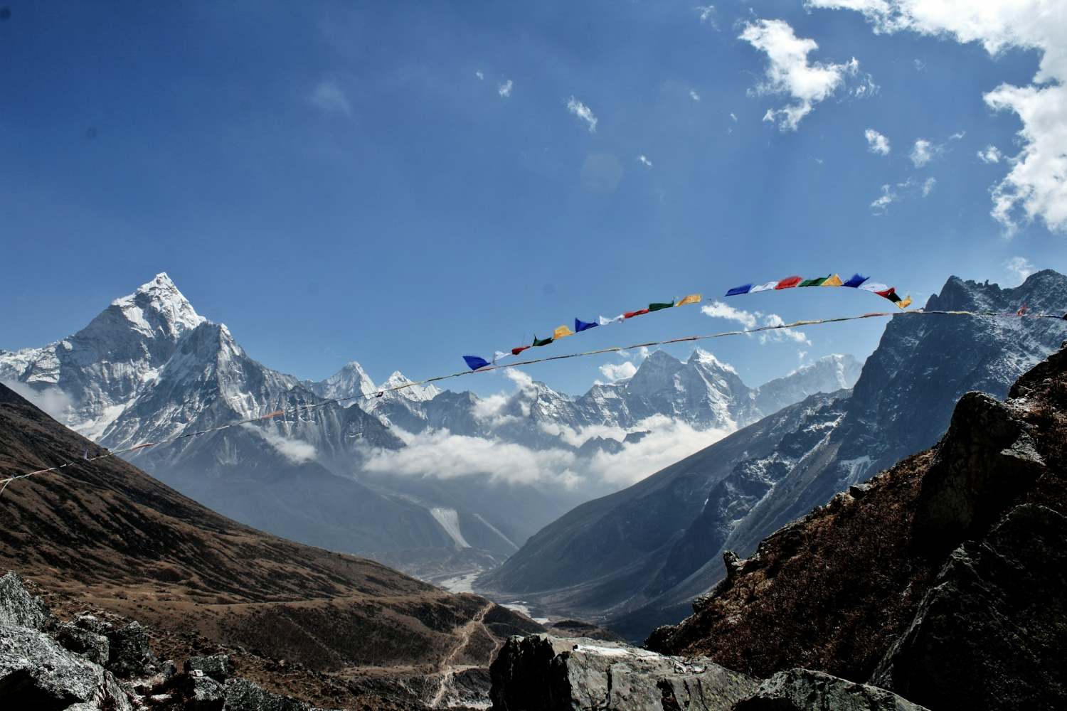
Everest Panorama Trek 2026
The Everest Panorama Trek: World-Class Views Without the Base Camp Burnout
For many, locking eyes with the world’s highest peak is the ultimate bucket-list dream. However, the legendary 14-day slog to Everest Base Camp (EBC)—with its punishing altitude of 5,364 meters, sub-zero nights in glacial winds, and the infamous "EBC cough"—can be a dealbreaker for first-time hikers, families, or those with limited vacation time.
Fortunately, there is a perfect, high-reward compromise: The Everest Panorama Trek (often marketed as the Everest View Trek). This shorter itinerary delivers jaw-dropping, 360-degree panoramas of the world’s most iconic 8,000-meter giants—Everest, Lhotse, Nuptse, and Ama Dablam—without ever forcing you to breach the 4,000-meter (13,123-foot) mark, significantly slashing the risk of Acute Mountain Sickness (AMS).
Here is why this trek is the ultimate "first taste of the Himalaya," offering a richer, more comfortable experience than the base camp grind:
1. The Sweet Spot of Altitude & Comfort While EBC trekkers spend multiple nights above 4,500 meters (where oxygen levels drop by nearly 50%), the Panorama Trek’s highest point is typically Kyangjuma Hill (3,850m) or the famous Hotel Everest View (3,880m) —the highest-altitude luxury hotel in the world. This lower ceiling allows you to sleep soundly, drastically reduces headaches and nausea, and means you can enjoy a hot shower and a private room with an en-suite bathroom at most tea houses, luxuries that disappear entirely on the Base Camp trail.
2. The Flight of a Lifetime Your adventure begins with one of the most spectacular commercial flights on Earth: a 35-minute hop from Kathmandu to Tenzing-Hillary Airport in Lukla (2,860m) . Perched on a cliffside, this tiny airstrip offers vertigo-inducing views out the cockpit window. From here, you bypass the dusty, lower-altitude villages and fly directly into the heart of Sherpa country, saving you 3 days of walking just to reach the scenic zone.
3. The "Living Museum" of Sherpa Culture Unlike the EBC route, which becomes a single-minded march toward a glacier, the Panorama Trek allows for deep cultural immersion. You will spend two nights in Namche Bazaar (3,440m) , the bustling, horseshoe-shaped trading hub known as the "Gateway to Everest." Here, you can:
-
Visit the Sherpa Culture Museum and the Himalayan Mountaineering Center to learn about the 1953 first ascent.
-
Hike to the Khunde Hospital, founded by Sir Edmund Hillary, to see his lasting legacy in community healthcare.
-
Sip chang (local millet beer) in a traditional wooden lodge while listening to elderly Sherpas recite stories of legendary summiteers.
4. The Ultimate Sunrise Show (Without the 3 AM Start) The itinerary is perfectly paced for sunrise photography. A short, 45-minute pre-dawn hike from Namche to the Syangboche Viewpoint rewards you with the famous "golden hour" where the sun strikes the southwest face of Everest in a blaze of orange and pink. For an even more dramatic perspective, you will trek to the iconic Thyangboche Monastery (3,867m) —a spiritual gem framed by the majestic peak of Ama Dablam. The monks' morning prayers here, accompanied by conch shells and chanting, are as unforgettable as the mountain views.
5. A Glimpse of the High-Altitude Lifestyle If you are feeling energetic, the itinerary includes a strenuous but rewarding day-hike to Kala Patthar (5,545m) ? No. This is the common misconception. Instead, you hike to the quaint village of Khumjung, where you can view the legendary Yeti Scalp preserved in the local monastery. Alternatively, you can take the gentle, forested trail to Kyangjuma, where you will have a front-row seat to the world’s highest-ever "ridge walk"—a view that is often considered more beautiful than Base Camp itself because you see the peaks in their symmetrical, unfettered glory, rather than from the rubble-strewn glacier floor.
6. Perfect for Every Demographic
-
Time-Savers: The full trek is completed in just 7 to 9 days, making it possible to fit into a single week of leave plus two weekends.
-
Families & Seniors: The trails are well-maintained, with fewer steep, rocky moraines. Children over 10 and active seniors in their 70s frequently complete this trek with smiles.
-
Acclimatization Easy Mode: Because you stay below 4,000m, you only need one dedicated acclimatization day in Namche (versus the 3-4 required on the EBC route), leaving more time to simply relax and soak in the views.
In Short: The Everest Panorama Trek is not a "consolation prize"—it is a smarter, more luxurious, and culturally richer alternative. You still get the iconic snapshot of Everest from the iconic stupa at Thyangboche, you still sleep in cozy lodges with Wi-Fi and bakeries, and you still fly into the world’s most dramatic airstrip. You simply skip the frostbite, the endless rock scrambles, and the sleepless nights, returning to Kathmandu with a camera full of once-in-a-lifetime shots and your energy intact—ready to plan your next adventure.
The Basics: Distance, Elevation, and Duration
While a standard full-package holiday—including your international arrival, a night in Kathmandu, the domestic flight to Lukla, and your return—spans about 9 to 10 days, your actual boots-on-the-ground hiking time is a manageable 7 days. Here is the precise breakdown of what that looks like:
-
Total Round-Trip Distance: 32–36 miles (51–58 km) . This is deceptively gentle; because the trail undulates constantly (you descend into river valleys and climb back out each day), your total vertical gain over the week is actually over 10,000 feet—comparable to a strenuous week of hill walking, just spread over a longer period.
-
Daily Hiking Average: 4 to 6 hours per day, covering roughly 4–6 miles. This leaves ample afternoons for side-excursions, photography, or simply sitting in a teahouse sunroom with a mug of chiya (spiced milk tea) while watching the afternoon clouds roll in.
-
Highest Point: 3,860 meters (12,664 feet) , reached at the famed Tengboche Monastery. However, you will actually sleep slightly lower, at 3,800 meters, which is the golden rule of altitude acclimatization: "climb high, sleep low." For comparison, the EBC trek requires sleeping at 5,100 meters—a 1,200-meter difference that has a profound impact on your physiology.
-
Total Ascent/Descent: You will climb roughly 2,400 meters (7,900 feet) cumulatively from Lukla to Tengboche, and descend the same back down. The steepest single section is the infamous "Namche Hill" —a relentless 2.5-hour, 600-meter (2,000-foot) climb out of the Dudh Kosi River valley on Day 2. It is tough, but after that, the trail eases into gentler forest switchbacks.
-
Difficulty Rating: Easy to Moderate (Grade 2-3 on a 5-point hiking scale). This trek is suitable for anyone with a basic level of fitness—think regular weekend walks of 5–6 miles, or the ability to climb a few flights of stairs without getting winded. No technical mountaineering or prior trekking experience is required. The biggest physical challenge is the altitude, not the distance.
-
Accommodation: Warm, wood-paneled mountain teahouses run by multi-generational Sherpa families. Unlike the basic, dormitory-style bunkhouses found higher up on the EBC route, these lodges often feature:
-
Private twin/double rooms (no more sharing a room with 10 strangers).
-
Attached bathrooms with flush toilets (a luxury that disappears above 4,200 meters).
-
Common dining halls with pot-bellied stoves, where you can charge your devices (for a small fee) and swap stories with trekkers from around the world.
-
Wi-Fi access via local Everest Link satellite networks (available in Namche, Tengboche, and most villages), though it is slow—best used for sending a quick "I'm safe!" WhatsApp, not for streaming.
-
-
Best Seasons: March to May (spring, for blooming rhododendron forests and clear skies) and October to November (autumn, for the most stable weather and crystal-clear, post-monsoon visibility). Winter (Dec-Feb) is bitterly cold but gloriously empty, while summer/monsoon (June-Sept) brings leeches, mud, and clouded-out views.
Why Choose the Panorama Trail over Everest Base Camp?
If you are torn between the two, here is a frank, side-by-side comparison that goes beyond marketing hype. The Panorama Trail is not a "lesser" version of EBC—it is an entirely different, often superior, experience for the majority of travelers.
1. Lower Altitude = Better Sleep, Stronger Body
-
The EBC Reality: On the Base Camp route, you spend three consecutive nights above 4,600 meters (at Lobuche and Gorak Shep). At this altitude, your blood oxygen saturation can drop to 75-80% (normal is 95-100%). This triggers periodic breathing (Cheyne-Stokes respiration), causing you to wake up gasping for air 5–10 times per night. Most trekkers report getting only 3–4 hours of fractured, restless sleep.
-
The Panorama Advantage: Because you never sleep above 3,800 meters, your oxygen saturation stays around 88-90% . Your body can actually enter REM sleep, meaning you wake up genuinely rested. You also sidestep the most common AMS symptoms—throbbing headaches, nausea, and loss of appetite—which affect over 50% of trekkers above 4,000 meters. This allows you to actually enjoy your evenings, eating hearty meals (try the dal bhat—rice and lentil soup—which is all-you-can-eat) and socializing rather than lying in a dark room with a headache.
2. Superior Viewpoints (You Actually See Everest!)
-
The EBC Irony: Here is the secret that guides don't always tell you: You cannot see the summit of Everest from Everest Base Camp itself. From the famous glacier rubble, the peak is completely obscured by the colossal bulk of Nuptse (7,861m) and the West Shoulder. The only reason trekkers go there is for the prestige of standing on the glacier—the view itself is actually quite underwhelming (a grey, rocky moraine).
-
The Panorama Advantage: This route is meticulously designed for viewing. From the Everest View Hotel (3,880m) balcony, you get a postcard-perfect, completely unobstructed panorama: Everest (8,848m) rising behind the dark ridge of Nuptse, Lhotse (8,516m) to its right, and the impossibly sharp, shark-tooth spire of Ama Dablam (6,812m) directly in front of you—so close you can see the crevasses glinting. The sunrise from Tengboche Monastery is arguably the most photographed mountain vista on Earth; the golden light strikes the summit of Everest a full 20 minutes before it hits the valley floor, creating a surreal, ethereal glow.
3. Enhanced Comfort & Infrastructure
-
The EBC Reality: Above Dingboche (4,410m), teahouses become spartan. Toilets are often non-flush, outdoor pit latrines; hot water is scarce and costs a premium ($5-7 for a bucket); rooms are unheated, and temperatures inside can drop to -5°C (23°F) at night. You will be sleeping in your down jacket.
-
The Panorama Advantage: Because you stay in the lower, more established villages (Lukla, Phakding, Namche, Tengboche), the teahouses benefit from better supply chains. Solar-powered hot water is more reliable—you have a 70-80% chance of getting a real hot shower every other day. Most rooms have electric blankets or thick, down duvets. You will even find bakeries in Namche selling fresh apple pie, cinnamon rolls, and espresso coffee—creature comforts that are wholly absent on the upper EBC trail.
4. Time Efficiency & Cost Effectiveness
-
The EBC Reality: The full EBC trek demands a minimum of 12-14 days of hiking, meaning you need nearly 3 weeks off work when you factor in international travel. This also means higher costs: permits, guide fees, extra accommodation, and the inevitable helicopter rescue if you get altitude sickness.
-
The Panorama Advantage: The entire experience fits into 9 days total (including your arrival and departure days). You can fly into Kathmandu on a Friday, start trekking Saturday, and be back in the capital by the following Sunday—making it achievable with just 7 days of leave from work. Financially, you save on extra guide days, higher-altitude food costs (which double above 4,000m), and the mandatory travel insurance with helicopter evacuation coverage (which is cheaper because the risk is lower).
5. A Richer Cultural Experience
-
On the EBC route, the trail becomes a single-minded procession of summit-bound climbers and speed-trekkers. The Panorama Trail, however, allows for genuine cultural pauses. You have time to:
-
Visit the weekly Saturday market in Namche, where Tibetan traders cross the border to sell yak butter, cheese, and hand-woven rugs.
-
Take a side-hike to Khumjung village to see the Hillary-founded school and the local monastery's famed Yeti scalp (a fascinating piece of Himalayan folklore).
-
Attend the evening prayer ceremony at Tengboche Monastery, where you can sit with the monks as they chant, their voices echoing off the wooden pillars with the massive bulk of Ama Dablam watching through the window—a spiritual moment that Base Camp trekkers, rushing for their summit push, often miss entirely.
-
In summary: The Panorama Trail offers you 90% of the photographic glory with 50% of the physical strain. It is not a compromise; it is a strategic choice for the traveler who values comfort, culture, and quality sleep as much as the summit view. You return from this trek not exhausted and haggard, but invigorated—with your lungs tested, your camera full, and your appetite for the Himalaya thoroughly whetted for future adventures.
-
Optional Side-trip: If you still have energy, hike 20 minutes to the small village of Syangboche (not the airstrip) for a final farewell view of Everest before it disappears behind the ridge.
-
Overnight: Enjoy a well-earned hot shower (you'll likely get one here, unlike in Tengboche), and splurge on a steak dinner or a slice of chocolate cake at the "Himalayan Café" in Namche.
Day 7: The Final Push – Namche to Lukla (2,860m)
-
The Trek (6–7 hours, 14 km / 8.7 miles, net descent of 580m): The last day is the longest in terms of distance. You will cruise through the pine forests, re-cross the massive Hillary Bridge (this time, going down the infamous Namche Hill, which is surprisingly hard on your toes—tighten your boot laces to avoid black toenails).
-
Final Views: As you approach Lukla in the late afternoon, turn around for one last, nostalgic look back at the distant white peaks—they will seem impossibly far away now.
-
Celebration: In Lukla, you will share a celebratory farewell dinner with your local guides and porters. Do: Treat your team to a round of
*chang*(local millet beer) and tip them directly—the standard rate is 10-15% of your total trek cost, split between guide and porter.
Best Time to Go & Practical Tips
The Golden Windows:
-
Autumn (October – November): The undisputed best season. The skies are crystal-clear, with zero haze, and temperatures are pleasant during the day (15°C / 59°F) but cold at night (0°C to -5°C / 23°F). The trail is busy but not overcrowded on this route.
-
Spring (March – May): Milder temperatures and the spectacular rhododendron bloom transform the forests into a colorful tapestry. Expect some afternoon cloud buildup, which can obscure summit views until early morning, but the floral beauty more than compensates.
The Shoulder & Off-Seasons:
-
Winter (December – February): The trails are snow-capped, the lodges are half-empty, and the silence is profound. However, nights drop to -15°C (5°F) , and some teahouses close down. Only for the cold-hardy and solitude-seekers.
-
Monsoon (June – September): Heavy rain, leeches, mudslides, and almost guaranteed cloud cover over Everest. Not recommended unless you enjoy mist and slippery trails.
What to Pack (The Essentials)
-
The "Layer System": Base layer (merino wool or synthetic, no cotton), mid-layer (fleece or light puffy jacket), and outer shell (windproof/waterproof jacket). You will add/remove these 5-6 times per day as you climb and descend.
-
Sleeping Bag: A 3-to-4-season comfort-rated bag (at least -10°C / 14°F). Teahouses provide blankets, but they are often thin. Rent one in Kathmandu for $1-2 per day rather than lugging yours from home.
-
Footwear: Worn-in, waterproof, high-ankle hiking boots with thick soles. Crucial: Break them in for at least 3 weeks before arriving—blisters are the #1 trek-ender.
-
Power & Connectivity: A high-capacity power bank (20,000 mAh) . Teahouses charge 200–500 NPR ($1.50–$4 USD) to charge your phone/camera, and plugs are scarce. Electricity is solar-dependent; it may go out after 9 PM.
-
Water Purification: Do not buy bottled water (plastic waste is a huge problem). Bring a SteriPen, purification tablets, or a Sawyer filter—you can fill up from village taps and glacial streams for free.
-
First-Aid Kit: Include Diamox (altitude sickness medication—consult your doctor), blister plasters (Compeed), ibuprofen, and rehydration salts (ORS).
Fueling Up: The Trekker's Menu
-
Dal Bhat (The Himalayan Powerhouse): The ultimate fuel—a platter of lentil soup, steamed rice, and vegetable curry (often with pickles). The magical words are "Dal Bhat power, 24-hour!" —it is all-you-can-eat, and you will need the carbs.
-
Momos: Steaming vegetable or buffalo-milk-dumplings, served with a spicy tomato chutney. The perfect après-hike snack.
-
Breakfast: Porridge with honey is the traditional start; it releases energy slowly. Pancakes or Tibetan bread (fried dough) with jam are also excellent options.
-
Drinks:
*Chiya*(spiced milk tea) is comforting;*Jhangi*(local barley beer) is a celebratory treat; and garlic soup is a Sherpa remedy believed to thin the blood and help with acclimatization—order it even if you don't feel sick, just as a preventative.
Final Thoughts
You do not need to push your body to its absolute breaking point to experience the magic of the Himalaya. The Everest Panorama Trek strikes the perfect balance—delivering the jaw-dropping, close-up vistas of the world's highest peaks; offering a deep, unhurried dive into living Sherpa culture; and giving you the thrill of Himalayan trekking, all while keeping the journey accessible, safe, and profoundly enjoyable. You return to Kathmandu not as an exhausted survivor, but as an inspired traveler, already planning your next "first step" into the mountains.
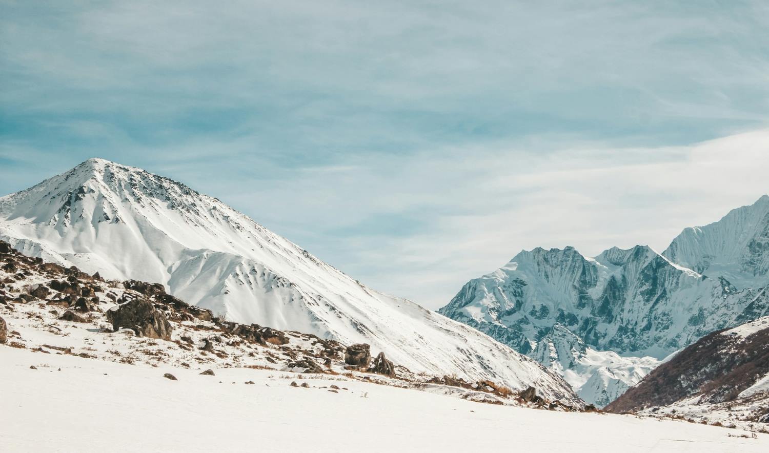
Langtang Valley Trek in Nepal: Everything You Need to Know
The Valley of Glaciers: Ultimate Guide to the Langtang Valley Trek
When planning a trekking adventure in Nepal, iconic routes like Everest Base Camp and the Annapurna Circuit typically dominate the conversation. However, tucked directly north of the Kathmandu Valley lies one of the central Himalaya's most compelling geographical gems: the Langtang Valley Trek.
Affectionately designated as the "Valley of Glaciers," Langtang provides a serene, low-congestion alternative that mirrors the dramatic vertical relief of Nepal’s more famous high-altitude circuits. This trail packs an extraordinary cross-section of ecosystems into a compact 7-to-8-day itinerary, guiding trekkers out of roaring subtropical river canyons, through dense temperate forests, and directly into alpine glacial bowls rimmed by 7,000-meter peaks.
Whether you are a novice seeking a foundational Himalayan experience or a seasoned alpine trekker looking for an off-the-beaten-path journey, this comprehensive guide outlines exactly what makes the Langtang Valley an unparalleled trekking destination.
Why Choose the Langtang Valley Trek?
1. Simplified Logistics (No Domestic Flights Required)
One of the primary advantages of the Langtang region is its accessibility. Unlike the Everest region, which relies heavily on weather-dependent, high-altitude flights into Lukla's Tenzing-Hillary Airport, Langtang is reached entirely by ground transport. The journey begins with a 122-kilometer (75-mile) drive from Kathmandu to the trailhead at Syabrubesi. While the road winding past the Trishuli River and Dhunche is notoriously rugged and takes roughly 7 to 9 hours, it eliminates the budget inflation and scheduling volatility of domestic air travel.
2. Strategic Altitude Profile for Beginners
While classic routes often require crossing high alpine passes exceeding 5,000 meters early in the itinerary, the Langtang Valley trail climbs progressively along the floor of a deep river valley carved by the Langtang Khola.
-
The trek kicks off at a modest 1,460 meters (4,790 feet) in Syabrubesi.
-
It scales gradually to 3,870 meters (12,696 feet) at the final overnight hub of Kyanjin Gompa.
This steady, predictable rate of ascent allows for excellent natural acclimatization, vastly reducing the clinical incidence of Acute Mountain Sickness (AMS). It stands out as an ideal choice for multi-generational families, seniors, and first-time Himalayan hikers.
3. Deep Cultural Immersion in Tamang Heritage
The Langtang region offers a distinct cultural landscape heavily influenced by Tibetan Buddhism. Upwards of 80% of the local population identifies as Tamang—an ancient indigenous ethnic group with their own Tibeto-Burman language, distinct dress, and rich musical traditions (centered around the Damphu drum). As you move from village to village, the trail is lined with intricate, stone-carved mani walls, chortens, and cascading prayer flags. Staying in local lodges provides a firsthand look at traditional mountain economies, which are deeply intertwined with seasonal alpine agriculture and transhumant yak herding.
4. Eco-Tourism and Economic Resilience
The Langtang Valley was the epicenter of catastrophic landslides triggered by the 7.8-magnitude earthquake in April 2015, which completely buried the original Langtang Village. The story of the valley today is one of profound resilience. Local communities have successfully rebuilt structurally sound, modern teahouses with improved amenities. Because this region sits entirely within the protected boundaries of Langtang National Park (Nepal’s first Himalayan national park, established in 1976), independent and guided tourism serves as the primary economic engine driving the area's ecological conservation, local schooling, and cultural restoration projects.
5. High-Reward Side Excursions
Though the valley floor is highly accessible, adventure-seekers are not limited by the modest altitude of the main trail. From the base camp at Kyanjin Gompa, trekkers can tackle challenging day-hikes to spectacular vantage points:
-
Kyanjin Ri: 4,380 meters (14,370 feet)
-
Tserko Ri: 4,984 meters (16,351 feet)
Completing the steep climb up Tserko Ri rewards hikers with an unobstructed, 360-degree panorama of the central Himalayas, dominated by Langtang Lirung (7,245 m), Dorje Lakpa (6,966m), Gangchempo (6,387m), and the massive Shishapangma (8,027 m) rising just across the border in Tibet.
Core Trekking Metrics Table
| Metric | Details |
| Total Round-Trip Distance | ~65 to 80 kilometers (40 to 50 miles), depending on side treks |
| Trek Duration | 7 to 8 Days (typically 5–6 days of active walking, 2 days of transit) |
| Average Daily Hiking Time | 5 to 7 hours per day |
| Difficulty Rating | Moderate |
| Required Permits | Langtang National Park Entry Permit (NPR 3,000 / approx. USD 25) |
| Primary Accommodation | Locally run mountain teahouses (twin-sharing rooms) |
The 8-Day Standard Itinerary: Day-by-Day Field Guide
While excellent regional extensions exist—such as climbing southwest toward the sacred alpine waters of Gosainkunda Lake (4,380m) or looping northwest through the Tamang Heritage Trail—the classic 8-day itinerary remains the definitive choice for experiencing the core valley. Here is the technical breakdown of what to expect on the trail each day.
Day 1: Overland Transit from Kathmandu to Syabrubesi
-
Distance Covered: ~122 kilometers (75 miles)
-
Transit Duration: 7 to 9 hours (dependent on localized monsoon damage and traffic)
-
Starting Elevation: 1,395 meters (4,576 feet)
-
Ending Elevation: 1,460 meters (4,790 feet)
-
Terrain & Route: Headed north out of Kathmandu, the route follows the Pasang Lhamu Highway, tracing the deep gorges carved by the Trishuli River. The initial paved segments offer views of terraced farmlands, roadside bazaars, and distant glimpses of the Manaslu Massif and Ganesh Himal. Past the district headquarters of Dhunche (2,030m), where your Langtang National Park permits are verified at a military checkpost, the road transitions into a rugged, unpaved dirt track that descends sharply via switchbacks to the riverside trading town of Syabrubesi.
Day 2: Trailhead Departure from Syabrubesi to Lama Hotel
-
Trekking Distance: ~11.5 kilometers (7.1 miles)
-
Hiking Duration: 5 to 6 hours
-
Net Elevation Gain: +1,010 meters
-
Ending Elevation: 2,470 meters (8,103 feet)
-
Terrain & Route: The trek officially commences by crossing a suspension bridge over the Bhote Koshi River, followed quickly by another over the Langtang Khola. From here, you walk upstream along the northern bank of the river. The trail plunges into a dense, humid subtropical forest canopy dominated by oak, maple, and rhododendron trees. You will navigate a series of stone steps past the isolated riverside tea stops of Doman, Pairo (where the trail splits via an upper route to Sherpa Gaun), and Bamboo. This section serves as a prime habitat for wild gray langurs, Himalayan black bears, and the endangered red panda. The day concludes with a final steep push up to the forested clearing of Lama Hotel.
Day 3: Lama Hotel to Mundu (via the Old Langtang Village Site)
-
Trekking Distance: ~11.8 kilometers (7.3 miles)
-
Hiking Duration: 5 to 7 hours
-
Net Elevation Gain: +985 meters
-
Ending Elevation: 3,455 meters (11,335 feet)
-
Terrain & Route: Leaving Lama Hotel, the trail continues its steady, forested ascent alongside the roaring river canyon. At Ghora Tabela (3,030m), a former Tibetan resettlement project and current army checkpoint, the dense canopy abruptly gives way to a wide, U-shaped glacial valley. The air becomes noticeably thinner and drier as you cross into subalpine territory marked by wide yak pastures and stone walls.
Shortly after, you will cross a vast, somber boulder and debris field. This is the precise location where the original Langtang Village was completely buried by a massive, earthquake-triggered ice and rock avalanche in 2015. A memorial wall stands here to honor the locals and international trekkers who lost their lives. Skirting the edge of this field leads to the newly constructed settlements and the nearby village of Mundu, where modern teahouses feature enhanced insulation and solar utilities.
Day 4: Mundu to Kyanjin Gompa
-
Trekking Distance: ~6.5 kilometers (4.0 miles)
-
Hiking Duration: 3 to 4 hours
-
Net Elevation Gain: +415 meters
-
Ending Elevation: 3,870 meters (12,696 feet)
-
Terrain & Route: Designed deliberately short to mitigate high-altitude fatigue and promote acclimatization, this morning's trek follows a gradual incline through the upper valley floor. The trail winds past traditional dry-stone walls, active chortens, and the largest mani wall in the region, featuring thousands of hand-carved Buddhist prayers.
As you round the final ridge, the valley opens completely into a dramatic alpine amphitheater. Kyanjin Gompa sits tucked beneath the towering southwest face of Langtang Lirung. After checking into your lodge by lunchtime, spend your afternoon visiting the village's historic 13th-century monastery or touring the government-supported Kyanjin Yak Cheese Factory, which produces artisanal cheese from native nak (female yak) milk between May and November.
Day 5: Summit Excursion: Kyanjin Ri or Tserko Ri Peak
-
Trekking Distance: Variable; 5 to 9 kilometers (3 to 5.5 miles) round-trip
-
Hiking Duration: 3 to 4 hours (Kyanjin Ri) or 6 to 8 hours (Tserko Ri)
-
Maximum Elevation: 4,380 meters (Kyanjin Ri) or 4,984 meters (Tserko Ri)
-
Ending Elevation: 3,870 meters (Return to Kyanjin Gompa)
-
Terrain & Route: This dedicated acclimatization day offers two distinct alpine climbing options depending on your physical condition and comfort with steep gradients:
-
Option A (Kyanjin Ri - 4,380m): A steep, dirt-and-rock switchback trail directly behind the village. It provides an excellent introduction to higher altitudes with minimal technical risk, overlooking the tumbling icefalls of the Langtang Lirung glacier.
-
Option B (Tserko Ri - 4,984m): A physically demanding, high-altitude alpine push over loose scree and rocky ridges. The lung-burning ascent requires a pre-dawn start but rewards successful hikers with a staggering, unobstructed 360-degree panorama. The view is dominated by the massive walls of Langtang Lirung (7,245 m), Yala Peak (5,520), Dorje Lakpa (6,966), and the massive pyramid of Mt. Shishapangma (8,027m) towering directly across the northern border in Tibet.
-
Day 6: Valley Descent from Kyanjin Gompa back to Lama Hotel
-
Trekking Distance: ~18.3 kilometers (11.3 miles)
-
Hiking Duration: 5 to 6 hours
-
Net Elevation Loss: -1,400 meters
-
Ending Elevation: 2,470 meters (8,103 feet)
-
Terrain & Route: This day reverses your approach itinerary, condensing two days of uphill walking into a single, extended downward stretch. Because you are heading downhill into oxygen-rich air, progress is exceptionally fast. You will trace the valley floor back through Mundu, past the avalanche debris field, and drop below the subalpine line at Ghora Tabela. The path re-enters the humid oak and rhododendron forests, crossing the familiar suspension bridges before stopping for the night at Lama Hotel.
Safety Note: Continuous downhill trekking over stone steps can place intense stress on your knees and quadriceps. Secure your trekking poles tightly and maintain a deliberate, controlled pace.
Day 7: Lama Hotel to Syabrubesi
-
Trekking Distance: ~11.5 kilometers (7.1 miles)
-
Hiking Duration: 4 to 5 hours
-
Net Elevation Loss: -1,010 meters
-
Ending Elevation: 1,460 meters (4,790 feet)
-
Terrain & Route: The final day on the trail follows the familiar contours of the Langtang Khola canyon floor. For an interesting structural variation, many guides opt for the slightly higher alternative trail that routes through Sherpa Gaun (2,563m) and Khangjim. This alternative path offers unique vantage points looking down into the river gorge and passes through traditional terraced farming villages before dropping sharply down to the main suspension bridges. By mid-afternoon, you will arrive back in Syabrubesi to conclude your foot journey.
Day 8: Return Overland Transit from Syabrubesi to Kathmandu
-
Distance Covered: ~122 kilometers (75 miles)
-
Transit Duration: 7 to 9 hours
-
Ending Elevation: 1,395 meters (4,576 feet)
-
Terrain & Route: After an early breakfast, you re-board your private 4x4 jeep or local public bus for the return journey to the capital. The route retraces the winding mountain roads out of the Rasuwa district, passing back through the Dhunche checkpoint and descending toward the warmer, lower valleys surrounding the Trishuli River. The drive concludes by climbing over the outer rim of the Kathmandu Valley, returning you directly to your hotel in Thamel.
Seasonal Analysis: When to Trek Langtang
Choosing the correct seasonal window directly impacts trail conditions, mountain visibility, and your overall safety. The Himalayan trekking calendar is sharply divided into four distinct phases.
1. Spring (March to May) – Peak Floral Season
-
Temperature Range: Lower elevations (Syabrubesi/Lama Hotel) range from 15C to$22C during the day. Nighttime temperatures at Kyanjin Gompa drop to between -5Cand -3C .
-
Trail Conditions: Clear mornings with occasional afternoon cloud build-up or localized showers. Trails are dry and high passes are typically clear of heavy winter snow by mid-April.
-
Highlights: This season offers exceptional biodiversity. Subtropical and temperate zones between 2,000m and 3,000m erupt with blooming rhododendron forests (Lali Gurans), orchids, and magnolia trees. Wildlife, including the endangered red panda and Himalayan tahr, is highly active.
2. Autumn (September to November) – Optimal Clarity
-
Temperature Range: Mild daytime temperatures hovering around 10C to 18C . Nights become progressively colder as November approaches, dropping to between -10 C and -2C at upper limits.
-
Trail Conditions: Exceptionally stable weather systems. The atmospheric scrubbing from the preceding monsoon rains leaves the air remarkably crisp, providing the highest percentage of crystal-clear, unobstructed mountain views.
-
Highlights: This is the absolute peak trekking window. Trails and teahouses operate at maximum capacity. It coincides with major Nepalese festivals like Dashain and Tihar, adding a vibrant cultural layer to the journey.
3. Winter (December to February) – Solitude and Snow
-
Temperature Range: Daytime temperatures rarely exceed 5C(41F) in the upper valley, while nighttime temperatures routinely plummet below -15C .
-
Trail Conditions: High risk of heavy snowfall, ice accumulation on narrow river paths, and occasional trail closures.
-
Highlights: Ideal for experienced alpine hikers seeking absolute solitude and dramatic, snow-draped landscapes. However, it requires advanced cold-weather gear, microspikes, and a flexible itinerary. Many high-altitude teahouses in Kyanjin Gompa close entirely as locals migrate to lower elevations.
4. Monsoon / Summer (June to August) – High-Risk Off-Season
-
Temperature Range: Warm, humid, and wet. Lower trails are slick, with temperatures staying above 20C .
-
Trail Conditions: High risk of landslides along the vehicular road from Kathmandu to Syabrubesi, particularly around Dhunche. The trails feature dense mud and an abundance of leeches in the forested zones below 3,000m. Clouds frequently obscure the peaks completely.
-
Highlights: The valley transforms into a lush, vibrant green, and alpine meadows are carpeted with wildflowers. Monsoon trekking is strictly recommended only for seasoned hikers focusing on botanical research or those working with experienced local guides who can navigate dynamic landslide zones.
Critical Trekking Logistics
1. Required Permits and Regulations
Navigating the regulatory checkpoints in the Rasuwa district requires specific paperwork. Under current trekking guidelines, independent solo trekking without a licensed guide is heavily restricted or banned across various jurisdictions in Nepal to ensure safety; booking through a registered local agency handles all logistics automatically.
-
Langtang National Park Entry Permit: This is a mandatory conservation permit.
-
Cost: NPR 3,000 per person (approx. USD 25) for foreign nationals; NPR 1,500 for SAARC citizens.
-
Where to Acquire: Available at the Department of National Parks and Wildlife Conservation (Bhrikuti Mandap, Kathmandu) or directly at the park entry checkpoint in Dhunche.
-
Requirements: Photocopy of your passport bio-page and two passport-sized photographs.
-
-
TIMS Card / Local Treker Registration: The Trekkers' Information Management Systems (TIMS) card or local local government registration acts as a critical safety tracking mechanism. This is monitored closely at checkpoints in Dhunche and the entry point of Syabrubesi.
Pro Tip: Keep both your physical permits and digital backups readily accessible in your daypack. These documents are verified at multiple military and civil checkpoints throughout Langtang National Park.
2. Mountain Teahouse Infrastructure & Dining
The Langtang route is a classic "teahouse trek," meaning you do not need camping or survival gear. The lodges are family-run operations providing fundamental comforts.
-
Lodging: Rooms typically feature two single foam mattresses over wooden frames. While pillows and thick quilts are standard, a personal 3-to-4-season sleeping bag (rated to $-10^\circ\text{C}$ minimum) is highly recommended for hygiene and crucial insulation during freezing alpine nights. Common dining areas are heated in the evenings by central stoves fueled by wood or dried yak dung.
-
Dietary Management: Menus are standardized by local lodge management committees to regulate pricing. The staple dish is Dal Bhat (steamed rice, lentil soup, spiced vegetable curry, and greens), which features free, unlimited refills—making it the most cost-effective, high-calorie fuel source on the mountain. Other options include Momo (dumplings), Thukpa (Tibetan noodle soup), porridge, and basic pastas. Vegetarian and vegan options are standard, and it is highly advised to avoid meat consumption above Lama Hotel, as all meat must be portered up on foot without refrigeration.
3. Power, Connectivity, and Communications
While the trek offers an escape into nature, cellular and utility grids have improved significantly across the central Himalayas.
-
Mobile Networks: Both Ncell and Nepal Telecom (NTC) offer 4G coverage along the trail. NTC generally maintains a more stable, consistent signal within the deep gorges between Syabrubesi and Langtang Village, though connectivity becomes highly dependent on daily weather conditions once you reach the wide glacial basin of Kyanjin Gompa.
-
Satellite Wi-Fi: Many teahouses offer access to private satellite networks like Everest Link or local long-range Wi-Fi systems. Access is granted via pre-paid cards or a flat daily usage fee ranging from USD 3 to USD 5. Expect speeds to slow down significantly during peak evening hours when everyone logs on.
-
Auxiliary Fees: Power is a premium asset in the mountains, often relies on solar panels, and is not included in the baseline room rate. Teahouses charge incremental fees for the following services:
-
Device Charging: USD 2 to USD 4 per hour (carrying a high-capacity $20,000\text{mAh}$ power bank is essential).
-
Hot Gas/Solar Showers: USD 2 to USD 5 per shower (showering is not recommended above Langtang Village to avoid rapid cooling and hypothermia risks).
-
Conclusion: Synthesizing the Langtang Experience
Ultimately, the Langtang Valley Trek defies the hyper-commercialized, peak-bagging culture often found on more crowded Himalayan circuits. Rather than focusing purely on technical endurance or reaching a grueling physical checkpoint, Langtang is fundamentally a trek of connection—one that offers an intimate window into the resilience of central Nepal’s mountain communities and the changing dynamics of its unique alpine ecosystems.
It strikes a precise structural balance for a trekker: challenging enough to require physical preparation and cardiovascular stamina, yet accessible enough to prevent exhaustion from overshadowing the landscape.
To optimize your journey through the Valley of Glaciers, keep these final actionable directives in mind:
1. Master the Art of Minimalist Packing
Because there are no domestic flight weight restrictions on this route, it can be tempting to overpack. However, keeping your baseline pack weight between 8 and 9 kilograms (17 to 20 pounds) is critical for your comfort—or the physical well-being of your porter. Prioritize a technical layering system: a breathable base layer, a heavy insulating mid-layer (down jacket), and a wind- and waterproof outer shell.
2. Commit to Sustainable Travel and Ethical Guiding
Hiring a licensed local guide does more than just secure your safety through dynamic terrain and landslide zones. It provides critical economic support directly to Tamang families who rely on tourism to sustain their communities. Furthermore, traveling with a local guide grants you deep access to oral histories, regional customs, and hidden monastic traditions that you won't find in any standard guidebook.
3. Embrace the Philosophy of Bistarai, Bistarai
The golden rule of high-altitude trekking in Nepal is captured in the Nepali phrase Bistarai, bistarai—meaning "slowly, slowly." Forcing a rapid pace up the steep river canyons between Syabrubesi and Lama Hotel only increases your risk of early fatigue and poor acclimatization. By deliberately managing your heart rate, staying consistently hydrated with 3 to 4 liters of filtered water daily, and matching your stride to the natural rhythm of the mountain, you allow your body to adapt smoothly to the thinning air.
The Langtang Valley remains a rare sanctuary where the grandeur of the high Himalayas meets a deeply grounding cultural journey. By stepping onto the trail with preparation, respect, and curiosity, you ensure that your journey through this magnificent glacial valley is both personally unforgettable and profoundly impactful to the resilient communities hosting you.
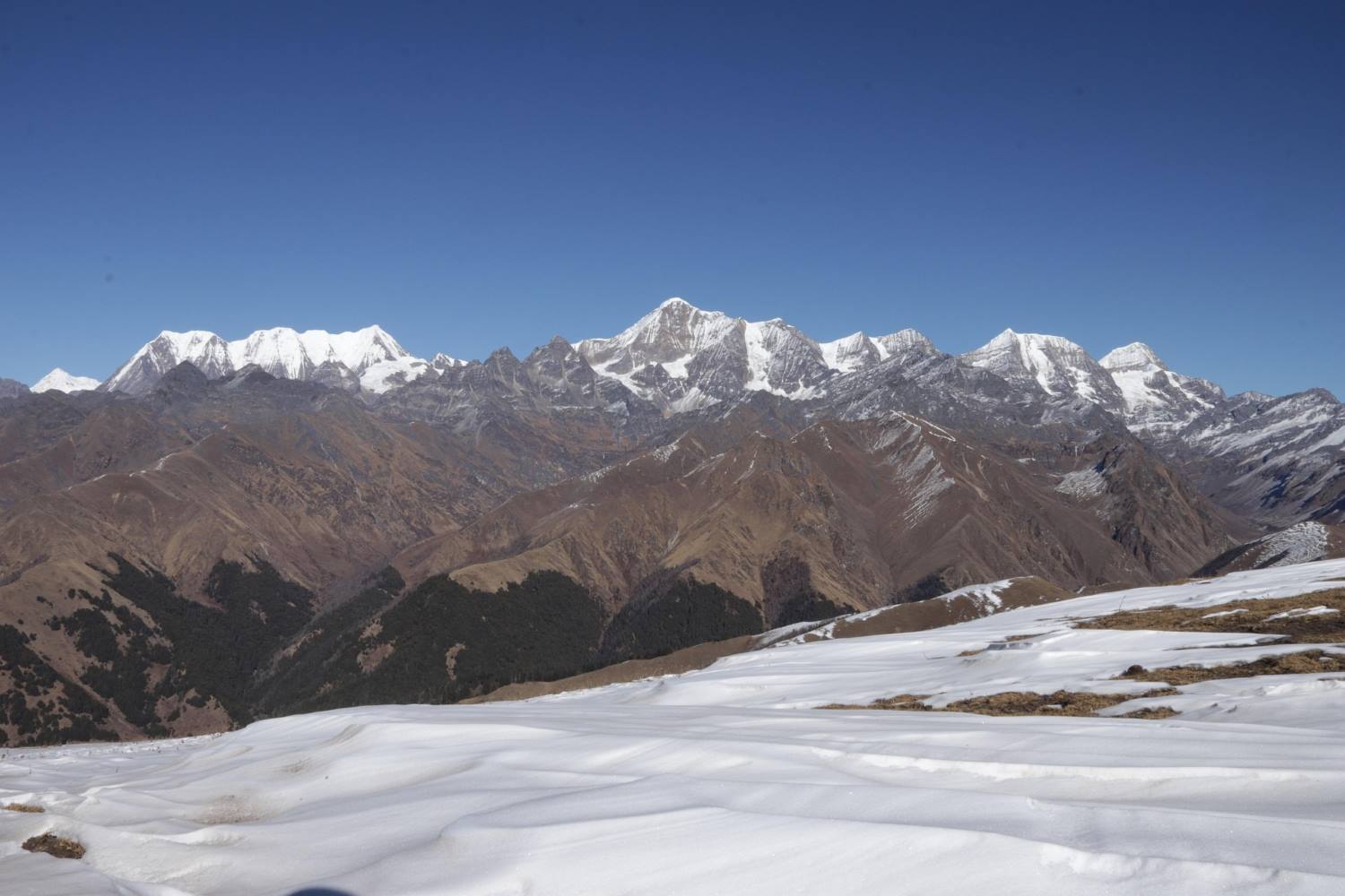
Dolpo Nepal Trekking Adventure for 2026
The Last Frontier: An In-Depth Guide to Trekking in Nepal’s Distant Dolpo Region
For seasoned adventurers who have already crossed the Thorong La or stood at Everest Base Camp, the well-trodden trails of the Annapurna and Khumbu regions can sometimes feel a bit too familiar. If you are seeking a profound return to raw, untouched wilderness, Nepal still guards an untamed frontier. Located in the remote mid-western reaches of the country and bordered by the Tibetan Plateau to the north, lies the mystical, restricted region of Dolpo.
Dolpo is not a standard trekking destination. It is a vast, high-altitude desert oasis defined by deep-blue turquoise lakes, ancient Bon monasteries, and grueling mountain passes. Immortalized by Peter Matthiessen’s 1978 National Book Award-winning travelogue The Snow Leopard and Eric Valli’s 1999 Oscar-nominated film Himalaya, Dolpo offers a rare, living window into a centuries-old Tibetan lifestyle that remains thoroughly insulated from modern globalization.
If you are looking for a true wilderness expedition, this guide outlines everything you need to know about navigating the geography, culture, and logistics of the Dolpo region.
Geographic and Cultural Landscape: What Makes Dolpo Unique?
Unlike the teahouse-centric infrastructures of eastern and central Nepal, trekking in Dolpo demands a fully self-sufficient expedition mentality. The region is physically and culturally distinct from the rest of the country due to several key factors:
1. The Trans-Himalayan Rain-Shadow Advantage
Dolpo sits directly behind the massive Dhaulagiri massif (8,167m), which acts as a colossal meteorological barrier. This unique positioning places Dolpo in a trans-Himalayan rain shadow. Consequently, while the rest of mainland Nepal is heavily drenched by south Asian monsoon rains from June to August, Dolpo remains dry, arid, and highly trekable. This makes it one of the premier summer trekking destinations in Asia, offering barren, canyon-like landscapes reminiscent of Tibet.
2. The Living Sanctuary of Pre-Buddhist Bon-Po Culture
Culturally, Dolpo is a living museum. It is one of the last remaining enclaves on Earth where the ancient Bon-Po religion—a shamanistic, animistic faith that predated Buddhism in Tibet—is actively practiced alongside Tibetan Buddhism. As you walk through villages, you will notice Bon monasteries (Gompas) where trekkers must circumambulate shrines counter-clockwise, rather than the clockwise direction practiced by traditional Buddhists.
3. Uncompromised Wilderness Ecosystems
There are no luxury lodges, heated dining halls, or stable cellular networks here. Trekking through Dolpo requires a classic wilderness setup: camping in high-altitude meadows under pristine skies, relying on mule trains for logistics, and traversing the Shey Phoksundo National Park—Nepal's largest national park. The park serves as a critical habitat for endangered wildlife, including the Himalayan blue sheep (bharal) and the elusive snow leopard.
Understanding the Routes: Lower vs. Upper Dolpo
The region is administratively and geographically split into two distinct sectors. Choosing between them depends on your budget, timeframe, and physical conditioning.
-
The Lower Dolpo Circuit (Approx. 14–18 Days): This route serves as a magnificent introduction to the region’s biodiversity. It transitions from lush pine, bamboo, and cedar forests into stark alpine environments. The crown jewel of this trek is Phoksundo Lake, a mesmerizing alpine lake sitting at 3,611 meters, famed for its deep, shifting turquoise hues and the fact that it is completely devoid of aquatic life. This loop requires crossing two challenging high passes: Numa La (5,309m) and Baga La (5,169m), before dropping into the unique, flat-roofed mudbrick village of Dho Tarap—one of the highest permanent human settlements on earth.
-
The Upper Dolpo Circuit (Approx. 24–28 Days): For those seeking an epic, once-in-a-lifetime Himalayan odyssey, Upper Dolpo crosses far north into the restricted inner valleys near the Tibetan border. This demanding route takes you beyond Phoksundo Lake and across the grueling Kang La Pass (5,360m) to reach Shey Gompa, a 12th-century monastery nestled at the base of the sacred Crystal Mountain (a peak embedded with marine fossils, circumambulated by hundreds of pilgrims annually).
Essential Logistics and Permit Framework
Because Dolpo shares a sensitive border with Tibet and hosts highly fragile cultural ecosystems, independent trekking is strictly forbidden. You must book through a registered Nepalese trekking agency, hire a licensed guide, and travel with a minimum of two people in your group to secure government permits.
-
Permit Costs: * Lower Dolpo: Requires a restricted area permit costing $20 USD per person, per week.
-
Upper Dolpo: Requires a highly exclusive Department of Immigration permit costing $500 USD per person for the first 10 days, and $50 USD per day for every day thereafter.
-
Additionally, a Shey Phoksundo National Park entry permit (approx. $30 USD) is mandatory for both regions.
-
-
Getting There: The journey is a multi-step transit. Trekkers typically fly from Kathmandu to the sub-tropical lowland city of Nepalgunj. The following morning, a thrilling mountain flight brings you into the short, gravel airstrip of Juphal (2,475m) in western Nepal, which serves as the official trailhead. Because these mountain flights are entirely weather-dependent, building 2 to 3 buffer days into your travel itinerary is strongly advised.
Thoughts
A trek into Dolpo is far more than a physical endurance test; it is an active step back in time. It demands mental resilience, a willingness to disconnect entirely from modern conveniences, and a deep respect for an isolated culture. For the select few willing to make the journey, the reward is an unparalleled sense of solitude, dramatic trans-Himalayan vistas, and a rare look at a frontier that remains largely hidden from the rest of the world.
Strategic Route Selection: Lower Dolpo vs. Upper Dolpo
The Dolpo region is geographically and administratively bifurcated into two primary trekking circuits. Choosing between them dictates not only the duration and physical demands of your expedition, but also the specific ecological zones and cultural depths you will experience.
1. The Lower Dolpo Circuit (14–18 Days)
Overview & Terrain Dynamics Lower Dolpo serves as an excellent introduction to the region's geographical diversity. This circuit cuts through the lower valleys of the Shey Phoksundo National Park, acting as a transitional corridor. Trekkers experience a dramatic ecological shift: starting in lush subtropical forests of pine, oak, and giant cedar, the trail climbs alongside the raging waters of the Bheri and Phoksundo rivers before breaking through the tree line into stark, arid trans-Himalayan landscapes.
Key Technical & Cultural Highlights:
-
Phoksundo Lake (3,611m): The undisputed centerpiece of the trek. This alpine, oligotrophic lake is famous for its striking turquoise color—a result of its extreme depth (reaching up to 145 meters) and the lack of organic matter or aquatic life. On its southern cliffs sits Ringmo Village, a traditional settlement where you can observe centuries-old Bon-Po practices.
-
The High Mountain Passes: The trek features two grueling, consecutive high-altitude passes:
-
Baga La (5,169m): Known for its steep, rocky switchbacks that offer panoramic views of the Kanjirowa Himalayan range.
-
Numa La (5,309m): A demanding, windswept saddle that provides sweeping views of Dhaulagiri ($8,167\text{m}$) to the south and the barren Tibetan peaks to the north.
-
-
Dho Tarap (4,080m): After crossing the passes, you descend into this remarkable valley. Composed of several clustered mudbrick villages, Dho Tarap is recognized as one of the highest permanently inhabited human settlements on Earth. It serves as a vital trade junction where local Dolpo-pa combine agro-pastoral farming (mostly barley and buckwheat) with trans-Himalayan yak caravans.
2. The Upper Dolpo Circuit (24–28 Days)
Overview & Terrain Dynamics For elite trekkers seeking a true world-class wilderness expedition, Upper Dolpo extends far north into the restricted inner valleys adjacent to the Tibetan border. This route requires exceptional physical conditioning and mental resilience, as it spends weeks entirely cut off from modern infrastructure. The landscape here is an extension of the Tibetan Plateau—a high-altitude desert characterized by wind-eroded canyons, massive scree slopes, and extreme exposure to the elements.
Key Technical & Cultural Highlights:
-
The Kang La Pass (5,360m): To enter the inner sanctuary of Upper Dolpo from Phoksundo Lake, trekkers must scale this formidable pass. The ascent involves navigating steep, unstable scree fields, but the summit rewards climbers with a stark, birds-eye view of the forbidden landscapes stretching toward Tibet.
-
The Sacred Shrine of Shey Gompa (4,160m): Nestled on the other side of Kang La, this legendary 12th-century monastery belongs to the Kagyupa sect of Tibetan Buddhism. It is the spiritual heart of Dolpo.
-
The Crystal Mountain (Shel-ri): Shey Gompa sits at the base of this mystical peak. The mountain gets its name from its unique geological composition—its cliffs are heavily laced with veins of quartz and marine fossils, proving the region was once an ancient ocean floor (the Tethys Sea). Every year during the full moon of late summer, pilgrims travel here to complete a holy kora (circumambulation) around the mountain.
-
The Isolated Northern Villages (Saldang and Yangjer Gompa): The return loop winds through Saldang (3,620m), the largest village cluster in Upper Dolpo. This arid valley remains highly dependent on the traditional salt trade. Local traders navigate caravan routes over high passes to trade Tibetan rock salt for grain from the middle hills of Nepal, maintaining a barter economy that has vanished virtually everywhere else in the world.
Summary Comparison
| Factor | Lower Dolpo Circuit | Upper Dolpo Circuit |
| Average Duration | 14 to 18 Days | 24 to 28 Days |
| Max Elevation | $5,309 (Numa La) | $5,360 (Kang La) |
| Permit Cost | $20 USD / week | $500 USD for first 10 days (+ $50/day after) |
| Terrain Style | Forested gorges to alpine valleys | High-altitude trans-Himalayan desert |
| Primary Culture | Mixed Bon-Po and Tibetan Buddhist | Deeply isolated Tibetan Buddhist & Nomad |
| Physical Difficulty | Strenuous | Extreme / Expedition Level |
Expedition Logistics & Operational Realities: What to Expect
Trekking in the Dolpo region requires shifting your mindset from the modern, commercialized tea-house trekking found in Everest or Annapurna to that of a full-scale, self-sufficient wilderness expedition.
Accommodations & Field Logistics
Because infrastructure in this remote corner of western Nepal is minimal, your daily life on the trail relies heavily on a synchronized support crew.
-
The Expedition Framework: While a handful of rudimentary local homestays have emerged in Ringmo (near Phoksundo Lake) and Dho Tarap, they lack standard amenities like hot showers, indoor plumbing, or electricity. Therefore, the vast majority of both Lower and Upper Dolpo itineraries are operated as fully supported camping treks.
-
Crew Architecture: Your expedition team will typically outnumber the trekkers. A registered agency coordinates a licensed mountain guide, a camp chef, kitchen assistants, and local muleteers.
-
Daily Operations: A train of pack mules or yaks transports your heavy duffel bags, mess tents, sleeping tents, kitchen equipment, and fresh food supplies for the entire duration. While you hike with a light daypack, the crew ahead moves swiftly to pitch camp and prepare fresh, three-course hot meals daily, prioritizing high-carbohydrate and nutrient-dense foods to fuel high-altitude exertion.
-
Power & Connectivity: Cellular service is virtually non-existent past Juphal. Satellite phones or Garmin inReach devices are mandatory for emergency communication. For power, you must rely entirely on personal, portable solar panels to charge camera batteries and devices, as there is no grid electricity.
Aviation Transit & Geographic Access
Reaching the remote trailhead of Dolpo is an multi-stage aviation challenge where itineraries must remain flexible.
-
Flight 1: Kathmandu (KTM) to Nepalgunj (KEP): You begin with a standard domestic flight from Kathmandu down to the sub-tropical plains of the Terai region along the Indian border. Trekkers typically overnight in Nepalgunj.
-
Flight 2: Nepalgunj (KEP) to Juphal (VNJ): Early the following morning, you board a small, twin-otter turboprop plane for a dramatic, 35-minute mountain flight. This flight maneuvers through deep river gorges and ascends into the mountains, landing on a short, bench-like mountain airstrip at Juphal (2,475m).
Critical Advisory: The flight from Nepalgunj to Juphal operates strictly under visual flight rules (VFR). High winds, mountain fog, or cloud cover in the passes can instantly ground flights for days at a time. It is vital to build at least 2 to 3 contingency buffer days into your international travel itinerary to account for potential weather delays.
Regulatory Permits & Legal Compliance
Due to Dolpo’s proximity to the sensitive international border with Tibet and its fragile cultural heritage, the Department of Immigration strictly regulates access. Independent trekking (FIT) is completely illegal. To obtain the necessary permits, you must go through an authorized Nepalese trekking agency, travel with a minimum of two trekkers, and be accompanied by a licensed guide.
The permit system is strictly tiered based on your route:
-
Shey Phoksundo National Park Entry Fee: Mandatory for all visitors at approximately $30 USD (RS 3,000) per person.
-
Lower Dolpo Restricted Area Permit: Costs $20 USD per person, per week.
-
Upper Dolpo Special Restricted Area Permit: This is one of the most exclusive and expensive permits in Nepal. It costs $500 USD per person for the first 10 days, plus an additional $50 USD per person for every day thereafter.
Seasonal Climate Analysis: When to Go
Dolpo’s unique geography creates a climate profile that differs drastically from the rest of mainland Nepal, making it an excellent alternative during months when other trails are inaccessible.
-
Spring (April to May): A transitional window. Temperatures in the valleys range from 10°C to 20°C during the day, though nights drop below freezing above 4,000 meters. The lower valleys burst into color with blooming rhododendrons and alpine wildflowers. However, early spring trekkers may still encounter heavy winter snow blocking the high passes like Numa La or Kang La.
-
Summer / Monsoon (June to August): While the rest of Nepal experiences heavy downpours, muddy trails, and obscured mountain views, this is prime trekking season for Dolpo. Safe behind the Dhaulagiri rain shadow, Dolpo enjoys clear, dry weather. This season coinciding with peak agricultural activity—local communities are out farming barley fields and herding livestock, making it the most vibrant cultural window.
-
Autumn (September to November): The most stable weather window for high-altitude pass crossings. The post-monsoon air is incredibly crisp, offering unparalleled visibility of the Dhaulagiri and Kanjirowa massifs. Daytime temperatures are highly comfortable for hiking, though night temperatures above 4,000 meters plunge significantly down to -10°C or -15°C.
Final Thoughts
Embarking on a journey through the Dolpo region is not merely a strenuous physical challenge; it is an immersive exercise in time travel. It demands physical endurance, mental resilience to handle isolation, and deep cultural humility. For the select few travelers willing to navigate the strict permits, unpredictable flights, and rigorous camping conditions, the payoff is unparalleled: absolute solitude on the trail, intact ancient traditions, and a rare look at a Himalayan frontier that remains fiercely independent of the modern world.
Read more... Read less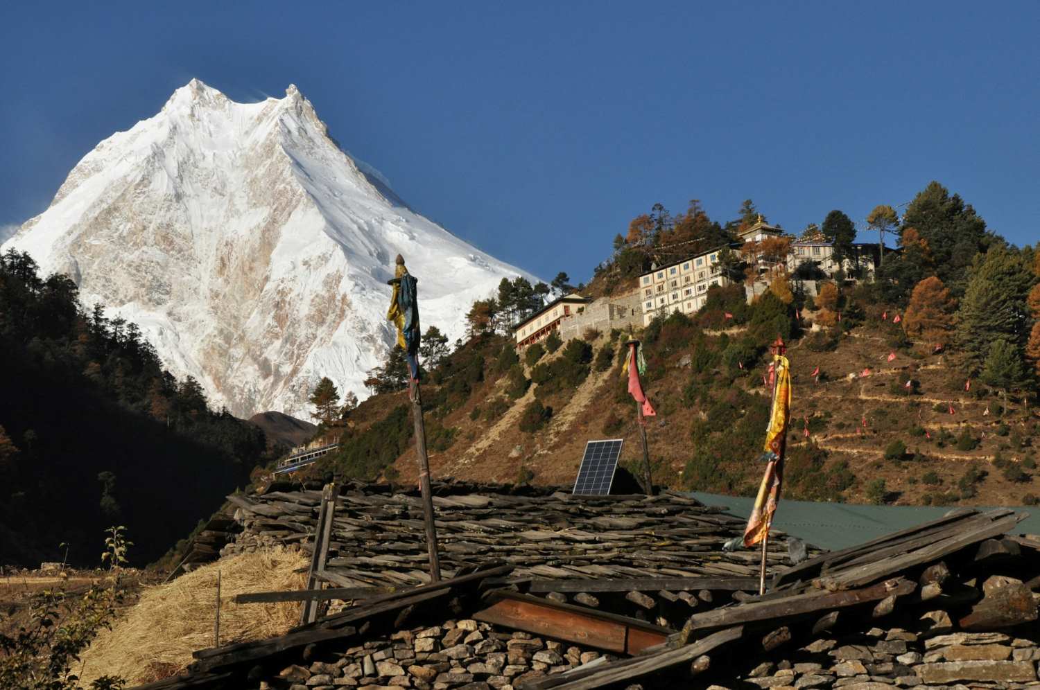
Manaslu Circuit Trek 2026
The Ultimate Guide to the Manaslu Circuit Trek: Nepal’s Most Spectacular Off-the-Beaten-Path Adventure
If you have ever dreamed of trekking through the raw, untouched wilderness of the Himalayas—far from the busy trails of the Everest Base Camp Trek or the commercialized sections of the Annapurna region—the Manaslu Circuit Trek offers one of the most authentic mountain adventures in Nepal.
Encircling Mount Manaslu, the world’s eighth-highest mountain at 8,163 meters (26,781 feet), this remarkable trekking route combines dramatic Himalayan scenery, remote Tibetan-influenced culture, high mountain passes, glacial valleys, and pristine forests into one unforgettable journey.
Often described as the “best alternative to the Annapurna Circuit,” the Manaslu route remains far less crowded due to its status as a government-designated restricted region. The result is a trekking experience that feels wild, authentic, and deeply connected to both nature and local Himalayan traditions.
Why Choose the Manaslu Circuit Trek?
1. A Truly Remote Himalayan Experience
Unlike Nepal’s more crowded trekking regions, the Manaslu Circuit still feels unexplored. Foreign trekkers were only allowed into the area in 1991, and strict permit regulations continue to limit visitor numbers.
This controlled tourism helps preserve:
- Ancient mountain cultures
- Fragile alpine ecosystems
- Traditional village lifestyles
- Undisturbed trekking trails
For trekkers seeking solitude, authenticity, and raw Himalayan beauty, the Manaslu region delivers an experience that is increasingly difficult to find elsewhere in Nepal.
2. Incredible Geographic Diversity
One of the greatest highlights of the Manaslu Circuit is the dramatic change in landscapes throughout the journey.
Within just two weeks, trekkers experience:
Subtropical River Valleys
The trek begins in the lower Budhi Gandaki valley, where lush forests, cascading waterfalls, suspension bridges, and terraced rice fields dominate the scenery.
Deep Himalayan Gorges
As the trail climbs higher, the Budhi Gandaki River cuts through steep canyon walls surrounded by towering cliffs and hidden villages.
Alpine Forests and Yak Pastures
Midway through the trek, pine forests, juniper trees, and high-altitude grazing lands begin to replace subtropical vegetation.
Glacier Landscapes
Near the upper Manaslu region, the scenery transforms into a dramatic alpine world filled with glaciers, frozen streams, and rugged mountain terrain.
High Mountain Passes
The crossing of Larkya La Pass at 5,106 meters is considered one of Nepal’s most spectacular Himalayan passes, offering panoramic views of Himlung Himal, Cheo Himal, Kang Guru, and Annapurna II.
3. Deep Cultural Immersion
The Manaslu region is not only geographically diverse—it is also culturally extraordinary.
Lower Region Communities
In the lower valleys, trekkers pass through traditional settlements inhabited by Gurung, Magar, and Tamang communities. These villages feature:
- Stone houses
- Terraced farms
- Local tea houses
- Traditional agriculture
- Warm Nepalese hospitality
Tibetan Buddhist Heritage
As you ascend toward the Tibetan border, the culture shifts dramatically. The upper Manaslu region shares deep historical and spiritual ties with Tibet.
You will encounter:
- Ancient monasteries (Gompas)
- Chortens and mani walls
- Prayer wheels
- Colorful prayer flags
- Monks in traditional robes
- Tibetan-style architecture
Villages such as Samagaon and Samdo provide a rare glimpse into Himalayan Buddhist life that has remained largely unchanged for centuries.
Highlights of the Manaslu Circuit Trek
Spectacular Mountain Views
The trek offers close-up views of some of the Himalayas’ most impressive peaks, including:
- Mount Manaslu (8,163m)
- Himalchuli
- Ngadi Chuli
- Ganesh Himal
- Annapurna II
- Cheo Himal
On clear mornings, the snow-covered peaks glow brilliantly under the Himalayan sunrise.
Crossing Larkya La Pass (5,106m)
The crossing of Larkya La is the physical and emotional high point of the trek.
Trekkers begin before sunrise, climbing gradually over icy moraine and snow-covered trails before reaching the prayer-flag-covered summit of the pass.
From the top, you are rewarded with:
- 360-degree Himalayan panoramas
- Massive glacier views
- Dramatic icefalls
- Rugged alpine scenery
- One of Nepal’s finest high-pass trekking experiences
Although challenging, the pass is considered non-technical and achievable for fit trekkers with proper acclimatization.
Manaslu Base Camp Excursion
Most itineraries include an acclimatization day at Samagaon, where trekkers can hike to Manaslu Base Camp.
This optional side trip offers:
- Stunning glacier views
- Close-up perspectives of Mount Manaslu
- Alpine lakes and yak pastures
- Excellent acclimatization benefits
Another popular acclimatization hike leads to the sacred Birendra Lake, known for its striking turquoise waters.
Best Time to Trek the Manaslu Circuit
Spring (March–May)
Spring is one of the most popular seasons due to:
- Stable weather
- Clear mountain views
- Blooming rhododendron forests
- Moderate temperatures
Temperatures are comfortable at lower elevations, while higher regions remain cold but manageable.
Autumn (September–November)
Autumn is widely considered the best trekking season in Nepal.
Advantages include:
- Crystal-clear skies
- Dry trails
- Excellent visibility
- Stable mountain weather
- Comfortable trekking temperatures
This season also coincides with major Nepali festivals such as Dashain and Tihar.
Winter (December–February)
Winter trekking is possible but far more demanding.
Challenges include:
- Heavy snowfall
- Freezing temperatures
- Risk of Larkya La closure
- Limited tea house availability
Only experienced trekkers should consider winter departures.
Monsoon (June–August)
The summer monsoon brings:
- Heavy rain
- Landslides
- Leeches in lower forests
- Poor visibility
However, upper Manaslu lies partly in a rain-shadow area, meaning some experienced trekkers still visit during this period.
Required Permits for the Manaslu Trek
Because the Manaslu region is restricted, trekkers need multiple permits:
- Manaslu Restricted Area Permit (MRAP)
- Manaslu Conservation Area Permit (MCAP)
- Annapurna Conservation Area Permit (ACAP)
Trekkers must also:
- Travel with a licensed guide
- Trek in a group of at least two people
- Arrange permits through a registered Nepal trekking agency
Accommodation and Food
The Manaslu Circuit is now a well-established tea-house trek, though facilities remain more basic than Everest or Annapurna.
Accommodation
Typical tea houses provide:
- Twin-sharing rooms
- Foam mattresses
- Shared bathrooms
- Limited hot showers
- Charging facilities (often extra cost)
Higher elevations offer more basic conditions.
Food Options
Common meals include:
- Dal Bhat (Nepal’s staple meal)
- Fried rice
- Noodles
- Tibetan bread
- Momos
- Pancakes
- Soups and tea
Dal Bhat remains the best option for energy and nutrition during long trekking days.
Difficulty Level
The Manaslu Circuit Trek is considered a moderate to challenging trek.
Main Challenges
- Long daily walking hours
- High altitude
- Steep ascents and descents
- Cold temperatures near the pass
- Remote terrain
No technical climbing skills are required, but good physical fitness and proper acclimatization are essential.
Most trekkers complete the circuit in 13–17 days depending on side trips and acclimatization schedules.
Thoughts
The Manaslu Circuit Trek is one of Nepal’s most rewarding Himalayan adventures. It combines the grandeur of the high Himalayas with rich Tibetan culture, remote mountain villages, ancient monasteries, dramatic river gorges, and one of the finest mountain passes in the country.
For trekkers seeking an experience that feels authentic, adventurous, and far removed from crowded tourist trails, the Manaslu Circuit stands among the very best trekking routes in the world.
Key Highlights of the Manaslu Circuit Trek Crossing the Legendary Larkya La Pass (5,106m / 16,752ft)
The crossing of Larkya La Pass is the defining moment of the entire Manaslu Circuit Trek and one of the most dramatic high mountain passes in Nepal. Trekkers usually begin the ascent before dawn, navigating frozen trails, glacial moraines, and rocky alpine terrain under a sky filled with stars. As the sun rises, the surrounding Himalayan giants gradually illuminate, creating one of the most unforgettable mountain panoramas in the country. From the summit of the pass, trekkers are rewarded with breathtaking views of: Himlung Himal Cheo Himal Kang Guru Annapurna II Mount Manaslu Although the pass is non-technical, it is physically demanding due to: Thin high-altitude air Strong mountain winds Long trekking hours Snow and ice during colder months Steep descents toward Bimthang For many trekkers, crossing Larkya La becomes the emotional and spiritual highlight of the journey. Sama Gaon & Samdo: Windows into Tibetan Himalayan Life The villages of Samagaon and Samdo offer one of the richest cultural experiences anywhere in the Nepal Himalayas. Located close to the Tibetan border, these high-altitude settlements preserve centuries-old Tibetan Buddhist traditions that remain deeply woven into daily life. What Makes Sama Gaon Special? Sama Gaon serves as the primary acclimatization stop on the trek and is surrounded by spectacular Himalayan scenery. Highlights include: Traditional stone-built Tibetan homes Ancient monasteries and mani walls Yak caravans and grazing pastures Prayer wheels and fluttering prayer flags Stunning glacier views beneath Mount Manaslu The village is also the gateway to several rewarding side hikes. Popular Side Trips from Sama Gaon Manaslu Base Camp A challenging but rewarding hike reaching approximately 4,800 meters. The route passes glaciers, rocky moraines, and alpine landscapes while offering close-up views of Mount Manaslu. Birendra Lake A beautiful glacial lake famous for its turquoise water and dramatic mountain backdrop. This shorter acclimatization hike is ideal for trekkers wanting a lighter day. Pungyen Gompa An ancient monastery hidden beneath the towering Manaslu Glacier. The trail to the monastery offers extraordinary mountain scenery and a peaceful spiritual atmosphere. Optional Detours: Tsum Valley & Serang Gompa For trekkers seeking deeper cultural immersion and spiritual solitude, the Manaslu Circuit can be extended into some of Nepal’s most mystical Himalayan valleys. Tsum Valley — The Hidden Valley of Happiness Tsum Valley remained isolated from the outside world for centuries and was only opened to trekkers in 2008. Strongly influenced by Tibetan Buddhism, the valley is renowned for its sacred monasteries, remote villages, and peaceful atmosphere. Trekkers visiting Tsum Valley can experience: Ancient Buddhist monasteries Remote cliffside villages Traditional Tibetan culture Sacred caves used by Buddhist saints Spectacular Ganesh Himal views The valley is considered a spiritual sanctuary where non-violence and compassion are deeply respected cultural values. Serang Gompa Hidden within dense alpine forests, Serang Gompa is believed to be more than 500 years old and remains one of the region’s most isolated monasteries. This detour offers: A quieter alternative trail Remote forest landscapes Opportunities to interact with monks Deep spiritual tranquility Authentic Himalayan monastery life Typical 14-Day Manaslu Circuit Itinerary While itineraries vary depending on fitness, acclimatization, and side trips, the classic 14-day route offers the ideal balance of adventure, altitude adaptation, and cultural exploration. Day 1: Drive from Kathmandu to Maccha Khola (890m) Your adventure begins with a long but scenic drive from Kathmandu toward the remote Gorkha region. Highlights include: Trishuli River scenery Terraced farmland Rural Nepali villages Mountain highways and off-road sections The final stretch beyond Arughat is rough, dusty, and adventurous, especially during monsoon season. Day 2: Trek from Maccha Khola to Jagat (1,410m) The trail follows the roaring Budhi Gandaki River through narrow gorges, subtropical forests, and traditional settlements. Highlights: Suspension bridge crossings Hot springs at Tatopani Waterfalls and river cliffs Stone staircases carved into hillsides Jagat also marks the official checkpoint for the restricted Manaslu region. Day 3: Trek from Jagat to Deng (1,804m) As the trail climbs higher, the cultural atmosphere gradually shifts toward Tibetan influence. Trekkers pass: Buddhist prayer walls Pine forests Landslide sections Deep river canyons The scenery becomes increasingly dramatic and remote. Day 4: Trek from Deng to Namrung (2,630m) This section introduces trekkers to the first major Himalayan panoramas. Highlights include: Traditional Tibetan architecture Forested ridgelines Views of snow-covered peaks Ancient monasteries Namrung is known for its peaceful atmosphere and beautiful mountain scenery. Day 5: Trek from Namrung to Shyala (3,480m) This is one of the most visually spectacular trekking days. As you climb above the tree line, giant Himalayan peaks dominate the skyline. Trekkers enjoy incredible views of: Mount Manaslu Himalchuli Ngadi Chuli Ganesh Himal Shyala is widely considered one of the best mountain-view villages on the route. Day 6: Trek from Shyala to Sama Gaon (3,530m) A shorter trekking day allows time to explore monasteries and local culture. Optional visits include: Pungyen Gompa Local yak pastures Traditional Tibetan homes The altitude becomes more noticeable here, so slow pacing and hydration are essential. Day 7: Acclimatization Day at Sama Gaon This important rest day helps your body adapt to the increasing altitude. Recommended acclimatization hikes include: Manaslu Base Camp Birendra Lake Pungyen Gompa Proper acclimatization greatly reduces the risk of altitude sickness before crossing Larkya La Pass. Day 8: Trek from Sama Gaon to Samdo (3,870m) A relatively short trekking day leads to the remote Tibetan-origin village of Samdo. Highlights include: Expansive alpine landscapes Yak caravans Tibetan refugee heritage Border trade history The surrounding scenery feels wild, barren, and deeply Himalayan. Day 9: Trek from Samdo to Dharamsala / Larkya Phedi (4,460m) This short but important day positions trekkers below Larkya La Pass. The environment becomes increasingly rugged with: Glacier valleys Rocky slopes Strong winds Sparse vegetation Early sleep and preparation are critical for the next day’s pass crossing. Day 10: Cross Larkya La Pass & Descend to Bimthang (3,700m) This is the toughest and most rewarding day of the trek. Expect: 8–10 hours of trekking Pre-dawn departure High-altitude conditions Snow and icy trails Steep descent into Bimthang Reaching the summit of Larkya La is a major achievement for trekkers. Day 11: Trek from Bimthang to Tilje (2,300m) After the harsh alpine environment, the trail descends into beautiful forests filled with rhododendron, pine, and oak trees. The warmer temperatures and greener landscapes feel dramatically different from the upper Himalayas. Day 12: Trek to Dharapani or Tal & Drive to Besisahar The trail officially connects with the famous Annapurna Circuit route before driving toward Besisahar. Day 13–14: Drive Back to Kathmandu The journey concludes with a scenic return drive through central Nepal’s hills, rivers, and villages. Essential Logistics & Trekking Regulations Because the Manaslu region borders Tibet and falls within both the Manaslu and Annapurna conservation zones, trekking regulations are strictly controlled. Independent solo trekking is currently prohibited. Mandatory Requirements for the Manaslu Circuit Trek Licensed Guide Requirement All trekkers must hire a government-licensed trekking guide through a registered Nepali trekking agency. Guides provide: Safety and navigation Permit management Local cultural knowledge Emergency support Communication assistance Minimum Group Size To obtain the Restricted Area Permit (RAP), trekkers must travel in a minimum group of two people. Solo travelers typically join existing groups through trekking agencies. Required Permits 1. Manaslu Restricted Area Permit (RAP) This special permit is mandatory because the region lies near the Tibetan border. Permit Costs: September–November: USD $100 for the first 7 days Additional days: Extra daily charges apply December–August: Lower seasonal pricing 2. Manaslu Conservation Area Permit (MCAP) Required for entry into the protected Manaslu conservation region. Approximate Cost: Around NPR 3,000 per person 3. Annapurna Conservation Area Permit (ACAP) Necessary because the trek exits through the Annapurna region after crossing Larkya La. Approximate Cost: Around NPR 3,000 per person These permit fees help support conservation projects, local communities, and sustainable tourism initiatives throughout the Himalayan region. Tea House Experience on the Manaslu Circuit Trek The Manaslu Circuit Trek is a classic Himalayan tea house trek, meaning trekkers stay in locally operated mountain lodges rather than camping. While the infrastructure has improved significantly in recent years, accommodation remains far more basic and authentic compared to the Everest or Annapurna regions. For many trekkers, this simplicity becomes one of the most memorable aspects of the journey, offering a genuine connection to local Himalayan life. What to Expect in Tea Houses Rooms & Sleeping Conditions Most tea houses provide: Twin-sharing rooms with simple wooden beds Foam mattresses, pillows, and basic blankets Thin plywood or stone walls with minimal insulation Shared bathrooms and toilets Communal dining halls heated by yak-dung stoves At lower elevations, some tea houses offer attached bathrooms and hot showers, but facilities become increasingly basic as you climb higher toward Larkya La Pass. In villages such as Dharamsala or Larkya Phedi, accommodation is extremely simple due to the remote high-altitude environment. Toilet Facilities Trekkers may encounter both: Western-style toilets Traditional squat toilets Toilet paper is rarely provided, so carrying your own is essential. Food on the Trail Despite the remote setting, tea houses provide surprisingly filling and nutritious meals designed for long trekking days. Most Common Meals Dal Bhat Nepal’s famous staple meal consisting of: Lentil soup Rice Seasonal vegetables Pickles Occasionally potatoes or curry A major advantage of Dal Bhat is the unlimited refill system commonly offered in tea houses, making it the best high-energy meal for trekkers. Other Popular Foods You will also commonly find: Momos (Nepali dumplings) Fried rice Garlic soup Tibetan bread Noodles and pasta Pancakes and porridge Eggs and potatoes Tea, coffee, and hot lemon drinks Garlic soup is particularly popular at high altitude because many trekkers believe it helps support acclimatization. Power, Wi-Fi & Connectivity Electricity is available in most villages, but charging devices usually comes with an additional fee. Important Things to Know Charging Costs Increase with Altitude The higher you go, the more expensive charging becomes because electricity is generated through small hydro systems or solar panels. Wi-Fi Availability Basic Wi-Fi is available in some villages, especially: Namrung Samagaon Samdo However, connections are often: Slow Weather dependent Unstable at high elevations Near Dharamsala and Larkya La Pass, internet access may disappear completely. Essential Recommendation Always carry: A high-capacity power bank Spare charging cables Solar charger (optional) Offline maps and downloaded documents Cold temperatures drain batteries quickly, so keep electronics inside your sleeping bag at night. Drinking Water & Staying Hydrated Hydration is critical for preventing altitude sickness and maintaining energy during the trek. Best Water Practices Instead of constantly buying plastic bottles, trekkers are encouraged to carry: Reusable water bottles Insulated flasks Water purification tablets Portable water filters or UV purifiers Most tea houses provide boiled drinking water for a small fee. Using reusable bottles helps: Reduce plastic pollution Lower trekking costs Support sustainable tourism practices At higher elevations, warm water inside insulated bottles also helps prevent freezing. Cash Is Essential There are no reliable ATMs anywhere along the Manaslu Circuit route. Once you leave Kathmandu, cash withdrawal options become extremely limited or nonexistent. Expenses Trekkers Often Forget Bring enough Nepalese Rupees for: Hot showers Battery charging Wi-Fi access Snacks and drinks Extra meals Tips for guides and porters Emergency expenses Carrying small denominations is highly recommended because remote villages may struggle to provide change. Physical Preparation: Can You Handle the Manaslu Circuit? The Manaslu Circuit Trek is considered a moderate to challenging Himalayan trek, but it is highly achievable for trekkers who prepare properly. Unlike technical mountaineering expeditions, the trek requires no climbing experience. However, it demands endurance, mental resilience, and proper altitude awareness. Why the Trek Is Challenging Trekkers typically walk: 5–8 hours daily Up to 10–12 hours on Larkya La Pass day Challenges include: Steep stone staircases Rocky and uneven terrain Glacier crossings High altitude Cold temperatures Long descents Thin oxygen levels above 5,000 meters At the altitude of Larkya La Pass, oxygen availability drops by nearly 40% compared to sea level, making even slow walking physically demanding. Recommended Training Plan Start Training Early Ideally, begin preparing: 12–16 weeks before departure Consistency matters far more than extreme workouts. Focus on Cardiovascular Fitness Strong cardiovascular endurance helps your body perform efficiently in low-oxygen environments. Recommended Activities Running Cycling Swimming Stair climbing Hiking Incline treadmill walking Aim for: 3–4 cardio sessions weekly 45–90 minutes per session Build Lower-Body Strength Your legs carry you through thousands of uphill and downhill steps. Key Exercises Squats Lunges Step-ups Deadlifts Calf raises Wall sits Core training is equally important for backpack stability and posture. Practice Hiking with Weight One of the best preparations is hiking with a loaded backpack similar to what you will carry in Nepal. Recommended Practice Backpack weight: 10–12kg Train on uneven terrain Hike consecutive days when possible Wear your trekking boots during training This helps: Toughen muscles and joints Reduce blister risk Improve stamina Simulate real trail fatigue Altitude Awareness & Acclimatization Altitude sickness can affect anyone regardless of age or fitness level. Common Symptoms Headache Nausea Dizziness Loss of appetite Fatigue Difficulty sleeping The key prevention strategies are: Slow ascent Proper hydration Acclimatization days Avoiding alcohol Listening to your guide The acclimatization stop at Samagaon plays a crucial role in preparing trekkers for the higher elevations ahead.Final Thoughts
The Manaslu Circuit Trek is far more than a mountain hike—it is an immersive journey through remote Himalayan wilderness, ancient Tibetan Buddhist culture, and some of Nepal’s most dramatic alpine landscapes. From crossing the windswept heights of Larkya La Pass to sharing tea with local villagers beneath towering Himalayan peaks, every day on the trail delivers a sense of adventure that feels increasingly rare in the modern world. The trek demands preparation, patience, and respect for the mountains. Yet for those willing to embrace the physical challenge, basic tea house comforts, and unpredictable Himalayan conditions, the rewards are extraordinary. For many trekkers, the Manaslu Circuit becomes more than just a trekking route—it becomes a life-changing Himalayan experience that leaves a lasting connection to Nepal’s mountains, cultures, and wilderness.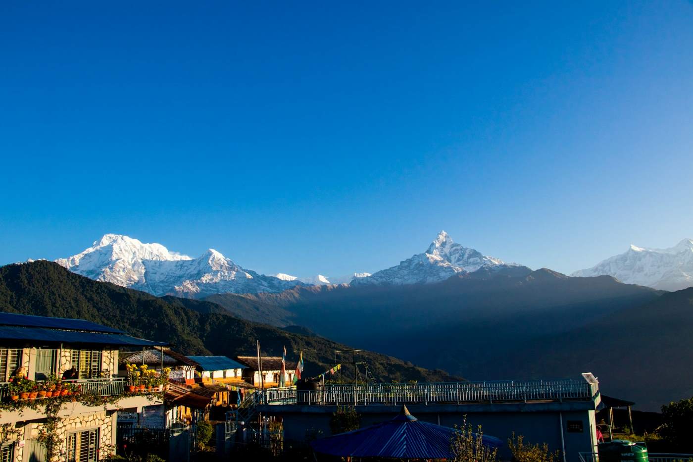
Annapurna Panorama Trek 2026
The Gateway to the Himalayas: A Complete Guide to the Annapurna Panorama Trek
If you have ever dreamed of standing beneath the towering Himalayas, watching the sunrise ignite snow-covered peaks in shades of gold and crimson, but feel intimidated by extreme altitudes or long expeditions, the Annapurna Panorama Trek is the perfect introduction to trekking in Nepal. Popularly known as the Ghorepani Poon Hill Trek, this short yet spectacular Himalayan journey combines breathtaking mountain scenery, rich cultural encounters, dense rhododendron forests, and comfortable trekking routes into one unforgettable adventure. Unlike high-altitude expeditions such as the Annapurna Circuit or Everest Base Camp Trek, this trail remains below the risky altitude threshold, making it one of the safest and most accessible treks in Nepal. Reaching a maximum elevation of only 3,210 meters at Poon Hill, the trek significantly lowers the chances of altitude sickness while still delivering panoramic views of some of the tallest mountains on Earth. This makes it an excellent choice for beginners, families, photographers, solo travelers, and trekkers with limited vacation time. Whether you have five days or a week, the Annapurna Panorama Trek offers the perfect balance of adventure, comfort, and authentic Himalayan culture. Why Choose the Annapurna Panorama Trek? The Annapurna Panorama Trek is often considered Nepal’s best short trek because it delivers an incredible Himalayan experience without requiring advanced trekking skills or months of preparation. Key Reasons Trekkers Love This Route Moderate difficulty suitable for most fitness levels Short itinerary ideal for travelers with limited time Comfortable teahouse accommodations throughout the route Stunning sunrise and sunset mountain panoramas Rich Gurung and Magar cultural experiences Lower altitude with minimal acclimatization concerns Beautiful forests filled with rhododendrons, bamboo, and oak trees Easy accessibility from Pokhara The trail passes through the lower Annapurna region, offering constantly changing landscapes—from terraced farmland and subtropical forests to alpine viewpoints overlooking the massive Himalayan range. Major Highlights of the Trek The Legendary Poon Hill Sunrise The biggest highlight of the trek is undoubtedly the early morning hike to Poon Hill (3,210m), one of Nepal’s most famous Himalayan viewpoints. Before dawn, trekkers climb uphill with headlamps to reach the summit in time for sunrise. As the first rays of sunlight strike the peaks, the entire Annapurna and Dhaulagiri ranges glow in brilliant shades of orange and gold. From the viewpoint, you can witness a breathtaking 360-degree panorama that includes: Annapurna I (8,091m) Dhaulagiri (8,167m) Annapurna South Hiunchuli Nilgiri Machhapuchhre (Fishtail) Tukuche Peak Lamjung Himal The changing colors of the mountains during sunrise create one of the most iconic trekking moments in Nepal. Rhododendron Forests and Natural Beauty One of the most magical aspects of the Annapurna Panorama Trek is the journey through dense rhododendron forests, especially during spring (March to April). During blooming season, the hillsides transform into vibrant landscapes filled with: Red rhododendrons Pink rhododendrons White rhododendrons Moss-covered oak forests Bamboo groves Waterfalls and mountain streams Nepal’s national flower, the rhododendron, creates a colorful canopy that makes the trail feel almost surreal. The forests also provide habitat for birds, langurs, and other Himalayan wildlife. Authentic Gurung and Magar Culture The trek is not only about mountains—it is also a cultural journey through traditional Himalayan villages inhabited primarily by the Gurung and Magar communities. Villages such as: Ulleri Ghorepani Tadapani Ghandruk offer opportunities to experience authentic Nepali mountain culture. Trekkers can observe: Traditional stone houses Ancient farming practices Buddhist prayer flags and monasteries Local hospitality and homemade meals Traditional dances and cultural customs Ghandruk, in particular, is one of the most picturesque villages in the Annapurna region and provides excellent close-up views of Annapurna South and Machhapuchhre. Relax at Jhinu Danda Hot Springs After several days of trekking, few experiences feel better than soaking in the natural hot springs at Jhinu Danda. Located beside the Modi Khola (river), these therapeutic pools are believed to help relax muscles, improve circulation, and relieve trekking fatigue. Trekkers descend through lush forests to reach the riverside pools, where they can unwind while listening to the sounds of flowing Himalayan waters surrounded by jungle-covered hills. This is one of the most relaxing and rewarding highlights of the trek. The Iconic Machhapuchhre (Fishtail Peak) Throughout the trek, one mountain consistently dominates the skyline: Machhapuchhre (6,993m), famously known as Fishtail Mountain due to its distinctive double-peaked summit. Unlike many Himalayan mountains, Machhapuchhre remains officially unclimbed because it is considered sacred by local communities. Its sharp, elegant silhouette becomes especially dramatic during sunrise and sunset, making it a favorite subject for photographers. The mountain appears incredibly close from villages like Ghandruk and Tadapani, offering unforgettable Himalayan scenery throughout the trek. Trek Difficulty and Altitude The Annapurna Panorama Trek is classified as an easy to moderate trek. Maximum Elevation Poon Hill: 3,210 meters Daily Walking Hours Approximately 4–6 hours per day Trek Duration Typically 4–7 days Because the route stays below high-altitude danger zones, most trekkers can complete the journey comfortably without acclimatization days. However, basic physical fitness is still recommended due to frequent uphill and downhill sections, particularly the famous stone staircase climb to Ulleri. Best Time to Trek Spring (March to May) Best rhododendron blooms Pleasant temperatures Clear mountain views Autumn (September to November) Stable weather Excellent visibility Crisp mountain air Winter (December to February) Fewer crowds Cold mornings and evenings Snow possible near Poon Hill Monsoon (June to August) Lush green landscapes Frequent rain and leeches Cloud-covered mountain views Autumn and spring remain the most popular trekking seasons. Typical Annapurna Panorama Trek Route A standard itinerary usually includes: Drive from Pokhara to Nayapul Trek to Ulleri or Tikhedhunga Trek to Ghorepani Sunrise hike to Poon Hill Trek to Tadapani Trek to Ghandruk Trek to Jhinu Danda Return to Pokhara The route can be shortened or extended depending on available time and fitness level. Accommodation and Food The trek is supported by well-developed teahouses offering: Comfortable twin-sharing rooms Hot meals Wi-Fi in many villages Hot showers Charging facilities Popular trekking meals include: Dal Bhat Fried rice Momos Noodles Pancakes Tibetan bread Tea and coffee The hospitality of local lodge owners is often one of the most memorable aspects of the trek. Thoughts The Annapurna Panorama Trek perfectly captures the essence of trekking in Nepal without requiring extreme endurance or technical climbing skills. In just a few days, trekkers can experience towering Himalayan peaks, colorful forests, traditional mountain villages, and unforgettable sunrises. For travelers seeking a short yet rewarding Himalayan adventure, this trek offers one of the best trekking experiences in Nepal. It is scenic, culturally rich, beginner-friendly, and accessible for nearly all age groups. Whether you are trekking for the first time or simply looking for a peaceful Himalayan escape, the Annapurna Panorama Trek is a journey that leaves a lasting impression long after the mountains disappear from view. The Route: What to Expect on the Annapurna Panorama Trek The Annapurna Panorama Trek follows one of the most scenic and culturally rewarding routes in Nepal’s Annapurna region. Depending on your itinerary, fitness level, and side trips, the trek can be completed in 6 to 9 days, making it ideal for travelers seeking a shorter Himalayan adventure without sacrificing mountain views or authentic cultural experiences. The journey typically begins and ends in the beautiful lakeside city of Pokhara, often called Nepal’s adventure capital. From here, trekkers enter a world of terraced hillsides, dense rhododendron forests, traditional mountain villages, and breathtaking Himalayan panoras. Phase 1: The Ascent into the Annapurna Foothills The adventure starts with a scenic drive from Pokhara to the trekking trailhead at Nayapul, Birethanti, or sometimes Hile, depending on the chosen itinerary and road conditions. As the road disappears behind you, the atmosphere immediately changes. The trail winds through: Traditional farming villages Terraced rice and millet fields Waterfalls and river valleys Dense forests of oak, bamboo, and rhododendron The first few trekking days gradually introduce you to the rhythm of Himalayan trekking. One of the most memorable sections is the legendary stone staircase climb to Ulleri, consisting of thousands of hand-laid stone steps ascending steep hillsides. Although physically demanding, this climb rewards trekkers with increasingly dramatic views of: Annapurna South (7,219m) Hiunchuli (6,441m) Machhapuchhre (6,993m) Surrounding green valleys and forest ridges As elevation increases, temperatures become cooler and the air noticeably fresher. The trail eventually reaches Ghorepani (2,855m), a lively mountain settlement surrounded by rhododendron forests and panoramic Himalayan scenery. Ghorepani serves as the main overnight stop before the famous sunrise excursion to Poon Hill. Phase 2: Sunrise at Poon Hill — The Trek’s Defining Moment The highlight of the Annapurna Panorama Trek arrives early in the morning on day three or four. Before dawn, trekkers leave Ghorepani carrying headlamps and warm layers for the short but steep uphill climb to Poon Hill (3,210m). The ascent typically takes 45 minutes to 1 hour, depending on pace and trail conditions. As the darkness fades, the Himalayan skyline slowly begins to emerge. Then comes the unforgettable moment: The first rays of sunlight strike the snow-covered peaks, transforming the mountains into glowing shades of gold, orange, and pink. From Poon Hill, trekkers enjoy one of Nepal’s most spectacular panoramic viewpoints, with uninterrupted views of: Dhaulagiri (8,167m) Annapurna I (8,091m) Annapurna South Nilgiri Hiunchuli Machhapuchhre (Fishtail) Tukuche Peak Lamjung Himal Several surrounding Himalayan summits Unlike many high-altitude trekking destinations, this incredible panorama is accessible without extreme altitude exposure or technical difficulty, making it one of the best viewpoints in Nepal for beginner trekkers and photographers. After sunrise, trekkers return to Ghorepani for breakfast before continuing deeper into the Annapurna foothills. Phase 3: Forest Trails, Gurung Culture & Mountain Villages Leaving Ghorepani behind, the trail traverses beautiful forest ridges toward Tadapani, one of the most peaceful sections of the trek. This area is especially popular among: Birdwatchers Nature photographers Wildlife enthusiasts The forests around Tadapani are rich in Himalayan biodiversity and often filled with the sounds of birds echoing through the trees. From Tadapani, the trail descends toward the famous village of Ghandruk, one of the largest and most culturally significant Gurung settlements in the Annapurna region. Exploring Ghandruk Village Ghandruk offers an authentic glimpse into traditional Himalayan life. The village is known for: Stone-paved alleys Traditional slate-roof houses Gurung culture and hospitality Ancient Buddhist traditions Incredible mountain backdrops Trekkers can visit the local Gurung museum to learn about: Traditional clothing Historical weapons Local customs and festivals The Gurkha military legacy Ghandruk also provides some of the closest and clearest views of Annapurna South and Machhapuchhre. Phase 4: Relaxation at Jhinu Danda Hot Springs After several days of hiking, the trek offers a well-earned opportunity to relax at Jhinu Danda, famous for its natural hot springs located beside the Modi Khola river. To reach the springs, trekkers descend a short trail from the village through forested slopes to the riverside pools. The hot springs are believed to: Relieve muscle soreness Improve circulation Reduce fatigue after trekking Surrounded by lush greenery and the soothing sound of the river, this is one of the most relaxing experiences in the Annapurna region. Many trekkers consider the hot springs the perfect conclusion to the physically demanding sections of the journey. Phase 5: Return Through Scenic Villages to Pokhara The final stage of the Annapurna Panorama Trek leads trekkers through charming hillside villages such as: Landruk Tolka Pothana Dhampus This section features: Terraced farmland Traditional stone homes Suspension bridges Expansive valley views Dense pine forests The village of Dhampus is particularly famous for its sunset and sunrise views over the Annapurna range and Pokhara Valley. Eventually, the trail reaches the road-access point, where a short drive returns you to Pokhara. After days spent in the mountains, arriving back at the peaceful lakeside atmosphere of Pokhara feels both rewarding and nostalgic. What Makes This Route Special? The Annapurna Panorama Trek stands out because it combines nearly every element trekkers seek in Nepal within a relatively short timeframe: Spectacular Himalayan panoramas Rich Gurung and Magar culture Comfortable teahouse trekking Forest and wildlife experiences Hot springs and relaxation Moderate altitude with low acclimatization risk Easily accessible from Pokhara For travelers seeking the perfect balance between scenery, culture, comfort, and adventure, this route remains one of the finest short treks in the Himalayas. Teahouse Culture & Comforts on the Annapurna Panorama Trek One of the biggest advantages of the Annapurna Panorama Trek is its well-developed teahouse trekking system, which allows travelers to experience the Himalayas comfortably without carrying camping gear or cooking equipment. Unlike remote wilderness expeditions, this trek offers a network of cozy, family-run mountain lodges that provide accommodation, hot meals, and warm hospitality throughout the route. These teahouses are an essential part of Nepal’s trekking culture and often become one of the most memorable aspects of the journey. Trekkers not only enjoy a comfortable place to rest each evening but also gain an authentic cultural experience by staying with local Gurung and Magar families. Accommodation: What the Teahouses Are Like Teahouses along the Annapurna Panorama Trek are generally simple yet comfortable, especially compared to higher-altitude trekking regions. Typical Room Features Most rooms include: Twin beds with foam mattresses Pillows and basic blankets Wooden interiors and insulated walls Shared bathrooms Charging facilities (usually for an extra fee) Wi-Fi access in many villages While luxury accommodations are limited in remote sections, villages such as: Ghorepani Ghandruk Tadapani Ulleri offer increasingly comfortable eco-lodges with upgraded facilities. During colder months, dining halls are heated with traditional wood or yak-dung stoves, creating a warm social atmosphere where trekkers gather in the evenings to share stories and relax. Showers, Electricity & Connectivity Modern trekking infrastructure has significantly improved across the Annapurna region in recent years. Hot Showers Most teahouses provide: Gas-heated showers Solar-heated water systems Bucket showers in more remote areas A small additional fee is usually charged for hot water. Electricity & Charging Electricity is available in nearly all villages, though charging devices often costs extra due to limited power resources in the mountains. It is recommended to carry: A power bank Universal charging adapters Spare camera batteries Wi-Fi & Mobile Networks Wi-Fi is widely available along the route, though speeds may vary depending on weather and location. Nepal Telecom and Ncell mobile coverage work in many sections of the trek, especially near larger villages. Food on the Trek: Fresh, Nutritious & Surprisingly Diverse Food is one of the most enjoyable parts of trekking in Nepal. Teahouse menus have evolved to cater to both local and international trekkers, offering a wide variety of meals. Popular Meals Available Trekkers commonly enjoy: Pancakes and porridge for breakfast Fried rice and noodles Pasta and pizza Tibetan bread Momos (Nepali dumplings) Soups and curries Tea, coffee, and hot chocolate However, the undisputed king of trekking meals is Nepal’s traditional Dal Bhat. Dal Bhat: The Ultimate Trekking Fuel Dal Bhat is the staple meal of Nepal and the perfect energy source for trekking. A traditional Dal Bhat set typically includes: Steamed rice Lentil soup (dal) Seasonal vegetable curry Pickles and chutney Occasionally meat or yogurt The best part? Most teahouses offer unlimited refills. This balanced meal provides: Carbohydrates for energy Protein from lentils Vitamins and minerals from vegetables Long-lasting stamina for trekking As locals proudly say: “Dal Bhat Power, 24 Hour!” After a long day on the trail, sharing a warm plate of Dal Bhat while overlooking the Himalayas becomes an unforgettable experience. Best Time to Visit the Annapurna Panorama Trek Although the Annapurna Panorama Trek can technically be completed throughout the year, two seasons offer the best combination of weather, visibility, and trail conditions. Spring Season (March to May) Spring is considered one of the most beautiful times to trek in the Annapurna region. Why Trek in Spring? Warm daytime temperatures Blooming rhododendron forests Colorful mountain landscapes Excellent photography conditions Longer daylight hours The forests around Ghorepani and Tadapani transform into vibrant tunnels of red, pink, and white rhododendrons, creating one of the most scenic trekking environments in Nepal. Spring is especially ideal for: Nature lovers Birdwatchers Photographers First-time trekkers Autumn Season (September to November) Autumn is the most popular trekking season in Nepal. Following the monsoon rains, the skies become exceptionally clear, revealing crystal-sharp mountain views. Why Trek in Autumn? Stable weather conditions Clear blue skies Best Himalayan visibility Comfortable temperatures Dry trekking trails This season offers the best panoramic views from Poon Hill and is ideal for travelers prioritizing mountain scenery. Because it is peak trekking season, teahouses can fill quickly, so advance booking is recommended. Winter & Monsoon Conditions Winter (December to February) Colder mornings and nights Occasional snowfall near Poon Hill Fewer crowds and peaceful trails Clear mountain views on many days Monsoon (June to August) Lush green landscapes Frequent rainfall Leeches in forest areas Cloud-covered mountain views While possible, monsoon trekking is generally less popular due to slippery trails and reduced visibility. Permits & Trekking Regulations To preserve the environment and improve trekker safety, Nepal requires official permits for the Annapurna Panorama Trek. Required Permits Annapurna Conservation Area Permit (ACAP) Required for entering the Annapurna Conservation Area. Approximate cost: NPR 3,000 (around USD 25) TIMS Card (Trekkers’ Information Management System) Used to track trekkers for safety and emergency purposes. Approximate cost: NPR 2,000 (around USD 17) Permit prices may occasionally change, so checking updated regulations before travel is recommended. Hiring a Guide: Why It Matters Under Nepal’s current trekking regulations, hiring a licensed trekking guide is strongly encouraged and often required in many trekking regions, including Annapurna-managed routes. Traveling with a professional guide provides several benefits: Assistance with permits and logistics Cultural and historical insights Navigation support Emergency management Local language assistance Support for local mountain communities Partnering with a registered local trekking agency also helps contribute directly to Nepal’s tourism economy and sustainable mountain tourism. Essential Packing Tips Because the Annapurna Panorama Trek stays below extreme altitude zones, you can pack relatively light compared to longer Himalayan expeditions. Recommended Packing List Clothing Moisture-wicking base layers Warm fleece or down jacket Waterproof outer shell Hiking pants Thermal layers for evenings Footwear Well-broken-in hiking boots Comfortable trekking socks Sandals or camp shoes Trekking Essentials Headlamp for the Poon Hill sunrise hike Sunglasses and sunscreen Reusable water bottle Water purification tablets or filter Trekking poles Small first-aid kit Sleeping bag for colder nights Temperatures can drop significantly after sunset, especially during autumn and winter, so warm layers remain important even on this lower-altitude trek. Final Thoughts The Annapurna Panorama Trek proves that you do not need to climb to dangerous altitudes or endure weeks of physical hardship to experience the beauty of the Himalayas. In just a few days, this incredible journey delivers: Spectacular Himalayan panoramas Authentic mountain culture Comfortable teahouse trekking Vibrant forests and wildlife Relaxing hot springs Warm Nepali hospitality It is the perfect introduction to trekking in Nepal and one of the best short Himalayan adventures for travelers of all experience levels. Whether you are watching sunrise over Annapurna from Poon Hill, sharing Dal Bhat beside a teahouse stove, or walking through ancient Gurung villages, the Annapurna Panorama Trek offers memories that last a lifetime. So lace up your boots, breathe in the mountain air, and answer the call of the Himalayas. Read more... Read less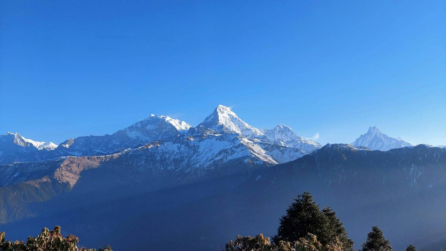
Annapurna Trek Routes 2026
The Ultimate Guide to Annapurna Trek Routes: 7 Detailed Trails for Every Adventurer
The Annapurna region of Nepal is one of the most diverse trekking destinations in the world. Stretching across central Nepal, this vast Himalayan landscape offers trekkers an extraordinary journey through dense rhododendron forests, terraced farmlands, glacial valleys, alpine meadows, and high-altitude deserts that resemble the Tibetan Plateau. Home to some of the tallest mountains on Earth, including Annapurna I (8,091m), Machhapuchhre (6,993m), and Dhaulagiri (8,167m), the region attracts adventurers from every corner of the globe. What makes the Annapurna region truly unique is its incredible diversity. Within a single trek, hikers can experience dramatic climatic changes, rich cultural traditions, ancient monasteries, remote mountain villages, and panoramic Himalayan views. The region is also considered one of the most accessible trekking destinations in Nepal, with routes ranging from short 4-day hikes to challenging multi-week expeditions. Managed under the Annapurna Conservation Area Project (ACAP), Nepal’s largest protected area, the region is famous not only for its mountains but also for its biodiversity. Trekkers often encounter Himalayan wildlife, waterfalls, suspension bridges, and traditional Gurung, Magar, and Thakali communities that have preserved their unique cultures for generations. Below is a detailed breakdown of the two most iconic trekking routes in the Annapurna region.1. Annapurna Circuit Trek (The Classic Himalayan Journey)
Trek Overview
- Maximum Altitude: 5,416m (Thorong La Pass)
- Difficulty Level: Challenging
- Average Duration: 14–20 Days
- Best Seasons: Spring (March–May) and Autumn (September–November)
- Estimated Budget: USD 800–1,300
- Required Permits:
- TIMS Card
- Annapurna Conservation Area Permit (ACAP)
Why the Annapurna Circuit Is Special
The Annapurna Circuit stands out because of its unmatched geographical and cultural diversity. During the trek, you gradually transition from lush subtropical valleys filled with waterfalls and rice terraces to dry, wind-swept valleys that resemble the landscapes of Tibet. The route also crosses several ethnic regions, allowing trekkers to experience the traditions of Gurung, Manangi, and Thakali communities. Ancient monasteries, prayer wheels, mani walls, and colorful prayer flags line the trail, reflecting the strong Tibetan Buddhist influence in the higher regions.Route Breakdown
Kathmandu to Dharapani
The journey usually begins with a scenic drive from Kathmandu to Besisahar, followed by an off-road jeep ride to Dharapani. This section introduces trekkers to rural Nepal, passing through rivers, waterfalls, terraced farms, and hillside villages.Dharapani to Chame
The lower section of the trail follows the Marsyangdi River through pine and fir forests. The climate remains relatively warm, and trekkers pass traditional stone-built villages with stunning mountain backdrops.Chame to Manang
As the elevation increases, the landscape transforms dramatically. Dense forests slowly disappear, replaced by rocky cliffs and open valleys. Trekkers begin to see spectacular views of Annapurna II, Annapurna III, Pisang Peak, and Gangapurna. The village of Manang is one of the most important acclimatization stops on the trek. Most trekkers spend at least one extra day here to adapt to the altitude before ascending further.Acclimatization in Manang
Acclimatization is essential to prevent Acute Mountain Sickness (AMS). Popular acclimatization hikes around Manang include:- Gangapurna Lake
- Ice Lake (Kicho Tal)
- Praken Gompa
- Gangapurna Glacier viewpoint
Thorong La Pass – The Highest Point
The crossing of Thorong La Pass (5,416m) is the highlight of the Annapurna Circuit Trek. Trekkers typically start before sunrise from Thorong Phedi or High Camp to avoid strong afternoon winds. Crossing the pass is physically demanding due to the thin air, freezing temperatures, and steep ascent. However, the reward is extraordinary panoramic views of the Annapurna and Dhaulagiri ranges. Because the pass is prone to snowstorms and avalanches during winter and monsoon seasons, trekking is strongly recommended during spring or autumn.Muktinath – A Sacred Pilgrimage Site
After crossing Thorong La, the trail descends into the Mustang region and reaches Muktinath, one of Nepal’s most sacred pilgrimage destinations. Muktinath is revered by both Hindus and Buddhists:- Hindus believe bathing in the 108 water spouts cleanses sins.
- Buddhists associate the site with Guru Rinpoche (Padmasambhava).
Jomsom and the Kali Gandaki Valley
The trail from Muktinath to Jomsom now follows a motorable road, and many trekkers choose jeep transportation to avoid dust and heavy traffic. However, those who continue trekking can explore:- Kagbeni village
- Apple orchards of Marpha
- Traditional Thakali settlements
- The Kali Gandaki Gorge, considered one of the world’s deepest gorges
Side Trips and Extensions
Trekkers can customize the Annapurna Circuit with several popular extensions:Tilicho Lake Extension
Tilicho Lake (4,919m) is one of the world’s highest lakes and adds 2–3 days to the itinerary. The turquoise alpine lake surrounded by snow-covered peaks is one of the most spectacular side trips in Nepal.Poon Hill Extension
Many trekkers finish the circuit by trekking through Ghorepani and hiking to Poon Hill for a famous sunrise panorama over Annapurna and Dhaulagiri.Accommodation and Food
The Annapurna Circuit is a tea house trek, meaning accommodation and meals are available throughout the route. Typical meals include:- Dal Bhat (traditional Nepali meal)
- Fried rice
- Tibetan bread
- Noodles and soups
- Pancakes and porridge
Difficulty and Preparation
The Annapurna Circuit is considered challenging primarily due to:- Long trekking days
- High altitude
- Thorong La Pass crossing
- Rapid weather changes
- Cardiovascular training
- Multi-day hiking practice
- Proper trekking gear
- Layered clothing for extreme temperature variation
Best Time to Trek
Spring (March–May)
- Blooming rhododendron forests
- Stable weather
- Warm daytime temperatures
- Excellent visibility
Autumn (September–November)
- Crystal-clear mountain views
- Dry trails
- Comfortable temperatures
- Most popular trekking season
2. Annapurna Base Camp Trek (The Annapurna Sanctuary Experience)
Trek Overview
- Maximum Altitude: 4,130m (Annapurna Base Camp)
- Difficulty Level: Moderate
- Average Duration: 7–14 Days
- Best Seasons: Spring and Autumn
- Estimated Budget: USD 700–1,200
- Major Highlight: Overnight stay inside the Annapurna Sanctuary
What Makes the ABC Trek Special?
The Annapurna Base Camp Trek combines stunning mountain scenery with rich cultural experiences and relatively accessible trekking conditions. Key highlights include:- Close-up views of Annapurna I
- Machhapuchhre (Fishtail Mountain)
- Annapurna South
- Hiunchuli
- Traditional Gurung villages
- Dense bamboo and rhododendron forests
- Natural hot springs at Jhinu Danda
Standard Route via Poon Hill (10–12 Days)
Pokhara to Nayapul
Most ABC treks begin with a scenic drive from Pokhara to Nayapul or nearby trailheads.Trek Through Gurung Villages
The lower section passes through beautiful villages such as:- Tikhedhunga
- Ulleri
- Ghorepani
- Tadapani
- Chomrong
Poon Hill Sunrise Viewpoint
One of the trek’s biggest highlights is the early morning hike to Poon Hill (3,210m). From the viewpoint, trekkers can witness a spectacular sunrise over:- Dhaulagiri I
- Annapurna South
- Annapurna I
- Machhapuchhre
- Nilgiri
- Hiunchuli
Chomrong – Gateway to the Sanctuary
Chomrong is the last large settlement before entering the Annapurna Sanctuary. Beyond this point, the trail becomes more remote and follows steep stone staircases, dense forests, and river valleys.Bamboo Forests and Avalanche Zones
The route between Bamboo, Deurali, and Machhapuchhre Base Camp passes through narrow valleys and avalanche-prone sections. Trekkers should remain cautious during heavy snowfall or poor weather. The environment becomes increasingly alpine as the forest line disappears.Machhapuchhre Base Camp (MBC)
Machhapuchhre Base Camp offers incredible views of the sacred Fishtail Mountain. Climbing Machhapuchhre itself is prohibited because the mountain is considered sacred by local communities. The sunset and sunrise views from MBC are among the most memorable moments of the trek.Annapurna Base Camp (ABC)
At 4,130m, Annapurna Base Camp sits in the center of a giant natural amphitheater surrounded by Himalayan giants. The panoramic scenery includes:- Annapurna I
- Annapurna South
- Hiunchuli
- Baraha Shikhar
- Machhapuchhre
- Tent Peak
Direct Short Route (6–7 Days)
Trekkers with limited time can skip the Poon Hill section and drive directly closer to Chomrong. A shorter itinerary may follow: Pokhara → Jhinu Danda/Matque → Chomrong → Bamboo → Deurali → MBC → ABC This version reduces trekking days while still reaching the sanctuary.Cultural Experience
The Annapurna Base Camp Trek offers a strong cultural component. Trekkers encounter:- Traditional Gurung hospitality
- Buddhist monasteries and prayer flags
- Hindu shrines
- Local farming lifestyles
- Traditional music and dances during festivals
Food and Accommodation
Tea houses along the ABC route are generally comfortable and well-developed. Popular food options include:- Dal Bhat
- Momos
- Garlic soup
- Fried noodles
- Pancakes
- Tea and coffee
Difficulty Level
The ABC Trek is considered moderate because:- Daily walking hours are manageable
- Altitude is lower than many high Himalayan passes
- Trails are well established
- Continuous stone staircases
- Cold temperatures at higher elevations
- Possible altitude-related symptoms
Best Time to Trek
Spring (March–May)
- Rhododendron blooms
- Mild temperatures
- Excellent mountain views
Autumn (September–November)
- Stable weather
- Dry conditions
- Clear skies
Essential Packing List for Annapurna Treks
Regardless of the route, trekkers should carry:- Waterproof trekking boots
- Warm down jacket
- Sleeping bag
- Trekking poles
- Layered clothing
- Headlamp
- Water purification tablets
- Sunscreen and sunglasses
- First aid kit
- Rain protection
- The Annapurna Circuit is ideal for trekkers seeking diversity, long-distance trekking, and high mountain passes.
- The Annapurna Base Camp Trek is perfect for those wanting close-up Himalayan scenery within a shorter timeframe.
3. Ghorepani Poon Hill Trek (The Best Short Trek in Nepal)
Trek Overview
- Maximum Altitude: 3,210m (Poon Hill)
- Difficulty Level: Easy to Moderate
- Average Duration: 4–6 Days
- Best Seasons: Spring and Autumn
- Estimated Budget: USD 500–740
- Required Permits: TIMS Card and Annapurna Conservation Area Permit (ACAP)
The Ghorepani Poon Hill Trek is one of Nepal’s most popular short treks and is often recommended for beginners, families, solo travelers, and trekkers with limited time. Despite its relatively low altitude and short duration, the trek delivers some of the finest panoramic Himalayan views in the country.
Unlike high-altitude expeditions such as the Annapurna Circuit or Everest Base Camp, this route does not involve serious altitude risks, making it ideal for first-time trekkers.
Why the Poon Hill Trek Is Famous
Poon Hill is widely considered one of the best sunrise viewpoints in Nepal. The early morning hike from Ghorepani village to the summit takes approximately 45 minutes to 1 hour, following a stone staircase trail through forested hills.
As the sun rises, golden light gradually illuminates a vast Himalayan panorama stretching over 70 kilometers.
Major Peaks Visible from Poon Hill
- Dhaulagiri I (8,167m)
- Annapurna I (8,091m)
- Annapurna South
- Machhapuchhre (Fishtail)
- Hiunchuli
- Nilgiri
- Manaslu on clear days
The combination of snow-capped peaks, rolling green hills, and colorful sunrise skies creates one of Nepal’s most iconic mountain experiences.
Historical Importance of the Trail
The Ghorepani route historically formed part of the ancient Trans-Himalayan salt trade route connecting Nepal and Tibet. Traders once carried salt, wool, and grains along these mountain paths using mule caravans.
The name “Ghorepani” itself translates roughly to “horse water,” referring to an important resting point where traders watered their horses and mules.
Forests and Natural Beauty
One of the trek’s biggest attractions is its beautiful rhododendron forest.
During spring (March to May), the hills burst into vibrant shades of:
- Red
- Pink
- White
- Purple
Rhododendron is Nepal’s national flower, and the forests around Ghorepani are among the most spectacular in the Himalayas.
Trekkers also pass through:
- Oak forests
- Bamboo groves
- Waterfalls
- Terraced farmlands
- Traditional mountain villages
Birdwatchers may spot Himalayan pheasants, eagles, and colorful forest birds along the trail.
Typical Route
A standard itinerary includes:
Day 1:
Pokhara → Nayapul → Tikhedhunga/Ulleri
Day 2:
Trek through rhododendron forests to Ghorepani
Day 3:
Early morning sunrise hike to Poon Hill → Trek to Tadapani
Day 4:
Descend to Ghandruk → Drive to Pokhara
Some itineraries also include Jhinu Danda hot springs for relaxation after trekking.
Cultural Experience
The route passes through traditional Gurung and Magar villages where trekkers experience authentic mountain hospitality.
Cultural highlights include:
- Stone-roofed houses
- Traditional farming lifestyles
- Buddhist prayer flags
- Local museums in Ghandruk
- Gurung cultural performances
Ghandruk village is especially famous for its preserved architecture and spectacular Annapurna views.
Accommodation and Food
The Poon Hill Trek has excellent tea house infrastructure.
Popular meals include:
- Dal Bhat
- Tibetan bread
- Pancakes
- Momos
- Noodle soup
- Apple pie
Most lodges provide comfortable rooms, hot showers, charging facilities, and Wi-Fi in lower elevations.
Best Time for the Trek
Spring (March–May)
- Rhododendron blooms
- Pleasant temperatures
- Colorful landscapes
Autumn (September–November)
- Clear mountain views
- Stable weather
- Peak trekking season
Winter is also possible due to the relatively low altitude, though mornings can be cold.
4. Mardi Himal Trek (The Hidden Gem of Annapurna)
Trek Overview
- Maximum Altitude: Approximately 4,500m (Mardi Himal Base Camp)
- Difficulty Level: Moderate
- Average Duration: 4–7 Days
- Estimated Budget: USD 650–850
- Required Permits: ACAP and TIMS
The Mardi Himal Trek is one of Nepal’s fastest-growing trekking routes and is often described as a quieter alternative to the Annapurna Base Camp Trek. Opened to foreign trekkers only in recent years, the trail remains far less crowded than other Annapurna routes.
Located east of the Annapurna Sanctuary, the trek climbs a spectacular ridge directly beneath the sacred Machhapuchhre (Fishtail Mountain).
Why Mardi Himal Is Special
The greatest appeal of Mardi Himal lies in its solitude and close-up mountain scenery.
Unlike the crowded ABC route, Mardi Himal offers:
- Quiet forest trails
- Remote tea houses
- Peaceful ridge walks
- Dramatic alpine scenery
The trek provides unusually close views of:
- Machhapuchhre
- Annapurna South
- Hiunchuli
- Annapurna I
- Dhaulagiri
Many trekkers describe the ridge section as “walking above the clouds.”
The Trail Experience
Forest Camp Section
The lower trail passes through dense forests filled with:
- Rhododendron
- Moss-covered trees
- Oak forests
- Bamboo vegetation
The environment often feels mystical, especially during foggy mornings.
High Camp to Base Camp
Beyond High Camp, vegetation disappears and the landscape becomes rugged and alpine.
Trekkers follow a narrow ridge with steep drop-offs on both sides. The final ascent to Mardi Himal Base Camp offers breathtaking panoramic views across the Annapurna range.
This section can be windy and cold, particularly before sunrise.
Machhapuchhre – Nepal’s Sacred Mountain
Machhapuchhre, also called “Fishtail Mountain,” dominates the entire trek.
The mountain is sacred to local people and officially closed to climbers. Its perfectly symmetrical shape makes it one of the most recognizable peaks in Nepal.
At sunrise, the changing colors on Machhapuchhre create unforgettable photography opportunities.
Difficulty Level
The Mardi Himal Trek is considered moderate because of:
- Continuous uphill sections
- Steep stone staircases
- Narrow ridgeline trails
- Cold temperatures near Base Camp
However, the relatively short duration makes it achievable for reasonably fit trekkers.
Accommodation and Facilities
Tea houses on the Mardi route are more basic compared to ABC or Poon Hill.
Facilities may include:
- Shared bathrooms
- Limited electricity
- Simple meals
- Minimal Wi-Fi
The remoteness is part of the trek’s charm.
Best Time for Mardi Himal Trek
Spring (March–May)
- Rhododendron blooms
- Warm temperatures
- Clear mountain views
Autumn (September–November)
- Stable weather
- Dry trails
- Excellent visibility
Winter trekking is possible but snow can block the ridge route.
5. Tilicho Lake Trek (Journey to One of the World’s Highest Lakes)
Trek Overview
- Maximum Altitude: 4,919m (Tilicho Lake)
- Difficulty Level: Challenging
- Average Duration: 10–14 Days
- Estimated Budget: USD 1,000–1,280
- Main Challenge: Landslide and rockfall zones
Tilicho Lake Trek is one of the most adventurous high-altitude journeys in the Annapurna region. Although traditionally a side trip of the Annapurna Circuit, Tilicho Lake has become a major trekking destination on its own.
The lake is considered one of the world’s highest alpine lakes and holds both geological and spiritual significance.
The Landscape
The trek gradually transitions from green valleys into a barren alpine wilderness.
The environment includes:
- Rocky cliffs
- Glacial valleys
- Snow-covered peaks
- Dry Himalayan deserts
The scenery becomes increasingly dramatic after Manang.
The Dangerous Landslide Section
One of the most notorious parts of the trek lies between Tilicho Base Camp and the lake.
Trekkers must cross a steep slope vulnerable to:
- Rockfalls
- Landslides
- Loose scree
- Falling ice
Guides strongly recommend crossing this section early in the morning before strong winds increase the danger.
Tilicho Lake – The Reward
The lake itself is breathtaking.
Surrounded by towering grey cliffs and snow-covered mountains, the turquoise water changes color depending on sunlight and weather conditions.
On calm days, Tilicho Peak reflects beautifully on the lake surface.
Religious Importance
Tilicho Lake holds sacred importance for both Hindus and Buddhists.
According to Hindu mythology, the lake is connected to the ancient epic Ramayana. Pilgrims visit the lake seeking spiritual purification and blessings.
6. Khopra Ridge Trek (The Peaceful Alternative to Poon Hill)
Trek Overview
- Maximum Altitude: 3,660m (Khopra Ridge)
- Optional Extension: Khayar Lake (~4,500m)
- Difficulty Level: Moderate
- Average Duration: 5–7 Days
- Estimated Budget: USD 900–1,150
The Khopra Ridge Trek is one of the best off-the-beaten-path treks in Nepal. It offers panoramic Himalayan scenery similar to Poon Hill but with significantly fewer trekkers.
Why Khopra Is Unique
Unlike Poon Hill, which is mainly a single sunrise viewpoint, Khopra Ridge provides continuous panoramic mountain scenery for several days.
Trekkers walk along exposed ridges with uninterrupted views of:
- Dhaulagiri
- Nilgiri
- Annapurna South
- Fang Peak
- Hiunchuli
The peaceful atmosphere makes it ideal for trekkers seeking solitude and photography opportunities.
Khayar Lake Side Trip
Many itineraries include a challenging day hike to Khayar Lake, a sacred alpine lake located high above the ridge.
The route crosses remote yak pastures and rugged alpine terrain rarely visited by tourists.
Community-Based Tourism
Khopra is famous for its community-managed lodges, where tourism income directly supports local villages and schools.
This makes the trek a strong example of sustainable tourism in Nepal.
7. Nar Phu Valley Trek (The Forbidden Himalayan Kingdom)
Trek Overview
- Maximum Altitude: Approximately 5,300m (Kang La Pass)
- Difficulty Level: Very Challenging
- Average Duration: 14–18 Days
- Estimated Budget: USD 1,300–1,550+
- Special Requirement: Restricted Area Permit
The Nar Phu Valley Trek is one of Nepal’s most remote and culturally preserved trekking adventures. Opened to foreigners only in 2003, the region remains largely untouched by modernization.
Located near the Tibetan border, the valley offers a rare glimpse into ancient Himalayan life.
The Landscape
Unlike the green hills of lower Annapurna, Nar Phu features:
- Dry canyons
- Rocky cliffs
- High-altitude deserts
- Ancient cave systems
- Wind-eroded landscapes
The scenery strongly resembles Tibet.
Unique Tibetan Culture
The villages of Nar and Phu preserve ancient Tibetan Buddhist traditions.
Cultural highlights include:
- Ancient monasteries (Gompas)
- Prayer wheels
- Chortens
- Yak caravans
- Stone villages
- Traditional Tibetan clothing
Many homes still rely on yak herding and subsistence farming.
Kang La Pass
Crossing Kang La Pass is physically demanding but incredibly rewarding.
From the top, trekkers enjoy panoramic views of:
- Annapurna II
- Gangapurna
- Tilicho Peak
- The remote Nar Valley
Because of the altitude and remoteness, the trek is recommended only for experienced trekkers.
Practical Information: Weather & Trekking Seasons
| Season | Months | Conditions | Best For |
|---|---|---|---|
| Autumn | Sep–Nov | Clear skies, stable weather, cold nights | All Annapurna treks |
| Spring | Mar–May | Warm weather, rhododendron blooms | ABC, Poon Hill, Mardi |
| Winter | Dec–Feb | Snowfall at high elevations | Lower altitude treks |
| Monsoon | Jun–Aug | Heavy rain and slippery trails | Rain-shadow regions like Nar Phu and Mustang |
Final Word: Which Annapurna Trek Is Right for You?
Best for Beginners
Ghorepani Poon Hill Trek
- Easy trails
- Comfortable tea houses
- Low altitude risk
Best for Scenic Photography
Mardi Himal Trek
- Dramatic ridgelines
- Close-up mountain views
- Fewer crowds
Best Bucket-List Adventure
Annapurna Circuit Trek
- Thorong La Pass
- Diverse landscapes
- Full Himalayan experience
Best for Solitude
Khopra Ridge or Nar Phu Valley
- Remote trails
- Authentic culture
- Peaceful trekking experience
Best Spiritual and Natural Experience
Tilicho Lake Trek
- Sacred alpine lake
- Extraordinary scenery
- High-altitude adventure
Important Permit Information
Most Annapurna treks require:
- ACAP (Annapurna Conservation Area Permit)
- TIMS (Trekkers’ Information Management System)
Combined permit costs generally range between USD 40–50 depending on nationality and trekking regulations.
Restricted regions such as Nar Phu Valley require additional special permits and a licensed guide.
Permits can be arranged through trekking agencies in Kathmandu or Pokhara.
Read more... Read less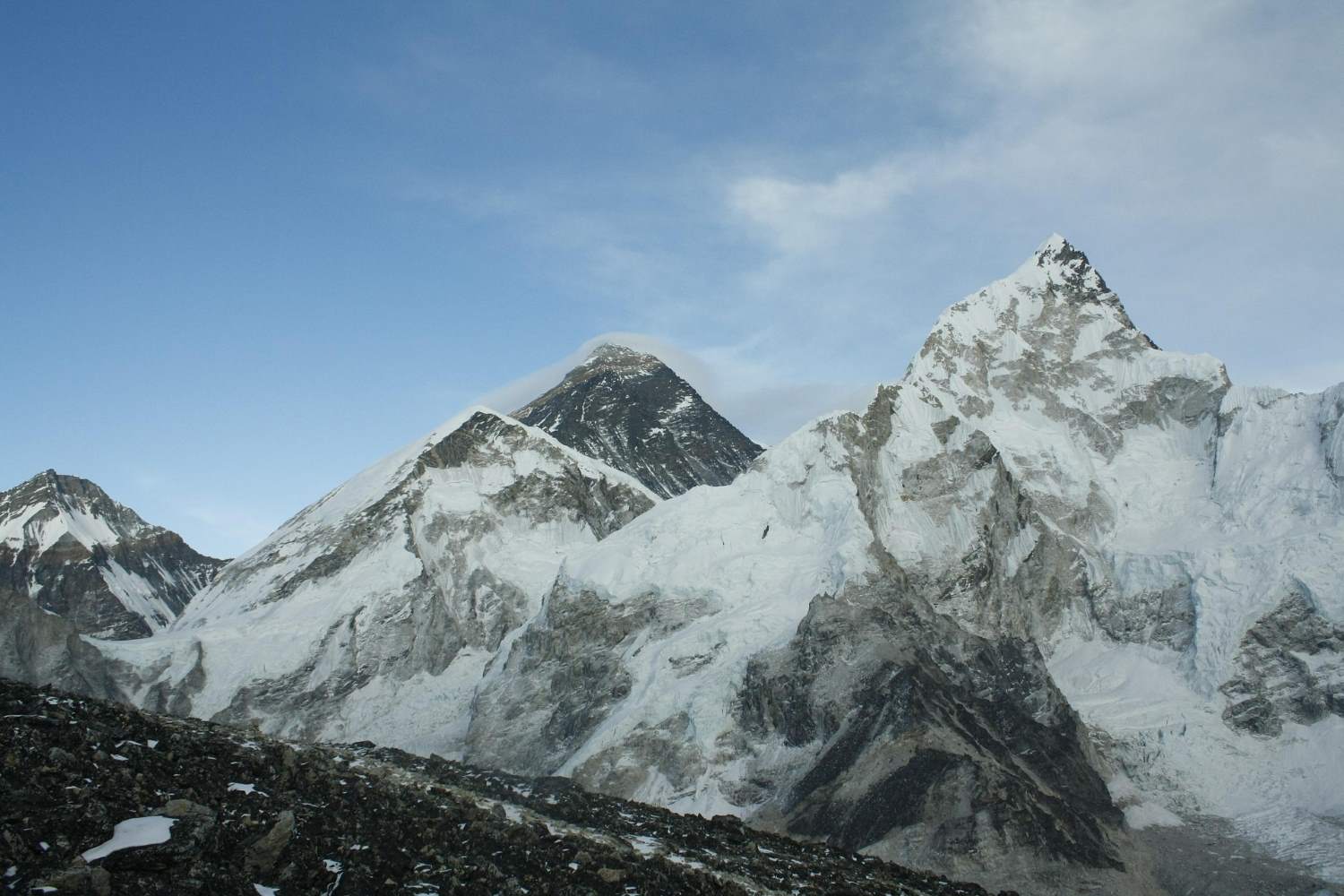
FAQ FOR EBC TREK 2026
The Ultimate Guide to Everest Base Camp Trek: Top 30 FAQs Answered
Planning a trip to the Everest Base Camp (EBC) is an exciting yet daunting task. As the highest base camp on earth, sitting at 5,364 meters (17,598 feet), it’s a journey that demands respect, preparation, and knowledge.
Part 1: The Basics & Logistics
1. Where is Mount Everest located?
Mount Everest lies on the border of Nepal and the Autonomous Region of Tibet. The Southern (Nepal) Base Camp is the most popular trekking route. The mountain’s official height is 8,848.86 meters (29,032 feet) , re-measured by Nepal and China in 2020.
2. How do I get to Everest Base Camp?
The most popular way is a flight from Kathmandu to Lukla (2,860m) . From Lukla, it is a 10-day round-trip trek. An older, longer route starts from Jiri, adding 2-3 weeks to your journey.
3. When is the best time to trek?
The best windows are Spring (March to May) and Autumn (September to November) .
-
Spring: Fantastic views, warmer temperatures, and blooming rhododendrons.
-
Autumn: Crystal clear skies, stable weather, and the busiest season.
-
Winter (Dec/Feb) offers fewer crowds but freezing temperatures.
-
Monsoon (June/Aug) is wet and slippery, though flights are cheaper.
4. Do I need a guide?
While the Nepali government has debated making guides mandatory, it is currently not legally mandatory but highly recommended. Due to altitude, potential avalanches, and ensuring you support the local economy, a licensed guide is a safety net worth having.
5. What permits do I need?
You need two main permits:
-
Sagarmatha National Park Permit (Entry to the park).
-
Khumbu Pasang Lhamu Rural Municipality Permit (Local government tax). Note: The TIMS (Trekkers' Information Management System) card is sometimes required or included by agencies.
6. How expensive is the trek?
For a standard teahouse trek, budget between 1,600to1,600to2,000 USD per person for a 12-16 day trip. This includes flights, permits, food, lodging, and a guide. Luxury treks or helicopter returns will cost significantly more.
7. How much cash should I carry?
Carry about $200 USD (converted to Nepali Rupees) for personal expenses. You will need cash for:
-
Hot showers (3−3−6)
-
Charging electronics (2−2−5 per hour)
-
WiFi (5−5−10)
-
Snacks and bottled water
-
Tips for guides/porters
Part 2: Difficulty & Fitness
8. How difficult is the EBC trek?
It is graded as moderate to challenging. It is not technically difficult (no climbing required), but the altitude is the enemy. You will walk 4-8 hours a day on steep, rocky terrain. Most experts agree: trekking is 70% mentality and 30% physical fitness.
9. Is it very steep?
Yes. You will encounter long, steep climbs and descents of 500 meters or more. You don’t need to be fast, but you need stamina, confidence, and continuity.
10. Do I need to train?
Absolutely. You should exercise minimum 5 times a week for an hour. Focus on:
-
Cardio: Running, cycling, swimming.
-
Strength: Squats, lunges, and leg presses (to carry your body up stairs).
-
Practice: Hiking with a weighted backpack on steep hills.
11. Can a beginner do this trek?
Yes, but you need preparation. If you can hike for 6-7 hours a day for a week straight and acclimatize well, it is achievable. Start a physical warm-up routine 15-20 days prior.
Part 3: Health & Altitude
12. What is Altitude Sickness (AMS)?
Altitude sickness occurs when you ascend too quickly above 3,500 meters. Symptoms include headache, loss of appetite, nausea, dizziness, and shortness of breath.
-
Mild: AMS (Acute Mountain Sickness)
-
Severe: HAPE (fluid in lungs) or HACE (brain swelling).
13. How likely am I to get sick?
Altitude sickness can strike anyone, regardless of fitness. The key to prevention is the rule: "Walk high, sleep low." Never gain more than 300-500 meters of sleeping altitude per day.
14. Should I take Diamox?
Consult your doctor. Diamox (Acetazolamide) helps prevent AMS. A common side effect is that it makes your fingers tingle and makes you urinate frequently (requiring cold middle-of-the-night bathroom trips).
15. What happens in an emergency?
Guides carry medical kits and portable altitude chambers (Gamow bags). If you have severe AMS, the only cure is immediate descent. In serious cases, a helicopter evacuation will take you to Kathmandu. *Ensure your travel insurance covers high-altitude rescue (up to 6,000m).*
16. Is the trek safe regarding accidents?
Generally yes, but stay vigilant. The main physical dangers are not cliffs, but yaks. Give the yaks (and dzopkyos) the inside of the trail; if you are on the cliff edge, they might knock you off.
Part 4: On the Trail (Food, Tech & Gear)
17. What is the accommodation like?
EBC is a "Teahouse Trek." You stay in basic lodges. Rooms are twin-sharing with wooden beds and thin pillows. Expect shared squat toilets (bring your own toilet paper). At lower elevations (Namche), you get nicer rooms; higher up (Gorak Shep), it is very basic.
18. Can I shower on the trek?
Yes, but you will likely pay for it. In Namche, you can get a hot shower (solar/gas) for a fee. Above Namche, showers are often bucket showers (hot water in a bucket) costing 3−3−6. Most trekkers opt for wet wipes to stay warm.
19. What is the food like?
Surprisingly good! Most teahouses serve Dal Bhat (rice, lentils, curry—all you can eat, giving you "24 hours of power"). You can also get pizza, pasta, noodles, potatoes, yak steak, and soup. Avoid raw salads or uncooked meat at high altitude to prevent food poisoning.
20. Can I charge my phone and get WiFi?
-
Electricity: Available for a fee (2−2−5 per hour). The price increases with altitude.
-
WiFi: Available in Namche, Dingboche, Lobuche, and Gorak Shep (Everest Link). It gets expensive (5−5−10 for limited data).
-
Pro Tip: Bring a high-capacity power bank. Don't rely on teahouse charging.
21. What should I pack?
Avoid overpacking. You need layers, not heavy jackets (though you need a good down jacket for night). Essentials:
-
Upper Body: Thermal base layer, fleece, down jacket, waterproof shell.
-
Lower Body: Trekking pants (no shorts above the knee for cultural respect), long underwear.
-
Feet: High-ankle waterproof trekking boots (broken in!).
-
Gear: Sunglasses (glare snow hurts), sunscreen, lip balm, headlamp, water purification (iodine/tablets), dry bags.
22. Should I buy gear at home or in Kathmandu?
Quality vs. Price. Gear in Thamel (Kathmandu) is very cheap but often counterfeit/fake (North Face labels on low-quality coats). If you buy at home (USA/Europe/Australia), you pay more but get reliable warmth. If on a budget, Thamel works, but check the stitching and zippers.
Part 5: Itinerary & Extras
23. Do I sleep at Everest Base Camp?
Usually, no. You stay overnight at Gorak Shep (5,164m) . On the day you reach Gorak Shep, you drop your bags and hike 2-3 hours to Base Camp, then return to Gorak Shep to sleep. Sleeping at Base Camp requires expensive special expedition permits.
24. Can I see Everest from Base Camp?
Ironically, no. From the actual Base Camp, the massive peak of Everest is hidden behind the giant West Shoulder of the mountain (Nuptse). You see the Khumbu Icefall, not the summit peak. To see Everest's summit, you must hike to Kala Patthar (5,545m) at sunrise.
25. Can I drink alcohol on the trek?
You can buy Everest Beer along the trail, but experts strongly advise against it.
-
Alcohol dehydrates you.
-
It constricts blood vessels.
-
It masks symptoms of altitude sickness.
-
Save the beer celebration for your last night in Lukla or Kathmandu.
26. Is it culturally okay to wear leggings?
Dress modestly. If you wear leggings, wear a long top that covers your bottom/knees. The local Sherpa people may feel embarrassed if foreigners wear extremely tight or revealing clothing. Be a respectful guest.
27. How big are the groups?
Small trekking agencies average 6 to 12 people. Some budget operators take 16+. A typical staff ratio includes: 1 Main Guide, 2-4 Assistant Guides, a Sirdar (porter manager), and a Cook.
28. Do I need climbing gear (ropes, harness)?
No. This is a trek, not a climb. You need sturdy hiking boots and trekking poles. You do not need crampons or ice axes unless you are doing the passes (Cho La) in heavy snow.
29. How much should I tip?
Tipping is expected but not mandatory. It is a gesture to thank the porters and guides who work incredibly hard. Guideline: Collectively, groups usually tip 80−80−120 for the guide and 50−50−80 for porters (depending on trip length).
30. Why choose a local agency vs. an international one?
-
Local Agencies: Cheaper, money goes directly to the local economy, authentic experience.
-
International : Higher cost, but includes luxury camping, better medical support, and guarantees like private heated dining tents. Always check that the agency is authorized by the Government of Nepal and a member of TAAN (Trekking Agencies' Association of Nepal).
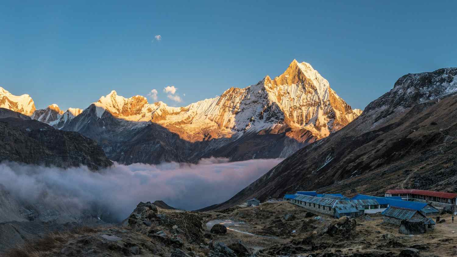
How Hard Is The Annapurna Circuit trek in 2026 For Beginners
Annapurna Trek: A True Test of Endurance
The Annapurna Circuit Trek is more than just a hike—it’s a true test of your legs, lungs, and mental resilience. This iconic route takes you through some of the world’s most breathtaking—and demanding—landscapes. You’ll journey from steamy lowland jungles to windswept alpine deserts, crossing a high mountain pass at altitudes where even small aircraft fly. Due to these dramatic changes in terrain and elevation, the Annapurna Circuit Trek is rated as moderate to challenging—even for seasoned trekkers. The trek is not consistently difficult, but certain sections can be overwhelming if you’re not well prepared. Thorong La Pass on the Annapurna Circuit Altitude: 5,416m | Oxygen: 47% of sea level The most demanding sections include: - The ascent from Manang to Thorong Phedi, where the air begins to thin - The 4 AM climb over Thorong La Pass—Nepal’s highest trekking pass—where icy winds sting your face and the trail can vanish beneath the snow - The steep descent to Muktinath, which puts intense strain on your knees as you cross barren, high-altitude rock fields And yet, thousands of people complete it every year, including first-time trekkers. So how can you tell if it’s too difficult for you? In this guide, we cut through the noise and offer a detailed breakdown of the challenge: - How to make the trek easier with smarter choices - What makes each section difficult - How your fitness and mindset affect your experience - Why altitude—not distance—is your biggest obstacleAnnapurna Circuit Difficulty Overview: Are You Ready for the Challenge?
Let’s get straight to the point. The Annapurna Circuit trek is not just about walking—it’s about endurance. You’ll need to manage altitude, pack efficiently (carrying enough, but never too much), and wake up on day ten still eager to put on your boots. Here’s the catch: how difficult this trek feels depends more on you than on the trail itself. So, are you up for it? Take a deep breath and scroll slowly. Dhikur Pokhari, Day 4 It looks easy here. But behind that smile are sore calves, frozen fingers, and an incredible sense of accomplishment. Your Trekker Profile: The Five-Zone Challenge The difficulty of the Annapurna Circuit Trek depends more on your personal attributes than simply the number of kilometers you cover each day. Below is a breakdown of the three most common trekker profiles, the challenges the Circuit presents to each, and strategies to help you finish stronger. The Weekend Warrior You are physically strong, likely fitter than most. However, physical strength does not guarantee altitude awareness, and the mountains punish ego faster than any leg press machine. Strengths: - Can handle steep sections with muscle power - Likely to recover quickly from fatigue - Enjoys the physical aspect of the challenge Weaknesses: - May hike too quickly and risk altitude sickness - Has less experience with breath control and pacing - May underestimate the mental fatigue after Day 8 Trekking Strategy: - Focus on breathwork and pacing rather than speed - Train for sustained uphill walking, not just weightlifting - Schedule an extra acclimatization day in Manang or at Ice Lake The mountain does not care about muscle; it rewards humility. The Slow and Steady First-Timer You may not be a trail athlete, but you are consistent—and that consistency is invaluable on the Circuit. Pacing is more important than pushing, and your steady rhythm is your secret weapon. Strengths: - Natural patience and body awareness - Conservative pace supports acclimatization - Less likely to overexert early Weaknesses Limited gear knowledge can lead to blisters. Leg fatigue becomes significant after more than 10 days. Struggles with extreme cold and basic trail discomfort. Pro Trek Strategy Hike 2–3 hours per day with a 6 kg pack before leaving for Nepal. Break in your boots and test all gear before arriving in Kathmandu. Add motivational audio or podcasts to help build mental stamina. Progress comes from patience, not speed. The Seasoned Trekker Your experience is obvious, but the Annapurna Circuit’s varied terrain—from lush jungle to alpine desert to glacial pass—can still surprise even veteran hikers. Strengths Familiar with pacing, layering, and altitude. Comfortable adapting to rough terrain and teahouse life. Strategic about rest and energy management. Weaknesses May underestimate early trail heat or sudden snowstorms. Can become bored or complacent on easier days. Might skip acclimatization out of overconfidence. Pro Trek Strategy Consider adding Tilicho Lake or Kang La Pass for extra elevation and challenge. Mentor less-experienced trekkers; it will enhance your own journey. Pack for both cold mornings and hot midday conditions. A familiar trail still offers a new perspective.Trail Breakdown: Where the Trek Challenges or Transforms You
Standard itineraries don’t reveal the real challenge. What matters most is how the trek feels—how it evolves and tests your limits mentally, physically, and emotionally. We’ve identified five distinct Challenge Zones: a high-altitude transformation told in five acts. Stage 1: The Green Confidence Zone Route: Besisahar to Dharapani to Chame Altitude: 760 m to 2,650 m Duration: Days 1–4. Stage 1: The Comfort Zone Terrain: Lush forests, riverside paths, stone staircases The trail begins gently—almost deceptively so. You wind through warm lowlands filled with banana trees and cascading waterfalls. Sleep comes easily, and your breathing is steady. You might think, This isn’t so bad. Tip: Start hydrating early. Begin acclimatization practices now—not just when the trek gets challenging. Stage 2: The Reality Check Route: Chame → Upper Pisang → Manang Altitude: 2,650m to 3,540m Duration: Days 5–7 Terrain: Pine forest ridges, wide valleys, glacial views The ascent begins. The air thins, and you notice it’s harder to tie your boots in the morning. The temperature drops. That easy confidence from earlier? It starts to fade. Manang will charm you, but it also marks the mental shift into high-altitude mode. Tip: Spend two nights in Manang. Hike to Ice Lake or the Gangapurna viewpoint to aid acclimatization. Stage 3: The Mental Wall Route: Manang → Yak Kharka → Thorong Phedi Altitude: 3,540m to 4,500m Duration: Days 8–10 Terrain: Alpine desert, exposed ridgelines, dry riverbeds This is where the challenge intensifies—physically and mentally. The landscape becomes lunar and barren, almost surreal. Your pace slows. Fatigue sets in each morning, and you may question whether to continue. This is where people cry, headaches strike, and motivation wanes. Zone Self-Assessment (Score Each 1–5) Fitness: Can I comfortably walk 6+ hours a day carrying a 5–8kg pack? (1 = No / 5 = Easy) Altitude Readiness: Have I been above 3,000m and handled it well? (1–5) Mental Grit: Can I stay positive when it’s -10°C and I haven’t showered in three days? (1 = Panic-prone / 5 = Zen mode) Packing Discipline: Is Everything in My Pack Essential, or Just Emotional Baggage? (Rate Yourself 1–5) Trekking Know-How: Can I Pace Myself, Stay Hydrated, Snack Wisely, and Layer My Clothes Effectively? The pros don’t sweat—they layer. Think of this as your Himalayan readiness passport.Annapurna Circuit Difficulty: Key Trail Specifications
Now compare your self-assessment with the realities of the trail: Metric | What to Expect Trail Length: Approximately 160–230 km (depending on detours and transportation) Total Ascent: Over 4,000 meters of elevation gain Maximum Altitude: 5,416 meters (Thorong La Pass) Average Trekking Time per Day: 6–8 hours Total Duration: 12–20 days (depending on your itinerary and acclimatization) Key Tip: At 5,416 meters, your lungs receive only 47% of the oxygen available at sea level. Even sipping water can feel exhausting. Trekker Difficulty Wheel: Annapurna Circuit Trek (Visual radar chart suggested here—leave as is.) What Kind of Trekker Are You? This trail is not a treadmill—it’s a Himalayan mosaic of altitude, endurance, mindset, and the unpredictable moods of Mother Nature. Tip: Attempt the High Camp option (4,800 meters) only if you are fully acclimatized. Otherwise, sleep at a lower elevation and ascend gradually. Elevation vs. Oxygen Level: Annapurna Circuit Trek Stage 4: The Summit Push Route: Thorong Phedi → Thorong La Pass → Muktinath Altitude: 4,500m → 5,416m → 3,800m Duration: Day 11 Terrain: Snow, switchbacks, high winds, prayer flags This is the infamous Thorong La Pass. You’ll start at 4 AM and curse every switchback. Each step feels like it takes your breath away. But at the top—the wind, the sky, the prayer flags—it’s pure transcendence. You might cry here, and that’s okay. Tip: Eat something, even if you feel nauseous. Carry electrolytes and caffeine chews. Summit, then descend quickly. Stage 5: The Descent and Renewal Route: Muktinath → Kagbeni → Jomsom Altitude: 3,800m → 2,700m Duration: Days 12–13 Terrain: Loose gravel, dry desert, wide river valleys You’re heading downhill, but the challenge isn’t over. Your legs are sore. The wind howls. The Mustang region feels almost Martian. The final test is convincing yourself that it’s nearly finished. Your body may be tired, but your spirit soars. Tip: Don’t rush to the finish. Savor your time in Kagbeni. Visit the monasteries. Reflect on your journey. The hardest part is behind you, but the transformation is still unfolding. Altitude Is the True Challenge—Not the Distance When most trekkers prepare for the Annapurna Circuit, they fixate on distance: How many kilometers per day? Is it longer than Everest Base Camp? But these are the wrong questions. The real difficulty of the Annapurna Circuit isn't in the number of steps you take. It's in the altitude. It's in how your body reacts as the oxygen thins. What Actually Happens to Your Body Above 3,000 Meters? At first, the changes are subtle. The trail looks the same. Your legs still obey. But something is different. You reach for your water bottle, and your hand moves more slowly. You laugh at a joke, but tears come for no reason. You lie down to sleep, and your heartbeat pounds in your ears like a war drum. Welcome to the invisible wall of altitude. Your mind becomes foggy—words blur, thoughts echo. Simple math suddenly feels complicated. You stare at your backpack, wondering how it became so heavy. Your heart tries to save you—beating faster, working overtime. You feel it when you bend down to tie your boots, when you stand up too quickly, when you climb five stone steps and feel as if you've run a mile. Your blood thickens in a desperate attempt to capture every bit of oxygen it can. But the price is pressure—pressure on your sleep, your thoughts, your decisions. Then comes the night. You lie in your teahouse bed, wrapped in three layers, barely moving, and still, you can't breathe properly. It's not fear. It's not the cold. It's something deeper, like trying to sleep with half your lungs tied behind your back, your dreams bouncing off thin air.Understanding Acute Mountain Sickness (AMS)
Forget the textbook definitions—here’s what altitude sickness actually feels like. Arriving in Upper Pisang (approximately 3,300 m) What You Might Experience: You feel slightly out of breath, but you attribute it to the climb. The air is cooler and crisper. Your heart beats faster, even during simple tasks like repacking your bag. That night, your sleep feels light and restless. What’s Happening in Your Body: You are acclimatizing to thinner air. Now above 3,000 m, this is where AMS symptoms often begin. There’s no need to worry—your guide will keep an eye on your breathing and pulse. We’ll ask questions like: Any pressure behind your eyes? How did you sleep? Because the smallest symptoms are important. What You Should Do: Stay hydrated. Eat dinner, even if you don’t feel hungry. Go to bed early and keep yourself warm.Trekking to Manang (approximately 3,540 m)
What You Might Experience: A dull headache starts—not severe, but persistent. Your appetite fades. You may feel oddly emotional: quiet one moment, irritated the next, without any clear reason. What’s Happening in Your Body: You’ve gained over 500 m in elevation since Pisang. AMS is now sending a gentle warning. Tips We schedule a rest day in Manang—not just because it’s beautiful, but because it’s essential for acclimatization. Your guide may suggest a short hike to Gangapurna Lake or the Ice Lake viewpoint: hike high, sleep low. What to Do Drink garlic soup—it’s not a myth; it helps stimulate blood flow. Avoid caffeine and alcohol. Walk slowly—this is not the time to rush. Night in Manang: Where Tomorrow Is Decided What You Might Feel Mild headache Unusual dreams Cold hands and feet Loss of appetite These are normal signs of mild Acute Mountain Sickness (AMS) as long as they’re managed. You don’t need to self-diagnose every headache or search symptoms online at 3,500 meters. Our guides are trained to spot AMS symptoms before you even notice them. They will: Measure your SpO₂ (oxygen saturation) Check your heart rate Ask if you feel dizzy or nauseous Decide whether to continue or rest another night Our guides have walked this trail hundreds of times, helping CEOs, solo backpackers, and first-time trekkers cross Thorong La safely. They’ll get you there, too. Altitude Challenges and Acclimatization Once you ascend above 2,500 meters, the risk of Acute Mountain Sickness (AMS) increases. As the air gets thinner and oxygen levels drop, you may experience: Headache Dizziness Nausea Fatigue Shortness of breath (Altitude vs. AMS risk curve chart) Acclimatization: The Key to Avoiding AMS Acclimatization is essential for preventing Acute Mountain Sickness (AMS). That’s why our itinerary includes rest days in Manang and side hikes to higher elevations such as Chongkor Viewpoint and Tilicho Lake—to help your body adjust gradually. How to Handle Mild AMS Mild AMS is not a crisis; it’s an early warning. If you respond promptly, you can continue your trek safely and finish strong. Here’s how to manage it: Immediate Actions to Take - Slow Your Pace – AMS worsens with rapid movement. Move slowly, breathe deeply, and take frequent micro-breaks. - Prioritize Hydration – Drink at least 3–4 liters of water daily and add electrolytes. Dehydration is a hidden risk factor for AMS. - Eat Light but Regularly – Even if you lose your appetite, try to consume something—garlic soup, ginger tea, or plain rice. Your body needs fuel to acclimate. - Consider Mild Medication – For headaches, take paracetamol, or consider Diamox (Acetazolamide) for altitude adjustment—but only under your guide’s supervision. - Sleep Early and Stay Warm – Prioritize rest and warmth. Use extra blankets and avoid cold exposure in the evenings. - Avoid Alcohol and Caffeine – Both dehydrate the body and hinder acclimatization. Save any celebratory drinks for Jomsom. - Hike High, Sleep Low – On acclimatization days, such as in Manang, take side hikes to higher elevations, then return to sleep at a lower altitude. - Rely on Your Guide – Our guides carry pulse oximeters, monitor your symptoms daily, and decide whether to continue ascending or to rest. Should You Hire a Guide? (Especially If You Think You Don’t) You’ve tackled solo hikes before. You’ve read the blogs and downloaded GPS trail maps. So, do you really need a guide for the Annapurna Circuit? Technically, no. Legally, it’s not mandatory—at least not yet. But practically? If you’re even asking the question, there’s a good chance the answer is yes. You probably should. Why Choosing a Guide Is Smart—Not Weak In a region where the terrain shifts by the hour, the weather changes without warning, and altitude can play tricks on your mind, having a local, professional guide isn’t a crutch. It’s a smart advantage. You walk the trail; they handle the details. Here’s what your guide manages while you’re immersed in the scenery: Adjusts your pace for the altitude – Guides notice when your breathing changes before you do. They’ll slow you down when you’re tempted to push ahead (the number one cause of altitude sickness in strong trekkers). Identifies altitude sickness before you mention it – Pale lips, slurred jokes, skipped meals. Experienced guides recognize these signs instantly and take action early. Navigates dangerous conditions with expertise – Whiteouts near Thorong La? Frozen streams near Yak Kharka? Your guide knows the safest detours, the best times to cross, and the last reliable teahouse before a storm. Gets you garlic soup before you ask for help – The moment you start to feel off, your guide is already ordering soup, checking your pulse, and reminding the teahouse staff to add extra blankets to your room.Questions to Consider Before Trekking Solo
Can I recognize the early signs of altitude sickness in myself? Do I know when it’s safer to turn back or wait another day? Can I find shelter quickly if the weather changes unexpectedly? Can I navigate when trail markers are buried under snow? Am I trekking for pride, or for the experience itself? A good guide doesn’t lead from the front. They walk beside you—as your protector, translator, cultural bridge, medical scout, and friend.Why the Annapurna Circuit Is More Accessible Than You Think
Let’s be honest—Annapurna Circuit Trek Difficulty sounds intimidating, and it does deserve its reputation. But here’s what most blogs and forums forget to mention: Although it’s a high-altitude challenge, it’s also one of the most supportive, scenic, and comfortable treks in the Himalayas. This isn’t a survival test. It’s an adventure—with pillows. Teahouses Instead of Tents You won’t be digging snow pits or waking up with frozen boots. Every night, you’ll be welcomed into a local teahouse where: A warm bed awaits Blankets are piled higher than your altitude gain The owner might offer you raksi (local rice wine) by the fire Fresh Food, Real Fuel Forget carrying freeze-dried meals or instant noodles. You’ll enjoy hot, hearty meals prepared fresh: Garlic soup (nature’s remedy for altitude) Thukpa noodle stews Dal Bhat (energy that lasts for hours) Fresh apple pies from Manang bakeries Annapurna Circuit: A Culinary Journey Through the Mountains — No Heavy Lifting Required Mule Teams and Porters: Less Weight, More Enjoyment There’s no need to carry everything yourself. With Magical Nepal’s porters or mule teams, you only need a daypack while they transport the rest — always with a friendly attitude.Annapurna Circuit vs. Other Treks: A Challenge Comparison
Nepal’s treks vary widely. Some are gentle and scenic, while others are steep and demanding. Certain routes test your endurance, while others challenge your mental resolve. So, how does the Annapurna Circuit truly measure up? Trek | Max Altitude | Days | Oxygen Drop | Trail Type Annapurna Circuit | 5,416 m | 12–18 | 47% | Diverse terrain Everest Base Camp | 5,364 m | 12–14 | 50% | Gradual climb Langtang Valley | 4,773 m | 7–10 | 40% | Steep, condensed (Infographic: Trail comparison chart) Seven Expert Tips to Make the Annapurna Circuit Feel Twice as Easy The Annapurna Circuit is not about brute strength; it’s about trekking smart. Follow these seven tips to make the journey feel half as difficult — and maybe even enjoyable when your legs say otherwise.- Use Walking Poles
- Your knees will thank you, especially on the long descent from Thorong La to Muktinath. Poles distribute pressure, improve balance, and turn you into a four-legged machine.
- Pro Tip: Adjust the pole height—shorter for uphill, longer for downhill.
- Train With Your Backpack
- Don’t show up with brand-new gear and no training. Even 5–8 kg will feel like bricks by Day 3 if your back isn’t prepared.
- Tip: Practice hiking 2–3 hours per week with your fully loaded daypack before the trek.
- Have Garlic Soup (Seriously)
- It’s more than just tradition—it helps thin your blood and improve circulation. Most teahouses serve it fresh in Manang and beyond.
- The taste is odd, but the effect is real.
- Start Slow, Finish Strong
- Your biggest enemy isn’t the terrain—it’s your pace. The slower you ascend, the more energy you’ll have for later stages.
- Those who start fast often quit early.
- Sleep Low, Hike High
- This is the golden rule of acclimatization. Take your high side trips (like Ice Lake or Tilicho Base), but always return to sleep at a lower elevation.
- Altitude sickness doesn’t care about ambition; it responds to smart strategy.
- Download Offline Maps
- No signal above 3,000 m? No problem. Apps like Maps.me, Gaia, and FarOut keep you on track even when you’re off the grid.
- Pro Move: Download each village section separately for better clarity at trail forks.
- Embrace the Discomfort—It’s Temporary
- Some moments will be tough. The wind will sting your face. Your breath will vanish at 5,000 m. Your legs will shake.
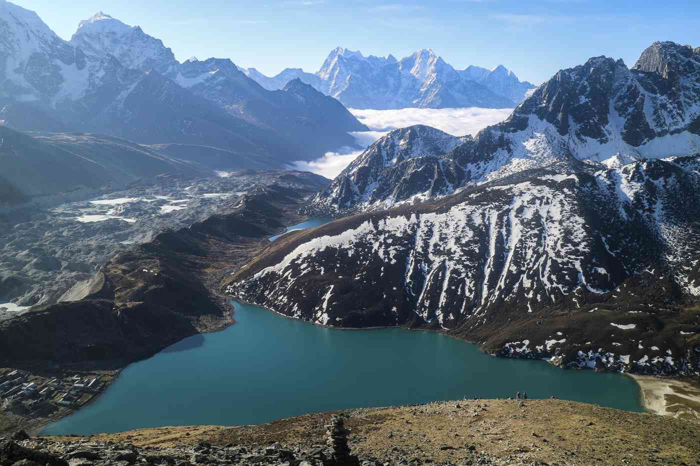
Best Treks In Nepal For 2026
The Complete Guide to Trekking in Nepal: 8 Best Treks for 2025/2026
Nepal is a singular destination. It’s a land where the world’s tallest mountains—eight of the 14 peaks above 8,000 meters—create a backdrop for cultural journeys through ancient Buddhist kingdoms, terraced farmlands, and rhododendron forests. Whether you have a long weekend or a month to spare, there is a perfect trek waiting for you.
Why Choose a Short Trek in Nepal? (3-8 Days)
More than 60% of trekkers in Nepal now choose routes under 10 days. Short treks are ideal for families, first-time hikers, or travelers who can’t take weeks off work. You still get stunning sunrise views over 7,000m peaks, authentic village stays, and the sense of Himalayan adventure—just in a compact timeframe.
Most short treks begin within hours of Kathmandu or Pokhara, keep you below 4,000m (reducing altitude risk), and use the famous teahouse system for accommodation and meals.
1. Ghorepani Poon Hill Trek
-
Duration: 4-5 days
-
Max Altitude: 3,210m (Poon Hill viewpoint)
-
Difficulty: Easy to Moderate
-
Best Season: March-May, Sept-Dec
-
Starting Point: Nayapul (1 hour from Pokhara)
-
Cost (approx): $710 USD (guide, permits, teahouses)
Why it’s #1 for beginners: The Poon Hill Trek is widely considered the best short trek in Nepal. The main event is a pre-dawn hike to Poon Hill, where the sunrise illuminates a stunning panorama of Mt. Dhaulagiri (8,167m), the entire Annapurna range (I-IV), Machhapuchhre (Fishtail), and Himchuli. The trail passes through traditional Magar and Gurung villages where locals have lived for generations. In spring, the trail explodes with red, pink, and white rhododendron blooms.
2. Mardi Himal Trek
-
Duration: 5 days
-
Max Altitude: 4,200m (Base Camp)
-
Difficulty: Easy to Moderate
-
Best Season: March-May, Sept-Dec
-
Starting Point: Kande (drive from Pokhara)
-
Cost (approx): $1,475 USD
Why it’s special: Mardi Himal is the hidden gem of the Annapurna region. It offers closer, more dramatic views of Machhapuchhre than any other trek, without the crowds of Poon Hill. The trail winds through dense oak and rhododendron forests, past wobbly suspension bridges, and up to a high ridge that feels like the top of the world. You can stop at the High Camp or push on to Mardi Himal Base Camp at 4,500m. Teahouses here are cozier and less commercialized.
3. Everest View Trek
-
Duration: 5-7 days
-
Max Altitude: 3,880m (Tengboche)
-
Difficulty: Easy to Moderate
-
Best Season: March-May, Sept-Dec
-
Starting Point: Lukla (30-min flight from Kathmandu)
-
Cost (approx): $1,190 USD
A taste of the Khumbu: This is the perfect trek for anyone who wants to see Mt. Everest without the 12-day commitment. You’ll take the thrilling flight to Lukla, trek through Phakding and Namche Bazaar (the bustling Sherpa capital), and reach Tengboche Monastery—the spiritual center of the Khumbu. From Tengboche, you get incredible views of Everest, Ama Dablam, Nuptse, and Lhotse. You’ll spin prayer wheels, stay in authentic Sherpa villages, and learn how people have lived in the high Himalayas for centuries.
4. Langtang Valley Trek
-
Duration: 8 days
-
Max Altitude: 5,050m (Kyanjin Ri)
-
Difficulty: Easy to Moderate
-
Best Season: March-May, Sept-Dec
-
Starting Point: Syabrubesi (6-7 hour drive from Kathmandu)
-
Cost (approx): $750 USD
The valley of glaciers: Just 19 miles from Kathmandu, Langtang is Nepal’s third most popular trekking region. You’ll walk through Langtang National Park, home to rare red pandas, monkeys, and over 250 bird species. The trail follows the Langtang River through oak, maple, and pine forests to the village of Kyanjin Gompa (3,870m). From there, climb Kyanjin Ri or Tserko Ri for jaw-dropping views of Langtang Lirung (7,227m) and Ganesh Himal. Don’t miss the local yak cheese—made fresh in Swiss-style factories.
5. Kathmandu Valley Trek (Shortest Option)
-
Duration: 3 days
-
Max Altitude: 2,100m (Nagarkot)
-
Difficulty: Easy
-
Best Season: March-May, Sept-Dec
-
Starting Point: Sundarijal (1 hour from Kathmandu)
-
Cost (approx): $350 USD
No altitude, no problem: This is the perfect escape from Kathmandu’s busy streets. You’ll start at Sundarijal Waterfall, enter Shivapuri National Park, and walk through lush forests and terraced farmlands to the hilltop village of Nagarkot. The sunrise from Nagarkot is spectacular, with views stretching from Langtang Lirung to Everest on clear days. The trek ends at the Changunarayan Temple, a UNESCO World Heritage site and the oldest Hindu temple in the Kathmandu Valley.
The Iconic Long Treks (10-21 Days)
For those with more time and a desire for a real physical challenge, these classic treks are legendary for good reason.
6. Everest Base Camp (EBC) Trek
-
Duration: 12 days (short itinerary)
-
Max Altitude: 5,545m (Kala Patthar)
-
Difficulty: Moderate to Strenuous
-
Best Season: March-May, Sept-Dec
-
Starting Point: Lukla
-
Cost (approx): $1,525 USD
-
Total Distance: ~123 km
The #1 trek on the planet: As Andy Moore, founder of EverTrek, says: "What more can be said about one of the best treks on the planet? If there is one trip that you should do before you ‘kick the bucket’, this is it!"
The EBC trek follows in the footsteps of Hillary, Tenzing, and Mallory. You’ll trek through Sagarmatha National Park, cross high suspension bridges over the Dudh Kosi River, and acclimatize in Namche Bazaar. Key highlights include:
-
Tengboche Monastery (3,867m): The spiritual heart of the Khumbu, with stunning views of Ama Dablam.
-
Dingboche (4,410m): A windswept village with a hike up Nangkartshang Peak for acclimatization.
-
Everest Base Camp (5,364m): Standing on the Khumbu Glacier at the foot of the world’s highest mountain.
-
Kala Patthar (5,545m): The best viewpoint for sunrise over Mt. Everest’s pyramid peak.
Warning: Many people think this trek is easy. It’s not. Temperatures can drop to -25°C at Base Camp. Respect the altitude and train beforehand.
7. Annapurna Base Camp (ABC) Short Trek
-
Duration: 6-9 days
-
Max Altitude: 4,230m
-
Difficulty: Moderate
-
Best Season: March-May, Sept-Dec
-
Starting Point: Pokhara
-
Cost (approx): $980 USD
The amphitheater of giants: While Everest is famous, many Nepali guides say the Annapurna region is their personal favorite. This short ABC trek takes you into the Annapurna Sanctuary—a natural amphitheater completely encircled by huge peaks including Annapurna I (8,091m), Machhapuchhre, and Hiunchuli.
The trail passes through thick rhododendron forests that bloom brilliantly in spring. At Jhinu Danda, you can relax in natural hot springs beside the river. Standing at Base Camp, surrounded by massive walls of rock, ice, and snow, is a truly spiritual experience.
8. Annapurna Circuit Short Trek
-
Duration: 7-12 days
-
Max Altitude: 5,416m (Thorong La Pass)
-
Difficulty: Strenuous
-
Best Season: March-May, Sept-Nov
-
Starting Point: Dharapani (drive from Pokhara)
-
Cost (approx): $1,250 USD
The ultimate diversity: This shortened version of the classic circuit is pure mountain magic. The variety is stunning: one day you’re sweating through jungle humidity, the next you’re bundled up crossing barren alpine ridges that look like another planet.
The physical highlight is crossing Thorong La Pass at 5,416m—a high, windswept pass that requires an early morning start. Culturally, you’ll pass ancient Buddhist monasteries with spinning prayer wheels and wood carvings, walk through the famous Mani wall of Upper Pisang, and experience the unique Tibetan-influenced culture of the Manang district. From the pass, huge peaks like Annapurna and Dhaulagiri fill the entire sky.
Frequently Asked Questions (FAQs) About Trekking in Nepal
Q1: Which is the shortest trek in Nepal?
A: The Ghorepani Poon Hill Trek is widely considered the shortest trek, as it can be completed in as little as 2-4 days. It offers excellent views of the Annapurna and Dhaulagiri mountains. Other short options include the Ghandruk Trek (3-4 days) and the Mardi Himal Trek (4-8 days), though Poon Hill is generally the shortest and most accessible for beginners. For an even quicker escape, the Kathmandu Valley Trek can be done in just 3 days.
Q2: What is the best 3-day trek in Nepal?
A: The best 3-day trek in Nepal for mountain views and culture is the Poon Hill Trek, which offers stunning panoramic views of the Annapurna and Dhaulagiri ranges and visits traditional Gurung villages. Other excellent short treks include the beginner-friendly Ghandruk Trek and the culturally rich Balthali Village Trek near Kathmandu. The Kathmandu Valley Trek (Chisapani-Nagarkot) is also a fantastic 3-day option.
Q3: Are there short treks available in the Annapurna region?
A: Yes! The Annapurna region has amazing short trekking options, including:
-
Ghorepani Poon Hill Trek (4-5 days) – Best for beginners and sunrise views.
-
Annapurna Base Camp Short Trek (6-7 days) – Ends with natural hot springs at Jhinu Danda.
-
Mardi Himal Trek (4-8 days) – Quiet trails and close-up Fishtail Mountain views.
-
Annapurna Circuit Short Trek (7-9 days) – The toughest option, crossing Thorong La Pass at 5,416m.
Q4: What short treks are available in the Everest region?
A: The Everest region has several short trekking options:
-
Everest View Trek (5 days) – Perfect for first-timers; views of Everest, Ama Dablam, and Lhotse.
-
Everest Base Camp Short Trek (12 days) – A manageable timeframe for active trekkers.
-
Pikey Peak Trek (7 days) – A hidden gem offering incredible Everest views without the crowds. From Pikey Peak summit, you can see Mount Everest and dozens of other snow-covered giants.
Q5: Can I do short hikes near Pokhara?
A: Absolutely. Pokhara is the perfect starting point for short treks. Top options include:
-
Ghorepani Poon Hill Trek (4-5 days) – The most popular.
-
Mohare Danda Trek – Less busy, with community-run eco-lodges.
-
Khopra Danda Trek – A peaceful ridge walk with sweeping mountain views.
-
Australian Camp & Dhampus Trek (2-3 days) – Easy trails with beautiful views of Machapuchare and Annapurna South.
-
Ghandruk Trek – A cultural walk to a traditional Gurung village.
Q6: What are the best short hikes around Kathmandu Valley?
A: Kathmandu Valley has wonderful short hikes for travelers with limited time:
-
Kathmandu Valley Trek (2-3 days) – Starts at Sundarijal Waterfall, ends at Changunarayan Temple (UNESCO site).
-
Langtang Valley Trek (8 days) – Just 19 miles from Kathmandu; known as the "valley of glaciers."
-
Helambu Trek (5-7 days) – Quiet trails through traditional Hyolmo villages, reaching Ama Yangri viewpoint at 3,771m.
Q7: What is the difference between a short trek and a long trek?
A: The main differences are:
| Feature | Short Trek | Long Trek |
|---|---|---|
| Duration | 3-12 days | 15-25 days |
| Daily Walking | 4-6 hours | 6-8+ hours |
| Max Altitude | Usually below 4,500m | Often above 5,000m |
| Difficulty | Easy to Moderate | Moderate to Strenuous |
| Cost | Lower (fewer days) | Higher (more days, permits) |
| Cultural Depth | 2-3 villages | Many remote villages |
Q8: When is the best time to trek in Nepal?
A: The best times are spring (March to May) and autumn (September to November) . Spring offers warm days and blooming rhododendron forests. Autumn provides crystal-clear skies and stable weather, making it the absolute peak season for mountain views. Avoid the monsoon (June-August) for most treks, though winter (December-February) offers clear, cold days with fewer crowds.
Q9: Do I need a guide or porter for short treks?
A: While not strictly required for all short treks, hiring a local guide or porter is highly recommended. They enhance your experience by:
-
Ensuring safety and recognizing altitude sickness symptoms
-
Introducing you to local families and customs
-
Carrying your main bag (porters carry up to 15kg)
-
Supporting the local mountain economy
Q10: What permits do I need for trekking in Nepal?
A: Most treks require two permits:
-
TIMS Card (Trekkers' Information Management System)
-
National Park Permit (specific to the region, e.g., Annapurna Conservation Area Permit or Sagarmatha National Park Permit)
Your trekking agency typically arranges these for you. Costs vary but are generally $30-50 USD total.
Q11: How fit do I need to be for a short trek?
A: For easy treks like Poon Hill or Kathmandu Valley, a basic level of fitness is sufficient—regular walking or stair climbing for a few weeks beforehand is helpful. For moderate treks like Mardi Himal or Langtang Valley, you should be comfortable walking 4-6 hours per day with some uphill sections. For strenuous treks like Annapurna Circuit or EBC, you should train with long hikes, bike rides, or stair climbing for several months in advance.
Q12: Is altitude sickness a risk on short treks?
A: Yes, but less so than on long treks. Most short treks stay below 4,000m, where altitude sickness is less common. However, treks like Mardi Himal (4,200m), Langtang Valley (5,050m), and Annapurna Circuit (5,416m) do reach significant altitudes. Watch for symptoms (headache, nausea, dizziness) and follow proper acclimatization: ascend slowly, drink plenty of water, and "climb high, sleep low."
Q13: What should I pack for a short trek in Nepal?
A: Pack light but smart. Essential items include:
-
Clothing: Base layers, fleece, down jacket (winter), waterproof shell, trekking pants, hat, gloves
-
Footwear: Hiking boots or trail runners, camp sandals
-
Gear: 20-30L daypack, headlamp, sunglasses, sunscreen, water bottle, trekking poles
-
First Aid: Diamox, ibuprofen, blister plasters, rehydration salts
-
Documents: Passport, permits, travel insurance details
You don't need fancy gear—most items can be rented or bought cheaply in Kathmandu or Pokhara.
Q14: How much does a short trek in Nepal cost?
A: Costs vary based on trek duration, region, and whether you hire a guide/porter. Approximate ranges (including permits, teahouses, meals, and guide):
-
3-day trek (Kathmandu Valley): $350 USD
-
5-day trek (Poon Hill): $710 USD
-
5-day trek (Mardi Himal): $1,475 USD
-
8-day trek (Langtang Valley): $750 USD
-
12-day trek (Everest Base Camp short itinerary): $1,525 USD
These prices typically do not include international flights, Lukla flights (Everest region), or travel insurance.
Q15: Is trekking in Nepal safe for solo travelers or women?
A: Yes, Nepal is generally very safe for solo travelers and women. The teahouse system is well-established, and local people are incredibly welcoming and respectful. However, it's always wise to:
-
Hire a reputable guide (especially for first-time or high-altitude treks)
-
Stay in busy, well-lit teahouses
-
Share your itinerary with someone at home
-
Avoid trekking alone after dark
-
Purchase comprehensive travel insurance with helicopter evacuation coverage
Q16: What is the food like on the trail?
A: Teahouses serve a variety of hearty, carb-rich meals perfect for trekking. Common options include:
-
Dal Bhat: Rice, lentil soup, vegetables, pickles—the classic Nepali meal (all-you-can-eat!)
-
Noodles: Fried noodles (chowmein) or noodle soup (thukpa)
-
Breakfast: Porridge, eggs, toast, pancakes, Tibetan bread
-
Snacks: Mars bars, Pringles, cookies, instant noodles
-
Drinks: Tea (masala chai), coffee, hot lemon, bottled water, local beers
Vegetarian and vegan options are widely available. Meat is less common at higher altitudes due to limited refrigeration.
Q17: Can I charge my phone or use WiFi on the trail?
A: Yes, but with limitations. Most teahouses offer:
-
Electricity for charging: Usually costs a small fee ($1-3 USD per device per hour)
-
WiFi: Available in many villages, especially on popular routes like EBC and Annapurna, but it's often slow and costs extra ($3-5 USD)
-
Mobile data: NTC and Ncell have spotty coverage; better in lower elevations
For short treks, bring a power bank to avoid paying for charging. Don't expect reliable connectivity—embrace the digital detox!
Q18: What are the options for short trekking in Eastern Nepal?
A: Short treks in Eastern Nepal include:
-
Pikey Peak Trek (7 days) – Stunning Everest views and Sherpa culture.
-
Arun Valley Trek – A less-crowded, culturally rich option.
-
Milke Danda Trek – Known for rhododendron forests and sunrise views.
-
Shorter portions of the major Everest or Makalu Base Camp treks.
The Pikey Peak Trek is the most popular short option in the east, offering incredible mountain panoramas without the crowds of the main Everest trail.
Q19: How do I get to the trek starting points?
A: Access depends on the region:
-
Annapurna region (Poon Hill, ABC, Mardi Himal): Drive from Pokhara (1-2 hours to trailheads).
-
Everest region (EBC, Everest View): 30-minute flight from Kathmandu to Lukla (notorious for delays).
-
Langtang region: 6-7 hour drive from Kathmandu to Syabrubesi.
-
Kathmandu Valley treks: 1-2 hour drive from Kathmandu city center.
Always factor in travel time and potential flight delays, especially for Lukla.
Q20: What should I do if I experience altitude sickness symptoms?
A: Descend immediately. Do not continue climbing. Follow these steps:
-
Stop and rest. Inform your guide or a companion.
-
Descend at least 300-500 meters to a lower altitude.
-
Hydrate with water or oral rehydration salts.
-
Take Diamox (acetazolamide) if you have it and haven't taken it before.
-
Seek medical help if symptoms worsen (confusion, loss of coordination, fluid in lungs).
Mild symptoms (headache, mild nausea) are common. Severe symptoms (vomiting, severe headache, inability to walk straight) are emergencies. Travel insurance with helicopter evacuation is essential for high-altitude treks.
Read more... Read less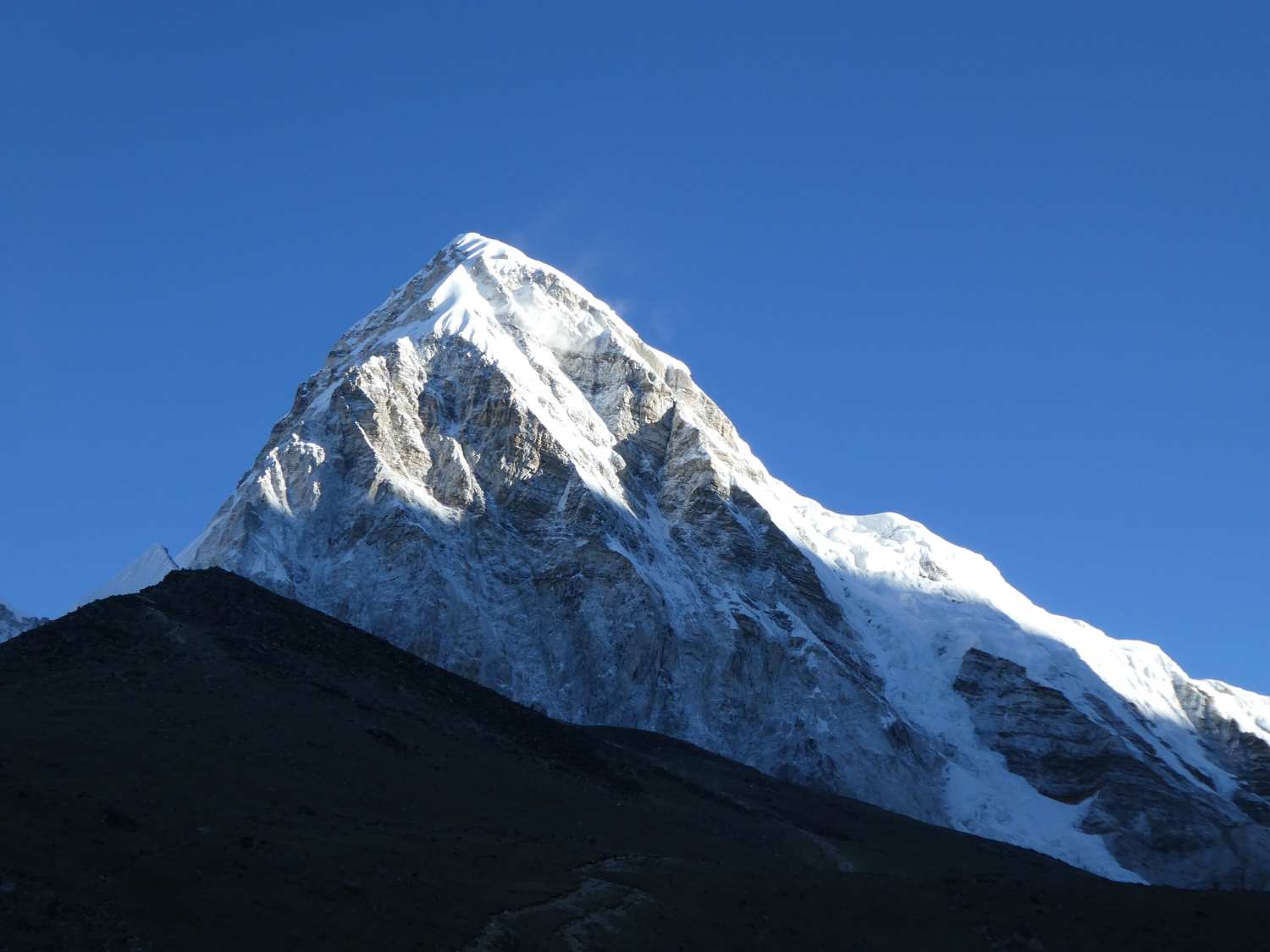
EBC Trek Guide 2026
Master the Journey: The Ultimate EBC Trek Guide
The air in the Himalayas doesn't just feel thinner; it feels alive with the scent of juniper incense and the distant ring of yak bells. Are you ready to stand at the foot of the world’s highest peak? Whether you’ve been dreaming of the Khumbu Valley for years or recently felt the pull of the mountains, embarking on an EBC Trek Guide is more than just a hike—it's a transformative pilgrimage through the heart of the Sagarmatha National Park.
But let’s be honest: a journey to Everest Base Camp isn't something you simply "show up" for. You likely have a dozen tabs open right now, wondering about the physical difficulty, the complexity of permits, or how to properly prepare for the Everest Base Camp altitude. We’ve all been there—feeling that mix of electric excitement and "am I actually ready for this?" nerves.
In this comprehensive guide, we are going to strip away the mystery of the trail. We’ll walk you through:
-
The best itinerary to ensure safe acclimatization.
-
How to immerse yourself in the rich traditions of the Sherpas.
-
Practical travel logistics, from landing in Kathmandu to the legendary flight to Lukla.
From the vibrant, terraced hillsides to the spiritual stillness of Buddhist monasteries, we’ve designed this resource to be your definitive companion. So, lace up your boots and take a deep breath—your journey to the top of the world begins right here.
The Foundations of Your Everest Base Camp Adventure
Before you ever set foot on a plane, you have to ask yourself: are you truly prepared for the "Roof of the World"? It is easy to get swept up in the stunning photography of the Himalayas, but the Everest Base Camp journey begins long before you reach the trail. Success in the Khumbu Valley is built on a foundation of smart planning and realistic expectations.
Assessing Trekking Difficulty: What Are You Really Signing Up For?
Is the trek hard? The honest answer is: it depends on your preparation. While you don't need to be a professional mountaineer, the difficulty lies in the endurance required to hike for two weeks straight.
-
The Vertical Challenge: You’ll be gaining thousands of meters in elevation, often on rocky, uneven terrain.
-
The Oxygen Factor: Physical exertion feels twice as heavy when there is 50% less oxygen available than at sea level.
-
The Mental Test: Can you handle basic teahouses and long days of walking? Your mindset is just as important as your leg strength.
The Ideal Itinerary: Why You Can’t Rush Greatness
We often see trekkers trying to shave days off their itinerary to save money or time. This is the biggest mistake you can make. A standard 12–14 day trekking duration isn't just a suggestion; it is a physiological necessity for acclimatization.
-
Safety First: Extra days allow your body to produce more red blood cells to carry oxygen.
-
Enjoyment: Do you want to suffer through a headache, or do you want to enjoy the view?
-
Flexibility: Mountain weather is unpredictable. A buffer day in your schedule can be the difference between reaching the base camp and turning back due to a closed airport.
Total Cost Breakdown: Investing in Your Experience
What does a dream like this actually cost? While trekking in Nepal is generally affordable compared to the Alps or the Rockies, the expenses add up when you are in a remote wilderness.
-
Flights and Transport: Budget for the round-trip flight from Kathmandu to Lukla.
-
Daily Expenses: Expect to spend between $30–$50 USD per day on food and a bed in a teahouse trek setting.
-
The "Luxury" Tax: Higher up, simple things like a hot shower, charging a camera, or a Wi-Fi card come with an extra fee.
Best Trekking Seasons: Timing Your Triumph
When should you go? Timing is everything when it comes to mountain views and trail safety.
-
Spring (March to May): You’ll share the trail with climbers aiming for the summit. The weather is warmer, and the rhododendrons are in full bloom.
-
Autumn (September to November): This is the gold standard for best trekking seasons. The monsoon has washed away the dust, leaving the air incredibly crisp and the views of the peaks razor-sharp.
Are you ready to turn these foundations into action? Let's look at the specific paperwork and logistics you'll need to handle before the fun begins.
Pre-Trip Logistics and Essential Documentation
Now that you’ve committed to the journey, it’s time to talk about the "boring" stuff that makes the "exciting" stuff possible. Have you ever stood in an international airport realizing you missed a single, crucial stamp? It’s a sinking feeling we want you to avoid. Navigating the travel logistics of Nepal requires a bit of patience, but once you have your ducks in a row, the path to the mountains opens up beautifully.
Securing Your Visa and Permits: The Keys to the Kingdom
Entering the Everest region isn't as simple as just showing up with a backpack. Because you’ll be wandering through the protected Sagarmatha National Park, there are specific permits you must obtain to keep your journey legal and support local conservation.
-
Nepal Entry Visa: You can typically get this on arrival at the airport in Kathmandu. Pro tip: Fill out the online form ahead of time to skip the longest queues!
-
Khumbu Pasang Lhamu Rural Municipality Entrance Permit: This is the local fee that replaced the old TIMS card for most trekkers.
-
Sagarmatha National Park Entry Permit: This is essential for entering the UNESCO World Heritage site where Everest lives.
-
Keep Them Handy: I recommend keeping physical copies of these in a waterproof folder in your daypack. You will be asked to show them at various checkpoints along the trail!
Arrival in Kathmandu: Your High-Altitude Launchpad
Think of Kathmandu as your final rehearsal. This vibrant, chaotic, and beautiful city is where you’ll do your final gear checks and soak up the last bit of "city comfort" before heading into the wild.
-
Gear Audit: Did you forget a down jacket? Don't panic. The Thamel district is packed with shops where you can buy or rent quality gear for a fraction of the price back home.
-
The Briefing: If you’ve booked guided tours, this is when you’ll meet your lead guide for a final safety briefing.
-
Currency Exchange: While some places take cards, the mountains run on cash. Stock up on Nepalese Rupees here, as ATMs in the mountains are notoriously unreliable.
The Flight to Lukla: An Adventure in Itself
Is the flight to Lukla as scary as the YouTube videos suggest? It’s certainly an adrenaline rush! This short flight takes you from the capital to the gateway of the Everest region, landing on a short, uphill runway carved into the side of a mountain.
-
Weather Delays: Be prepared for the "Lukla Wait." Flights only take off when visibility is perfect. Always build a "buffer day" into your itinerary to account for potential mountain fog.
-
The View: Sit on the left side of the plane when flying from Kathmandu for your first glimpse of the Himalayan giants.
Choosing Your Support: To Guide or Not to Guide?
One of the biggest questions we get is: "Should I go with independent trekking or hire a professional?"
-
The Guided Experience: Perfect if you want someone else to handle the teahouse trek bookings, navigation, and health monitoring. It’s also a fantastic way to learn about local culture directly from the Sherpas.
-
Going Independent: This offers maximum freedom and can reduce your cost, but the responsibility for safety and logistics falls entirely on your shoulders.
Whichever you choose, remember that hiring a local porter or guide isn't just about making your life easier—it's a direct and vital contribution to the local mountain economy. Ready to see what actually goes into that backpack? Let’s talk gear.
trategic Packing Lists for High-Altitude Success
Have you ever tried to zip up a suitcase and thought, "Am I forgetting something that might literally save my life?" When it comes to the Khumbu Valley, your packing list is more than just a list of clothes—it is your mobile life-support system. The secret to a successful Everest Base Camp trek isn't bringing more gear; it’s bringing the right gear. Let’s break down how to pack like a pro without weighing yourself down.
The Core Packing List: Mastering the Layering System
In the Himalayas, you can experience four seasons in a single afternoon. How do you stay comfortable when it’s sweating-hot in the sun and freezing in the shade? You layer.
-
The Base Layer: Opt for moisture-wicking merino wool. It keeps you dry and, crucially, stays relatively odor-free after four days of trekking.
-
The Mid Layer: A high-quality fleece or a "puffy" down jacket is your best friend. This traps your body heat when the sun dips behind a 7,000-meter peak.
-
The Outer Shell: You need a breathable, waterproof, and windproof jacket. This is your shield against the biting Himalayan wind.
Footwear and Hardware: Your Tools for the Trail
Your feet are your most valuable asset. If they fail, the journey ends. Are your boots truly broken in yet?
-
The Boots: Invest in high-top, waterproof trekking boots with a stiff sole. Wear them for at least 50 miles before arriving in Kathmandu to avoid trail-ending blisters.
-
Trekking Poles: Don't let pride get in the way of your knees. Poles reduce the impact on your joints by up to 25%—a lifesaver on the steep descents after reaching the Everest Base Camp altitude.
-
The Daypack: A 30L pack with a rain cover is perfect. You’ll carry your water, snacks, layers, and camera, while your porter (if you have one) carries the rest.
Tech and Power: Staying Charged in the Clouds
Staying connected during a teahouse trek is easier than it used to be, but it still requires a strategy.
-
Power Banks: Batteries drain faster in the cold. Bring at least two high-capacity power banks. Charging at teahouses in Lobuche or Gorak Shep can be expensive and slow.
-
Universal Adapters: While many places use standard European or Indian plugs, a universal adapter ensures you're never left in the dark.
-
Offline Maps: Download your trekking maps and guidebook onto your phone for those moments when the mountain Wi-Fi inevitably fails.
Medical Essentials: Your High-Altitude Toolkit
Beyond standard band-aids, your medical kit needs to be specifically tuned for the mountains.
-
Altitude Sickness Prevention: While we’ll dive deeper into safety later, having a supply of Diamox (Acetazolamide) and knowing how to use it is a common part of most packing lists.
-
Water Purification: Save money and the environment! Bring a Grayl filter or Chlorine dioxide drops. Buying bottled water at 5,000 meters is costly and adds to the plastic waste in the Sagarmatha National Park.
-
The "Himalayan Drugstore": Include rehydration salts, ibuprofen, and a broad-spectrum antibiotic (consult your doctor first).
Think you’ve got it all? Double-check your weight! Most domestic flights to Lukla have a strict weight limit (typically 15kg total). Once your bag is packed, it’s time to actually step onto the trail and witness the incredible culture of the Everest region.
Life on the Trail: Routes and Cultural Landmarks
Have you ever wondered what it feels like to walk through a living museum? Beyond the jagged peaks and the thin air, the Khumbu Valley is defined by a culture that is as resilient as the mountains themselves. This isn't just a hike; it is an immersion into the spiritual and daily lives of the Sherpas. As you move from one village to the next, you’ll find that the "path" is actually a network of ancient trails connecting centuries-old traditions.
The Classic Route vs. Route Variations: Choosing Your Path
While the standard path from Lukla is the most popular, did you know there are multiple ways to reach the base of the world's tallest mountain? Your choice changes the entire "flavor" of your itinerary.
-
The Classic Teahouse Trek: Starting in Lukla, this is the most direct route, perfect for those with a standard trekking duration of 12–14 days.
-
The Pioneers' Path: Starting from Jiri, this "walk-in" route adds about 5–7 days of lush, lower-altitude hiking. It offers incredible acclimatization benefits and a glimpse into rural Nepali life away from the main crowds.
-
The Three Passes Trek: For the true adventurer, this loop crosses high-altitude passes like Kongma La and Cho La. It is physically demanding but offers the most comprehensive view of the Sagarmatha National Park.
Namche Bazaar and Tengboche Monastery: The Heart of the High Himalaya
As you ascend, you’ll encounter landmarks that stay with you long after you’ve returned home.
-
Namche Bazaar: This horseshoe-shaped town is the unofficial capital of the Khumbu. It’s where you’ll spend your first acclimatization days, perhaps sipping a coffee at the world’s highest Irish Pub or browsing local handicrafts.
-
Tengboche Monastery: Perched on a ridge with a panoramic view of Everest, Lhotse, and Ama Dablam, this is the spiritual soul of the region. If you time your visit right, you might hear the deep, rhythmic chanting of monks during afternoon prayers.
-
Pheriche and Lobuche: These higher settlements offer a grittier, more rugged experience. Here, the trees disappear, and the landscape turns into a dramatic, lunar-like expanse of rock and ice.
The Teahouse Experience: Comfort in the Clouds
What is a teahouse trek actually like? Forget five-star hotels; here, luxury is defined by a warm stove and a steaming bowl of garlic soup.
-
Communal Living: Most teahouses feature a central dining room heated by a yak-dung stove—the social hub where trekkers from across the globe swap stories.
-
The Menu: You’ll quickly learn that Dal Bhat (lentil soup and rice) is the "power fuel" of the Himalayas. It’s nutritious, filling, and comes with free refills!
-
Sleeping Quarters: Expect simple, unheated twin rooms. This is where that high-quality sleeping bag from your packing list earns its keep.
Spiritual Landscapes: Respecting Local Traditions
You are a guest in a sacred landscape. How do you ensure your presence is respectful?
-
Mani Walls and Prayer Wheels: You will encounter stones carved with Tibetan Buddhist mantras. Always pass these on the left (clockwise) out of respect for local tradition.
-
The Khumbu Icefall: From the upper reaches of Gorak Shep, you’ll see the shifting blue ice of the glacier. It is a sobering reminder of the power of nature and the bravery of the mountain workers who navigate it.
By the time you reach the higher altitudes of the Khumbu Valley, the landscape changes from green forests to stark, high-alpine tundra. But as the scenery grows more harsh, the importance of safety becomes paramount. Let’s talk about how to stay healthy as the air gets thin.
Health, Safety, and the Ascent to Base Camp
As the jagged peaks of the Khumbu Valley begin to tower over you, the excitement is palpable—but so is the thinning air. Have you noticed your breath coming a little shorter? That’s the mountain reminding you who is in charge. Reaching the Everest Base Camp altitude of 5,364 meters is a monumental achievement, but the real victory is getting there safely and feeling strong enough to actually enjoy the view.
Acclimatization Protocols: Why Slow and Steady Wins the Race
If there is one thing I want you to remember, it’s that your body is a marvel of adaptation—it just needs time. We don't "conquer" the mountain; we ask it for permission to pass. This is why strategic rest days in villages like Namche Bazaar and Pheriche are non-negotiable parts of your itinerary.
-
The "Climb High, Sleep Low" Rule: During your acclimatization days, your guide will likely take you on a short, steep hike to a higher elevation before returning to a lower village to sleep. This "shocks" your system into producing more red blood cells without overtaxing you overnight.
-
Hydration is Your Fuel: You should be drinking 3–4 liters of water daily. Dehydration mimics the symptoms of altitude sickness, so keep that bladder full!
-
Listen to Your Body: A mild headache is common, but if it doesn't go away with water and rest, it's a signal you need to pay attention to.
Managing Altitude Sickness: Knowledge is Your Best Defense
What does altitude sickness (AMS) actually feel like? For most, it starts like a bad hangover: a persistent headache, loss of appetite, and trouble sleeping.
-
Early Detection: If you feel nauseous or unusually dizzy, tell your guide immediately. There is no room for "toughing it out" at 5,000 meters.
-
The Descent Rule: The absolute best cure for AMS is descending to a lower altitude. Even a drop of 500 meters can work wonders.
-
Medication: Many trekkers use altitude sickness prevention aids like Acetazolamide (Diamox). While it helps your body adjust faster, it isn’t a magic bullet—you still need to monitor your symptoms closely.
The Final Push: Reaching Everest Base Camp
The trail from Lobuche to Gorak Shep is where the landscape turns truly "otherworldly." You are walking alongside the massive Khumbu Glacier, a river of ice and rock that feels ancient and alive.
-
The Base Camp Experience: Standing at the prayer-flag-strewn rock that marks Everest Base Camp is a surreal moment. You’ll see the yellow tents of expedition teams and the terrifying beauty of the Khumbu Icefall.
-
The Reality Check: Remember, you can't actually see the summit of Everest from the Base Camp itself—it's hidden behind the massive Nuptse ridge. For that iconic view, you have one more challenge ahead.
Kala Patthar Sunrise: The Ultimate Reward
Is it worth waking up at 4:00 AM in sub-zero temperatures to climb a giant hill? Absolutely. Kala Patthar (5,550m) is the highest point most trekkers will reach, and it offers the most famous panoramic view in the world.
-
The View: As the sun rises, it hits the summit of Everest first, turning the peak a brilliant gold while the rest of the world is still in shadow.
-
The Achievement: Standing here, looking out over the giants of the Himalaya, the weeks of training and the cold nights suddenly make perfect sense.
You've reached the goal, but the journey isn't quite over. There are still hidden corners of this range to explore and essential safety nets to discuss. Are you ready to look beyond the standard trail?
Beyond the Base Camp: Extended Himalayan Challenges
So, you’ve reached the prayer flags of Everest Base Camp—congratulations! But as you stand there, looking at the horizon, do you feel that familiar itch for "just a little bit more"? The Khumbu region is a vast playground, and for those with extra time or a hunger for technical challenges, the classic route is just the beginning. Whether you want to escape the crowds or test your climbing mettle, these extensions turn a great trek into a legendary one.
The Gokyo Lakes Trek: A Turquoise Alternative
If you prefer shimmering glacial lakes over rocky moraines, the Gokyo Lakes Trek is calling your name. Many trekkers consider this the most beautiful valley in the Everest region.
-
The Six Sacred Lakes: Imagine standing beside a chain of six high-altitude lakes, their turquoise water contrasting against the stark white of the surrounding peaks.
-
Gokyo Ri: While Kala Patthar gives you the best close-up of Everest, Gokyo Ri (5,357m) offers a wider panorama that includes four 8,000-meter giants: Everest, Lhotse, Makalu, and Cho Oyu.
-
The Cho La Pass: Want the best of both worlds? You can connect the Gokyo Valley to the main EBC trail by crossing this high-altitude pass. It involves a steep, technical glacier crossing that will certainly get your heart racing!
Taking it Up a Notch: The Island Peak Climb
Are you ready to transition from trekking to mountaineering? Island Peak (Imja Tse) is the most popular "trekking peak" in Nepal for a reason. At 6,189 meters, it offers a true alpine experience without requiring decades of climbing history.
-
Technical Thrills: You’ll get to use crampons, harnesses, and ice axes to navigate a snow-covered summit ridge.
-
The View from the Top: Standing on the summit of Island Peak puts you right in the middle of a massive glacial circus, with the South Face of Lhotse looming directly over you.
Essential Safety Nets: Why Travel Insurance is Non-Negotiable
Let’s have a serious "trail talk" for a moment. In the Himalayas, the unexpected is the only thing you can count on. Have you checked the fine print on your travel insurance lately?
-
The 5,000m Rule: Most standard policies stop covering you once you cross 3,000 or 4,000 meters. For EBC, your policy must explicitly cover trekking up to 6,000 meters.
-
Helicopter Evacuation: A single rescue flight from the Khumbu to Kathmandu can cost between $3,000 and $7,000. Ensure your provider offers "direct billing" so you aren't stuck trying to find thousands of dollars in cash while dealing with a medical emergency.
-
Search and Rescue: Confirm that your coverage includes "Search and Rescue" as a separate clause from standard medical evacuation.
Navigating Like a Pro: Trekking Maps and Guidebooks
Even with a guide, staying oriented is part of the fun. In 2026, technology is better than ever, but the mountains still love to eat battery life.
-
Digital vs. Paper: Apps like Maps.me or AllTrails are great for offline GPS, but a physical trekking map (like those from National Geographic or Nepa Maps) doesn't need a charging port.
-
The Modern Guidebook: A good guidebook provides context that a map can’t—explaining the history of the Buddhist monasteries you pass or the significance of the Mani walls along the trail.
Whether you choose the classic path or a rugged high-pass circuit, the Everest region promises a journey that stays in your soul long after your boots have dried. Have these insights helped clarify your path? What part of the Everest adventure are you most excited—or perhaps a little nervous—to tackle?
Your journey to the roof of the world is more than a hike; it’s a testament to your resilience and a deep dive into one of the most storied landscapes on Earth. As we’ve explored, the secret to a successful Everest Base Camp adventure lies in the balance of meticulous preparation and the willingness to slow down. By prioritizing a smart itinerary, respecting the local Sherpa culture, and keeping a watchful eye on acclimatization, you transform a challenging high-altitude trek into a life-changing triumph.
The mountains are waiting, and with this EBC Trek Guide as your roadmap, you’re ready to trade the digital noise for the sound of prayer flags snapping in the wind. Pack your bags, trust your training, and prepare for the moment you finally stand at the base of the world’s highest peak.
Frequently Asked Questions
How difficult is the Everest Base Camp trek for beginners?
The trek is rated as "moderate to strenuous." You don't need technical climbing skills or ropes, but you do need solid cardiovascular endurance. If you can comfortably walk 5–7 hours a day on hilly terrain back home, you can succeed here with a slow and steady pace.
When is the best time to trek to EBC in 2026?
The two primary windows are Spring (March to May) and Autumn (September to November). Spring offers blooming rhododendrons and warmer temperatures, while Autumn is famous for having the crispest, most stable skies for photography.
What permits do I actually need?
As of 2026, you primarily need two permits: the Sagarmatha National Park Entry Permit and the Khumbu Pasang Lhamu Rural Municipality Permit. The old TIMS card is no longer required for this specific route, but always check for the latest local regulations in Kathmandu before you fly to Lukla.
How much does the trek typically cost?
A standard 14-day trek generally ranges from $1,300 to $2,500 USD, depending on whether you choose a luxury lodge or a budget teahouse trek. This typically covers your permits, local flights, food, and a guide.
Can I prevent altitude sickness with medication?
While many trekkers use Acetazolamide (Diamox) to aid acclimatization, it is not a substitute for a proper pace. The best prevention is staying hydrated, avoiding alcohol, and following an itinerary that includes rest days in Namche Bazaar and Dingboche.
Is independent trekking still allowed in the Everest region?
While Nepal has implemented stricter rules for many regions, the Khumbu (Everest) region has historically allowed more flexibility. However, as of 2026, hiring a licensed guide is highly recommended for safety and to ensure you can easily navigate the digital permitting systems now in place at trail checkpoints.
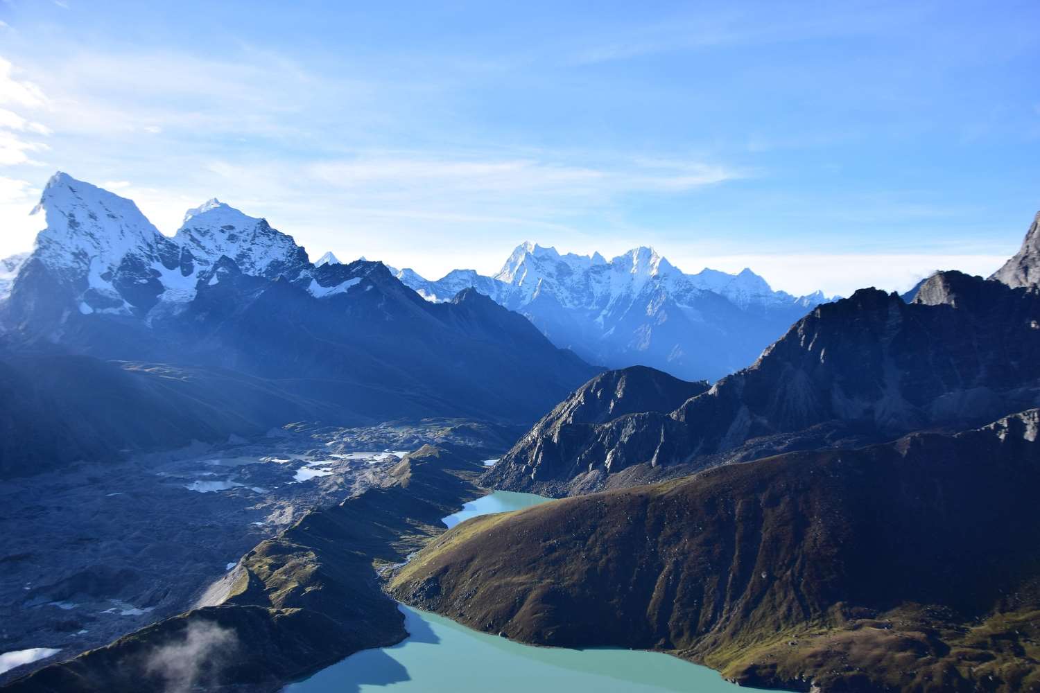
Annapurna Circuit vs Everest Base Camp: Which Trek Should You Choose in Nepal?
Annapurna Circuit vs Everest Base Camp: The Ultimate Comparison Guide
Choosing Between Two Legendary Himalayan Treks
If you're planning a trekking adventure in Nepal, you've likely encountered the ultimate dilemma: Annapurna Circuit vs Everest Base Camp—which one is better?
Both treks are world-famous, offering breathtaking Himalayan landscapes, rich cultural experiences, and a once-in-a-lifetime journey. But here's the challenge: they deliver very different experiences, and choosing the wrong one could mean missing out on what you truly want.
In this comprehensive guide, we'll break down everything you need to know—from cost and difficulty to scenery, permits, and logistics—so you can confidently choose between the Annapurna Circuit and the Everest Base Camp.
Quick Reference: Which Trek Should You Choose?
Not sure where to start? Use this simple decision flow chart:
| Your Priority | Recommended Trek |
|---|---|
| You dream of standing at the foot of Mount Everest | → Everest Base Camp |
| You want diverse landscapes from jungle to high desert | → Annapurna Circuit |
| Your budget is under $1,200 | → Annapurna Circuit |
| Budget is flexible ($1,500+) | → Either, but EBC requires more |
| You have 12-14 days total | → Everest Base Camp |
| You have 15+ days for a relaxed pace | → Annapurna Circuit |
| You prefer gradual altitude gain with lower AMS risk | → Annapurna Circuit |
| You're fit and ready for a high-altitude challenge | → Everest Base Camp |
| You want to trek independently without a guide | → Annapurna Circuit (easier to navigate solo) |
| You prefer organized group treks with fixed logistics | → Everest Base Camp (common with guides) |
Overview: Annapurna Circuit vs Everest Base Camp
What is the Annapurna Circuit Trek?
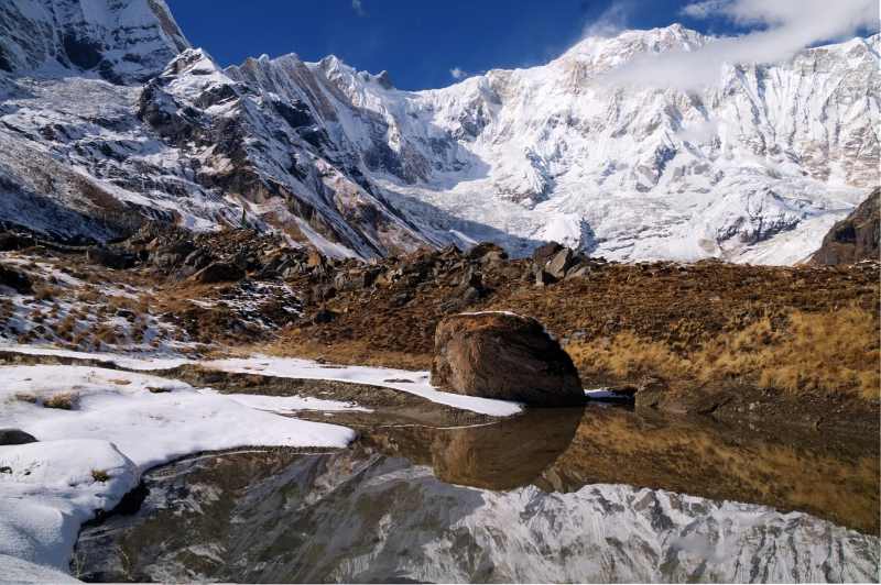
The Annapurna Circuit is one of Nepal's most diverse trekking routes, circling the massive Annapurna range. It takes you through lush forests, terraced farmlands, alpine valleys, and high mountain deserts—essentially experiencing all four seasons in a single journey.
Highlights include:
-
Crossing the iconic Thorong La Pass (5,416m) —a monumental, collective achievement
-
Experiencing diverse cultures (Gurung, Thakali, Tibetan) in traditional villages
-
Stunning views of Annapurna, Dhaulagiri, and Manaslu ranges
-
Ending in the Kali Gandaki Gorge, the world's deepest gorge
👉 Best for: Travelers seeking variety, cultural immersion, and a true sense of journey.
What is the Everest Base Camp Trek?
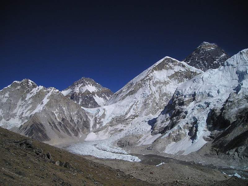
The Everest Base Camp (EBC) trek is a legendary journey that takes you to the foot of the world's highest mountain, Mount Everest. The focused goal creates a powerful sense of purpose, and the daily presence of massive, world-famous peaks creates constant awe.
Key highlights:
-
Reaching Everest Base Camp (5,364m) at the foot of the world's highest peak
-
Sunrise views from Kala Patthar (5,545m) —the best vantage point for Everest
-
Walking through iconic Sherpa villages like Namche Bazaar and Tengboche
-
Visiting ancient monasteries with breathtaking mountain backdrops
👉 Best for: Those chasing the iconic Everest dream and seeking a focused, high-altitude challenge.
Key Differences at a Glance
| Feature | Annapurna Circuit | Everest Base Camp |
|---|---|---|
| Duration | 12–20 days | 12–14 days |
| Max Altitude | 5,416m (Thorong La Pass) | 5,545m (Kala Patthar) |
| Cost | $700–$1,200 | $1,200–$2,500+ |
| Accessibility | Road access from Kathmandu/Pokhara | Flight to Lukla required |
| Experience | Diverse landscapes, cultural variety | Iconic mountain views, focused goal |
| Trail Vibe | A true "journey" through changing worlds | A purposeful "mission" with big peaks daily |
Difficulty Level: Which Trek is More Challenging?
Both treks are moderately difficult, but they challenge you in very different ways. Here's a detailed breakdown:
| Challenge | Annapurna Circuit | Everest Base Camp |
|---|---|---|
| Altitude Sickness Risk | Lower – Gradual ascent profile with built-in acclimatization days. The classic circuit allows your body to adapt slowly. | Higher – Faster altitude gain, especially the jump from Namche Bazaar (3,440m) to Dingboche (4,410m). Requires careful pacing. |
| Day-to-Day Physicality | Longer trekking days overall. The Thorong La Pass day is extremely demanding (7-9 hours of steady climbing at high altitude). Other days are moderate. | Shorter but consistent. Daily treks are 4-7 hours, but the terrain is constantly up and down. The final push to Kala Patthar and EBC is mentally and physically taxing at extreme altitude. |
| Terrain & Trail Conditions | Varied but generally well-defined. Lower sections are forested trails; after Manang, it becomes rugged high-desert with rocky paths. | Rocky, dusty, and involves walking on glacial moraine (unstable boulder fields). Famous suspension bridges add excitement but require care. |
👉 Verdict:
-
Choose Annapurna Circuit if you prefer a gradual ascent with lower altitude risk and don't mind longer trekking days.
-
Choose Everest Base Camp if you're fit, comfortable with faster altitude gain, and ready for intense high-altitude challenges.
Cost Comparison: Which Trek is More Affordable?
One of the biggest deciding factors is budget. Here's a realistic breakdown:
| Expense Category | Annapurna Circuit | Everest Base Camp |
|---|---|---|
| Permits | $30–$50 (ACAP + TIMS) | $50–$70 (Sagarmatha National Park + Khumbu Municipality) |
| Transport | $20–$50 (bus from Kathmandu to Besisahar or Pokhara) | $150–$200 (round-trip flight Kathmandu–Lukla) |
| Food & Accommodation | $20–$35 per day | $35–$60 per day (prices increase significantly with altitude) |
| Guide & Porter | $20–$30 per day for guide; $15–$20 for porter | $25–$35 per day for guide; $20–$25 for porter (higher demand) |
| Total Estimated Cost | $700–$1,200 (independent or guided) | $1,200–$2,500+ |
Hidden Costs to Consider
-
Travel Insurance: Mandatory for both, but EBC requires coverage up to 6,000m, which costs more.
-
Gear Rental: If you need to rent sleeping bags, down jackets, or trekking poles, budget an extra $50–$100.
-
Extra Expenses at Altitude: On EBC, expect to pay $3–$5 for hot showers, device charging, and WiFi once you're above Namche.
-
Buffer Days: Always add 2-3 buffer days for EBC in case of Lukla flight delays.
👉 Verdict: Annapurna Circuit is significantly more budget-friendly.
Scenery and Experience: Which Trek Offers Better Views?
Annapurna Circuit Experience
-
Incredible diversity: You'll walk through subtropical forests, terraced rice paddies, alpine meadows, and a high-altitude desert reminiscent of Tibet.
-
Cultural richness: Pass through Gurung, Manangi, and Thakali villages with distinct traditions, architecture, and cuisine.
-
The Thorong La moment: Crossing the 5,416m pass is a powerful, shared experience with fellow trekkers from around the world.
-
Less crowded: Outside the main season, sections of the trail feel remote and peaceful.
Everest Base Camp Experience
-
Close-up views of giants: Walk beneath Everest, Lhotse, Nuptse, and Ama Dablam—peaks that define Himalayan mountaineering.
-
Glacier landscapes: Trek alongside the Khumbu Glacier and experience the raw, dramatic terrain of the high Himalayas.
-
Sherpa culture: Immerse yourself in the world of the legendary Sherpa people, with monasteries, prayer flags, and vibrant mountain culture.
-
Sense of achievement: Reaching Base Camp and summiting Kala Patthar at sunrise delivers an unparalleled feeling of accomplishment.
👉 Verdict:
-
Choose Annapurna Circuit for variety and cultural depth.
-
Choose Everest Base Camp for iconic, dramatic mountain scenery.
Trek Duration and Itinerary Comparison
Annapurna Circuit Itinerary
-
Duration: 12–20 days depending on route and side trips
-
Flexibility: You can start at Besisahar or Chame and end at Jomsom or Pokhara. Many trekkers add side trips to Tilicho Lake or Poon Hill.
-
Pacing: Longer duration allows for more acclimatization and rest days.
Everest Base Camp Itinerary
-
Duration: 12–14 days standard route
-
Structure: More fixed due to Lukla flight logistics and limited side trip options (though you can add Gokyo Lakes or Chola Pass for extended treks)
-
Pacing: Compact itinerary with carefully planned acclimatization stops in Namche and Dingboche
👉 If you have limited time (12-14 days total), EBC is more suitable. If you have 15+ days and prefer flexibility, Annapurna Circuit allows for a more relaxed pace.
Accessibility and Transportation
| Factor | Annapurna Circuit | Everest Base Camp |
|---|---|---|
| Getting to Trailhead | 6-8 hour bus/jeep ride from Kathmandu to Besisahar or Pokhara. No flights required. | 30-minute flight from Kathmandu to Lukla (weather-dependent). Flight delays are common, especially in spring and autumn. |
| Trail Access | Road construction now reaches as far as Manang, allowing for shorter trek options. | Trail access only by foot from Lukla; no road access. |
| Return Transport | Easy bus or flight options from Jomsom or Pokhara back to Kathmandu. | Return flight from Lukla to Kathmandu; same weather risks apply. |
👉 Pro Tip: Always add 2-3 buffer days for Everest Base Camp treks to account for potential flight delays. For Annapurna Circuit, road transport is reliable and flexible.
Accommodation and Food Experience
Both treks operate on the tea house trekking system—basic lodges offering food and lodging along the trail.
| Aspect | Annapurna Circuit | Everest Base Camp |
|---|---|---|
| Accommodation Quality | More varied. In lower villages, rooms with attached bathrooms are common. Facilities become basic at higher altitudes, but villages are larger with more choices. | More standardized. Above Namche, rooms are very basic (often shared). Hot water, charging, and WiFi are available but cost extra ($3–$5 per item). |
| Food Variety | Wider selection—from traditional Nepali dal bhat to pizza, pasta, and Tibetan dishes. More developed villages offer diverse menus. | Simpler menus focused on carbohydrates for energy. Prices increase significantly with altitude. A bowl of dal bhat might cost $8–$10 near Base Camp. |
| Booking During Peak Season | Generally possible to find rooms without advance booking, though arriving early helps. | Highly recommended to book ahead in Namche and Dingboche during peak months (October–November, March–April). |
💡 Recommendation: Stick to local dishes like dal bhat (lentil soup with rice) for better hygiene, reliable energy, and often free seconds—a trekkers' favorite.
Best Time to Trek: Annapurna Circuit vs Everest Base Camp
Best Seasons for Both Treks
-
Spring (March–May): Stable weather, blooming rhododendrons, moderate temperatures.
-
Autumn (September–November): Crystal-clear skies, stable conditions, peak tourist season.
Weather Comparison
| Factor | Annapurna Circuit | Everest Base Camp |
|---|---|---|
| Temperature | Slightly warmer overall. Lower sections remain pleasant; Thorong La can be cold and windy. | Colder at all altitudes. Nighttime temperatures at Base Camp can drop to -10°C to -20°C. |
| Wind | Windy at Thorong La, but valleys are often sheltered. | Consistently windy, especially in the afternoons. |
| Crowds | Busy but spread out along the circuit. | Very congested on the main trail, especially in Namche and Tengboche during peak season. |
👉 Avoid the monsoon (June–August) unless you're experienced with slippery trails and leeches. Winter (December–February) is possible but requires serious cold-weather gear and some tea houses may be closed.
Solo vs. Guided Trekking: What You Need to Know
| Factor | Annapurna Circuit | Everest Base Camp |
|---|---|---|
| Solo Trekking | Easier to do independently. The trail is well-marked, infrastructure is robust, and you'll easily find tea houses and fellow trekkers. A guide is not mandatory but can add cultural depth. | Possible but more complex. Lukla flight logistics, permit checks (Khumbu Municipality permit), and higher altitude risks make a guide valuable. Many trekkers opt for groups. |
| Guided Trekking | Guides are affordable and can enrich your experience with cultural insights and local connections. | Highly recommended for first-timers. Guides help manage altitude symptoms, navigate crowded trails, and handle permits. |
| Permit Complexity | Simple: ACAP + TIMS. Can be obtained in Kathmandu or Pokhara. | More complex: Sagarmatha National Park permit + Khumbu Pasang Lhamu Rural Municipality permit. Permits are checked at multiple checkpoints. |
Permits: What You'll Need
Annapurna Circuit
-
Annapurna Conservation Area Permit (ACAP): NPR 3,000 (approx. $25) for foreign nationals
-
Trekkers' Information Management System (TIMS) Card: NPR 2,000 (approx. $15)
Everest Base Camp
-
Sagarmatha National Park Permit: NPR 3,000 (approx. $25)
-
Khumbu Pasang Lhamu Rural Municipality Permit: NPR 2,000 (approx. $15)—a local permit often checked in Monjo
💡 Pro Tip: Permits can be arranged through a trekking agency or obtained in Kathmandu. For EBC, ensure you have both permits before starting the trek.
Expert Tips for Choosing the Right Trek
✅ Assess your fitness level honestly. Both treks require good cardiovascular fitness. If you're unsure, consider adding training hikes beforehand.
✅ Consider your budget and time. Be realistic about what you can afford and how many days you truly have, including travel to/from Nepal.
✅ Travel with a guide for safety. Especially for EBC, a guide provides invaluable support for altitude management, logistics, and cultural context.
✅ Acclimatize properly. "Walk high, sleep low" is the golden rule. Never skip acclimatization days.
✅ Pack for the conditions. Annapurna requires layering for all seasons; EBC demands serious cold-weather gear.
✅ Add buffer days. For EBC, always plan 2-3 extra days for Lukla flight delays. For Annapurna, buffer days allow for rest or side trips.
💬 Personal Insight: Many trekkers I've worked with regret choosing Everest purely for its fame when Annapurna would have suited their style better. Choose based on experience, not hype.
What to Pack: Trek-Specific Gear Tips
For Annapurna Circuit
-
Prepare for all four seasons in one trek. You'll need gear for humid lowlands and freezing, windy high passes.
-
Layering is critical. Lightweight base layers, mid-layer fleece, and a warm down jacket for Thorong La morning.
-
Waterproof jacket and pants for lower sections where rain is possible.
For Everest Base Camp
-
Focus on extreme cold-weather gear. Nighttime temperatures at higher elevations drop significantly.
-
A high-quality down jacket (rated to -10°C or lower) is non-negotiable.
-
Warm sleeping bag (rated to -15°C or lower) as tea house blankets are often insufficient.
-
Insulated, waterproof boots are essential for cold, rocky, and potentially snowy trails.
FAQs: Annapurna Circuit vs Everest Base Camp
Which is better, Annapurna Circuit or Everest Base Camp? It depends on your goals—Annapurna offers variety and cultural depth, while Everest offers iconic mountain prestige and a focused challenge.
Is Annapurna Circuit easier than Everest Base Camp? Generally, yes. The gradual altitude gain and longer acclimatization period make it less prone to altitude sickness. However, the Thorong La crossing is a long, demanding day.
Which trek is more expensive? Everest Base Camp is significantly more costly due to flights, higher permit fees, and inflated prices for food and services at altitude.
Can beginners do Everest Base Camp trek? Yes, with proper preparation, fitness training, and careful acclimatization. However, it's not a "beginner" trek—most first-timers benefit from a guide.
Which trek has better views? Subjective. Annapurna Circuit offers incredible diversity of landscapes; Everest Base Camp delivers close-up, dramatic views of the world's highest peaks.
Do I need a guide for Annapurna Circuit? No, it's easily done independently. A guide adds cultural depth but is not required.
Do I need a guide for Everest Base Camp? Not mandatory, but highly recommended for first-timers due to logistics, altitude risks, and permit complexity.
Conclusion: Make the Right Trekking Choice
Choosing between the Annapurna Circuit and Everest Base Camp isn't about which trek is better—it's about which trek is better for you.
Choose Annapurna Circuit if:
-
You're on a budget
-
You want cultural and landscape diversity
-
You prefer lower altitude risk and gradual ascent
-
You have 15+ days and enjoy flexibility
-
You want to trek independently
Choose Everest Base Camp if:
-
You dream of standing at the foot of Everest
-
You want iconic, dramatic Himalayan views
-
Budget is not a major concern
-
You're comfortable with faster altitude gain
-
You prefer organized group treks with fixed itineraries
Ultimately, your decision comes down to your personal adventure style. Do you dream of the world's highest peak and thrive on focused, iconic challenges? Choose Everest Base Camp. Or do you seek a journey of immense diversity—through climates, cultures, and landscapes—with a legendary mountain pass as its crowning glory? Then the Annapurna Circuit is your perfect trek.
👉 Final Tip: Define your priorities—budget, time, experience—and your decision will become clear.
Ready to Explore Nepal's Himalayas?
Start planning your adventure today. Whether you choose the cultural diversity of the Annapurna Circuit or the iconic majesty of Everest Base Camp, you're guaranteed an unforgettable Himalayan journey.
For the safest and most enriching experience, consider booking with a reputable local trekking operator who can tailor the perfect itinerary to your goals, fitness level, and budget.
💬 If you found this guide helpful, share it with fellow trekkers!
Read more... Read less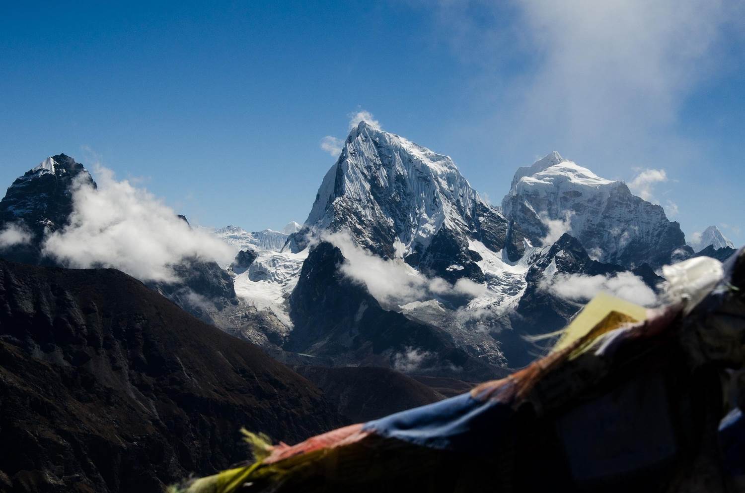
Best Everest Trekking Packages 2026: EBC, Gokyo Lakes & Three Passes
Comparing the Best Everest Trekking Packages for 2026: EBC, Gokyo, and Beyond
Have you ever felt the pull of the world’s highest peaks, a call that transcends mere travel and enters the realm of pure adventure? To stand in the shadow of Mount Everest (8848m) is a bucket-list dream for many, but the true magic of the Himalayas lies in the journey itself. Whether you know it as Sagarmatha (Nepal) or Chomolungma (Tibet), this region is a breathtaking tapestry of vertical landscapes and ancient traditions that remains unparalleled on our planet.
As you plan your journey into the heart of the Mahalangur Himal range, you might find yourself wondering: Which route truly captures the essence of the Khumbu? Is it better to witness the rhododendron forests in full bloom or the crisp, clear skies of the later months? Stepping into Sagarmatha National Park, a UNESCO World Heritage Site, is about more than just checking a destination off a list. It is about immersing yourself in the legendary Sherpa hospitality, navigating the winding trekking routes that have challenged explorers for decades, and testing your own limits against the thin, crisp mountain air.
In this guide, we’ll help you navigate the complexities of planning the ultimate trekking experience. From choosing the perfect Everest itinerary to understanding the vital role of acclimatization, we are here to ensure your expedition is as safe as it is spectacular. Are you ready to discover which path through the clouds is calling your name?
Looking for the best all-inclusive Everest Base Camp trekking packages for 2026? Experience the Khumbu with expert guides, permits, and luxury heli-returns included. Book your 2026 adventure today!
Essential Features of Everest Trekking Packages
When you decide to commit to an adventure in the Himalayas, the logistics should be the last thing on your mind. Have you ever wondered what separates a grueling ordeal from a life-changing journey? The secret lies in the details of your package. A premium experience in the Everest region isn't just about luxury; it’s about safety, cultural depth, and seamless execution.
To ensure you can focus entirely on the majestic Mahalangur Himal range, top-tier trekking packages prioritize the following pillars of service:
-
Expertly Managed Logistics & Permissions: Navigating the bureaucracy of high-altitude travel can be daunting. A quality package handles all necessary trekking permits, including the Sagarmatha National Park Entry Permit and the Khumbu Pasang Lhamu Rural Municipality Permit, so you can walk past the checkpoints with ease.
-
Safety-First Altitude Management: How do you plan to handle the thinning air? Premium operators integrate strict acclimatization schedules into their itineraries. This isn't just a suggestion—it's a vital health protocol to prevent altitude sickness and ensure you enjoy the view from the top rather than the inside of a rescue helicopter.
-
Authentic Hospitality: Beyond the gear and the trails, it is the people who define the Khumbu. We believe your journey is enriched when you stay in hand-picked teahouses that offer genuine hospitality, providing a warm, local perspective that a standard guidebook simply can't capture.
-
Environmental Stewardship: As you traverse a UNESCO World Heritage Site, your footprint matters. Responsible packages focus on sustainable trekking practices that protect the delicate ecosystem of Sagarmatha (Nepal) for generations to come.
Navigating the Technicalities
Before you lace up your boots, ask yourself: Am I fully prepared for the specific requirements of the trail? Beyond your physical fitness, there are technical layers to consider:
-
Fixed-Wing and Rotor Logistics: Standard packages include the famous flight to Lukla, but premium options often provide "Heli-treks" to bypass the repeated descent.
-
Specialized Documentation: If you are a content creator, ensure your agency assists with drone permits, as flying without one in the national park can lead to heavy fines and equipment seizure.
-
Comprehensive Gear Lists: From down jackets rated for the Khumbu Valley winters to the right solar chargers, your package should provide a detailed manifest of what to carry and what they provide.
By choosing a package that balances professional support with personal freedom, you aren't just buying a tour—you’re investing in a successful summit of your own personal goals.
Iconic Everest Base Camp Trek (12-16 Days)
Have you ever closed your eyes and imagined standing at the very base of the highest point on Earth? The Everest Base Camp (EBC) trek is more than just a walk; it is a pilgrimage through the heart of the Himalayas that challenges your body while feeding your soul. For many of us, this 12-to-16-day journey represents the ultimate adventure, a chance to walk in the footsteps of mountaineering legends who have looked up at Mount Everest (8848m) with both awe and ambition.
But what makes this specific route the gold standard of trekking? It’s the perfect harmony between raw natural power and the warmth of the local culture. As you wind through the Khumbu Valley, every turn reveals a new perspective of the world's most dramatic skyline.
Why the Classic Route Remains Unbeatable
While there are many trekking routes in Nepal, the path to Base Camp offers a unique sequence of highlights that you simply won't find anywhere else:
-
Gateway to the High Peaks: Your journey begins with a thrilling flight to Lukla, dropping you straight into the high-alpine world of the Mahalangur Himal range.
-
The Sherpa Capital: Spending time in Namche Bazaar isn't just for acclimatization; it’s your primary window into the vibrant Sherpa hospitality and history that sustains every expedition.
-
Spiritual Landscapes: Passing through the Tengboche Monastery, you’ll feel the spiritual pulse of Sagarmatha (Nepal), where the mountains are revered as sacred deities.
-
The Khumbu Icefall Vista: Standing at Everest Base Camp, you aren't just looking at a destination; you are witnessing the starting point of the world’s most dangerous climbing route.
Maximizing Your Success on the Trail
How do you ensure you actually reach the 5,364-meter mark feeling strong? It comes down to a blend of patience and preparation. We always emphasize that this trek is a marathon, not a sprint.
-
Prioritize Your Health: Respecting the thin air is non-negotiable. Modern packages integrate extra nights in Namche and Dingboche to help your body naturally adjust and ward off altitude sickness.
-
Timing is Everything: To see the mountains at their sharpest, aim for the Autumn (September-November) season. If you prefer the vibrant colors of blooming rhododendron forests, the Spring (March-May) window is your best bet.
-
The Kala Patthar Bonus: Never skip the sunrise hike to Kala Patthar. While Base Camp puts you at the mountain, this viewpoint gives you the most iconic, unobstructed view of the Everest summit itself.
By the time you return to the lower valleys, you’ll realize that while the destination was the goal, the cultural experiences and the quiet moments of reflection among the peaks are what truly stay with you.
Serene Gokyo Lakes and Gokyo Ri Trek (12-14 Days)
Are you the kind of traveler who seeks the path less traveled? If you love the idea of the Everest region but crave a quieter, more contemplative adventure, then the Gokyo Lakes trek might be your perfect match. While the main trails can buzz with activity, heading west into the Gokyo Valley feels like stepping into a hidden sanctuary of ice and turquoise water.
The centerpiece of this journey is a series of six spectacular high-altitude lakes, which are among the highest freshwater systems in the world. But don't let the "serene" title fool you; this is a true Himalayan challenge that rewards your effort with some of the most surreal landscapes in Sagarmatha National Park.
Why Choose the Gokyo Route?
If you’re weighing your options between different trekking routes, here is why the Gokyo circuit consistently wins the hearts of seasoned hikers:
-
Unrivaled Panoramic Views: Many veterans argue that the view from Gokyo Ri (5,357m) actually surpasses that of Kala Patthar. From this single vantage point, you can see four 8,000-meter giants at once: Mount Everest (8848m), Lhotse, Makalu, and Cho Oyu.
-
The Ngozumpa Glacier: You’ll have the chance to stand beside the largest glacier in the Nepal Himalayas. Hearing the occasional crack and groan of the moving ice is a powerful reminder of the raw, living nature of this landscape.
-
A Quieter Atmosphere: Because this route peels away from the main Base Camp trail, you’ll enjoy more intimate cultural experiences at local teahouses and a deeper sense of solitude among the peaks.
-
Stunning Alpine Scenery: The contrast of the deep blue lakes against the stark white of the surrounding Mahalangur Himal range creates a photographer’s paradise that no filter can replicate.
Essential Tips for the Gokyo Circuit
How do you prepare for a trek that reaches such extreme elevations? Success in the valley depends on more than just physical grit; it requires a smart strategy.
-
Watch the Pace: Even though the incline can feel gradual, you are still deep in altitude sickness territory. We recommend a slow and steady ascent with a dedicated acclimatization day at the third lake.
-
Plan for the Season: To see the lakes in their liquid, turquoise state, aim for Autumn (September-November). If you visit during the Winter (December-February), be prepared for a magical, frozen world where the lakes turn into solid sheets of ice.
-
The Hidden Fifth Lake: If you have the energy, hike further up the valley to the fifth and sixth lakes. Most trekkers stop at the village, but pushing onward brings you face-to-face with the massive Scoundrel's View, offering a dramatic look at the Everest north face.
Choosing this route means embracing a different side of trekking. It’s a journey defined by reflection, massive glacial moraines, and the quiet beauty of the high-alpine world.
The Ultimate Challenge: Everest Three High Passes (18-20 Days)
Are you an experienced trekker who feels that simply reaching a base camp isn't enough? Do you find yourself looking at the high ridgelines of the Himalayas and wondering what lies on the other side? If you possess a restless spirit and a hunger for a true high-altitude adventure, then the Three Passes Trek is your ultimate calling. This is not just a hike; it is a full-scale expedition through the most rugged and rewarding corners of the Mahalangur Himal range.
By connecting the three highest navigable passes in the region—Kongma La, Cho La, and Renjo La—this 18-to-20-day circuit offers a complete 360-degree immersion into Sagarmatha (Nepal). You won't just see the mountains; you will live among them, crossing from one spectacular valley to the next.
Why the Three Passes Trek is the Peak of Trekking
What sets this route apart from any other in the world? It is the sheer variety of terrain and the sense of achievement that comes with crossing a 5,000-meter threshold not once, but three times:
-
Kongma La (5,535m): The highest and often quietest of the passes, offering a direct, bird’s-eye view of the Khumbu Glacier and Nuptse.
-
Cho La (5,420m): A thrilling crossing that often involves walking over a stable glacier, connecting the Everest Base Camp trail with the shimmering Gokyo Lakes.
-
Renjo La (5,360m): Many argue this pass provides the single best view in all of Nepal, looking back over the turquoise lakes toward Mount Everest (8848m) and Lhotse.
-
A Journey Through Four Valleys: You will traverse the Khumbu Valley, the Imja Valley near Chhukung, the Gokyo Valley, and the remote Bhote Koshi Valley, experiencing the full geographical diversity of the region.
Preparing for the "Grand Circle"
How do you ensure you have the stamina to complete such a demanding circuit? This route requires more than just a sturdy pair of boots; it demands a tactical approach to the mountains.
-
Strategic Acclimatization: Because the passes are all above 5,300 meters, your itinerary must include extra "buffer days" in villages like Namche and Chhukung. This is the best defense against altitude sickness when you are pushing your physical limits.
-
Pack for Every Reality: On this trek, you might experience four seasons in a single day. While Autumn (September-November) offers the most stable weather, you must be prepared for everything from sun-drenched valleys to snow-covered passes.
-
Local Expertise is Non-Negotiable: While some trekkers go solo on the main trails, we strongly recommend a guide for the Three Passes. Navigating glacial moraines and finding the trail after a light dusting of snow is much safer with someone who knows the Sagarmatha National Park like the back of their hand.
Crossing these passes is a transformative experience. By the time you reach the quiet village of Thame in the Bhote Koshi Valley, you’ll realize you haven't just seen the Everest region—you’ve truly conquered it.
Time-Efficient and Luxury Variations
Do you feel the call of the Himalayas but find your calendar at odds with a three-week expedition? Or perhaps you crave the raw beauty of Sagarmatha (Nepal) but prefer a soft pillow and a warm shower at the end of a long day on the trail? You’ll be glad to know that trekking in the shadow of Mount Everest (8848m) is no longer reserved solely for the rugged backpacker. Modern itineraries have evolved to meet you exactly where you are, whether you are short on time or seeking a more refined adventure.
From "Heli-treks" that cut your travel time in half to boutique lodges that redefine high-altitude comfort, these variations ensure that the Everest experience is accessible to everyone.
Tailoring the Journey to Your Lifestyle
If the traditional 14-day route doesn't fit your plans, consider these specialized trekking routes designed for maximum impact with minimum stress:
-
The Luxury Lodge Circuit: Why sacrifice comfort for views? You can now traverse the Khumbu Valley while staying in premium accommodations that offer heated rooms, electric blankets, and gourmet dining—allowing you to enjoy the Mahalangur Himal range without the traditional "roughing it" experience.
-
Everest View Heli-Trek (5-7 Days): Short on time? This "best of" itinerary takes you through the rhododendron forests to Namche Bazaar for essential acclimatization before whisking you away by helicopter for a private flyover of Everest Base Camp and a scenic return to Kathmandu.
-
Ama Dablam Base Camp Trek: If you want a focused, high-impact adventure, a side-trip to the base of the world's most beautiful mountain offers stunning photography opportunities and a quieter trail than the standard EBC route.
-
Photography and Cultural Specials: Some packages are timed specifically for the Spring (March-May) bloom or local festivals, ensuring you capture the vibrant cultural experiences and wildlife of the region in their prime.
Is a Specialized Package Right for You?
Choosing a variation isn't just about saving time; it’s about optimizing your personal enjoyment. Ask yourself these three questions:
-
What is my physical comfort threshold? If a shared teahouse bathroom is a dealbreaker, the Luxury Lodge variation is your best bet for maintaining Sherpa hospitality with a modern twist.
-
How much time can I realistically commit? If you only have a week, focusing on the lower Sagarmatha National Park and utilizing a helicopter return allows you to see the big peaks without the long walk back down.
-
Am I seeking a specific "moment"? If your goal is to see the Gokyo Lakes without the 12-day commitment, private heli-charters can place you on the shores of these turquoise gems in a single morning.
By choosing a variation that aligns with your needs, you ensure that your time in the Himalayas is defined by wonder rather than exhaustion. Whether you're flying or walking, the majesty of the world's highest peaks remains just as breathtaking.
Planning for the 2026/2027 Trekking Season
Are you ready to turn your Himalayan dreams into a reality? As we look toward the 2026/2027 season, the landscape of trekking in Nepal continues to evolve, offering more structured support and clearer regulations than ever before. Whether you are eyeing the classic Everest Base Camp or a more remote journey through the Bhote Koshi Valley, a little foresight goes a long way in ensuring your expedition is as smooth as the mountain air is crisp.
Planning an international expedition can feel like a mountain in itself, but breaking it down into manageable steps makes the summit achievable. Here is how you can set yourself up for success in the coming year.
Choosing Your Window: The 2026/2027 Calendar
The trekking seasons in Nepal are distinct, and your choice will define the "personality" of your trip. Ask yourself: Do I want vibrant life or crystal-clear solitude?
-
Spring (March–May): This is the season of rebirth. You’ll walk through lush rhododendron forests in full bloom and share the trail with climbers preparing for their Mount Everest (8848m) summits. It’s a high-energy time when the Khumbu feels truly alive.
-
Autumn (September–November): Following the monsoon (June–August), the dust is washed from the air, providing the sharpest, most iconic views of the Himalayas. This is peak season for a reason—the weather is at its most stable.
-
Winter (December–February): For the experienced trekker seeking peace, winter offers deserted trekking routes and brilliant, deep-blue skies. Just be prepared for the bite of the high-altitude cold!
Navigating the 2026 Permit Landscape
To protect the integrity of Sagarmatha National Park, a UNESCO World Heritage Site, Nepal has streamlined its permit system. Gone are the days of confusing paperwork; for the 2026 season, you will typically need:
-
Sagarmatha National Park Entry Permit: This contributes directly to the conservation of the region's unique wildlife and trails.
-
Khumbu Pasang Lhamu Rural Municipality Permit: A local fee that supports infrastructure development within the Khumbu Valley.
-
Specialized Clearances: If you're a content creator planning to capture aerial footage, remember that drone permits are strictly enforced. You’ll need approval from CAAN and the local authorities to fly legally in this sensitive airspace.
Your Final Checklist for Success
How do you bridge the gap between "planning" and "doing"? It comes down to respecting the mountain and your own limits.
-
The Guide Requirement: As of recent regulations, trekking with a licensed guide is mandatory for foreign nationals. This isn't just a rule—it’s your best safety net for navigating acclimatization and local customs.
-
Health and Safety: Never underestimate the risk of altitude sickness. Ensure your 2026 itinerary includes at least two dedicated rest days before you cross the 4,000-meter mark.
-
Sustainable Travel: As a visitor to this sacred land, aim to minimize your plastic waste and support local lodges that prioritize eco-friendly practices.
The peaks of the Mahalangur Himal range are waiting for you. By starting your preparations now, you aren't just booking a flight—you're investing in an experience that will stay with you long after you've returned from the clouds.
Conclusion: Your Himalayan Journey Awaits
As you look toward the 2026/2027 season, the call of the Himalayas is clearer than ever. Whether you choose the iconic path to Everest Base Camp, the quiet turquoise shores of the Gokyo Lakes, or the legendary challenge of the Three Passes Trek, you aren't just booking a trip—you are stepping into a transformative adventure.
The mountains of Sagarmatha (Nepal) offer a rare perspective on the world, one defined by the resilience of the Sherpa hospitality, the raw power of the Mahalangur Himal range, and the personal triumph of every step taken at altitude. With updated 2026 regulations ensuring better safety and support for every trekker, there has never been a more secure time to test your limits.
Ready to Start Your Expedition?
Planning the perfect trek requires balancing your ambition with expert logistics. To ensure your journey is seamless, ask yourself:
-
Do I have the right expert support to navigate the new 2026 mandatory guide requirements?
-
Is my itinerary paced correctly to ensure safe acclimatization and avoid altitude sickness?
-
Have I secured the necessary trekking permits to enter this UNESCO World Heritage Site?
Don't leave your dream to chance. Whether you are seeking a high-octane expedition or a luxury cultural immersion, the right preparation is the foundation of your success.
To ensure your adventure in the Himalayas is both safe and comfortable, I’ve compiled the ultimate gear checklist updated for the 2026/2027 season. Whether you’re navigating the Khumbu Valley or crossing the Three Passes, this list covers everything from technical layers to the latest 2026 permit requirements.
1. The 3-Layer Clothing System
The secret to trekking in the Mahalangur Himal range is moisture management and heat retention. Avoid cotton at all costs, as it stays damp and cold.
-
Base Layer (Moisture-Wicking): 2–3 pairs of Merino wool or synthetic long-sleeve tops and bottoms. These stay odor-free longer and dry quickly.
-
Mid-Layer (Insulation): A high-quality fleece jacket (200–300 weight) and a lightweight down vest for core warmth.
-
Outer Layer (Weather Protection):
-
Down Jacket: A heavy-duty, hooded down jacket rated for -15°C to -20°C (essential for evenings and the EBC summit push).
-
Hardshell Jacket: Waterproof and windproof (Gore-Tex recommended) to block the biting Himalayan winds.
-
Trekking Pants: 2 pairs of quick-dry hiking trousers and 1 pair of waterproof shell pants.
-
2. Footwear & Extremities
Your feet are your most important asset on the trail. Don't skim on quality here.
-
Trekking Boots: Sturdy, waterproof, and completely broken in before you arrive in Kathmandu.
-
Camp Shoes: Lightweight sandals (like Crocs) or sneakers to let your feet breathe at the teahouse.
-
Socks: 5–6 pairs of Merino wool trekking socks and 2 pairs of thin liner socks to prevent blisters.
-
Gloves: 1 pair of lightweight liner gloves and 1 pair of heavy, waterproof insulated mittens.
-
Headwear: A warm wool beanie, a buff (crucial for the "Khumbu Cough" and dust), and a wide-brimmed sun hat.
3. Technical Gear & Sleeping
-
Sleeping Bag: A 4-season bag rated to -15°C. Even if teahouses provide blankets, a personal bag is more hygienic and warmer.
-
Trekking Poles: Adjustable poles with lever-locks (easier to use with gloves than twist-locks).
-
Headlamp: Minimum 300 lumens with spare lithium batteries (standard batteries drain instantly in the cold).
-
Daypack (30-40L): With a rain cover. This is what you carry; the rest goes in a duffel with the porter.
4. 2026 Mandatory Documentation & Permits
As of 2026, regulations are strictly enforced. Ensure you have the following:
-
E-TIMS Registration: The new digital Trekkers’ Information Management System code (approx. NPR 2,000).
-
Sagarmatha National Park Permit: Required for entry (approx. NPR 3,000).
-
Khumbu Pasang Lhamu Local Permit: Specifically for the Everest region (approx. NPR 2,000).
-
Licensed Guide Credentials: Under the 2026 "No Guide, No Trek" policy, you must be accompanied by a licensed guide from a registered agency.
-
Insurance: Must explicitly cover emergency helicopter evacuation up to 6,000 meters.
5. Electronics & Health
-
Power Bank: 20,000mAh capacity. Charging at teahouses is often expensive and solar-dependent.
-
Water Purification: Steripen (UV) or purification tablets. Buying bottled water in Sagarmatha National Park is discouraged for environmental reasons.
-
Medical Kit: Include Diamox (for altitude sickness), Ibuprofen, rehydration salts, and a generous supply of blister plasters (Compeed).
The secret to a successful Himalayan expedition isn't how fast you can run; it’s how long you can keep moving. At high altitudes, your body operates on about 50% less oxygen, meaning your "engine" needs to be incredibly efficient.
For the 2026/2027 season, experts recommend an 8-to-12-week progressive plan that mirrors the actual demands of the trail.
Phase 1: The Foundation (Weeks 1–4)
Goal: Build a consistent movement habit and prepare your joints for the miles ahead.
-
Cardio (3x/week): 30–45 minutes of brisk walking, cycling, or swimming at a "conversational pace" (you should be able to speak in full sentences).
-
Strength (2x/week): Bodyweight squats, lunges, and planks. Focus on form to protect your knees for the descent.
-
The Weekend Walk: A 2-hour hike on local trails. Start wearing your trekking boots now to break them in.
Phase 2: Endurance & Vertical (Weeks 5–8)
Goal: Strengthen your legs for the "Himalayan Flats" (which are never actually flat).
-
The "Secret Weapon": 30–45 minutes of stair climbing or incline treadmill walking (7–10% grade). If you do nothing else, do this—it is the best simulation for the trek.
-
Weighted Training: Start wearing a small daypack (3–5 kg) during your walks to get your shoulders used to the load.
-
Strength (2x/week): Add step-ups (onto a bench) and calf raises. These are vital for the rocky, uneven steps of the Khumbu Valley.
Phase 3: Trek Simulation (Weeks 9–12)
Goal: Build the stamina to hike back-to-back days when you are tired.
-
Back-to-Back Hikes: Hike for 4–5 hours on Saturday and 3 hours on Sunday. This teaches your body to recover overnight, exactly as it must in a teahouse.
-
Full Pack Weight: Increase your training pack to 7–10 kg (the maximum you’ll likely carry on the trail).
-
Taper (The Final Week): Cut your activity by 50%. You want to arrive in Kathmandu feeling "bouncy" and fully recovered, not overtrained.
The "Benchmark" Test
How do you know if you are physically ready? Before you fly to Lukla, you should be able to:
-
Walk 15 km on hilly terrain with a 7 kg pack and feel tired, but not destroyed.
-
Climb 40 flights of stairs without needing a long break to catch your breath.
-
Recover overnight after a 5-hour hike so that you are ready to go again the next morning.
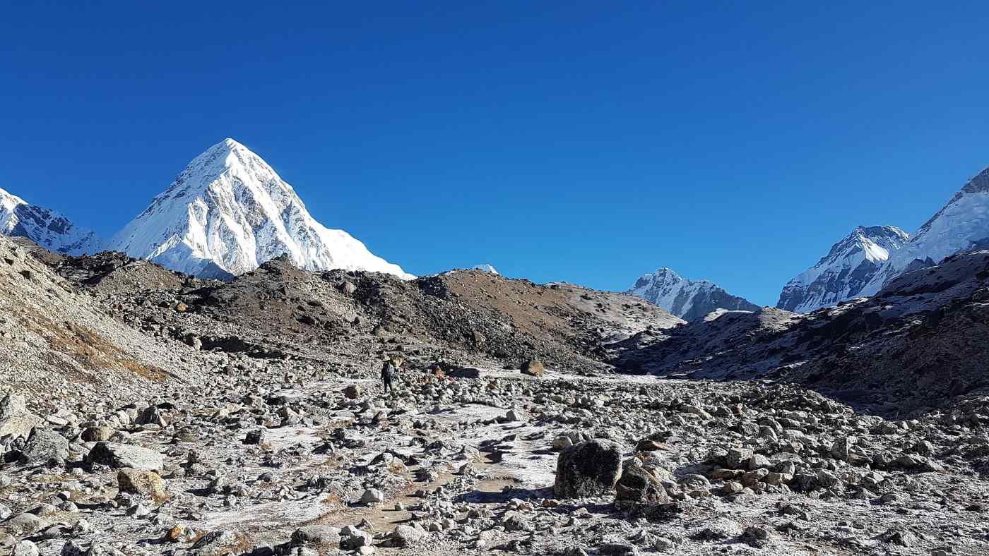
Is Everest Base Camp trek difficult for beginners in 2026?
Everest Base Camp for Beginners: Your 2026 Success Guide
Is it actually possible for a first-timer to stand at the base of the world’s highest mountain? The short answer is a resounding yes. While the Everest Base Camp Trek is rated as moderate to strenuous, it is essentially a long-distance walk—not a technical climb.
However, for those without prior trekking experience, the "difficulty" often comes from a lack of preparation rather than a lack of ability. Here is how to ensure you are part of the successful majority in the 2026 season.
The "Newbie" Reality Check: 3 Common Hurdles
If you've never trekked at high altitude, these are the three factors that will test you the most:
-
The 50% Rule: By the time you reach Everest Base Camp (5,364m), there is roughly 50% less oxygen in the air than at sea level. Your body will feel "heavy," and even a slight incline can feel like a sprint.
-
The "Himalayan Flat": You will walk for 5–7 hours daily over rugged terrain. This isn't a paved path; it’s a mix of stone steps, loose gravel, and glacial moraine.
-
The Mental Shift: You are trading your home comforts for basic accommodations. This means shared bathrooms, unheated rooms, and limited amenities like Wi-Fi or hot water as you go higher.
2026 Strategy: How to Guarantee Your Success
-
Prioritize "Pace" Over "Power": In the Khumbu, the local phrase is "Bistari, bistari" (Slowly, slowly). The biggest mistake trekkers make is rushing the first few days. A slow, steady heart rate is the best defense against altitude sickness.
-
Follow the 300-Meter Rule: Once you pass 3,000 meters (just after Lukla and Namche), ensure your itinerary doesn't increase your sleeping altitude by more than 300–500 meters per night. This is why "rest days" in Sherpa villages are non-negotiable.
-
Invest in "Specific" Training: Don't just run on a flat treadmill. Your physical preparation should include:
-
The Stairmaster: This is the "secret weapon" for EBC. It perfectly mimics the thousands of stone steps you'll encounter.
-
Weighted Hikes: Carry a 5–7 kg daypack during your training walks to condition your shoulders and core.
-
Broken-in Boots: Never arrive in Nepal with brand-new boots. Wear them for at least 50km of walking before your flight.
-
Beginner FAQ for 2026
| Question | The Reality |
| Do I need a guide? | As of 2026, guides are highly recommended (and often required for permit processing) for safety and logistics. |
| What about the food? | Stick to the "Sherpa Fuel"—Dal Bhat. It's fresh, calorie-dense, and much safer than meat, which is often carried for days without refrigeration. |
| Is it too cold? | Night temperatures at Gorak Shep can hit -15°C. A quality -20°C rated sleeping bag and a down jacket are your "life support" gear. |
Standing at the edge of the Tenzing-Hillary Airport in Lukla, the thin air immediately tells your lungs a different story than the one they are used to. You look up, and the jagged, snow-capped giants of the Himalayas aren't just scenery anymore—they are your reality for the next two weeks. But as you tighten your laces, a question likely lingers: Do I actually have what it takes to reach the foot of Mount Everest?
The Everest Base Camp Trek is arguably the most iconic walk on the planet, but it is far from a stroll in the park. For many first-timers, the true difficulty of the journey remains shrouded in myth. Is it a feat reserved only for elite athletes, or can everyday trekkers with the right physical preparation stand at the base of the world's highest peak?
In this guide, we’re going to peel back the curtain on the trekking challenges you’ll face—from the lung-burning reality of high altitude to the rhythmic mental grind of the rugged terrain. Whether you are worried about altitude sickness or wondering if your cardiovascular fitness is up to the task, we have you covered.
We aren't just talking about the walking distance; we’re diving into the mental resilience required to swap luxury for basic accommodations and the endurance needed to cross swaying suspension bridges high above the Dudh Koshi River.
Are you ready to transform your "someday" into a concrete itinerary? Let’s break down exactly what it takes to navigate the weather changes and physical demands of the Khumbu, ensuring your journey to the heart of the Himalayas is as safe as it is unforgettable.
How far can you push your limits when the air begins to thin? When you consider the Everest Base Camp Trek, it’s easy to get lost in the romance of the photos, but the reality is built on a foundation of grit. The difficulty of this journey isn't found in technical rock climbing; rather, it's a relentless test of your endurance over a trekking duration that typically spans two weeks of constant movement.
The Reality of the Trail
You aren't just walking; you are navigating a living, breathing landscape. The rugged terrain of the Khumbu region is a mosaic of steep stone stairways, loose scree, and dusty paths that demand your full attention.
-
The Daily Grind: You will cover a significant walking distance—roughly 130km round trip.
-
Constant Elevation: Expect "Himalayan Flats," which is a local term for grueling ups and downs that test your leg strength and patience.
-
Traffic Jams: You’ll frequently yield the trail to yak caravans and fellow trekkers on narrow ledges.
The Invisible Challenge: High Altitude
The most significant hurdle you will face isn't the weight of your pack, but the lack of oxygen. As you ascend, the atmospheric pressure drops, making acclimatization the single most important part of your itinerary.
-
Thin Air: At the start in Lukla, you are already at 2,860m. By the time you reach the base of Mount Everest, oxygen levels drop by nearly 50%.
-
Strategic Rest: This is why a professional itinerary includes "rest days" in Sherpa villages like Namche Bazaar. You aren't being lazy; you are literally teaching your blood how to carry more oxygen.
-
Recognizing the Signs: We prioritize safety by monitoring for early symptoms of altitude sickness, such as persistent headaches or loss of appetite.
Why the Mental Game Matters
Have you ever wondered how you’ll react when the "newness" wears off on day eight? This is where mental resilience becomes your greatest asset. Between the weather changes that can turn a sunny morning into a freezing afternoon and the limited amenities of higher elevations, your mindset dictates your success.
You’ll swap hot showers for wet wipes and high-speed internet for the sound of wind against the teahouse walls. Are you prepared to embrace the discomfort for the sake of the view? Most first-timers find that while their legs do the work, it’s their mental preparation that actually gets them to the finish line.
How do you prepare your body for a world where every breath provides only half the oxygen you're used to? If you’re eyeing the Everest Base Camp Trek, you’ve likely realized that "winging it" isn't an option. The secret to a successful summit of the base camp lies in a specialized approach to physical preparation that mimics the demands of the Khumbu.
Building Your "Mountain Engine"
When we talk about cardiovascular fitness, we aren't just talking about running a fast mile. You need the kind of heart and lung capacity that can sustain a slow, steady incline for six hours straight. Your training should prioritize aerobic efficiency over raw speed.
-
Zone 2 Training: Focus on long, low-intensity sessions where you can still hold a conversation. This builds the mitochondrial health needed for high-altitude endurance.
-
Incline is King: If you don't have mountains nearby, the "StairMaster" or a treadmill set to a 10–15% grade will become your best friend.
-
Sport-Specific Movement: Nothing beats hiking in your actual trekking gear. Breaking in your boots now prevents a blister-induced disaster later.
Strengthening the Foundation: Leg Strength & Core
Have you considered the impact of descending thousands of stone steps? While climbing is hard on the lungs, the descent is a brutal test of your leg strength and joint stability.
-
Eccentric Loading: Incorporate lunges, step-downs, and weighted squats. These movements strengthen the muscles around your knees, protecting them from the rugged terrain.
-
Core Stability: A strong core helps you balance on uneven paths and carry your daypack without straining your lower back.
-
Weighted Hikes: Gradually increase the weight in your pack during training sessions until you are comfortable carrying 7–10 kg.
The Mental Edge: Beyond the Muscles
Is your mental preparation as sharp as your physical conditioning? On day ten, when the weather conditions turn gray and your legs feel like lead, your mental resilience is what keeps your boots moving forward.
Pro Tip: Train in "bad" weather. If it’s raining or cold, don’t skip your workout. Learning to stay positive when you’re uncomfortable is a skill that will serve you well when you hit a wall at 4,000 meters.
Nutrition and Recovery Strategies
Fueling your training is just as important as the workouts themselves. In the high Himalayas, your body burns calories at a significantly higher rate just to stay warm and breathe.
-
Complex Carbs: These are your primary fuel source for the trail.
-
Hydration Habits: Start practicing "proactive hydration" now. Aiming for 3–4 liters a day during your training prepares your kidneys for the demands of acclimatization.
-
Rest Cycles: Don't overtrain. Safety starts with a body that isn't already burnt out before it even reaches Lukla.
Could the logistics of a trip be more famous than the destination itself? In the Everest region, the answer is a resounding yes. Beyond your physical grit, navigating the "uncontrollables"—from the notorious flight to Lukla to the nuances of Himalayan etiquette—is what separates a stressful trip from a life-changing adventure.
Starting with the "Scariest" Flight in the World
Your journey truly begins at the doorstep of the Khumbu. Flying into Lukla is an adrenaline rush like no other, but it requires a flexible mindset.
-
Weather Conditions: The Himalayas create their own microclimates. It is common to experience flight delays due to fog or high winds.
-
Pro Tip: Always build "buffer days" into your itinerary. Expecting the unexpected is the first rule of mountain travel.
-
The Weight Limit: Remember, small planes have strict weight restrictions (usually 10kg for your main kit and 5kg for your daypack). Packing smart is a skill, not a suggestion.
Essential Trekking Gear: Your Life Support System
When you are miles away from the nearest road, your gear is your sanctuary. Are you investing in quality or just buying for the brand name?
-
The Layering System: Weather changes can swing 20 degrees in an hour. You need a moisture-wicking base layer, a warm fleece or down mid-layer, and a windproof/waterproof outer shell.
-
Footwear: Your boots should be waterproof and well-worn before you arrive. Nothing ends a trek faster than a preventable blister on day two.
-
Sleeping Bag: Even with basic accommodations, the rooms are unheated. A -20°C rated bag is your best friend when the sun goes down.
Life in the Teahouses: Amenities and Expectations
What does "basic" actually mean at 4,000 meters? As you pass through iconic Sherpa villages, you'll stay in local teahouses.
-
Limited Amenities: Expect plywood walls and communal spaces. As you go higher, luxuries like hot showers and charging ports for your phone come with an extra fee.
-
Nutrition and Safety: Stick to the "Trekker’s Rule"—eat fresh, cooked meals. To avoid food poisoning, many veterans skip meat above Namche Bazaar, as all meat is carried up by porters or yaks without refrigeration.
-
Hydration: Use water purification tablets or a filter. Buying plastic bottles is discouraged to protect the pristine environment.
The Power of Local Support: Guides and Porters
Have you thought about who will lead the way? While some attempt the trek solo, hiring professional guides and porters is about more than just carrying a heavy bag—it’s about safety and cultural immersion.
-
Navigation: They know every turn, every bridge, and every shortcut.
-
Health Monitoring: An experienced guide can spot the early signs of altitude sickness before you even realize you're feeling unwell.
-
Cultural Connection: They bridge the gap between you and the local communities, sharing stories and history you won't find in any guidebook.
How do you define success when the summit isn't a peak, but a deeper understanding of your own limits? After the physical grind and the logistical hurdles, the Everest Base Camp Trek ultimately transforms into a psychological expedition. Whether you are joining group tours or trekking with a private team, the final stretch toward the base of Mount Everest is where your mental preparation truly meets the mountain.
Cultivating Mental Resilience on the Trail
Have you ever noticed how your internal monologue changes when you’re tired? In the Khumbu, your mind can be your greatest ally or your most difficult obstacle. Mental resilience isn't about ignoring discomfort; it’s about acknowledging the trekking challenges and choosing to take the next step anyway.
-
The "Slow and Steady" Mantra: Comparing your pace to others is a trap. Success in the Himalayas belongs to those who embrace a slow, rhythmic cadence.
-
Managing Expectations: You will encounter basic accommodations and perhaps a lack of sleep. Accepting these as part of the "authentic" experience reduces the mental friction of the journey.
-
Focusing on the "Why": When the wind howls and the air feels thin, reminding yourself why you started—whether for personal growth, a tribute, or the love of adventure—provides an instant boost of endurance.
Group Dynamics and Local Wisdom
Are you prepared for the social side of the trek? One of the most underrated aspects of the Everest Base Camp Trek is the community you build along the way. From sharing stories in Sherpa villages to cheering on your teammates, the "tribe" effect is powerful.
-
Shared Strength: In group tours, the collective energy often pulls individuals through their toughest days.
-
Learning from Guides: Your guides are more than just navigators; they are masters of the mountain psyche. Listen to their stories—they have seen thousands of trekkers succeed and fail, and their wisdom is your best safety net.
-
The Porter Connection: Seeing the incredible strength of the porters as they navigate rugged terrain with heavy loads is often the perspective shift a struggling trekker needs to keep going.
Safety, Health, and the Final Push
As you reach the higher altitudes, your focus shifts from "hiking" to "managing." Your itinerary has led you here, but your daily habits will get you to the finish line.
-
Monitoring Your Body: Be honest with your team about how you feel. Early intervention for altitude sickness is the difference between a successful trek and an emergency evacuation.
-
Nutrition as Fuel: Even if you lose your appetite—a common side effect of high altitude—forcing yourself to eat calorie-dense nutrition is vital for maintaining your endurance.
-
The Reward: Crossing that final set of suspension bridges and seeing the Khumbu Icefall for the first time is a moment that defies description. It is the point where the difficulty fades and the accomplishment takes over.
Is This Your Year?
Now that you understand the seasonal difficulty and the preparation required, the only question left is: are you ready to commit? The Himalayas don't demand perfection; they demand presence. With the right preparation strategies and a respect for the mountains, the path to Everest is open to you.
Embracing the Journey: Your Path to the Khumbu
So, where do you stand now that the mist has cleared from the trail? The Everest Base Camp Trek is undoubtedly a formidable challenge, but as we’ve explored, it is one defined by preparation, not just raw talent. From the initial adrenaline of landing in Lukla to the quiet, oxygen-starved moments of acclimatization in high-altitude Sherpa villages, every step of this itinerary is designed to transform you.
The difficulty of reaching the base of Mount Everest is real, but so is the profound sense of safety and accomplishment that comes from following a structured plan. Whether you are a first-timer building your cardiovascular fitness or a seasoned trekker refining your trekking gear, the Himalayas have a way of stripping life down to its most beautiful essentials. You’ll find that the rugged terrain doesn’t just test your leg strength—it builds a level of mental resilience you’ll carry long after you’ve left the mountains behind.
Are you ready to stop scrolling through photos and start breaking in your boots? The trekking duration might only be two weeks, but the impact of standing amidst the world's highest peaks lasts a lifetime. Whether you choose the camaraderie of group tours or the focused support of private guides and porters, the Khumbu is waiting to tell you its story.
Read more... Read less





