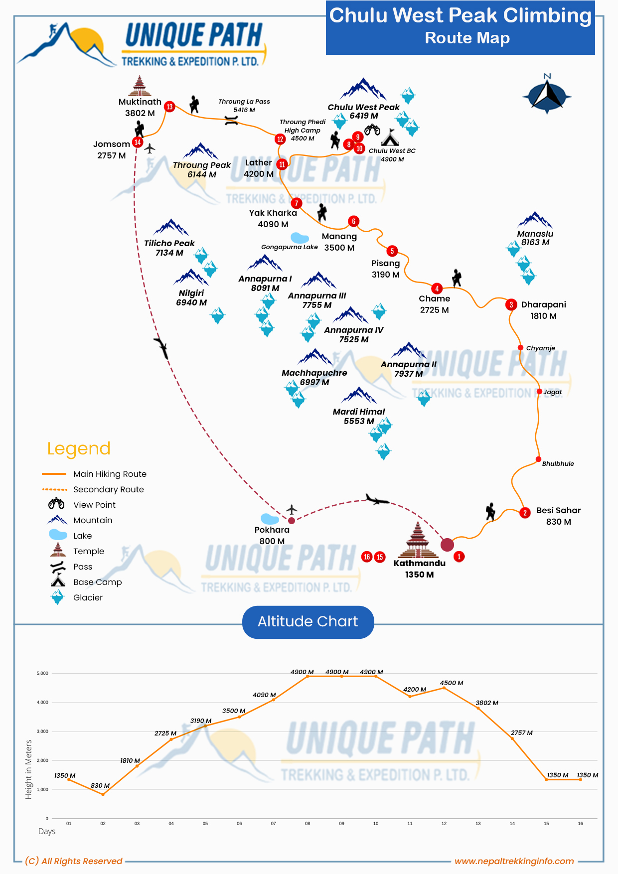
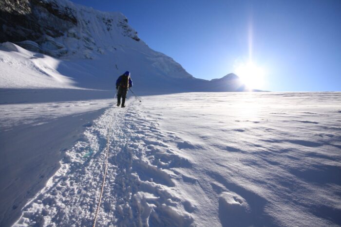
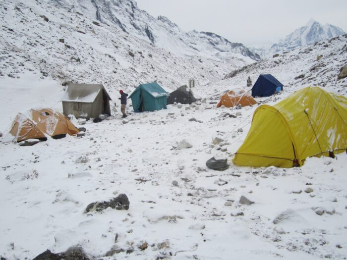
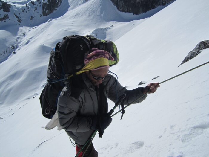
Chulu West Peak Climbing
Annapurna Trekking

Chulu West Peak Climbing

Book Now

Image Gallery

Trip Facts

  • Max Altitude 6,419 m
  • Grade Moderate
  • Duration 16 Days
  • Group Size 1 - 15

Overview

Chulu West (6,419 m/ 21,059 ft) is one of the most beautiful mountains of Nepal and among the favorite mountains for climbers and mountaineers. It is located in the northern part of the Manang District. Chulu West Peak Climbing takes you to the beautiful mountain district, Manang of Nepal. There are twin peaks in the Chulu ridge – the Chulu West and the Chulu East (6,584 m/ 21,601 ft). These peaks are a part of the Manang Himal system which in itself is a part of the even larger Damodar Himal range. The Chako Peak (6,687 m) lies to the north of the twin Chulu peaks.

The peak is encircled by rivers like Nar, Hulung, Phu, and Marsyangdi. The Kali Gandaki valley lies to the west, not far from the Chulu peaks. There are many confusions regarding the altitude of Chulu peaks and even regarding which peaks are in fact Chulu East and West peaks. This is because of the fact that the Chulu ridge peaks at many places which are similar in altitude and lead to confusion among climbers.

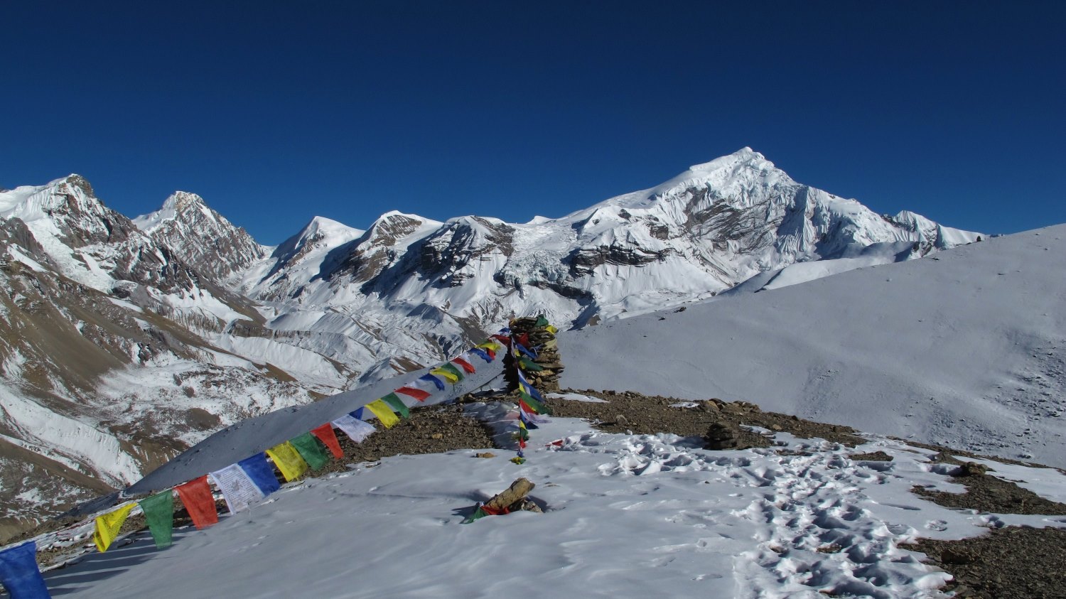
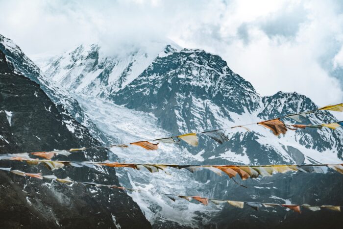
The Chulu peaks provide a stunning view of the mountains like Tilicho, Annapurna, Manaslu, and Dhaulagiri. The trek starts from the mid-hills a bit further north from Besisahar, the district headquarters of the Lamjung district. Chulu West Peak Climbing walks along the banks of the gorgeous Marshyangdi river for most of the trek. The wide basin of the river is forested by trees like rhododendron, juniper, pine, fir, cedar, etc. In between these forests like wonderful villages like Chame, Manang, Kharsang, Mungji, etc.

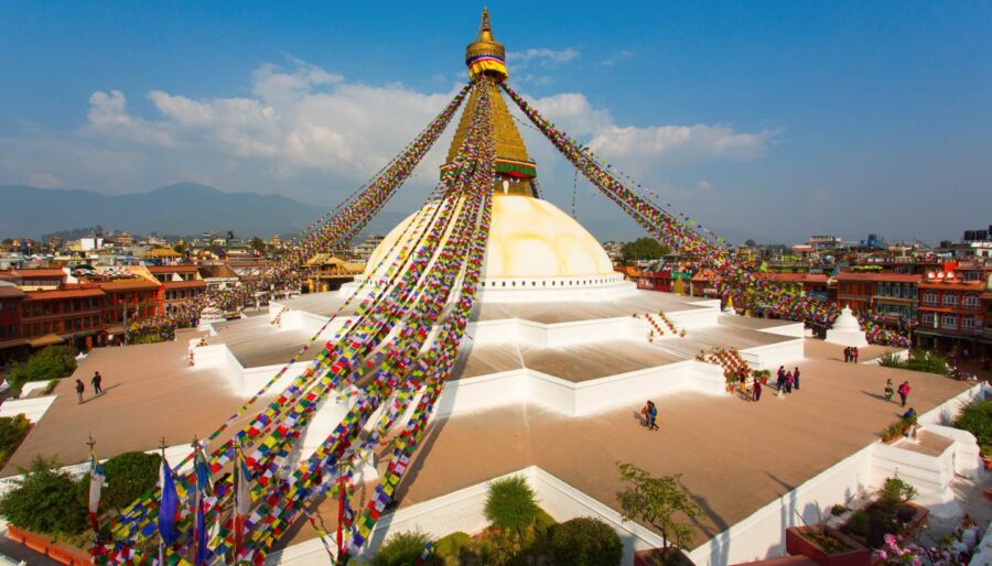
These villages are settled by the Gurung, Tamang, Magar, and Sherpa people with the Gurung people constituting the majority of the population. These people have a unique culture and tradition which has remained intact for generations. The hospitality of the people of this region is impeccable and they consider guests as God-sent messengers. Most of the people of the region are Buddhists and we will also come across beautiful monasteries like Bodzo, Braka, and Lophelling.

The Chulu Ridge lies north of the valley of Pisang. Beyond the Chulu Peaks lies Thorong La Pass, which is one of the most adventurous high Himalayan passes in Nepal. The pass connects the district of Manang with the district of Mustang. We will enter the Kali Gandaki Valley in Mustang after crossing the Thorong La Pass. We will enter the Annapurna Sanctuary from Tatopani, which lies on the eastern mountains ridge surrounding Kali Gandaki Valley.

Itinerary

Day 01

Arrival in Kathmandu airport. Our Airport Representative transferred to hotel by private tourist vehicle

We will begin our tour with a drive to Besisahar, the headquarters of the Lamjung district which is located in the western part of Nepal. We will follow the Prithvi Highway up to Dumre from where we will head north towards Besisahar. The drive up to Dumre takes place along the banks of the Trishuli river. The Trishuli river originates from the valleys in the northeast part of Manang, our trek destination, and flows into the Narayani river.

After taking a 90-degree turn from Dumre, we will drive along the banks of the Marsyangdi River, which flows to our right in the opposite direction of our travel. We will see a large Hydropower Project in the Marsyangdi River as we approach the midpoint between Dumre and Besisahar. This is the second hydropower project we meet on the Marsyangdi river, with the first one encountered a few kilometers before we reached Dumre. We will stay at a guest house in Besisahar for the night.

  • Max. Altitude
    1345m/4412ft
  • Accomodation
    3 stars level hotel
Day 02

Drive from Kathmandu to Besi Shahar by bus. Driving 6 hours.

We will begin our day with either a jeep ride or a bus ride from Besisahar. The blacktopped road ends after we drive for a short while from Besisahar. We will get introduced to the beautiful countryside with terraced fields and stone-topped houses. In between these villages lie wide stretches of forests that climb from the top of one hill to another as far as our eyes can see. The Marsyangdi river lies to our right and thunders down like a roaring lion.

There is a high suspension bridge over the Marsyangdi river just before we reach Chyamje. We will get off our couch and cross the suspension bridge. The village of Chyamje will provide us with some rest and tea. We will fill our bottles with hot water and then embark on a glorious trek towards the northern reaches of the Manang district.

The village of Tal welcomes us before we reach Dharapani. There is a beautiful waterfall near Tal where we can soak ourselves if we are interested. We will reach Dharapani after about five and a half hours of trek from Dharapani. We will rest at a guest house in Dharapani for the night.

  • Max. Altitude
    830m/2723ft
  • Meal
    Breakfast/ Lunch/Dinner
  • Accomodation
    Hotel/Tea house
Day 03

Drive to Chyamje by Jeep then trek to Dharapani . Driving 2:30 hours & walking 5:30 hours

We will begin our trek from Dharapani after breakfast. We will continue walking along the basin of the Marsyangdi River. We will see that the forest starts to get thinner and thinner as we move upwards. The western Himalayas of Nepal bears a close resemblance to its arid and surreal northern counterpart – the Tibetan Plateau. We will come across the villages of Danaque, Bagarchap, and Timing on our way to Chame.

We will reach a wide valley in the second half of the day. The valley is encircled by mountains like Manang, Tilicho, Pisang, Himchuli, and Chulu on all sides. At the heart of the valley lies the village of Chame, which is the largest settlement in the Manang district and also its administrative head. We will explore the village of Chame and rest at a guest house there.

  • Max. Altitude
    1810m/5937ft
  • Meal
    Breakfast/ Lunch/Dinner
  • Accomodation
    Hotel/Tea house
Day 04

Dharapani to Chame. Walking 6 hours.

We will embark on a gentle trek today towards Pisang through dense green forests at the banks of the Marsyangdi River which sweeps up like a carpet to the top of the surrounding hills and gets lost out of sight into adjacent valleys. We can encounter the national bird of Nepal – Danphe – at these heights during winter. If we are traveling in spring or summer the birds usually lay nest in the far northern reaches of the region which are situated at higher altitudes.

The little village of Barthang is situated on the ridge of the mountain and provides us with an opportunity to freshen up mid-trek. We will continue our journey further towards the village of Pisang after heading up from the Barthang. As we approach Pisang, the pyramid shape of the Pisang peak starts to get prominent. Pisang is a village located at the entrance of the Pisang valley. Pisang peak stands at the center of the valley. We will also get a spectacular view of other peaks like Chulu, Tilicho, Manang, and Annapurna from Pisang village.

  • Max. Altitude
    2725m/8938ft
  • Meal
    Breakfast/ Lunch/Dinner
  • Accomodation
    Hotel/Tea house
Day 05

Chame to Pisang . Walking 5:30 hours.

We will begin our trek towards another trading center in the Manang district today – the namesake village of Manang. It is the second-largest village in Manang after Chame. The walk takes us through sporadic forests, grasslands, pastures, and arid mountainsides; the view changes so rapidly that we will be in awe of the possibilities of nature. If we are lucky then we can also encounter rare animals like the Himalayan blue sheep and the Himalayan tahr.

The Braka monastery lies on our way to Manang. It is the largest monastery in the district of Manang. Before we reach the Braka monastery we will see many Chortens, stupas, prayer flags, and mani walls on our way. Manang is a large village of closely tied houses. We will see traders and mule caravan jostling with pace along the thoroughfares of the village as we approach it. We will stay at a guest house in Manang for the night.

  • Max. Altitude
    3190m/10464ft
  • Meal
    Breakfast/ Lunch/Dinner
  • Accomodation
    Hotel/Tea house
Day 06

Pisang to Manang. Walking 5:30 hours.

We will head towards the village of Yak Kharka today. The literal meaning of the name of the village is Yak Grazing pasture and you will see many yak grazing pastures in and around Yak Kharka. We will first come across the Jarshang river which we will cross via a wooden bridge.

We will now be moving further away from the Marsyangdi river because we will now turn full 180 degrees towards the Kali Gandaki river valley in the west, which we will enter via Thorong la Pass, before going full circle of the Annapurna Massif by entering the Annapurna Sanctuary from Tatopani, en route to Ghorepani.

Yak Kharka is a small village situated on the slope of the mountain. Herds of yaks will welcome us as we move nearer to the village. We can taste exotic Himalayan cheese and other dairy products in Yak Kharka. We will get a spectacular view of the twin peaks of the Chulu by the time we reach Yak Kharka. We will rest at a guest house in Yak Kharka for the night.

  • Max. Altitude
    3500m/11480ft
  • Meal
    Breakfast/ Lunch/Dinner
  • Accomodation
    Hotel/Tea house
Day 07

Manang to Yak Kharka . Walking 5 hours.

We will head towards the Chulu Base Camp today. We take the Thorong La Pass route from Yak Kharka at first. We will come across the small village of Ledar after walking from Yak Kharka. After walking for a short while from Ledar we will come at an intersection, from where the paths to Thorong La Pass and the Chulu Base Camp get separated.

We will take the path to the Chulu Base Camp which first goes over the ridge and then climbs down a little to show the majestic view of the Chulu Peaks. The Chulu Base Camp is located at a considerably high altitude compared to Yak Kharka and thus today’s part of the trek is one of the toughest, comparable with the ascent to Chulu west itself. We will either set camp or stay at a temporary teahouse in the Base Camp for the day.

  • Max. Altitude
    4090m/13416ft
  • Meal
    Breakfast/ Lunch/Dinner
  • Accomodation
    Hotel/Tea house
Day 08

Yak kharka to Chulu west base camp. Walking 5 hours.

We will spend the day at the Chulu West Base Camp. This will help us acclimatize for the further journey because we will be entering the altitude of above 5,000 m and 6,000 m in subsequent days. The base camp provides a wonderful view of the mountains like Chulu, Manang, Tilicho, Damodar, Nilgiri, Dhaulagiri, and Annapurna.

We will learn how to use equipment like ropes, ice axes, and harnesses and take part in a team-building exercises. We will also learn how to communicate and coordinate effectively in the mountain slope. We will spend the night at the Base Camp.

  • Max. Altitude
    4900m/16072ft
  • Meal
    Breakfast/ Lunch/Dinner
  • Accomodation
    Tented camp
Day 09

Rest and acclimatization at Chulu west base camp

Chulu High Camp is situated at 600 m higher altitude than the Chulu West Base Camp. We will take a slow but slippery walk towards the high camp following breakfast. The magnificent view of the Gangapurna peak along with gigantic peaks like Himchuli, Annapurna, and Dhaulagiri is one to behold.

We will reach the Chulu West High camp after five hours of walking from Chulu West Base Camp. We will slide into our camps early because a strong and chilly wind blows in the High Camp after sunset.

  • Max. Altitude
    4900m/16072ft
  • Meal
    Tented camp
  • Accomodation
    Breakfast/ Lunch/Dinner
Day 10

Chulu west high camp. Approximately 5:30 hours.

We will wake much before sunrise today because our target is to summit the peak before the strong winds that blow in the mountains during mid-day. The climb must be done carefully because will need to lay ropes for the most part of the journey. Our team leaders and professional helpers will lead the way for us along the mountain slopes.

After we get to the top of the Chulu West Peak, we will see another prominent peak on the same ridge towards the east, which is the Chulu East Peak. There are numerous other peaks on the same ridge, which extends its way to the mountain in the Manang range. The Manang range goes further northwards to merge with the larger Damodar system of mountains. We will get a 360-degree view of some of the highest and most beautiful mountains in the world from the top of Chulu peak. We will get back to the Chulu West Base Camp after the climb.


  • Max. Altitude
    4900m/16072ft
  • Meal
    Breakfast/ Lunch/Dinner
  • Accomodation
    Tented camp
Day 11

Summit Chulu west peak (6419/ 21055ft) and back to Lather. Approximately 11 hours.

We will head towards the Thorong Phedi today. This part of the trek takes us up and down the same route, we walked yesterday and the day before up to the intersection from where the roads to the Chulu West Base Camp and the Thorong Phedi separate. We will once again come across the village of Ledar, this being the third time we have encountered the village.

As we head towards Thorong Phedi we will see snow covering most of the ground, with occasional patches of grassland and pastures being seen. If we are lucky then we can catch a glimpse of the Himalayan Blue Sheep in these areas. Thorong  Phedi is situated at the base of the Thorong La Camp and will be our abode for the day.

  • Max. Altitude
    4200m /13776ft
  • Meal
    Breakfast/ Lunch/Dinner
  • Accomodation
    Hotel/Tea house
Day 12

Lather to Throung Phedi high camp. Walking 5 hours.

This is the most challenging part of the trek after the ascent to Chulu West Peak. We will walk almost uphill from the base of Thorong Phedi along glacial slopes until we reach the pass. The pass is covered with prayer flags and signs rested there by travelers.

The Thorong La Pass connects the district of Mustang in the west with the district of Manang in the east. We will enter the Mustang district and head towards the village of Muktinath located on its eastern ridges. The temple of Muktinath and its famed 108 taps, bathing upon which is believed to wash away sins, is located in Muktinath.

  • Max. Altitude
    4500m/14760ft
  • Meal
    Breakfast/ Lunch/Dinner
  • Accomodation
    Hotel/Tea house
Day 13

Thorung Phedi high camp to Muktinath via Thoroung-la passes (5416m). Walking 8:30 hours.

We will drive along a road carved on the edge of high mountain cliffs today. Our target for the day is the village of Tatopani where lies the most famous natural hot water spring of Nepal. The road leading up to Tatopani provides one of the most thrilling driving experiences of your life.

We will rest at a guest house in Tatopani but before that, we will head towards the natural hot water spring and relax with a calming balm-like bath on the waters that are heated by the natural mountain system.

  • Max. Altitude
    3802m /12470ft
  • Meal
    Breakfast/ Lunch/Dinner
  • Accomodation
    Hotel/Tea house
Day 14

Morning visit Muktinath Temple then trek to Jomsom. Walking 4:30 hours

We will resume trek today and head towards the village of Ghorepani. Between Tatopani and Ghorepani are located sweeping green valleys of the Annapurna Sanctuary. We will walk across dense forests of rhododendron and cedar while being welcomed by chirping birds and shy animals who readily hide in bushes at the sight of humans.

We will reach the beautiful village of Ghorepani at the end of the trek. The village is settled by the local Gurung people and provides a great peek a boo into the history of the Gurung people. We will stay at a guest house in Ghorepani for the night. We also have the option of staying in homestays with the locals.

  • Max. Altitude
    2757m /9043ft
  • Meal
    Breakfast/ Lunch/Dinner
  • Accomodation
    Hotel/Tea house
Day 15

Flight to Kathmandu via Pokhara.

We will begin the day with a hike to the top of Poon Hill which is located near the village of Ghorepani. The top of Poon Hill provides a spectacular end-to-end view of mountains in the central and western parts of Nepal. It is ideal to reach Poon Hill before sunrise because the sight of the sun glistening against peaks like Machhapuchhre, Annapurna, Dhaulagiri, HImchuli, etc. is one to behold for a lifetime.

We will get back to our hotel after enjoying the early morning view from Poon Hill. We will resume our trek after breakfast and head towards Nayapul, which is situated at the foot of the mountain. We will catch a bus from Nayapul and will be Pokhara bound with a three hour ride. We will rest at a hotel in Pokhara for the night.

  • Max. Altitude
    1345m/4412ft
  • Meal
    Breakfast/Lunch
  • Accomodation
    3 stars level hotel
Day 16

The trip ends, our Airport Representative will drop you to the Kathmandu international airport for your final flight departure from Nepal. Driving 15 km – 10 minutes

We will go full circle of the Annapurna Massif, including the adventurous climb of Chulu West Peak today. We will board a tourist bus from Pokhara. Our trip will come back to square one as we reach Dumre.

We will drive back along the same route we took earlier from Kathmandu on the Prithvi Highway now. The bus will drop us at Kathmandu during mid-day. Our trip ends after you check back into your hotel.

  • Meal
    Breakfast

Pricing

Price for Chulu West Peak Climbing in different currency as follows:

Currency Pricing USD Euro AUD CAD Indian Rupees
Price per person US$ 2575 N/A N/A N/A N/A

WANT TO KNOW LATEST DEALS ?
For latest offers & pricing for group & individual, please contact us.

Service Includes and Excludes

Service Included in this Trip

  • All the ground transportation is as per the itinerary. 
  • Hotel in Kathmandu, inclusive breakfast at 3 stars level (1 night before trekking and 1 night after trekking).
  • Meals 3 times a day( Breakfast, lunch, and dinner) in trekking and climbing for you.
  • Seasonable Local fresh fruits after dinner.  
  • Filtered water in trekking using (Katadyn Pocket Water Filter) 
  • Twin sharing a private comfortable room in trekking part and tented camp at climbing part.
  • Trip Map. 
  • Domestic flight tickets from Jomsom to Pokhara to Kathmandu, inclusive of taxes.
  • First aid medical kit, Ox meter to check pulse, heart rate, and oxygen saturation at higher altitude.
  • An experienced government-licensed holder trekking/climbing guide and porters to carry your luggage during the trek.
  •  Food, drinks, accommodation, insurance, salary, equipment, transportation, and local tax for trekking and climbing staff.
  • All necessary camping gear like two men’s tents, kitchen tent, kitchen equipment, and mattress while climbing period.
  • Group medical supplies (first aid kit will be available).
  • All necessary paper works and national park entry permits.
  • Climbing permit.
  • TIMS (Trekkers’ Information Management System). 
  • Climbing equipment like ice axe, Ice crew, snow bar, and climbing rope.
  • Emergency helicopter rescue arrangements will be paid for by your insurance company. 
  •  Farewell dinner in Kathmandu.
  •  All our government taxes, vat, local tax, and tourist service charges.

Service Excluded in this Trip

  • Extra accommodation and meals in Kathmandu (Except Farewell Dinner)
  • All kinds of drinks (Hot/cold & alcoholic) in trekking.
  • Personal equipment.
  • Climbing boots, gaiters and jackets.
  •  Travel and rescue insurance.
  • Extra personal expenses (phone calls, laundry, bar bills, battery recharge, laundry, shower, excess baggage charges).
  • Tips for trekking staffs and driver (Tipping is expected).
  • Any others expenses which are not mentioned on ‘Price Includes’ section.

Fixed Departure

Year
  • 2023
  • 2024
Start Date End Date Availability Booking
03 Sep, 2023 19 Sep, 2023 OPEN Book Now
07 Sep, 2023 23 Sep, 2023 OPEN Book Now
11 Sep, 2023 27 Sep, 2023 OPEN Book Now
14 Sep, 2023 30 Sep, 2023 OPEN Book Now
16 Sep, 2023 02 Oct, 2023 OPEN Book Now
21 Sep, 2023 07 Oct, 2023 OPEN Book Now
23 Sep, 2023 09 Oct, 2023 OPEN Book Now
27 Sep, 2023 13 Oct, 2023 OPEN Book Now
30 Sep, 2023 16 Oct, 2023 OPEN Book Now
03 Oct, 2023 19 Oct, 2023 OPEN Book Now
07 Oct, 2023 23 Oct, 2023 OPEN Book Now
11 Oct, 2023 27 Oct, 2023 OPEN Book Now
14 Oct, 2023 30 Oct, 2023 OPEN Book Now
16 Oct, 2023 01 Nov, 2023 OPEN Book Now
19 Oct, 2023 04 Nov, 2023 OPEN Book Now
21 Oct, 2023 06 Nov, 2023 OPEN Book Now
27 Oct, 2023 12 Nov, 2023 OPEN Book Now
30 Oct, 2023 15 Nov, 2023 OPEN Book Now
03 Nov, 2023 19 Nov, 2023 OPEN Book Now
07 Nov, 2023 23 Nov, 2023 OPEN Book Now
11 Nov, 2023 27 Nov, 2023 OPEN Book Now
14 Nov, 2023 30 Nov, 2023 OPEN Book Now
16 Nov, 2023 02 Dec, 2023 OPEN Book Now
19 Nov, 2023 05 Dec, 2023 OPEN Book Now
21 Nov, 2023 07 Dec, 2023 OPEN Book Now
23 Nov, 2023 09 Dec, 2023 OPEN Book Now
30 Nov, 2023 16 Dec, 2023 OPEN Book Now
03 Dec, 2023 19 Dec, 2023 OPEN Book Now
07 Dec, 2023 23 Dec, 2023 OPEN Book Now
11 Dec, 2023 27 Dec, 2023 OPEN Book Now
14 Dec, 2023 30 Dec, 2023 OPEN Book Now
16 Dec, 2023 01 Jan, 2024 OPEN Book Now
19 Dec, 2023 04 Jan, 2024 OPEN Book Now
21 Dec, 2023 06 Jan, 2024 OPEN Book Now
23 Dec, 2023 08 Jan, 2024 OPEN Book Now
27 Dec, 2023 12 Jan, 2024 OPEN Book Now
30 Dec, 2023 15 Jan, 2024 OPEN Book Now

Does our itinerary plan do not go with your holiday dates? Does fixed departure dates are not suitable for you? Do you want to extend or shorten your trip duration? No worries, we can create your own custom tailor-made holidays with flexible duration and dates.
Click here to share your plan with us.

Trip Info

The full board package includes your meals 3 times daily in trekking where as budget packages do not include meals. Please do let us know which package you would like to book we are here for your service.

Grade A: Easy *

Trekking is essentially day hiking and doesn’t require any special training. However, good physical condition, a love of walking, and a desire to enjoying the spectacular views of the mountains and encounter village life are essential. We offer a diverse range of easy treks. Categorizing a trek as easy means that no difficult climbing or ascents to high altitudes is involved. They take usually no more than a week and are suitable for anyone. Be assured that a loss of altitude in no way means a loss of interesting things to see and experience. While our more challenging treks get you closer to a small number of mountain ranges, lower altitude treks often provide better viewpoints from which to enjoy the colorful horizons of a whole series of ranges. The duration of a trek can be from 4 to 9 days with an average of 4 to 5 hours walking per day. The elevation of the trail will be between 800m/2624ft and 2800m/ 9240ft above sea level.

Grade B: Moderate **

These treks are suitable for any walker looking for something a little more challenging and energetic. They are a combination of some longer and shorter walks and hill-walking experience is desirable. The duration is usually from 10 to 15 days. Following the up and down terrain of Nepal and walking to higher elevations contrasts these treks to those in the easy classification. However, you will be rewarded for your efforts with spectacular close-up views of glaciers and of the high Himalayas. Although the terrain is not difficult, some vigorous hiking experience is useful. There may be up to 6 hours a day on the trail and the elevation rises and falls from 800m/ 2624ft to 4000m/13210ft above sea level.

Grade C: Fairly Strenuous ***

Since the terrain can be hard and the days long, hikers on these treks should be in good physical condition and have some previous mountain walking experience. Steep climbing may be involved, although it is never necessary to use ropes. Treks at this level can he arranged for periods of 16 to 21 days. Typically, a gradual ascent through a green river valley will lead you up to a number of high passes, where you will reach the altitude of 5416m. Often times, you will get a close insight into the Tibetan culture. Participants should except to trek above 5416m/17872ft.

Grade D: Strenuous ****

These real adventure treks are both technical and highly strenuous. Excellent physical condition is essential and mountaineering experience is preferable. Following rough terrain, they involve steep ascents to high altitudes with the possibility of some rope climbing. Stamina is needed to complete one of these treks, as it can take from 20 to 28 days to reach the heart of the wildernesses that they transverse. Participants should except to trek above 5600m/18480ft

EQUIPMENTS & GEARS

EQUIPMENTS, GEARS AND GUIDES

Nepal is one of the best places in the world for river rafting. Numerous fine rivers offer excellent opportunities for rafting, canoeing and simply immersing oneself in the magnificent landscape. Nepal’s thundering waters, coming from the glaciers of the mighty Himalayan, provide unmatched thrills.

Clothing

Down Or Fiber Filled Waterproof Jacket And Trousers 1
Fleece Jacket Or Pullover 1
Warm Cotton Trousers 2 Pairs
Shirts And T-Shirts 4 Pieces
Lightweight Cotton Long Pants 3 Pairs
Long Under Wear 2 Pieces
Short Under Wear 4 Pieces
Sun Hat Or Scarf 1
Woolen Hat 1
Sunglasses 1
Lightweight Gloves 1
Rain Coat 1
Heavyweight Gloves Or Mittens With A Waterproof 1

Footwear

Trekking Boot 1 Pair
Thick Socks 4 Pairs
Light Socks 3 Pairs
Camp Shoes 1 Pair
Sandals 1 Pair

Other Equipments

Sleeping Bag(4seasons) 1
Down Jacket 1
Daypack 1
Water Bottle 1
Sun Cream, Sunglasses
Flashlight With Spare Bulbs, Batteries, Lip Salve, Gaiters.

Optional

Insect Repellent Toilet Articles Note Book & Pen Toilet Roll
Laundry Soap Pocket Knife Towel Sewing Kit
Plasters Binoculars Camera Film
Cards And Personal Medical Kit

Travel insurance is compulsory for all Clients undertaking any tour. It should provide adequate protection for the full duration of the tour to cover personal injury, medical expenses, repatriation expenses, helicopter evacuation, loss of luggage, etc.

For your kind information, we would like to give a list of the insurance companies, please go through the links below:

For Canadians And Americans

  1. http://www.travelguard.com
  2. http://www.worldnomads.com
  3. http://www.mondial-assistance.ca
  4. http://www.travelassistnetwork.com
  5. http://www.travelex-insurance.com
  6. http://www.travelite.com
  7. http://www.travelunderwriters.com
  8. http://www.hccmis.com/atlas-travel-insurance

For Australians And New Zealanders

  1. http://www.covermore.com.au
  2. http://www.allianz.com.au
  3. http://www.worldnomads.com.au
  4. http://www.bupa.com.au
  5. http://www.itrektravelinsurance.com.au
  6. http://www.1cover.com.au

For British

  1. http://www.travel-guard.co.uk
  2. http://www.worldnomads.co.uk
  3. http://www.thebmc.co.uk
  4. http://www.direct-travel.co.uk
  5. http://www.essentialtravel.co.uk

For Europe And Slovenia

  1. http://www.coris.si
  2. http://www.europaeische.at

For South-Africa

  1. http://www.travel-guard.co.za
  2. http://www.tic.co.za

For Indians

  1. http://www.internationalsos.com/en/asia-pacific_india.htm

Acute Mountain Sickness (AMS) is common at high altitudes sickness. In general may occur when people ascend too quickly normally in altitudes of over 3000 m. The symptoms of altitude sickness are due to lower air pressure at high altitudes, which results in lower oxygen levels as you breathe the air in. The air is under less pressure and this makes it harder for your body to get the oxygen out of the air and into the circulation. It’s this extra strain on the body that causes altitude sickness.

Symptoms tend to be worse at night and include headache, dizziness, and lethargy, loss of appetite, nausea, breathlessness and irritability. Difficulty sleeping is another common symptom.

MAJOR SYMPTOMS OF ALTITUDE SICKNESS

INITIAL SYMPTOMS

  1. Periods of sleeplessness
  2. Runny nose.
  3. Extra tiredness
  4. Occasional loss of appetite
  5. Feeling laziness
  6. Wish to vomiting
  7. Periodic breathing

Above are normal symptoms which may occur into your body that you should not be worried. Every trekker will experience some or all of these, no matter how slowly they ascend.

ADVANCE SYMPTOMS

  1. Headache and vomiting
  2. Dizziness
  3. Racing heartbeat
  4. Exhaustion
  5. Nausea
  6. Diarrhoea
  7. Loss of apatite
  8. Weakness
  9. Hard to breath
  10. Extra tired
  11. Dry Raspy cough
  12. Sleeplessness

When above symptoms will occur into your body, these symptoms usually resolve by spending one or two extra nights at the same altitude or using medicine. Even you are resting at the same altitude or using medicine, if symptoms are becoming worse, then it is necessary to descend.

SERIOUS SYMPTOMS

  1. Worsening headache and vomiting
  2. Swelling of hands and face
  3. Reduced urine output
  4. Walking with a staggering gait
  5. Confusion
  6. Increased tiredness
  7. Breathing irregularity
  8. Visual hallucinations (seeing things that are not real)
  9. Changes in the ability to think
  10. Changes in normal behavior

If above serious symptoms will occur into your body, these extremely dangerous symptoms are called High Altitude Cerebral Edema (or HACE). They can lead to unconsciousness and death within 12 hours. Increasing shortness of breath, cough and tiredness may also be signs of High Altitude Pulmonary Edema or HAPE. HAPE can also be rapidly fatal if ignored.

TO PREVENT ACUTE MOUNTAIN SICKNESS

  1. If possible, don’t fly or drive to high altitude. Start below 3,000 metres (10,000 feet) and walk up.
  2. If you do fly or drive, do not overexert yourself or move higher for the first 24 hours.
  3. If you go above 3,000 metres (10,000 feet), only increase your altitude by 350 to 500 metres (1,000 feet) per day
  4. Climb high and sleep low! You can climb more than 300 to 500 metres in a day as long as you come back down and sleep at a lower altitude.
  5. If you begin to show symptoms of moderate altitude sickness, don’t go higher until symptoms decrease.
  6. Drink plenty of water, tea or juice etc (at least three to 4 liters per day). Urine output should be copious and clear to pale yellow.
  7. Eat high-carbohydrate foods (rice, pasta, cereal) for more energy.
  8. Take it easy and don’t overexert yourself when you first get up to altitude. But, light activity during the day is better than sleeping because respiration decreases during sleep, exacerbating the symptoms.
  9. Avoid alcohol as it may increase the risk of dehydration, and don’t smoke.
  10. Don’t push yourself when climbing up to passes, rather take plenty of breaks.
  11. Avoid taking sleeping pills.
  12. Avoid active movements and try to relax in the first one or two days upon arrival at the high altitude areas.
  13. Bring adequate medicine.
  14. If nothing else works, return to the areas with the lower elevation.
  15. Allow sufficient time for acclimatization (After 3000 meters).
  16. Don’t make rapid Ascent. Don’t go too far too fast.
  17. Do not trek/travel alone, take guide/porter.
  18. Follow the advice from your guide, hotel, local, guide book.
  19. Descent if mild symptoms rapidly getting worse.
  20. Never leave or descent sick person along.
  21. Avoid getting cold.
  22. Take an easy and comfortable trekking route even if its longer

MEDICINE

Following is a list of items you should consider including in your medical kit – consult your pharmacist for brands available in your country.

  1. Aspirin or paracetamol – for pain or fever
  2. Antihistamine – for allergies, eg hay fever; to ease the itch from insect bites or stings; and to prevent motion sickness.
  3. Antibiotics consider including these if you’re traveling well off the beaten track’ see your doctor, as they must be prescribed, and carry the prescription with you.
  4. Loperamides or Diphenoxylate ‘blockers’ for diarrhea’ Prochlorperazine or metaclopramide for nausea and vomiting.
  5. Rehydration mixture to prevent dehydration, eg due to severe diarrhea; particularly important when traveling with children.
  6. Insect repellent, sunscreen, lip balm and eye drops.
  7. Calamine lotion, sting relief spray or aloe vera-to ease irritation from sunburn and insect bites or stings.
  8. Antifungal cream or powder – for fungal skin infections and thrush.
  9. Antiseptic, such as povidone-iodine for cuts and grazes.
  10. Bandages, band-aids or plasters and other would dressings.
  11. Scissors, tweezers and a thermometer (note that mercury thermometers are prohibited by airlines)
  12. Cold and Flu tablets, throat lozenges and nasal decongestant.
  13. Multivitamines – consider for long trips, when dietary vitamin intake may be inadequate.