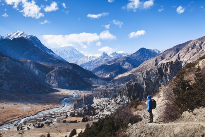
Circling Annapurna: A Field Guide to Nepal’s Trek
Everything that matters about the Annapurna Circuit — what the trail demands, what it gives back, and how to walk it well.
What This Trail Actually Is
The Annapurna Circuit is a footpath that wraps around the Annapurna massif in north-central Nepal. Depending on how you piece it together, it runs 12 to 22 days and covers roughly 130 to 230 kilometers. The route is not fixed. It shifts with road construction, weather closures, and the choices trekkers make about side trips and starting points.
What makes it singular is compression. In a single walk you pass through five distinct ecological zones — from subtropical river valley to alpine tundra to high-altitude cold desert — and through villages where four different ethnic groups have built lives shaped by altitude, isolation, and the physical presence of mountains that rise above 8,000 meters.
This is not a wilderness trek in the North American sense. You will sleep in lodges every night. You will eat cooked meals. You will share the trail with mule trains, porters carrying impossible loads, and the occasional jeep on lower sections where roads have pushed upward. What it offers instead is immersion: in a landscape that changes faster than your body can adapt to it, and in a human geography that has been negotiating that landscape for centuries.
The Direction Question: Why Everyone Goes the Same Way
The circuit is walked anticlockwise — starting in the Marsyangdi valley in the east, climbing gradually to Thorong La Pass, then descending the Kali Gandaki valley to the west. This is not tradition. It is physiology.
Starting low and climbing slowly gives your body time to manufacture the extra red blood cells it needs to function with less oxygen. By the time you reach Thorong La at 5,416 meters, you will have spent nearly two weeks ascending. Reverse the direction and you would force a rapid climb to the pass from the arid west — a much steeper profile that would dramatically increase your risk of altitude illness and reduce your probability of crossing successfully.
The anticlockwise route is the safer route. Full stop.
The Walk, Broken Into Pieces
The Warm Beginnings: Marsyangdi Valley (800m–1,400m)
The first days follow the Marsyangdi River upstream. You are in Gurung and Magar territory — communities that farm terraced hillsides of rice, millet, and maize in a landscape of waterfalls, dense forest, and humidity that clings to your skin. Villages like Bhulbhule and Chamje are your introduction. The architecture is stone and slate, built to shed monsoon rain. The people are warm, direct, and used to strangers passing through.
Snow peaks appear gradually on the horizon. You are not yet in the mountains. You are approaching them.
The Middle Ground: Pisang and the Climb to Manang (1,400m–3,540m)
Vegetation thins. Temperate forest replaces jungle. At Pisang, the trail divides: a lower route that follows the road, and an upper route that climbs through villages and offers better views of Annapurna II. The upper route is worth the effort if your legs are willing.
Manang (3,540m) is the largest settlement you will reach before the pass. It is also the most important. This is where you stop moving upward and let your body catch up. Most itineraries build in one to two rest days here. The wise do not rush this.
From Manang, the horizon is dominated by Annapurna II (7,937m), Gangapurna (7,455m), and Tilicho Peak (7,134m). The Himalayan Rescue Association runs a medical clinic in the village. Use it. Get your oxygen saturation checked. Talk to the staff about symptoms to watch for. This is not overcaution. This is how you avoid becoming a statistic.
Active recovery options from Manang:
-
Gangapurna Lake — a short walk above the village, good for gentle movement
-
Ice Lake (Kicho Tal) — a demanding day hike to 4,600m, then back down to sleep at 3,540m. This “climb high, sleep low” pattern is the single most effective acclimatization tool you have
-
Milarepa’s Cave — a sacred site associated with the Tibetan Buddhist poet-saint
The Thin Air: Yak Kharka to Thorong Phedi (3,540m–4,450m)
Above Manang, the landscape strips down to rock, scrub, and sky. You pass through Yak Kharka (4,020m), where yaks graze and prayer flags snap in wind that carries less oxygen with every gust. At this elevation, the air holds roughly 60% of the oxygen at sea level. Headaches, poor sleep, and fatigue are common here for trekkers who have not acclimatized properly.
Thorong Phedi (4,450m) is the last stop before the pass. Some trekkers push on to High Camp (4,880m) to shorten the crossing day, but this is a gamble. Sleeping higher when your body is already stressed can push mild symptoms into something dangerous. Unless you are fully acclimatized, Phedi is the smarter place to spend the night.
The Pass: Thorong La (5,416m)
The day begins in the dark — usually around 4:00 AM — because afternoon winds across Thorong La can make the crossing dangerous or impossible. The climb is over snow and ice, in temperatures that can drop well below freezing even in the warmest months.
The summit is marked by prayer flags, a small seasonal tea stall, and a view that stretches across the Annapurna and Dhaulagiri ranges. Dhaulagiri I (8,167m) — the seventh-highest mountain on Earth — is visible to the west.
Then the descent begins: over 1,600 meters of elevation loss to Muktinath (3,750m). This is a 10 to 12 hour day. It will test your knees, your concentration, and your reserves. Trekking poles are not optional here.
The Other Side: Muktinath to Jomsom (3,750m–2,700m)
Muktinath is sacred to both Hindus and Buddhists. The temple complex, with its 108 water spouts and eternal flame, draws pilgrims from across the subcontinent. The landscape has shifted to cold desert — dry, windswept, Tibetan in character.
The trail drops through the Kali Gandaki Gorge, the deepest canyon on Earth, with Annapurna I (8,091m) and Dhaulagiri I (8,167m) rising on either side. Kagbeni marks the boundary of the restricted Upper Mustang region. The culture here is Thakali — entrepreneurial, hospitable, and responsible for the best food on the circuit.
Most trekkers exit by flying from Jomsom to Pokhara. The flight is short (20–25 minutes) and weather-dependent. Morning departures are more reliable. If weather closes in, you wait, or you take a long jeep ride.
The Tilicho Lake Question
The detour to Tilicho Lake (4,919m) is the most popular side trip on the circuit. It is often called the highest lake of its size in the world, and it sits in a glacial basin surrounded by peaks that rise above 7,000 meters.
From Manang, you branch north to Tilicho Base Camp (4,150m), then climb steeply to the lake itself. The trail crosses exposed rock faces and high suspension bridges. Avalanche risk exists on the final approach.
What it costs you: 3–4 extra days, harder acclimatization demands, and the knowledge that the trail can be closed in winter (January–March) due to snow and ice.
What it gives you: One of the most visually striking landscapes in the Himalayas.
Whether it is worth it depends on your timeline, your acclimatization, and your tolerance for risk. There is no universal answer.
Where You Sleep: The Teahouse Economy
The Annapurna Circuit is a teahouse trek. You will not carry a tent. You will not cook your own food. Every night, you will sleep in a family-run lodge and eat what they serve.
The rooms are basic: twin beds, foam mattresses, blankets. Clean, but not comfortable by any standard you bring from home. A sleeping bag rated to at least -10°C is essential for warmth and hygiene.
The common room is the center of gravity. A wood or yak-dung stove warms the space. Trekkers dry boots, swap intelligence about trail conditions, play cards, and talk until the fire dies. This is where the social life of the trek happens. Many of the relationships formed here outlast the walk itself.
The food is functional first, varied second. Dal bhat — rice, lentil soup, vegetables, pickles — is the staple. It is filling, nutritious, and often served on an all-you-can-eat basis. At lower elevations, menus expand to include momos, noodles, pasta, even pizza. At higher elevations, the options narrow and the prices rise. A dal bhat that costs 400 NPR near the start might cost 1,200 NPR near the pass. Everything above Manang is carried in by porter or mule. The price reflects that labor.
What things cost (approximate, in Nepali Rupees):
Table
| Item | Lower Elevations | Higher Elevations |
|---|---|---|
| Room | 100–300 (often free if eating there) | 300–500 |
| Dal bhat | 400–600 | 800–1,200 |
| Hot shower | 200–300 | 300–500 |
| Device charging | 100–200 | 200–500 |
| WiFi | Often free | 100–300 |
WiFi exists in most teahouses now, though it is slow and unreliable above Manang. Solar power is limited at altitude. Charging your devices becomes a transaction.
Getting There and Back
Kathmandu to Pokhara
The trek begins in Kathmandu, Nepal’s capital. From there, you travel to Pokhara, the gateway to the Annapurna region.
-
Flight: 25 minutes, $100–$150. Sit on the left side for views of Annapurna, Manaslu, Ganesh, and Langtang.
-
Tourist bus: 7–8 hours, $10–$25. Bumpy but scenic, following the Trishuli River.
-
Private jeep: 6–7 hours, $150–$200. Faster, more comfortable, shareable.
Pokhara to the Trailhead
From Pokhara, it is 3–4 hours by road to Besisahar, where the trail starts. A direct bus from Kathmandu takes about 6.5 hours. Some trekkers start further up to save time, but this sacrifices acclimatization and the cultural texture of the lower valley.
Exit: Jomsom to Pokhara
The standard exit is a flight from Jomsom (20–25 minutes, $120–$150). Weather-dependent. Morning flights are more reliable. If cancelled, you wait or arrange ground transport.
When to Walk
| Season | Months | Conditions | Crowds | Best For |
|---|---|---|---|---|
| Winter | Dec–Feb | Cold, clear, stable. Nights to -20°C at the pass. | Very low | Solitude, photography, experienced trekkers |
| Spring | Mar–May | Warm days, occasional clouds. Rhododendrons bloom. | High | Flowers, comfortable temperatures, longer days |
| Autumn | Sep–Nov | Sunny, mild, most stable weather. Cold and windy at altitude. | Very high | Reliability, visibility, festival season (Dashain) |
| Summer | Jun–Aug | Warm. Rain at lower elevations. Drier above Manang. | Very low | Empty trails, lush greenery |
The rain shadow effect is critical to understand. The upper circuit, above Manang, sits on the leeward side of the Himalayas. Even during monsoon, it receives relatively little rain. The lower sections, however, can be wet and leech-infested in summer.
Snow is possible in any season. A clear October day can turn into a whiteout at Thorong La. Build flexibility into your itinerary. Carry gear for cold and wet conditions regardless of when you travel.
Altitude: The Physics of Thin Air
Altitude sickness is the greatest risk on this trek. It is not a matter of fitness. It is a matter of physics and physiology.
At 3,000m, each breath contains roughly 70% of the oxygen at sea level. At 5,416m (Thorong La), that drops to roughly 50%. Your body compensates by breathing faster, increasing heart rate, and — over days — producing more red blood cells. But these adaptations require time. Rush the ascent, and your body falls behind.
The Three Conditions
Acute Mountain Sickness (AMS): Headache, nausea, dizziness, fatigue, loss of appetite, poor sleep. Mild to moderate. Stop ascending. Rest. Hydrate. Consider Diamox.
High Altitude Pulmonary Edema (HAPE): Severe breathlessness, cough with frothy or pink sputum, chest tightness, blue lips or fingertips. Life-threatening. Immediate descent. Oxygen. Evacuation.
High Altitude Cerebral Edema (HACE): Severe headache, confusion, loss of coordination, altered mental state, hallucinations. Life-threatening. Immediate descent. Dexamethasone. Evacuation.
The Rules
-
Sleep no more than 500 meters higher per day above 3,000m. If the trail forces a bigger jump, add a rest day or split the stage.
-
Take rest days. At least one in Manang. Two is better.
-
Climb high, sleep low. Hike to a higher elevation during the day, then return to sleep lower.
-
Drink 3–4 liters of water daily. The air is thin and dry. Dehydration accelerates altitude problems. Clear urine is a good sign.
-
No alcohol. No sleeping pills. Both suppress breathing. Save the beer for after the pass.
-
Eat small, frequent meals. Digestion slows at altitude. Large meals can trigger nausea.
Diamox
Acetazolamide is a prescription medication that accelerates acclimatization by increasing breathing rate. It is widely used on the Annapurna Circuit, but it is not a substitute for gradual ascent.
-
Consult your doctor before the trip
-
Typical dose: 125–250mg twice daily, starting 1–2 days before high altitude
-
Side effects: increased urination, tingling in extremities, taste changes
-
It supplements proper acclimatization. It does not replace it
Emergency Resources
-
Manang Medical Clinic (3,540m): Run by the Himalayan Rescue Association. Pulse oximetry, altitude care, medications.
-
Muktinath Health Post (3,800m): Available during descent.
-
Helicopter evacuation: Possible from multiple points, weather permitting. Comprehensive travel insurance covering trekking above 5,000m and helicopter rescue is mandatory.
The rule that cannot be broken: If you have symptoms, do not go higher. Descending even 500–1,000 meters can transform a dangerous situation into a manageable one. The pass will be there tomorrow. You need to be, too.
What You Need: Permits, Insurance, and a Guide
Permits
| Permit | Cost | Purpose |
|---|---|---|
| ACAP | 3,000 NPR (~$22) | Entry into the Annapurna Conservation Area |
| TIMS Card | 2,000 NPR (~$15) | Safety tracking, search-and-rescue support |
Both are obtained in Kathmandu or Pokhara.
The Guide Requirement
Since April 1, 2023, Nepal has required all foreign trekkers in mountain regions to be accompanied by a licensed guide. Solo trekking is no longer permitted. This is not a suggestion. It is enforced at checkpoints.
A licensed guide is trained in first aid, altitude sickness recognition, and emergency response. They also handle logistics: booking teahouses, navigating route changes, communicating with authorities. The requirement has improved safety outcomes. It has also added to cost.
Insurance
Your policy must explicitly cover:
-
Trekking to 5,500m (Thorong La is 5,416m)
-
Emergency helicopter evacuation
-
Medical treatment in Nepal
-
Trip cancellation or interruption
Carry printed and digital copies. Rescue services will ask for proof before arranging evacuation.
Physical Preparation
You do not need to be an athlete. You need to be able to walk 4–8 hours per day for two weeks, often with a 5–8 kg pack, at altitudes where your body is working harder for every step. The Thorong La day alone is 10–12 hours with nearly 1,000m of ascent and over 1,600m of descent.
A 12-Week Framework
Weeks 1–4: Base
-
Cardio 3–4x/week: running, cycling, swimming (30–45 min)
-
Strength: squats, lunges, step-ups, planks
-
One long hike (2–3 hours) on weekends
Weeks 5–8: Load
-
Cardio 45–60 min; add intervals
-
Weighted squats, calf raises
-
Long hikes (3–5 hours) with a weighted pack (start at 5kg, build to 8kg)
-
Stair climbs: repeated ascents in a tall building or stadium
Weeks 9–11: Simulation
-
Back-to-back long hikes: two consecutive days of 5–6 hours with full pack
-
Elevation hiking if possible (even 2,000–3,000m helps)
-
Descent practice: downhill walking is where knees fail
-
Mental pressure: push through discomfort when tired and cold
Week 12: Taper
-
Reduce intensity by 50%
-
Mobility, stretching, rest
-
Final gear checks
What to Pack
Clothing
| Layer | What | Why |
|---|---|---|
| Base | 2–3 merino or synthetic tops; 2 bottoms | Wicks sweat, regulates temperature, resists odor |
| Mid | 1 fleece or light down jacket | Insulation, breathable |
| Shell | Waterproof jacket and pants | Rain, wind, snow protection |
| Down | 1 warm down jacket (800+ fill) | Essential for cold mornings and high camps |
| Pants | 2 lightweight, quick-dry pairs | Main hiking wear |
| Shorts | 1 pair | Lower elevations |
| Underwear | 4–5 pairs (merino or synthetic) | Quick-dry; avoid cotton |
| Socks | 4–5 pairs (merino wool) | Cushioning, moisture management |
| Gloves | 1 light pair; 1 insulated waterproof pair | Layering |
| Hat | 1 sun hat; 1 warm beanie | Sun protection and warmth |
| Neck | 1–2 buffs or gaiters | Versatile protection |
Footwear
-
Trekking boots: Mid-to-high ankle, waterproof, broken in. Never trek in new boots.
-
Camp shoes: Lightweight sandals or Crocs for teahouses
-
Gaiters: For snow, mud, leeches
Gear
-
Backpack: 40–50L daypack with rain cover
-
Duffel bag: For porter-carried gear (if using a porter)
-
Sleeping bag: Rated to at least -10°C
-
Sleeping bag liner: Silk or synthetic; adds warmth and hygiene
-
Trekking poles: Essential, especially for the Thorong La descent
-
Headlamp: For the pre-dawn pass start; extra batteries
-
Sunglasses: UV400, category 3–4; glacier glasses for snow
-
Water system: 2–3 liters capacity; bladders can freeze at altitude
-
Water purification: Tablets, drops, or filter
-
Sunscreen: SPF 50+; lip balm with SPF
-
First aid: Blister plasters, painkillers, antiseptic, anti-diarrheal, Diamox (if prescribed)
-
Electronics: Camera, power bank, cables, adapter (Nepal uses C/D/M plugs, 230V)
-
Toiletries: Biodegradable soap, toothpaste, wet wipes, sanitizer, toilet paper
-
Towel: Lightweight, quick-dry
Documents
-
Passport (valid 6+ months)
-
4–6 passport photos (for permits)
-
Travel insurance (printed and digital)
-
Permits (ACAP, TIMS)
-
Cash: Nepali Rupees. ATMs are rare on the trail. Carry enough for the entire trek.
The People and the Etiquette
Who Lives Here
Gurung and Magar in the lower hills — agricultural communities with a proud military tradition (the Gurkhas). Stone houses, slate roofs, warm directness.
Manangi (Nyeshang) in the Manang valley — Tibetan Buddhists whose flat-roofed homes, ancient monasteries, and prayer-flag-draped trails reflect centuries of connection to Tibet. The Braga Monastery is over 500 years old.
Thakali in the Kali Gandaki — former salt traders turned master hosts. Their villages, particularly Marpha, are immaculate. Their food is the best on the circuit. Their apple brandy is famous.
How to Behave
-
Walk clockwise around stupas, mani walls, and prayer wheels
-
Remove shoes before entering monasteries and homes
-
Ask permission before photographing people
-
Dress modestly — no revealing clothing in villages
-
Learn a few words: Namaste (hello/goodbye), Dhanyabad (thank you), Tashi Delek (Tibetan greeting)
Environmental Responsibility
-
Pack out all trash. There is no waste management on the trail.
-
Purify water instead of buying bottled. Plastic is a critical pollution problem.
-
Stay on marked trails to prevent erosion.
-
Respect wildlife — blue sheep, Himalayan tahrs, and diverse birds live here.
-
Use established toilet facilities.
What It Costs
Independent Trek (with Mandatory Guide)
| Item | Approximate Cost (USD) |
|---|---|
| Guide | $25–$40/day |
| Porter | $20–$25/day (optional; carries 15–20kg) |
| Permits | $40 total |
| Teahouse room | $0–$5/night |
| Food | $15–$30/day |
| Kathmandu–Pokhara flights | $100–$150 |
| Jomsom–Pokhara flight | $120–$150 |
| Gear | $200–$500 (if buying) |
| Insurance | $100–$200 |
| Miscellaneous | $100–$200 |
Total: $1,500–$2,500 for 14–18 days (excluding international flights)
Organized Trek
Reputable companies charge $1,800–$2,800 for 14–16 days, typically including guide, porter, all accommodation and meals, domestic flights, permits, some gear, and emergency support.
The Roads: What Has Changed and What Has Not
Road construction has altered portions of the Annapurna Circuit since the 1980s. Roads now reach toward Manang from the east and descend from Muktinath to Beni in the west. This has changed the experience in the lower and middle sections — more dust, more noise, less wilderness feel.
But the impact is not uniform. The upper circuit — Manang, Thorong La, the Kali Gandaki descent — remains largely road-free. And the trekking community has adapted. The New Annapurna Trekking Trail (NATT) system offers waymarked alternative routes that bypass road sections, preserving the original character of the walk. Most responsible companies now use these high trails.
The roads are a trade-off. They diminish the trekker’s experience in some places. They also give remote communities access to healthcare, education, and markets that were previously days away by foot. The task for modern trekkers is to use the alternatives where they exist and to understand that this landscape belongs to the people who live in it, not to those who pass through.
Final Word
The Annapurna Circuit is not a trophy. It is not a social media backdrop. It is a slow, physical negotiation with one of the most dramatic vertical landscapes on Earth — a place where the air thins, the culture shifts, and the mountains remind you with every step that they were here long before you arrived and will be here long after you leave.
You will begin in humidity and green. You will end in dry wind and stone. In between, you will cross the highest navigable pass on the planet, sleep in lodges warmed by fires that have burned for generations, and eat food cooked by people whose relationship with these mountains is not recreational but existential.
The roads have changed the edges of the trail. The regulations have tightened. The altitude has not become more forgiving. But the core experience — the immersion in a landscape that transforms faster than you can adapt to it — remains intact.
Come prepared. Respect the physics of thin air. Listen to what your body tells you. And walk slowly enough to notice that you are not just passing through a place — you are, for a brief window, part of it.
The pass will wait. Make sure you do, too.