Annapurna Trek: A True Test of Endurance
The Annapurna Circuit Trek is more than just a hike—it’s a true test of your legs, lungs, and mental resilience. This iconic route takes you through some of the world’s most breathtaking—and demanding—landscapes.
You’ll journey from steamy lowland jungles to windswept alpine deserts, crossing a high mountain pass at altitudes where even small aircraft fly. Due to these dramatic changes in terrain and elevation, the Annapurna Circuit Trek is rated as moderate to challenging—even for seasoned trekkers.
The trek is not consistently difficult, but certain sections can be overwhelming if you’re not well prepared.
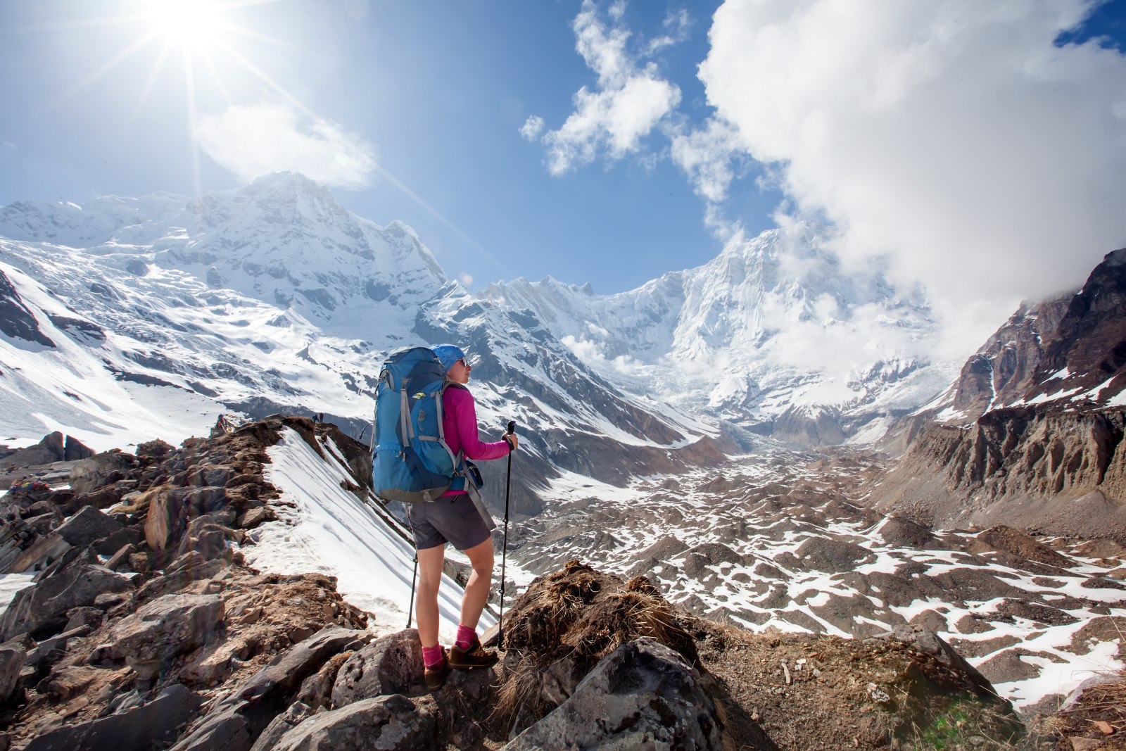
Thorong La Pass on the Annapurna Circuit
Altitude: 5,416m | Oxygen: 47% of sea level
The most demanding sections include:
– The ascent from Manang to Thorong Phedi, where the air begins to thin
– The 4 AM climb over Thorong La Pass—Nepal’s highest trekking pass—where icy winds sting your face and the trail can vanish beneath the snow
– The steep descent to Muktinath, which puts intense strain on your knees as you cross barren, high-altitude rock fields
And yet, thousands of people complete it every year, including first-time trekkers. So how can you tell if it’s too difficult for you?
In this guide, we cut through the noise and offer a detailed breakdown of the challenge:
– How to make the trek easier with smarter choices
– What makes each section difficult
– How your fitness and mindset affect your experience
– Why altitude—not distance—is your biggest obstacle
Annapurna Circuit Difficulty Overview: Are You Ready for the Challenge?
Let’s get straight to the point.
The Annapurna Circuit trek is not just about walking—it’s about endurance. You’ll need to manage altitude, pack efficiently (carrying enough, but never too much), and wake up on day ten still eager to put on your boots.
Here’s the catch: how difficult this trek feels depends more on you than on the trail itself.
So, are you up for it?
Take a deep breath and scroll slowly.
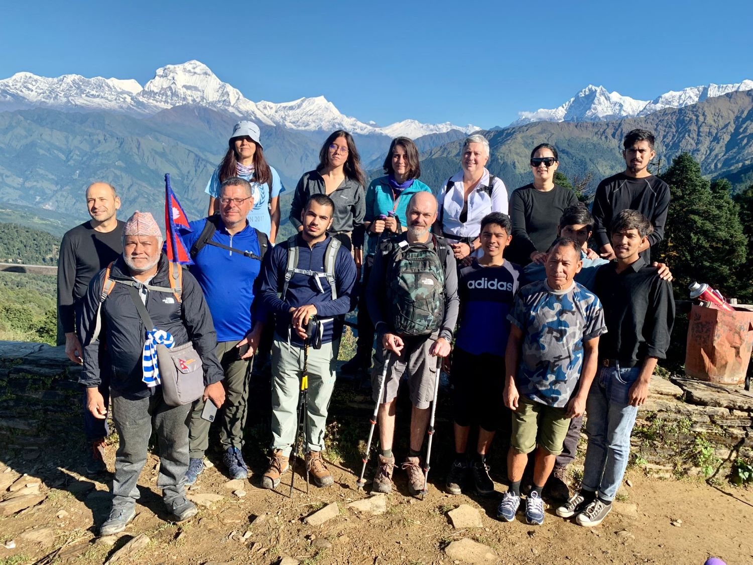
Dhikur Pokhari, Day 4
It looks easy here. But behind that smile are sore calves, frozen fingers, and an incredible sense of accomplishment.
Your Trekker Profile: The Five-Zone Challenge
The difficulty of the Annapurna Circuit Trek depends more on your personal attributes than simply the number of kilometers you cover each day.
Below is a breakdown of the three most common trekker profiles, the challenges the Circuit presents to each, and strategies to help you finish stronger.
The Weekend Warrior
You are physically strong, likely fitter than most. However, physical strength does not guarantee altitude awareness, and the mountains punish ego faster than any leg press machine.
Strengths:
– Can handle steep sections with muscle power
– Likely to recover quickly from fatigue
– Enjoys the physical aspect of the challenge
Weaknesses:
– May hike too quickly and risk altitude sickness
– Has less experience with breath control and pacing
– May underestimate the mental fatigue after Day 8
Trekking Strategy:
– Focus on breathwork and pacing rather than speed
– Train for sustained uphill walking, not just weightlifting
– Schedule an extra acclimatization day in Manang or at Ice Lake
The mountain does not care about muscle; it rewards humility.
The Slow and Steady First-Timer
You may not be a trail athlete, but you are consistent—and that consistency is invaluable on the Circuit. Pacing is more important than pushing, and your steady rhythm is your secret weapon.
Strengths:
– Natural patience and body awareness
– Conservative pace supports acclimatization
– Less likely to overexert early
Weaknesses
Limited gear knowledge can lead to blisters.
Leg fatigue becomes significant after more than 10 days.
Struggles with extreme cold and basic trail discomfort.
Pro Trek Strategy
Hike 2–3 hours per day with a 6 kg pack before leaving for Nepal.
Break in your boots and test all gear before arriving in Kathmandu.
Add motivational audio or podcasts to help build mental stamina.
Progress comes from patience, not speed.
The Seasoned Trekker
Your experience is obvious, but the Annapurna Circuit’s varied terrain—from lush jungle to alpine desert to glacial pass—can still surprise even veteran hikers.
Strengths
Familiar with pacing, layering, and altitude.
Comfortable adapting to rough terrain and teahouse life.
Strategic about rest and energy management.
Weaknesses
May underestimate early trail heat or sudden snowstorms.
Can become bored or complacent on easier days.
Might skip acclimatization out of overconfidence.
Pro Trek Strategy
Consider adding Tilicho Lake or Kang La Pass for extra elevation and challenge.
Mentor less-experienced trekkers; it will enhance your own journey.
Pack for both cold mornings and hot midday conditions.
A familiar trail still offers a new perspective.
Trail Breakdown: Where the Trek Challenges or Transforms You
Standard itineraries don’t reveal the real challenge. What matters most is how the trek feels—how it evolves and tests your limits mentally, physically, and emotionally.
We’ve identified five distinct Challenge Zones: a high-altitude transformation told in five acts.
Stage 1: The Green Confidence Zone
Route: Besisahar to Dharapani to Chame
Altitude: 760 m to 2,650 m
Duration: Days 1–4.
Stage 1: The Comfort Zone
Terrain: Lush forests, riverside paths, stone staircases
The trail begins gently—almost deceptively so. You wind through warm lowlands filled with banana trees and cascading waterfalls. Sleep comes easily, and your breathing is steady. You might think, This isn’t so bad.
Tip: Start hydrating early. Begin acclimatization practices now—not just when the trek gets challenging.
Stage 2: The Reality Check
Route: Chame → Upper Pisang → Manang
Altitude: 2,650m to 3,540m
Duration: Days 5–7
Terrain: Pine forest ridges, wide valleys, glacial views
The ascent begins. The air thins, and you notice it’s harder to tie your boots in the morning. The temperature drops. That easy confidence from earlier? It starts to fade.
Manang will charm you, but it also marks the mental shift into high-altitude mode.
Tip: Spend two nights in Manang. Hike to Ice Lake or the Gangapurna viewpoint to aid acclimatization.
Stage 3: The Mental Wall
Route: Manang → Yak Kharka → Thorong Phedi
Altitude: 3,540m to 4,500m
Duration: Days 8–10
Terrain: Alpine desert, exposed ridgelines, dry riverbeds
This is where the challenge intensifies—physically and mentally. The landscape becomes lunar and barren, almost surreal. Your pace slows. Fatigue sets in each morning, and you may question whether to continue.
This is where people cry, headaches strike, and motivation wanes.
Zone Self-Assessment (Score Each 1–5)
Fitness: Can I comfortably walk 6+ hours a day carrying a 5–8kg pack? (1 = No / 5 = Easy)
Altitude Readiness: Have I been above 3,000m and handled it well? (1–5)
Mental Grit: Can I stay positive when it’s -10°C and I haven’t showered in three days? (1 = Panic-prone / 5 = Zen mode)
Packing Discipline: Is Everything in My Pack Essential, or Just Emotional Baggage? (Rate Yourself 1–5)
Trekking Know-How: Can I Pace Myself, Stay Hydrated, Snack Wisely, and Layer My Clothes Effectively? The pros don’t sweat—they layer.
Think of this as your Himalayan readiness passport.
Annapurna Circuit Difficulty: Key Trail Specifications
Now compare your self-assessment with the realities of the trail:
Metric | What to Expect
Trail Length: Approximately 160–230 km (depending on detours and transportation)
Total Ascent: Over 4,000 meters of elevation gain
Maximum Altitude: 5,416 meters (Thorong La Pass)
Average Trekking Time per Day: 6–8 hours
Total Duration: 12–20 days (depending on your itinerary and acclimatization)
Key Tip: At 5,416 meters, your lungs receive only 47% of the oxygen available at sea level. Even sipping water can feel exhausting.
Trekker Difficulty Wheel: Annapurna Circuit Trek
(Visual radar chart suggested here—leave as is.)
What Kind of Trekker Are You?
This trail is not a treadmill—it’s a Himalayan mosaic of altitude, endurance, mindset, and the unpredictable moods of Mother Nature.
Tip: Attempt the High Camp option (4,800 meters) only if you are fully acclimatized. Otherwise, sleep at a lower elevation and ascend gradually.
Elevation vs. Oxygen Level: Annapurna Circuit Trek
Stage 4: The Summit Push
Route: Thorong Phedi → Thorong La Pass → Muktinath
Altitude: 4,500m → 5,416m → 3,800m
Duration: Day 11
Terrain: Snow, switchbacks, high winds, prayer flags
This is the infamous Thorong La Pass. You’ll start at 4 AM and curse every switchback. Each step feels like it takes your breath away. But at the top—the wind, the sky, the prayer flags—it’s pure transcendence.
You might cry here, and that’s okay.
Tip: Eat something, even if you feel nauseous. Carry electrolytes and caffeine chews. Summit, then descend quickly.
Stage 5: The Descent and Renewal
Route: Muktinath → Kagbeni → Jomsom
Altitude: 3,800m → 2,700m
Duration: Days 12–13
Terrain: Loose gravel, dry desert, wide river valleys
You’re heading downhill, but the challenge isn’t over. Your legs are sore. The wind howls. The Mustang region feels almost Martian. The final test is convincing yourself that it’s nearly finished.
Your body may be tired, but your spirit soars.
Tip: Don’t rush to the finish. Savor your time in Kagbeni. Visit the monasteries. Reflect on your journey. The hardest part is behind you, but the transformation is still unfolding.
Altitude Is the True Challenge—Not the Distance
When most trekkers prepare for the Annapurna Circuit, they fixate on distance:
How many kilometers per day?
Is it longer than Everest Base Camp?
But these are the wrong questions.
The real difficulty of the Annapurna Circuit isn’t in the number of steps you take. It’s in the altitude. It’s in how your body reacts as the oxygen thins.
What Actually Happens to Your Body Above 3,000 Meters?
At first, the changes are subtle. The trail looks the same. Your legs still obey. But something is different. You reach for your water bottle, and your hand moves more slowly. You laugh at a joke, but tears come for no reason. You lie down to sleep, and your heartbeat pounds in your ears like a war drum.
Welcome to the invisible wall of altitude.
Your mind becomes foggy—words blur, thoughts echo. Simple math suddenly feels complicated. You stare at your backpack, wondering how it became so heavy.
Your heart tries to save you—beating faster, working overtime. You feel it when you bend down to tie your boots, when you stand up too quickly, when you climb five stone steps and feel as if you’ve run a mile.
Your blood thickens in a desperate attempt to capture every bit of oxygen it can. But the price is pressure—pressure on your sleep, your thoughts, your decisions.
Then comes the night.
You lie in your teahouse bed, wrapped in three layers, barely moving, and still, you can’t breathe properly. It’s not fear. It’s not the cold. It’s something deeper, like trying to sleep with half your lungs tied behind your back, your dreams bouncing off thin air.
Understanding Acute Mountain Sickness (AMS)
Forget the textbook definitions—here’s what altitude sickness actually feels like.
Arriving in Upper Pisang (approximately 3,300 m)
What You Might Experience:
You feel slightly out of breath, but you attribute it to the climb. The air is cooler and crisper. Your heart beats faster, even during simple tasks like repacking your bag. That night, your sleep feels light and restless.
What’s Happening in Your Body:
You are acclimatizing to thinner air. Now above 3,000 m, this is where AMS symptoms often begin.
There’s no need to worry—your guide will keep an eye on your breathing and pulse. We’ll ask questions like:
Any pressure behind your eyes?
How did you sleep?
Because the smallest symptoms are important.
What You Should Do:
Stay hydrated.
Eat dinner, even if you don’t feel hungry.
Go to bed early and keep yourself warm.
Trekking to Manang (approximately 3,540 m)
What You Might Experience:
A dull headache starts—not severe, but persistent. Your appetite fades. You may feel oddly emotional: quiet one moment, irritated the next, without any clear reason.
What’s Happening in Your Body:
You’ve gained over 500 m in elevation since Pisang. AMS is now sending a gentle warning.
Tips
We schedule a rest day in Manang—not just because it’s beautiful, but because it’s essential for acclimatization. Your guide may suggest a short hike to Gangapurna Lake or the Ice Lake viewpoint: hike high, sleep low.
What to Do
Drink garlic soup—it’s not a myth; it helps stimulate blood flow.
Avoid caffeine and alcohol.
Walk slowly—this is not the time to rush.
Night in Manang: Where Tomorrow Is Decided
What You Might Feel
Mild headache
Unusual dreams
Cold hands and feet
Loss of appetite
These are normal signs of mild Acute Mountain Sickness (AMS) as long as they’re managed. You don’t need to self-diagnose every headache or search symptoms online at 3,500 meters.
Our guides are trained to spot AMS symptoms before you even notice them. They will:
Measure your SpO₂ (oxygen saturation)
Check your heart rate
Ask if you feel dizzy or nauseous
Decide whether to continue or rest another night
Our guides have walked this trail hundreds of times, helping CEOs, solo backpackers, and first-time trekkers cross Thorong La safely. They’ll get you there, too.
Altitude Challenges and Acclimatization
Once you ascend above 2,500 meters, the risk of Acute Mountain Sickness (AMS) increases. As the air gets thinner and oxygen levels drop, you may experience:
Headache
Dizziness
Nausea
Fatigue
Shortness of breath
(Altitude vs. AMS risk curve chart)
Acclimatization: The Key to Avoiding AMS
Acclimatization is essential for preventing Acute Mountain Sickness (AMS). That’s why our itinerary includes rest days in Manang and side hikes to higher elevations such as Chongkor Viewpoint and Tilicho Lake—to help your body adjust gradually.
How to Handle Mild AMS
Mild AMS is not a crisis; it’s an early warning. If you respond promptly, you can continue your trek safely and finish strong. Here’s how to manage it:
Immediate Actions to Take
– Slow Your Pace – AMS worsens with rapid movement. Move slowly, breathe deeply, and take frequent micro-breaks.
– Prioritize Hydration – Drink at least 3–4 liters of water daily and add electrolytes. Dehydration is a hidden risk factor for AMS.
– Eat Light but Regularly – Even if you lose your appetite, try to consume something—garlic soup, ginger tea, or plain rice. Your body needs fuel to acclimate.
– Consider Mild Medication – For headaches, take paracetamol, or consider Diamox (Acetazolamide) for altitude adjustment—but only under your guide’s supervision.
– Sleep Early and Stay Warm – Prioritize rest and warmth. Use extra blankets and avoid cold exposure in the evenings.
– Avoid Alcohol and Caffeine – Both dehydrate the body and hinder acclimatization. Save any celebratory drinks for Jomsom.
– Hike High, Sleep Low – On acclimatization days, such as in Manang, take side hikes to higher elevations, then return to sleep at a lower altitude.
– Rely on Your Guide – Our guides carry pulse oximeters, monitor your symptoms daily, and decide whether to continue ascending or to rest.
Should You Hire a Guide? (Especially If You Think You Don’t)
You’ve tackled solo hikes before. You’ve read the blogs and downloaded GPS trail maps. So, do you really need a guide for the Annapurna Circuit?
Technically, no. Legally, it’s not mandatory—at least not yet.
But practically? If you’re even asking the question, there’s a good chance the answer is yes. You probably should.
Why Choosing a Guide Is Smart—Not Weak
In a region where the terrain shifts by the hour, the weather changes without warning, and altitude can play tricks on your mind, having a local, professional guide isn’t a crutch. It’s a smart advantage.
You walk the trail; they handle the details.
Here’s what your guide manages while you’re immersed in the scenery:
Adjusts your pace for the altitude – Guides notice when your breathing changes before you do. They’ll slow you down when you’re tempted to push ahead (the number one cause of altitude sickness in strong trekkers).
Identifies altitude sickness before you mention it – Pale lips, slurred jokes, skipped meals. Experienced guides recognize these signs instantly and take action early.
Navigates dangerous conditions with expertise – Whiteouts near Thorong La? Frozen streams near Yak Kharka? Your guide knows the safest detours, the best times to cross, and the last reliable teahouse before a storm.
Gets you garlic soup before you ask for help – The moment you start to feel off, your guide is already ordering soup, checking your pulse, and reminding the teahouse staff to add extra blankets to your room.
Questions to Consider Before Trekking Solo
Can I recognize the early signs of altitude sickness in myself?
Do I know when it’s safer to turn back or wait another day?
Can I find shelter quickly if the weather changes unexpectedly?
Can I navigate when trail markers are buried under snow?
Am I trekking for pride, or for the experience itself?
A good guide doesn’t lead from the front. They walk beside you—as your protector, translator, cultural bridge, medical scout, and friend.
Why the Annapurna Circuit Is More Accessible Than You Think
Let’s be honest—Annapurna Circuit Trek Difficulty sounds intimidating, and it does deserve its reputation. But here’s what most blogs and forums forget to mention:
Although it’s a high-altitude challenge, it’s also one of the most supportive, scenic, and comfortable treks in the Himalayas.
This isn’t a survival test. It’s an adventure—with pillows.
Teahouses Instead of Tents
You won’t be digging snow pits or waking up with frozen boots. Every night, you’ll be welcomed into a local teahouse where:
A warm bed awaits
Blankets are piled higher than your altitude gain
The owner might offer you raksi (local rice wine) by the fire
Fresh Food, Real Fuel
Forget carrying freeze-dried meals or instant noodles. You’ll enjoy hot, hearty meals prepared fresh:
Garlic soup (nature’s remedy for altitude)
Thukpa noodle stews
Dal Bhat (energy that lasts for hours)
Fresh apple pies from Manang bakeries
Annapurna Circuit: A Culinary Journey Through the Mountains — No Heavy Lifting Required
Mule Teams and Porters: Less Weight, More Enjoyment
There’s no need to carry everything yourself. With Magical Nepal’s porters or mule teams, you only need a daypack while they transport the rest — always with a friendly attitude.
Annapurna Circuit vs. Other Treks: A Challenge Comparison
Nepal’s treks vary widely. Some are gentle and scenic, while others are steep and demanding. Certain routes test your endurance, while others challenge your mental resolve.
So, how does the Annapurna Circuit truly measure up?
Trek | Max Altitude | Days | Oxygen Drop | Trail Type
Annapurna Circuit | 5,416 m | 12–18 | 47% | Diverse terrain
Everest Base Camp | 5,364 m | 12–14 | 50% | Gradual climb
Langtang Valley | 4,773 m | 7–10 | 40% | Steep, condensed
(Infographic: Trail comparison chart)
Seven Expert Tips to Make the Annapurna Circuit Feel Twice as Easy
The Annapurna Circuit is not about brute strength; it’s about trekking smart. Follow these seven tips to make the journey feel half as difficult — and maybe even enjoyable when your legs say otherwise.
- Use Walking Poles
- Your knees will thank you, especially on the long descent from Thorong La to Muktinath. Poles distribute pressure, improve balance, and turn you into a four-legged machine.
- Pro Tip: Adjust the pole height—shorter for uphill, longer for downhill.
- Train With Your Backpack
- Don’t show up with brand-new gear and no training. Even 5–8 kg will feel like bricks by Day 3 if your back isn’t prepared.
- Tip: Practice hiking 2–3 hours per week with your fully loaded daypack before the trek.
- Have Garlic Soup (Seriously)
- It’s more than just tradition—it helps thin your blood and improve circulation. Most teahouses serve it fresh in Manang and beyond.
- The taste is odd, but the effect is real.
- Start Slow, Finish Strong
- Your biggest enemy isn’t the terrain—it’s your pace. The slower you ascend, the more energy you’ll have for later stages.
- Those who start fast often quit early.
- Sleep Low, Hike High
- This is the golden rule of acclimatization. Take your high side trips (like Ice Lake or Tilicho Base), but always return to sleep at a lower elevation.
- Altitude sickness doesn’t care about ambition; it responds to smart strategy.
- Download Offline Maps
- No signal above 3,000 m? No problem. Apps like Maps.me, Gaia, and FarOut keep you on track even when you’re off the grid.
- Pro Move: Download each village section separately for better clarity at trail forks.
- Embrace the Discomfort—It’s Temporary
- Some moments will be tough. The wind will sting your face. Your breath will vanish at 5,000 m. Your legs will shake.
But then you’ll round a corner and watch the Himalayas unfold like a dream.